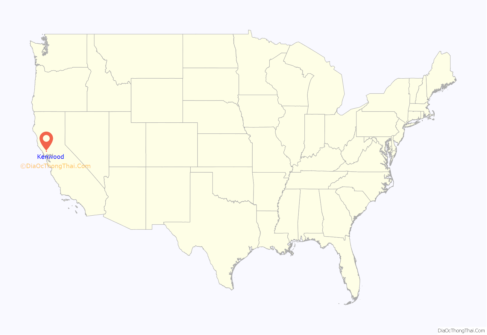
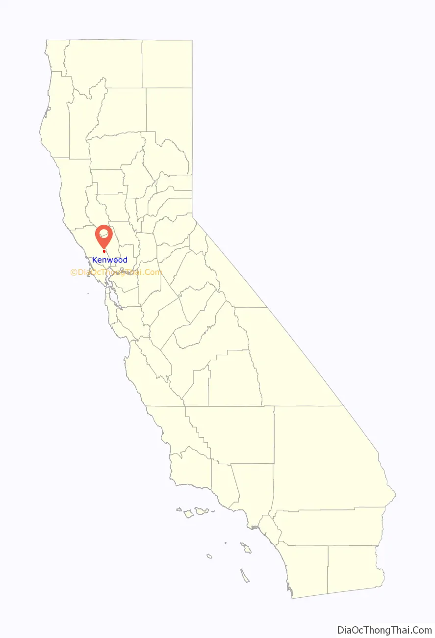
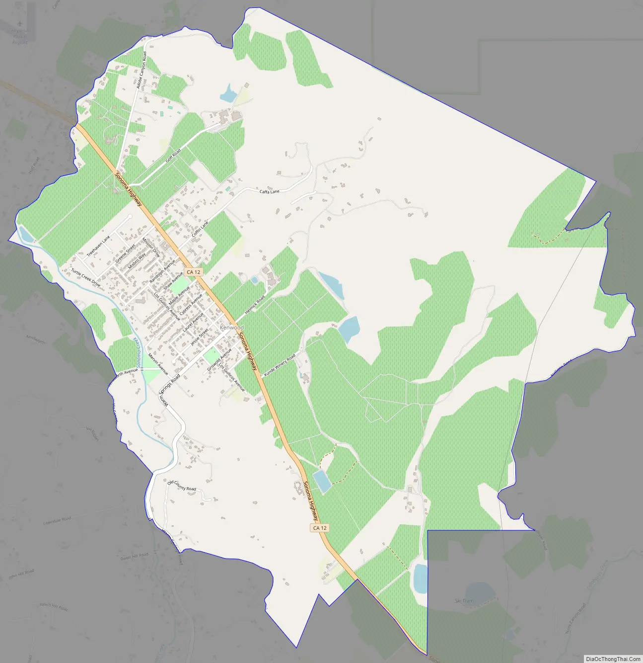
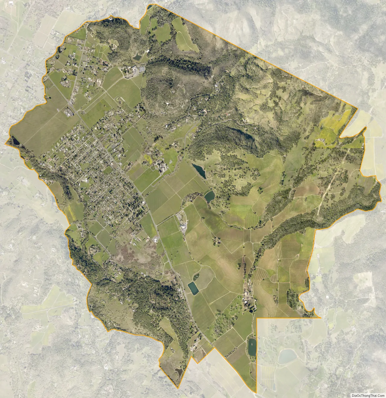
Kenwood is an unincorporated community and census-designated place (CDP) in Sonoma County, California, located on Sonoma Highway (State Route 12) between the cities of Santa Rosa and Sonoma. It lies east of Sonoma Creek in the upper part of Sonoma Valley, a region sometimes called the Valley of the Moon. Bennett Mountain lies west of the town, and Sugarloaf Ridge to the northeast. The population was 1,028 at the 2010 census.
Kenwood is considered part of the Wine Country. Viticulturally, it lies in the Sonoma Valley AVA. The Kenwood area is known for vineyards and wineries, restaurants, and a European-style resort. An area landmark is the Kunde Estate Winery on Sonoma Highway, which was first planted in 1879.
| Name: | Kenwood CDP |
|---|---|
| LSAD Code: | 57 |
| LSAD Description: | CDP (suffix) |
| State: | California |
| County: | Sonoma County |
| Elevation: | 423 ft (129 m) |
| Total Area: | 5.163 sq mi (13.371 km²) |
| Land Area: | 5.163 sq mi (13.371 km²) |
| Water Area: | 0 sq mi (0 km²) 0% |
| Total Population: | 1,028 |
| Population Density: | 200/sq mi (77/km²) |
| ZIP code: | 95409/95452 |
| Area code: | 707 |
| FIPS code: | 0638156 |
| GNISfeature ID: | 226527 |
Online Interactive Map
Click on ![]() to view map in "full screen" mode.
to view map in "full screen" mode.
Kenwood location map. Where is Kenwood CDP?
History
Kenwood is located on the Rancho Los Guilicos Mexican land grant. In 1887, the Sonoma Land & Improvement Company, which owned the property on which the town now sits, laid out lots in anticipation of the railroad which would arrive the following year. The infant community tried on many names: Rohrerville, for one of the owners of the land company; Los Guilicos, and then South Los Guilicos, for the Mexican land grant.
South Los Guilicos Depot on the Santa Rosa and Carquinez Railroad opened in 1887. The First Congregational Church of Los Guilicos was built in 1888. It was relocated from the corner of Los Guilicos and Laurel to its present site in 1893. The parsonage was used for the Kenwood School until construction was completed in 1960. The original name of the church was changed first to Los Guilicos Congregational Church and then to its current name Kenwood Community Church. In 1981, the church was designated Historic Landmark 82 by the County of Sonoma.
A number of townspeople were unhappy, complaining that “Guilicos” was hard to pronounce. Around 1895 a vote was taken to change the name again. One story says that Kenwood won because many of the settlers had come from Kenwood, Illinois. Another traces the choice to the fact that many landowners in the area were from old English families and so were familiar with London’s Kenwood House. It is possible that both stories are true, and the name’s permanence stemmed from its acceptability to different groups.
Some notable people had ranches in the area, including mining, railroad, newspaper and banking magnate, Thomas Kearns, who was also a U.S. Senator from Utah. It is reported that he entertained President Theodore Roosevelt there at the Kearns Ranch, also known as the William Hood House.
The World Pillow Fight Championships originated in Kenwood in the 1970s. Two local community groups held charitable functions to help raise funds that would make improvements to the town. One of these charitable functions was the World Pillow Fighting Championships. A steel pole was made to span the Los Guilicos Spring Creek, which was then filled with mud and the Pillow Fights became an annual event. The last World Pillow Fight Championships in Kenwood were held in Plaza Park in 2006, and subsequent events have been held around the United States. A return to Sonoma County is planned for 2019.
Ray Flugger founded Flowmaster, Inc. in 1983 while working out of a small barn in Kenwood.
Kenwood Road Map
Kenwood city Satellite Map
Geography
According to the United States Census Bureau, the CDP covers an area of 5.2 square miles (13.4 km), all of it land.
Climate
Under the Köppen Climate Classification climate classification, “dry-summer subtropical” climates are often referred to as “Mediterranean”. This climate zone has an average temperature above 10 °C (50 °F) in the warmest months, and an average in the coldest between 18 and -3 °C (64 to 27 °F). Summers tend to be dry with less than one-third that of the wettest winter month, and with less than 30mm (1.18 in) of precipitation in a summer month.
See also
Map of California State and its subdivision:- Alameda
- Alpine
- Amador
- Butte
- Calaveras
- Colusa
- Contra Costa
- Del Norte
- El Dorado
- Fresno
- Glenn
- Humboldt
- Imperial
- Inyo
- Kern
- Kings
- Lake
- Lassen
- Los Angeles
- Madera
- Marin
- Mariposa
- Mendocino
- Merced
- Modoc
- Mono
- Monterey
- Napa
- Nevada
- Orange
- Placer
- Plumas
- Riverside
- Sacramento
- San Benito
- San Bernardino
- San Diego
- San Francisco
- San Joaquin
- San Luis Obispo
- San Mateo
- Santa Barbara
- Santa Clara
- Santa Cruz
- Shasta
- Sierra
- Siskiyou
- Solano
- Sonoma
- Stanislaus
- Sutter
- Tehama
- Trinity
- Tulare
- Tuolumne
- Ventura
- Yolo
- Yuba
- Alabama
- Alaska
- Arizona
- Arkansas
- California
- Colorado
- Connecticut
- Delaware
- District of Columbia
- Florida
- Georgia
- Hawaii
- Idaho
- Illinois
- Indiana
- Iowa
- Kansas
- Kentucky
- Louisiana
- Maine
- Maryland
- Massachusetts
- Michigan
- Minnesota
- Mississippi
- Missouri
- Montana
- Nebraska
- Nevada
- New Hampshire
- New Jersey
- New Mexico
- New York
- North Carolina
- North Dakota
- Ohio
- Oklahoma
- Oregon
- Pennsylvania
- Rhode Island
- South Carolina
- South Dakota
- Tennessee
- Texas
- Utah
- Vermont
- Virginia
- Washington
- West Virginia
- Wisconsin
- Wyoming


