Santa Rosa (Spanish for “Saint Rose”) is a city and the county seat of Sonoma County, in the North Bay region of the Bay Area in California. Its population as of the 2020 census was 178,127. It is the largest city in California’s Wine Country and Redwood Coast. It is the fifth most populous city in the Bay Area after San Jose, San Francisco, Oakland, and Fremont; and the 25th most populous city in California.
| Name: | Santa Rosa city |
|---|---|
| LSAD Code: | 25 |
| LSAD Description: | city (suffix) |
| State: | California |
| County: | Sonoma County |
| Incorporated: | March 26, 1868 |
| Elevation: | 164 ft (50 m) |
| Land Area: | 42.52 sq mi (110.13 km²) |
| Water Area: | 0.17 sq mi (0.45 km²) 0.49% |
| Population Density: | 4,200/sq mi (1,600/km²) |
| ZIP code: | 95401–95407, 95409 |
| Area code: | 707 |
| FIPS code: | 0670098 |
| Website: | www.srcity.org |
Online Interactive Map
Click on ![]() to view map in "full screen" mode.
to view map in "full screen" mode.
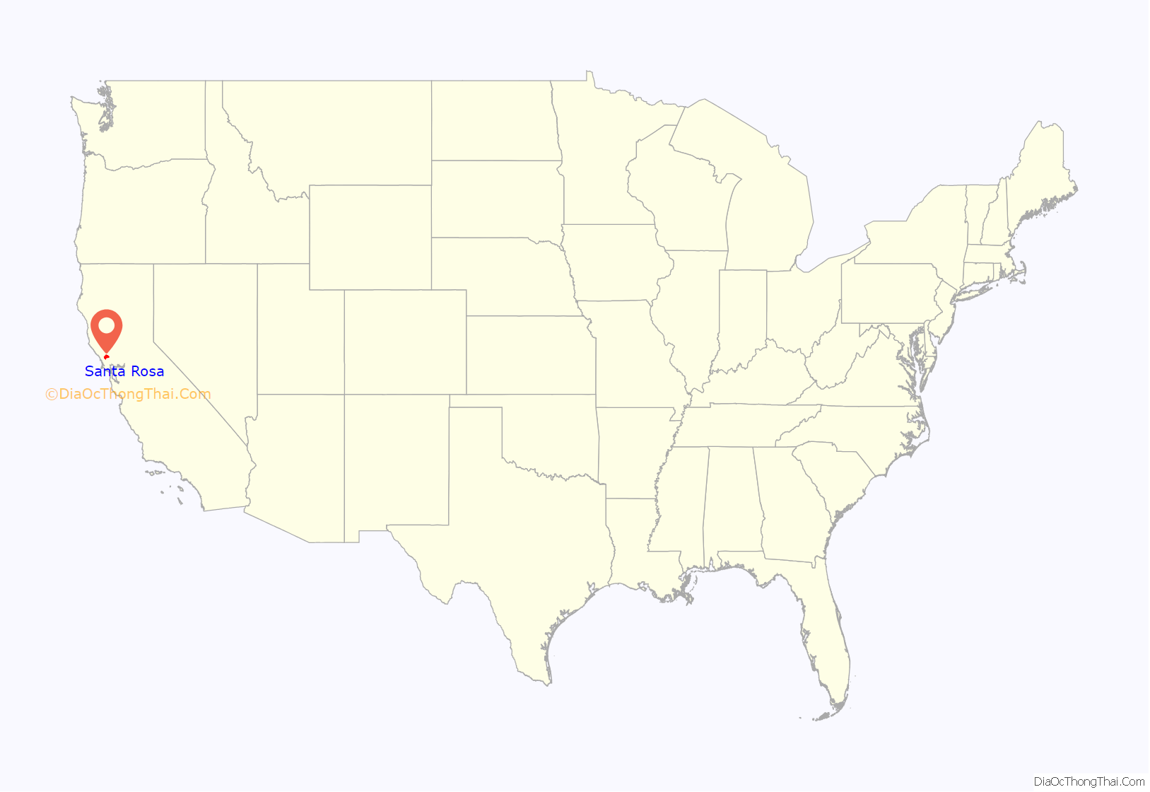
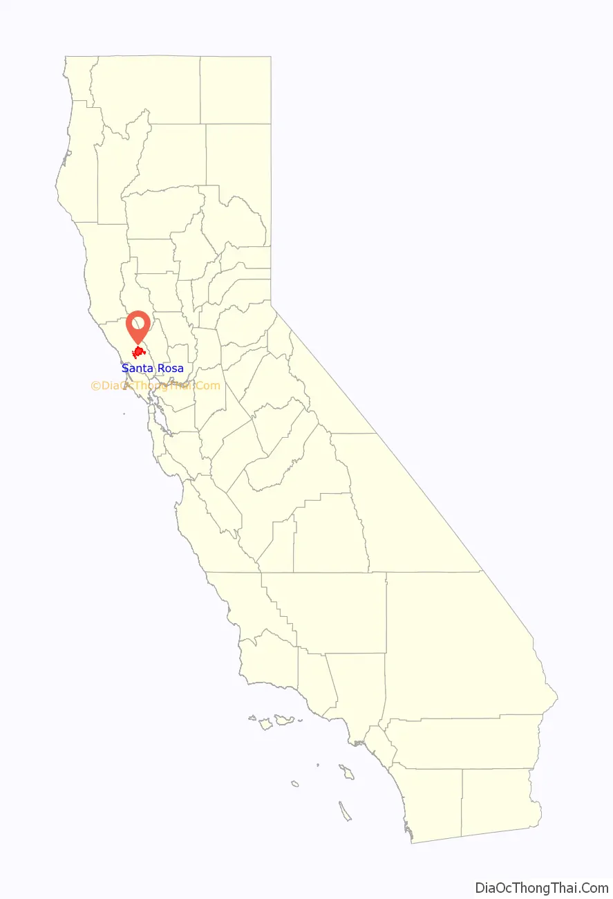
Santa Rosa location map. Where is Santa Rosa city?
History
Early history
Before the arrival of Europeans, what became known as the Santa Rosa Plain was occupied by a strong and populous tribe of Pomo natives known as the Bitakomtara. The Bitakomtara controlled the area closely, barring passage to others until permission was arranged. Those who entered without permission were subject to harsh penalties. The tribe gathered at ceremonial times on Santa Rosa Creek near present-day Spring Lake Regional Park.
Following the arrival of Europeans, initially Spanish explorers and colonists, the Pomos were decimated by smallpox brought from Europe. Social displacement and disruption followed. By 1900, the Pomo population had decreased by 95%.
Santa Rosa was founded in 1833 and named by Mexican colonists after Saint Rose of Lima. The first known permanent European settlement here was the homestead of the Carrillo family of California, in-laws to Mariano Guadalupe Vallejo, who settled the Sonoma pueblo and Petaluma area. In the 1830s, during the Mexican period, the family of María López de Carrillo built an adobe house on their Rancho Cabeza de Santa Rosa land grant, just east of what later became downtown Santa Rosa. By the 1820s, before the Carrillos built their adobe in the 1830s, Spanish and Mexican settlers from nearby Sonoma and other settlements to the south were known to raise livestock in the area.
They slaughtered animals at the fork of the Santa Rosa Creek and Matanzas Creek, near the intersection of modern-day Santa Rosa and Sonoma avenues. This is thought to have been the origin of the name of Matanzas Creek; because it was a slaughtering place, the confluence came to be called La Matanza.
By the 1850s, after the United States annexed California following its victory in the Mexican-American War, a Wells Fargo post and general store were established in what is now downtown Santa Rosa. In the mid-1850s, several prominent locals, including Julio Carrillo, son of Maria Carrillo, laid out the grid street pattern for Santa Rosa with a public square in the center. This pattern has been largely maintained in downtown to this day, despite changes to the central square, now called Old Courthouse Square.
In 1867, the county recognized Santa Rosa as an incorporated city; in 1868 the state officially confirmed the incorporation, making it the third incorporated city in Sonoma County after Petaluma, incorporated in 1858, and Healdsburg, incorporated in 1867.
U.S. Census records show that after California became a state, Santa Rosa grew steadily, though it lagged behind nearby Petaluma in the 1850s and early 1860s. According to the U.S. Census, in 1870 Santa Rosa was the eighth-largest city in California, and county seat of one of the most populous counties in the state. Growth and development after that was steady but never rapid. The city continued to grow when other early population centers declined or stagnated, but by 1900 it was being overtaken by many other newer population centers in the San Francisco Bay Area and Southern California. According to a 1905 article in the Press Democrat newspaper reporting on the “Battle of the Trains”, the city had just over 10,000 people at the time.
The 1906 San Francisco earthquake essentially destroyed the entire downtown, but the city’s population did not greatly suffer. However, after that period the population growth of Santa Rosa, as with most of the area, was very slow.
Since World War II
Santa Rosa grew following World War II because it was the location for Naval Auxiliary Landing Field Santa Rosa, the remnants of which are now located in southwest Santa Rosa. The city was a convenient location for San Francisco travelers bound for the Russian River.
The population increased by two-thirds between 1950 and 1970, an average of 1,000 new residents a year over the 20-year period. Some of the increase was from immigration, and some from annexation of portions of the surrounding area.
In 1958 the United States Office of Civil and Defense Mobilization designated Santa Rosa as one of its eight regional headquarters, with jurisdiction over Region 7, which included American Samoa, Arizona, California, Guam, Hawaii, Nevada, and Utah. Santa Rosa continued as a major center for civil defense activity (under the Office of Emergency Planning and the Office of Emergency Preparedness) until 1979 when the Federal Emergency Management Agency (FEMA) was created in its place, ending the civil defense’s 69-year history.
When the City Council adopted the city’s first modern General Plan in 1991, the population was about 113,000. In the 21 years following 1970, Santa Rosa grew by about 3,000 residents a year—triple the average growth during the previous twenty years.
Santa Rosa 2010, the 1991 General Plan, called for a population of 175,000 in 2010. The Council expanded the city’s urban boundary to include all the land then planned for future annexation, and declared it would be Santa Rosa’s “ultimate” boundary. The rapid growth that was being criticized as urban sprawl became routine infill development.
At the first five-year update of the plan, in 1996, the Council extended the planning period by ten years, renaming it Vision 2020 (updated to Santa Rosa 2020, and then again to Santa Rosa 2030 Vision), and added more land and population.
Santa Rosa annexed the community of Roseland in November 2017.
2017 firestorm
Beginning on the night of October 8, 2017, five percent of the city’s homes were destroyed in the Tubbs Fire, a 45,000-acre wildfire that claimed the lives of at least 19 people in Sonoma County. Named after its origin near Tubbs Lane and Highway 128 in adjacent Napa County, the fire became a major section of the most destructive and third deadliest firestorm in California history. Most homes in the Coffey Park, Larkfield-Wikiup, and Fountain Grove neighborhoods were destroyed.
A notable exception to the destruction in the area was the protection of more than 1,000 animals at the renowned Safari West Wildlife Preserve northeast of Santa Rosa. All of the preserve’s animals were saved by owner Peter Lang. At age 76, he single-handedly and successfully fought back the flames for more than 10 hours using garden hoses.
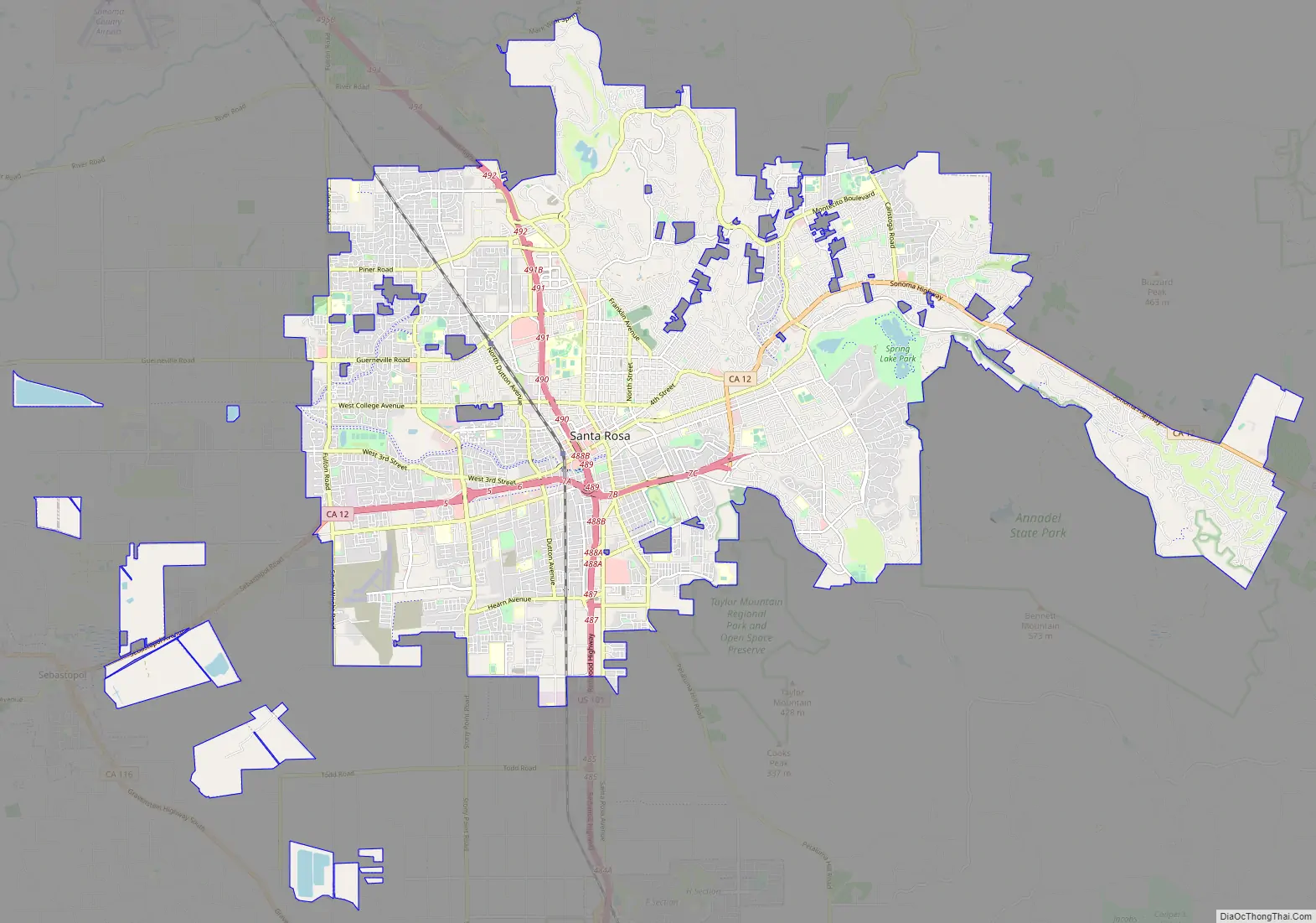
Santa Rosa Road Map
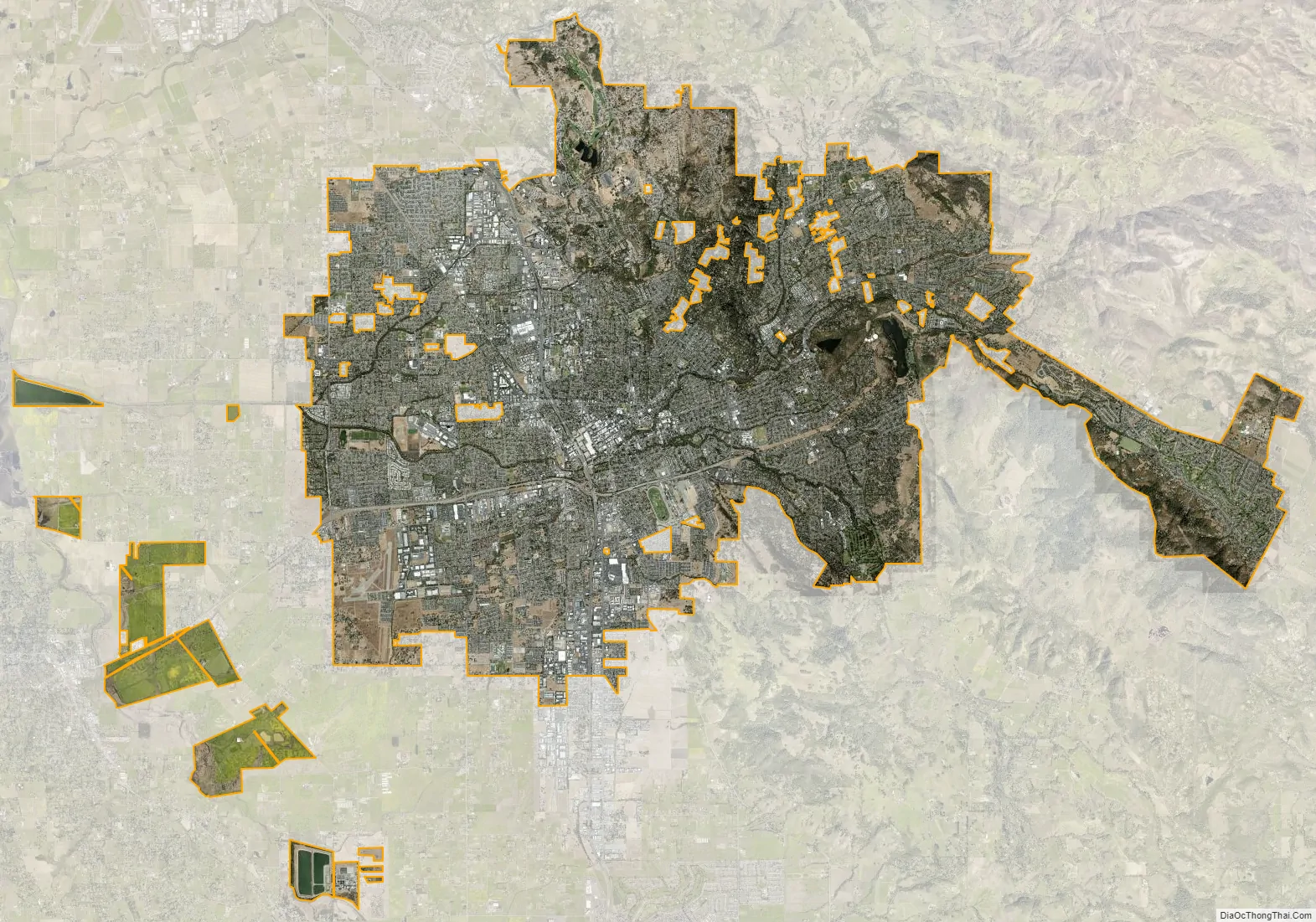
Santa Rosa city Satellite Map
Geography
According to the United States Census Bureau, the city has a total area of 41.50 sq mi (107.5 km). Of that area, 41.29 sq mi (106.9 km) is land and 0.205 sq mi (0.5 km), comprising 0.49%, is water.
The city is part of the North Bay region, which includes such cities as Petaluma, Rohnert Park, Windsor, and smaller cities as Sonoma, Healdsburg, Sebastopol. It lies along the US Route 101 corridor, approximately 55 miles (89 km) north of San Francisco, via the Golden Gate Bridge.
Santa Rosa lies on the Santa Rosa Plain. The city’s eastern extremities stretch into the Valley of the Moon, and the Sonoma Creek watershed known as the Sonoma Valley. The city’s western edge lies in the Laguna de Santa Rosa catchment basin.
The city is in the watershed of Santa Rosa Creek, which rises on Hood Mountain and discharges to the Laguna de Santa Rosa. Tributary basins to Santa Rosa Creek lying significantly in the city are Brush Creek, Matanzas Creek, and Piner Creek. Other water bodies within the city include Fountaingrove Lake, Lake Ralphine, and Santa Rosa Creek Reservoir.
The prominent visual features east of the city include Bennett Peak, Mount Hood, and Sonoma and Taylor mountains.
Climate
Santa Rosa has a warm-summer Mediterranean climate (Köppen Csb) with cool, wet winters and warm, dry summers. In the summer, fog and low overcast often move in from the Pacific Ocean during the evenings and mornings. They usually clear up to warm, sunny weather by late morning or noon before returning in the later evening but will occasionally linger all day. Average annual rainfall is 32.20 inches (818 mm), falling on 74 days annually. The wettest year was 1983 with 63.07 inches (1,602 mm) and the driest year was 1976 with 11.38 inches (289 mm). The most rainfall in one month was 19.42 inches (493 mm) in February 1998 and the most rainfall in 24 hours was 5.23 inches (133 mm) on December 19, 1981. Measurable snowfall is rare in the lowlands, but light amounts sometimes fall in the nearby mountains.
There are an average of 28.9 days with highs of 90 °F (32 °C) or more and an average of 30.2 days with lows reaching the freezing mark. The record high was 115 °F (46 °C) on September 6, 2022, and the record low was 9 °F (−13 °C) on December 25, 1924.
Seismicity
Santa Rosa lies atop the Healdsburg-Rodgers Creek segment of the Hayward-Rodgers Creek Fault System. The Working Group on California Earthquake Probabilities estimated a minimum 27 percent chance of a magnitude 6.7 or greater earthquake on this segment by 2037.
On November 21, 2005, the United States Geological Survey released a map detailing the results of a new tool that measures ground shaking during an earthquake. The map determined that the 1906 San Francisco earthquake was most powerful in an area between Santa Rosa and what is now Sebastopol, causing more damage in Santa Rosa (for its size) than any other city affected.
On October 1, 1969, two earthquakes of magnitudes 5.6 and 5.7 shook Santa Rosa, damaging about 100 structures. They were the strongest quakes to affect the city since 1906. The epicenters were about two miles (3.2 km) north of Santa Rosa.
Nature and wildlife
Due to its population, much of Santa Rosa’s remaining undisturbed area is on its urban fringe. However, the principal wildlife corridors of Santa Rosa Creek and its tributaries flow right through the heart of the town. Great blue herons, great egrets, snowy egrets and black-crowned herons nest in the trees of the median strip on West Ninth Street as well as along Santa Rosa Creek and downtown. Deer often are spotted roaming the neighborhoods nearer the eastern hills, as deep into town as Franklin Avenue and the McDonald area; rafters of wild turkeys are relatively common in some areas; and mountain lions are occasionally observed within city limits. Raccoons and opossums are a common sight throughout the city, while foxes, and rabbits may be regularly seen in the more rural areas. In addition, the city borders and then wraps around the northern end of Trione Annadel State Park, which itself extends into the Sonoma Mountains and Sonoma Valley. Trione-Annadel State Park also adjoins Spring Lake County Park and Howarth Park, forming one contiguous park system that enables visitors to venture into wild native habitats.
Neighborhoods
Santa Rosa can be seen as divided into four quadrants: Northeast, Southeast, Southwest, and Northwest. U.S. Route 101 runs roughly north–south through the city, and divides it into east and west sides. State Route 12 runs roughly east–west, and divides the city into north and south sides.
Neighborhoods, including both current ones and areas formerly known and named, include:
- Apple Tree I and II
- Bennett Valley
- Burbank Gardens Historic District
- Cherry Street Historic District
- Coffey Park
- Dutton Avenue
- Fountain Grove
- Hidden Valley
- Holland Heights
- Indian Village
- Juilliard Park
- Junior College
- Lomita Heights
- McDonald Mansion Historic District
- Monroe District, an area historically known, from 1870s on
- Montecito Heights
- Montgomery Village
- Moorland Avenue
- North Junior College
- North West Santa Rosa
- Oakmont Village
- Olive Park
- Railroad Square District
- Ridgway Historic District
- Rincon Valley
- Roseland
- Santa Rosa Avenue
- Skyhawk
- Spring Lake
- Annadel Heights
- South Park
- St. Rose Historic District
- Stonegate
- Town & Country/Grace Tract
- West 3rd
- West End Arts and Theater District
- West End Historic District
- West Junior College
- Valley Oak
See also
Map of California State and its subdivision:- Alameda
- Alpine
- Amador
- Butte
- Calaveras
- Colusa
- Contra Costa
- Del Norte
- El Dorado
- Fresno
- Glenn
- Humboldt
- Imperial
- Inyo
- Kern
- Kings
- Lake
- Lassen
- Los Angeles
- Madera
- Marin
- Mariposa
- Mendocino
- Merced
- Modoc
- Mono
- Monterey
- Napa
- Nevada
- Orange
- Placer
- Plumas
- Riverside
- Sacramento
- San Benito
- San Bernardino
- San Diego
- San Francisco
- San Joaquin
- San Luis Obispo
- San Mateo
- Santa Barbara
- Santa Clara
- Santa Cruz
- Shasta
- Sierra
- Siskiyou
- Solano
- Sonoma
- Stanislaus
- Sutter
- Tehama
- Trinity
- Tulare
- Tuolumne
- Ventura
- Yolo
- Yuba
- Alabama
- Alaska
- Arizona
- Arkansas
- California
- Colorado
- Connecticut
- Delaware
- District of Columbia
- Florida
- Georgia
- Hawaii
- Idaho
- Illinois
- Indiana
- Iowa
- Kansas
- Kentucky
- Louisiana
- Maine
- Maryland
- Massachusetts
- Michigan
- Minnesota
- Mississippi
- Missouri
- Montana
- Nebraska
- Nevada
- New Hampshire
- New Jersey
- New Mexico
- New York
- North Carolina
- North Dakota
- Ohio
- Oklahoma
- Oregon
- Pennsylvania
- Rhode Island
- South Carolina
- South Dakota
- Tennessee
- Texas
- Utah
- Vermont
- Virginia
- Washington
- West Virginia
- Wisconsin
- Wyoming


