Kingsburg is a city in Fresno County, California. Kingsburg is located 5 miles (8 km) southeast of Selma at an elevation of 302 feet (92 m), on the banks of the Kings River. The city is 21 miles (34 km) from Fresno, and about 130 miles (210 km) from the California Central Coast and Sierra Nevada mountain range. The population was 12,380 at the 2020 census.
| Name: | Kingsburg city |
|---|---|
| LSAD Code: | 25 |
| LSAD Description: | city (suffix) |
| State: | California |
| County: | Fresno County |
| Incorporated: | May 29, 1908 |
| Elevation: | 302 ft (92 m) |
| Total Area: | 3.71 sq mi (9.60 km²) |
| Land Area: | 3.71 sq mi (9.60 km²) |
| Water Area: | 0.00 sq mi (0.00 km²) 0% |
| Total Population: | 12,380 |
| Population Density: | 3,266.25/sq mi (1,261.04/km²) |
| ZIP code: | 93631 |
| Area code: | 559 |
| FIPS code: | 0638562 |
| Website: | www.cityofkingsburg-ca.gov |
Online Interactive Map
Click on ![]() to view map in "full screen" mode.
to view map in "full screen" mode.
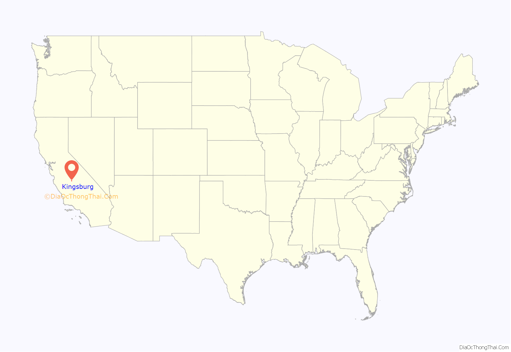
Kingsburg location map. Where is Kingsburg city?

History
Kingsburg was established as a railroad town, its site set by the Central Pacific Railroad when it completed the Valley Line in 1873. In the early 1870s, Swedish natives settled in a railroad town called “Kings River Switch”. Kingsburg started out as a flag stop on the Central Pacific Railroad called Kings River Switch. In 1874 Kingsburg was called Wheatville and had a post office, later that year they changed the name to Kingsbury. During this time period, Josiah Draper and Andrew Farley each owned a quarter section, about 160 acres (65 ha), Draper on the east side of the railroad tracks and Farley on the west side of the tracks. So it was suggested that the east side be called Drapersville and the west side called Farleyville. Two years after that it became Kingsburgh and in January 1894 took on its present spelling, “Kingsburg”, which was finally established as a town in 1908. By 1921, ninety-four percent of the population within a three-mile radius of Kingsburg was Swedish-American, giving the community the nickname of “Little Sweden”. To keep up with the town’s Swedish history most retail businesses are designed in Swedish architecture.
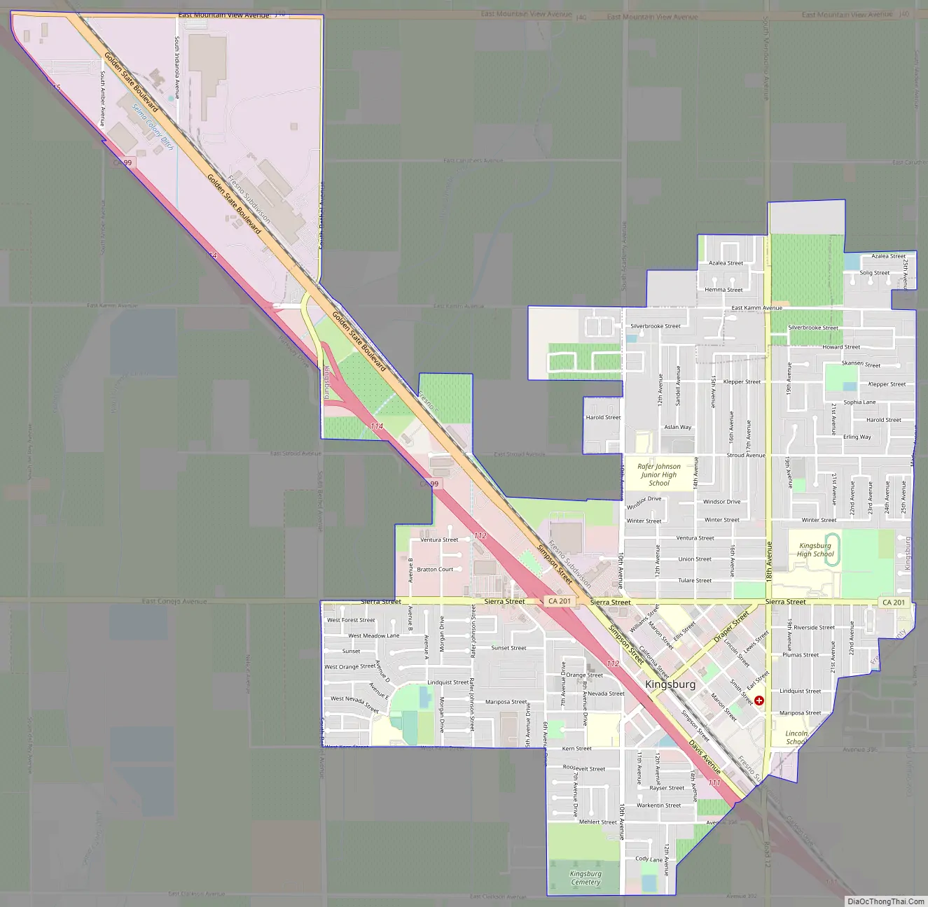
Kingsburg Road Map
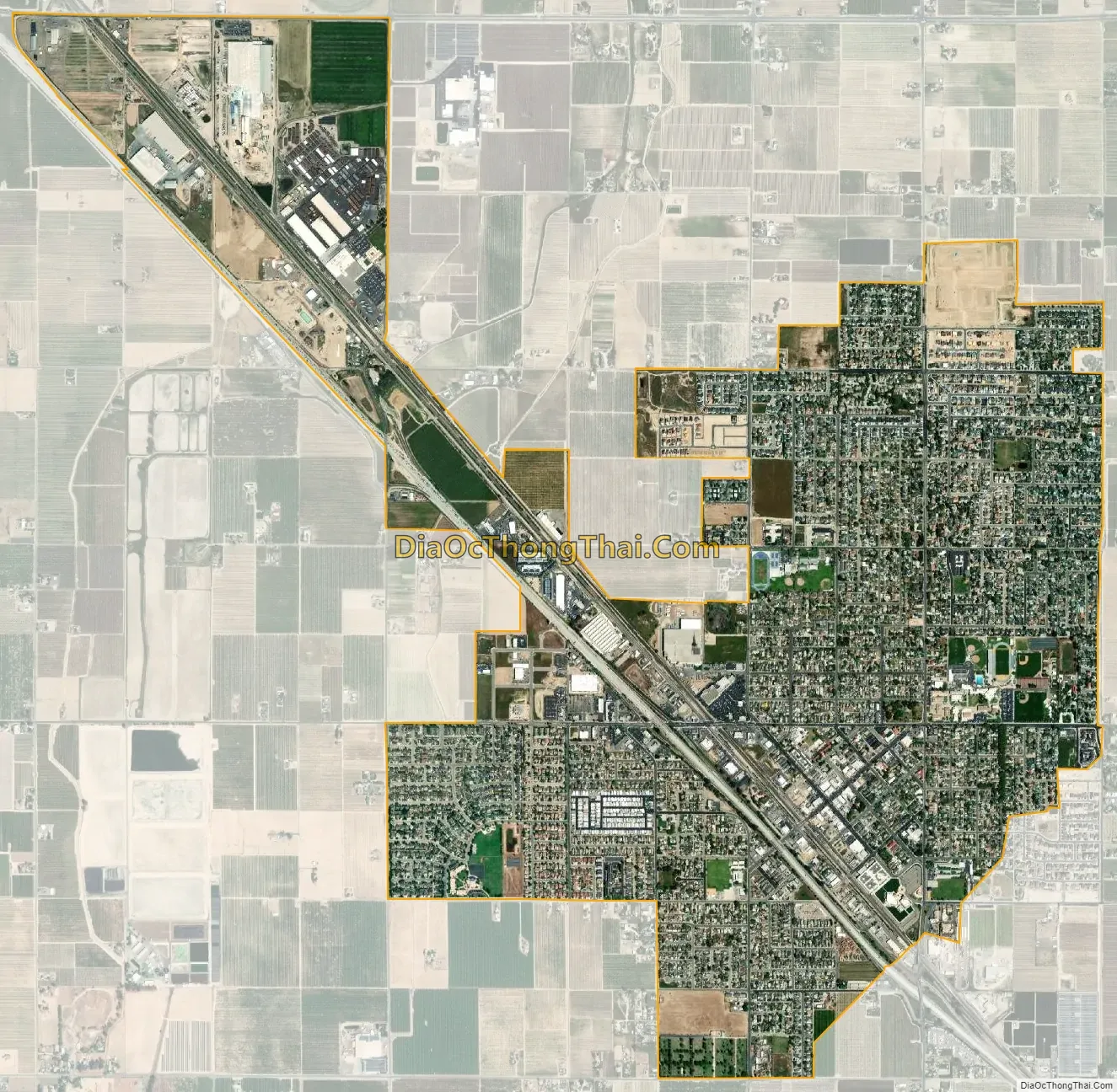
Kingsburg city Satellite Map
Geography
Kingsburg is located at 36°30′50″N 119°33′14″W / 36.51389°N 119.55389°W / 36.51389; -119.55389. Kingsburg is located in the central portion of the Central Valley of California. The town is two hours away from The Sierra Nevada Mountain range and the coast. It is about 3–4 hours away from Los Angeles, San Francisco, and Sacramento. According to the United States Census Bureau, the city has a total area of 2.8 square miles (7.3 km), all of it land.
See also
Map of California State and its subdivision:- Alameda
- Alpine
- Amador
- Butte
- Calaveras
- Colusa
- Contra Costa
- Del Norte
- El Dorado
- Fresno
- Glenn
- Humboldt
- Imperial
- Inyo
- Kern
- Kings
- Lake
- Lassen
- Los Angeles
- Madera
- Marin
- Mariposa
- Mendocino
- Merced
- Modoc
- Mono
- Monterey
- Napa
- Nevada
- Orange
- Placer
- Plumas
- Riverside
- Sacramento
- San Benito
- San Bernardino
- San Diego
- San Francisco
- San Joaquin
- San Luis Obispo
- San Mateo
- Santa Barbara
- Santa Clara
- Santa Cruz
- Shasta
- Sierra
- Siskiyou
- Solano
- Sonoma
- Stanislaus
- Sutter
- Tehama
- Trinity
- Tulare
- Tuolumne
- Ventura
- Yolo
- Yuba
- Alabama
- Alaska
- Arizona
- Arkansas
- California
- Colorado
- Connecticut
- Delaware
- District of Columbia
- Florida
- Georgia
- Hawaii
- Idaho
- Illinois
- Indiana
- Iowa
- Kansas
- Kentucky
- Louisiana
- Maine
- Maryland
- Massachusetts
- Michigan
- Minnesota
- Mississippi
- Missouri
- Montana
- Nebraska
- Nevada
- New Hampshire
- New Jersey
- New Mexico
- New York
- North Carolina
- North Dakota
- Ohio
- Oklahoma
- Oregon
- Pennsylvania
- Rhode Island
- South Carolina
- South Dakota
- Tennessee
- Texas
- Utah
- Vermont
- Virginia
- Washington
- West Virginia
- Wisconsin
- Wyoming


