Marina del Rey (Spanish for “Marina of the King”) is an unincorporated seaside community in Los Angeles County, California, with an eponymous harbor that is a major boating and water recreation destination of the greater Los Angeles area. The port is North America’s largest man-made small-craft harbor and is home to approximately 5,000 boats. The area is a popular tourism destination for both land and water activities such as paddle board and kayak rentals, dining cruises, and yacht charters. Land activities include bicycling on several bicycle paths, walking paths along the waterfront, and birdwatching (birding). Wildlife watching opportunities include California sea lions and harbor seals. Dolphins and whales occasionally visit the deeper waters of harbor. This Westside locale is approximately 4 miles (6.4 km) south of Santa Monica, 4 miles (6.4 km) north of Los Angeles International Airport, and 12.5 miles (20.1 km) west-southwest of Downtown Los Angeles.
The harbor is owned by Los Angeles County and managed by the Department of Beaches and Harbors (DBH), but the waters are environmentally regulated by state government and federal government through their many agencies and departments with overlapping oversight. The Los Angeles Times said in a 1997 editorial that the harbor is “perhaps the county’s most valuable resource”. The population was 11,373 at the 2020 census. For statistical purposes, the United States Census Bureau has defined Marina del Rey as a census-designated place (CDP). The census definition of the area may not precisely correspond to local understanding of the area with the same name; for example, the 90292 ZIP code includes all of Marina del Rey and portions of neighboring Los Angeles, such as Del Rey, and has a population of 21,576, more than double that of the CDP. Many residents of the 90292 ZIP code consider themselves to live in Marina del Rey even if they in fact live outside the official boundaries of the CDP.
| Name: | Marina del Rey CDP |
|---|---|
| LSAD Code: | 57 |
| LSAD Description: | CDP (suffix) |
| State: | California |
| County: | Los Angeles County |
| Elevation: | 0 ft (0 m) |
| Total Area: | 1.455 sq mi (3.768 km²) |
| Land Area: | 0.860 sq mi (2.226 km²) |
| Water Area: | 0.595 sq mi (1.541 km²) 40.91% |
| Total Population: | 11,373 |
| Population Density: | 7,800/sq mi (3,000/km²) |
| ZIP code: | 90291–90292, 90295 |
| Area code: | 310/424 |
| FIPS code: | 0645806 |
| GNISfeature ID: | 1852255 |
Online Interactive Map
Click on ![]() to view map in "full screen" mode.
to view map in "full screen" mode.
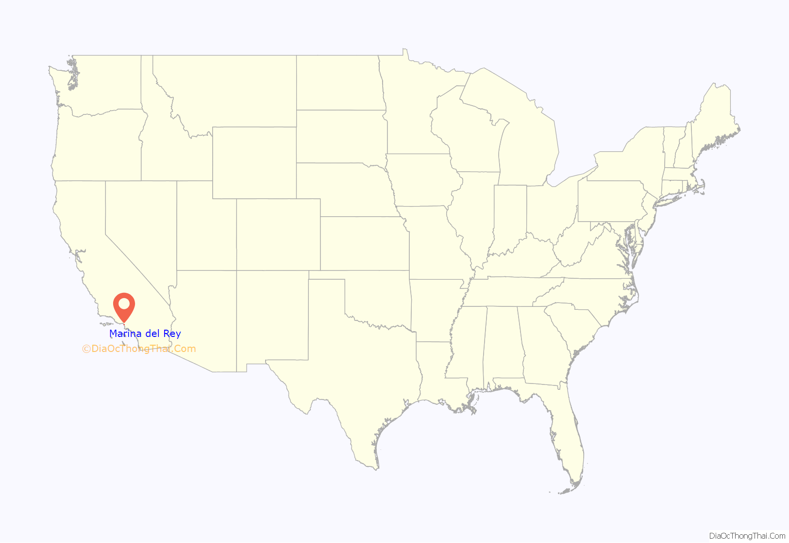
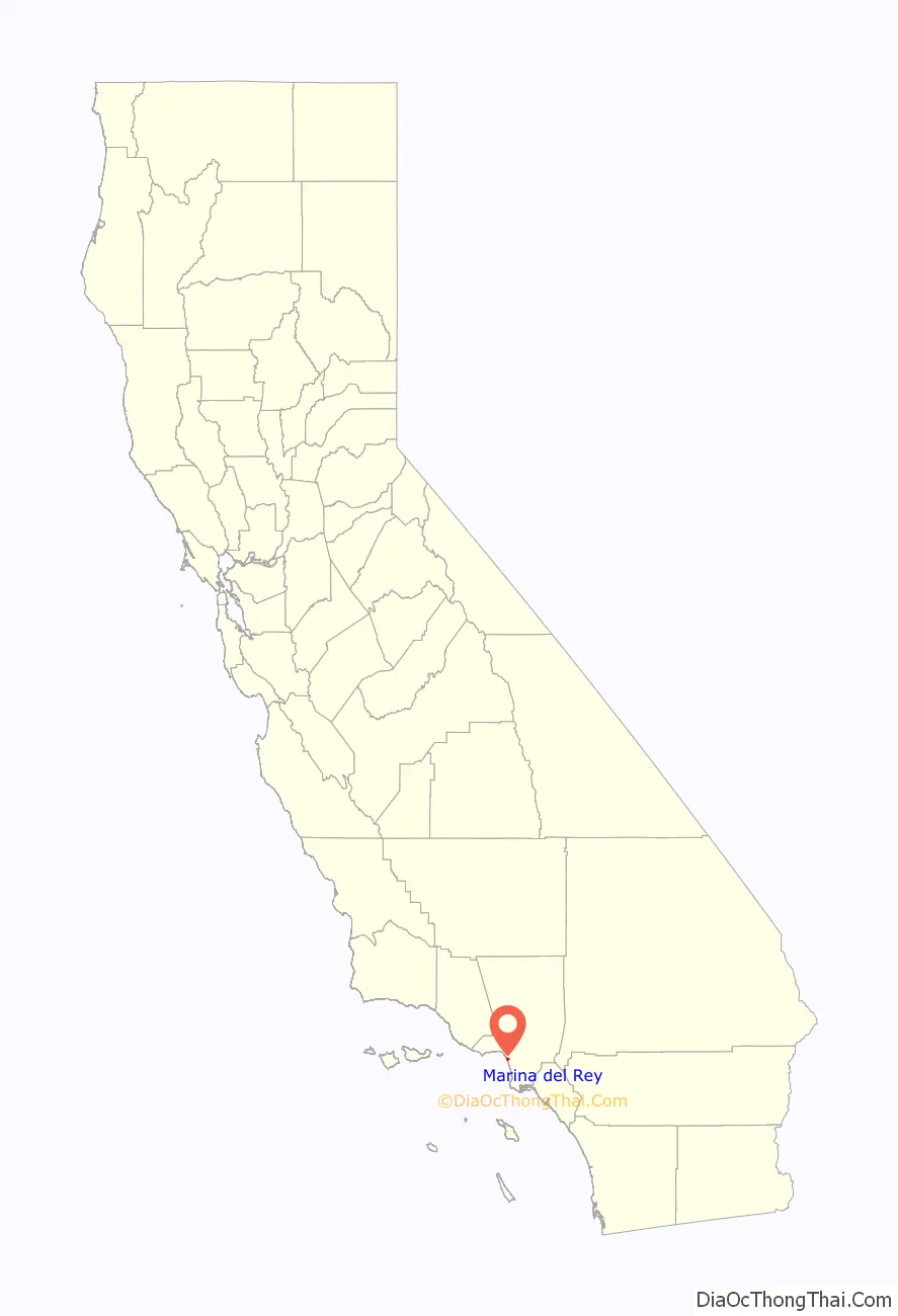
Marina del Rey location map. Where is Marina del Rey CDP?
History
Prior to its development as a small-craft harbor, the land occupied by Marina del Rey was a salt marsh fed by fresh water from Ballona Creek. The area was frequented by the Tongva, who used plank boats known as te’aats to traverse the waters and paddle out to the Channel Islands. Fishing and shellfish harvesting were common. The village of Guashna was a major regional trade center between villages on the islands and the mainland.
With the increasing arrival of European settlers, in the mid-19th century, Moye C. Wicks thought of turning this estuary and wetland of Playa del Rey into a commercial port. He formed the Ballona Development Company in 1888 to develop the area, but three years later the company went bankrupt. The area became frequented by duck hunters, including their hunting club, as well as by birdwatchers of the Los Angeles Audubon Society and the southern chapter of the Cooper Ornithological Club. Burton W. Chace, a former councilman of the City of Long Beach, who later became a member of the Los Angeles County Board of Supervisors, referred to the area as mud flats, though today the area would more properly be referred to as an estuary and wetland.
Port Ballona made by Louis Mesmer and Moye Wicks was then sold to Moses Sherman. Sherman purchased 1,000 acres (400 ha) of land around the Ballona lagoon and Port Ballona in 1902 under the name the Beach Land Company. Sherman and Clark renamed the land “Del Rey”. Port Ballona was then renamed Playa Del Rey. The port was serviced by the California Central Railway opened in September 1887, this line later became the Santa Fe Railway, that later became the Atchison, Topeka, and Santa Fe Railroad. The rail line ran from the port to Redondo junction. A street car tram line was made to the Port by the Redondo and Hermosa Beach Railroad company, that had incorporated on February 21, 1901. This company was part of the Los Angeles Pacific Railroad owned by Sherman. The tram line opened December 1902 departed downtown at 4th & Broadway.
In 1916, the U.S. Army Corps of Engineers revisited the idea of a commercial harbor, but declared it economically impractical. In 1936 the U.S. Congress ordered a re-evaluation of that determination, and the Army Corps of Engineers returned with a more favorable determination; however, the Marina del Rey harbor concept lost out to San Pedro as a commercial harbor and development funding went to the Port of Los Angeles instead.
In 1949, the Army Corps of Engineers submitted an elaborate $23 million plan for a marina with mooring space for over 8,000 small-craft boats. In 1954, President Eisenhower signed Public Law 83-780, authorizing the study of the creation of the Marina as a federal project. After seven years of legislative wrangling, Public Law 87-402 renamed the Playa Del Rey Inlet and Harbor as Marina Del Rey, implicitly enshrining the authorization of the project into law.
Ground breaking began shortly after, during the early years of the John F. Kennedy administration.
With construction almost complete, the marina was put in danger in 1962–1963 due to a winter storm. The storm caused millions of dollars in damage to both the marina and the few small boats anchored there. A plan was put into effect to build a breakwater at the mouth of the marina, and the L.A. County Board of Supervisors appropriated $2.1 million to build it. On April 10, 1965, Marina del Rey was formally dedicated. The total cost of the marina was $36.25 million for land, construction, and initial operation.
Los Angeles County then solicited bids for the harbor and port development, selling 60 year leaseholds to willing developers. Real estate developer Abraham M. Lurie was the single largest leaseholder responsible for the building of three hotels, two apartment complexes, 1,000 boat slips, and several shopping centers, offices, restaurants; his holdings also included the last undeveloped piece of waterfront land in Marina del Rey. He eventually ran into cash flow problems and sold a 49.9% interest to Saudi Arabian Sheik Abdul Aziz al Ibrahim, a brother of Waleed bin Ibrahim Al Ibrahim and a brother-in-law of King Fahd; the investment soon turned sour and following a protracted and aggressive lawsuit, in 1993 Lurie lost his entire interest in the development to Abdul Aziz.
Marina del Rey Road Map

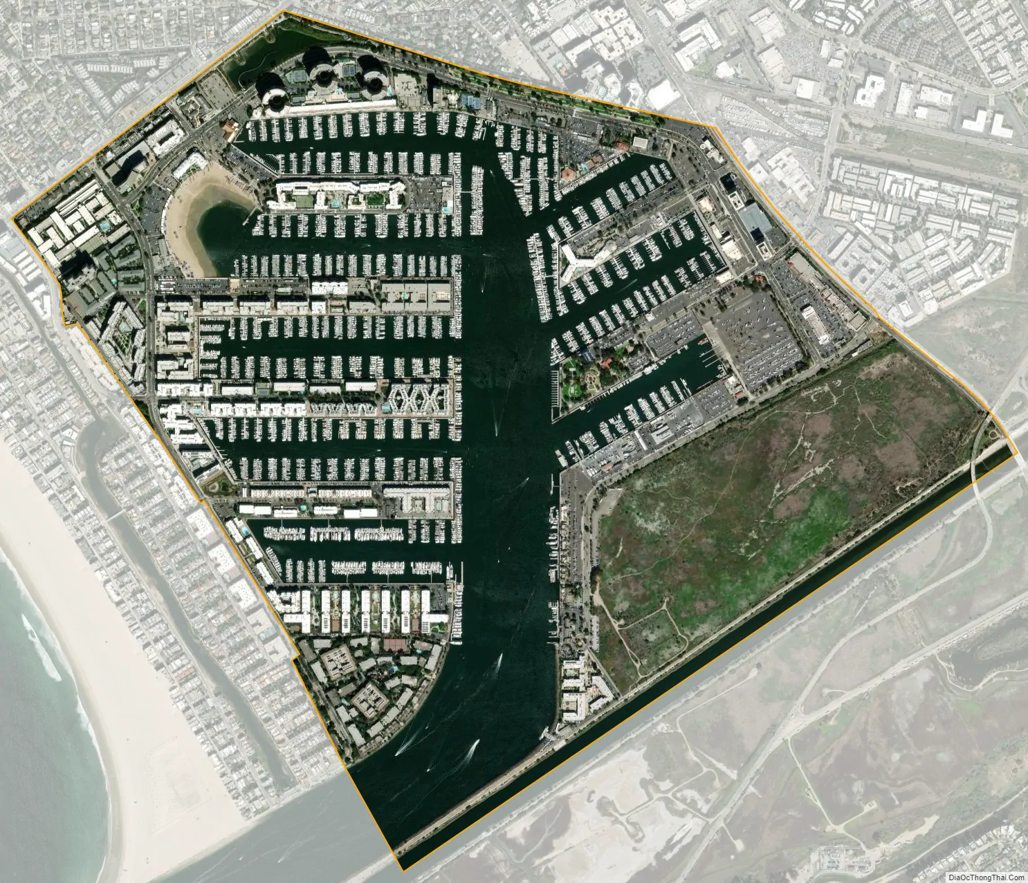
Marina del Rey city Satellite Map
Geography
Marina del Rey falls within unincorporated Los Angeles County and is southeast of Venice and north of Playa del Rey, near the mouth of Ballona Creek. The harbor and port is located four miles (6 km) north of Los Angeles International Airport.
The harbor and the unincorporated residential and business community of Marina del Rey is bounded on all sides by the city of Los Angeles. The beach-style homes, on the inner portion of the coastal strand and the beach (see photo), west of the harbor, are within the city limits of Los Angeles, but share the same zip code as Marina del Rey. The name of this coastal strand that surrounds an estuarine inlet known as the Ballona Lagoon Marine Preserve is called the Marina Peninsula. The city street, Via Dolce, forms the boundary between Los Angeles and the unincorporated area of Los Angeles County, known as Marina del Rey.
According to the United States Census Bureau, Marina del Rey has an area of 1.5 square miles (3.9 km). Nine-tenths of a square mile (2.2 km) is land and 0.6 square miles (1.6 km) is water (40.91%).
One of the highest and tallest buildings in Marina del Rey is the large high-rise condominium building known as “The Admiralty High-Rise” or simply AHR. AHR is a large condominium complex, having three official names: Azzura condos, Regatta condos, or The Cove. AHR has a height of about 170 feet (50 m), 20 floors and can house a maximum of about 2,500 people (800 condominiums) which is almost 30% of the population of Marina del Rey. AHR is located across Admiralty Way from the harbor and has a bright green-aquamarine color. It was built in 2003. AHR, or specifically The Cove, was the main location in the 2010 film Skyline.
The specially designed harbor has many kinds of moorings with significant cement pilings for pleasure craft and large boats, including Catalina Island multi-passenger ferry boats, a large whale watching boat as well as a pelagic seabird watching boat, commercial fishing boats, harbor cruise ships, a U.S. Coast Guard Cutter Ship, LA County Fire Department and Sheriff Department boats, and is surrounded by high-rise condos, hotels, apartments, shops, and restaurants. The area also includes the University of Southern California Information Sciences Institute, the UCLA Marina Aquatic Center, and the Loyola Marymount University boathouse.
The community is served by the 3-mile-long (4.8 km) Marina Freeway (State Route 90), which links Marina del Rey directly to Interstate 405 and nearby Culver City.
The area codes of Marina del Rey are 310 and 424. Its ZIP code is 90292.
Climate
See also
Map of California State and its subdivision:- Alameda
- Alpine
- Amador
- Butte
- Calaveras
- Colusa
- Contra Costa
- Del Norte
- El Dorado
- Fresno
- Glenn
- Humboldt
- Imperial
- Inyo
- Kern
- Kings
- Lake
- Lassen
- Los Angeles
- Madera
- Marin
- Mariposa
- Mendocino
- Merced
- Modoc
- Mono
- Monterey
- Napa
- Nevada
- Orange
- Placer
- Plumas
- Riverside
- Sacramento
- San Benito
- San Bernardino
- San Diego
- San Francisco
- San Joaquin
- San Luis Obispo
- San Mateo
- Santa Barbara
- Santa Clara
- Santa Cruz
- Shasta
- Sierra
- Siskiyou
- Solano
- Sonoma
- Stanislaus
- Sutter
- Tehama
- Trinity
- Tulare
- Tuolumne
- Ventura
- Yolo
- Yuba
- Alabama
- Alaska
- Arizona
- Arkansas
- California
- Colorado
- Connecticut
- Delaware
- District of Columbia
- Florida
- Georgia
- Hawaii
- Idaho
- Illinois
- Indiana
- Iowa
- Kansas
- Kentucky
- Louisiana
- Maine
- Maryland
- Massachusetts
- Michigan
- Minnesota
- Mississippi
- Missouri
- Montana
- Nebraska
- Nevada
- New Hampshire
- New Jersey
- New Mexico
- New York
- North Carolina
- North Dakota
- Ohio
- Oklahoma
- Oregon
- Pennsylvania
- Rhode Island
- South Carolina
- South Dakota
- Tennessee
- Texas
- Utah
- Vermont
- Virginia
- Washington
- West Virginia
- Wisconsin
- Wyoming


