North Richmond is an unincorporated area in Contra Costa County, California, a census-designated place (CDP) with a population of 3,717 adjacent to and nearly surrounded by the city of Richmond.
| Name: | North Richmond CDP |
|---|---|
| LSAD Code: | 57 |
| LSAD Description: | CDP (suffix) |
| State: | California |
| County: | Contra Costa County |
| Elevation: | 16 ft (5 m) |
| Total Area: | 1.549 sq mi (4.01 km²) |
| Land Area: | 1.408 sq mi (3.65 km²) |
| Water Area: | 0.141 sq mi (0.37 km²) 9.1% |
| Total Population: | 3,717 |
| Population Density: | 2,400/sq mi (930/km²) |
| ZIP code: | 94801 |
| Area code: | 510, 341 |
| FIPS code: | 0652162 |
Online Interactive Map
Click on ![]() to view map in "full screen" mode.
to view map in "full screen" mode.
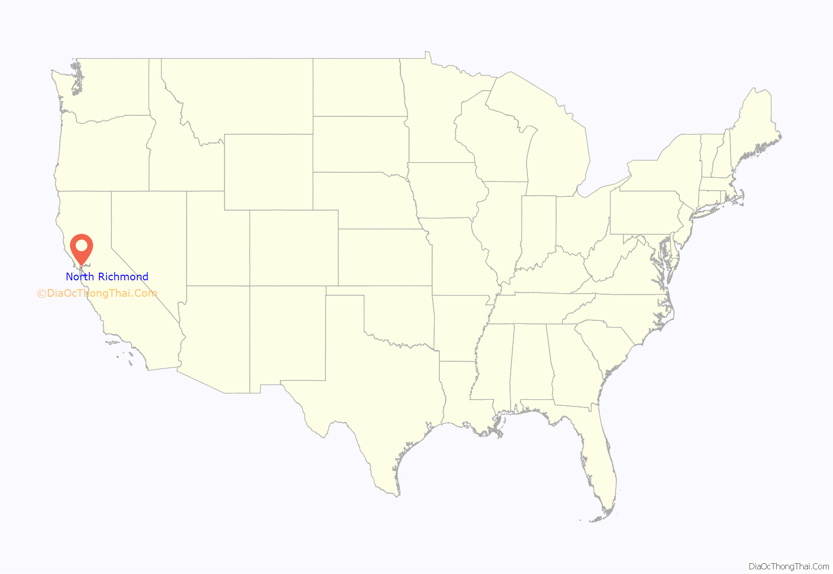
North Richmond location map. Where is North Richmond CDP?
History
The area of North Richmond was populated by Ohlone tribes which settled the area in the 6th century. However, Hokan speaking people may have inhabited the area even earlier, and archaeological evidence shows human settlement to have begun at least by 4000 BC. The Ohlone tribesmen subsisted from hunter-gathering the bountiful amount of land and sea life of the area. Especially the great amounts of seafood made available along the coastline of Castro Cove and the surrounding marshlands and delta of Wildcat and San Pablo creeks. The majority of present-day North Richmond was territory of the Karkin tribe (or Carquinez) however the land lies on what was a border area with the Chocheño tribe and likely had influences of both groups. The tribes made great use of the salmon and trout runs on the rivers. However, today, culverting and damming has decimated the habitat for these species and they are rarely present ever at the opening of the watercourse.
In the early part of the 20th century, North Richmond was populated by Italian-Americans. During World War II, many African-Americans moved from the South and Midwest and came to the Western United States in order to find jobs helping the war effort. Many came to work in Richmond’s shipyards and consequently, moved into North Richmond.
Subsequently many of the residents were employed in the petroleum, railway, and shipping industries.
Currently the population is estimated to be about 2,300 by the county of Contra Costa and 2,500 by the Richmond Confidential.
North Richmond Road Map
North Richmond city Satellite Map
See also
Map of California State and its subdivision:- Alameda
- Alpine
- Amador
- Butte
- Calaveras
- Colusa
- Contra Costa
- Del Norte
- El Dorado
- Fresno
- Glenn
- Humboldt
- Imperial
- Inyo
- Kern
- Kings
- Lake
- Lassen
- Los Angeles
- Madera
- Marin
- Mariposa
- Mendocino
- Merced
- Modoc
- Mono
- Monterey
- Napa
- Nevada
- Orange
- Placer
- Plumas
- Riverside
- Sacramento
- San Benito
- San Bernardino
- San Diego
- San Francisco
- San Joaquin
- San Luis Obispo
- San Mateo
- Santa Barbara
- Santa Clara
- Santa Cruz
- Shasta
- Sierra
- Siskiyou
- Solano
- Sonoma
- Stanislaus
- Sutter
- Tehama
- Trinity
- Tulare
- Tuolumne
- Ventura
- Yolo
- Yuba
- Alabama
- Alaska
- Arizona
- Arkansas
- California
- Colorado
- Connecticut
- Delaware
- District of Columbia
- Florida
- Georgia
- Hawaii
- Idaho
- Illinois
- Indiana
- Iowa
- Kansas
- Kentucky
- Louisiana
- Maine
- Maryland
- Massachusetts
- Michigan
- Minnesota
- Mississippi
- Missouri
- Montana
- Nebraska
- Nevada
- New Hampshire
- New Jersey
- New Mexico
- New York
- North Carolina
- North Dakota
- Ohio
- Oklahoma
- Oregon
- Pennsylvania
- Rhode Island
- South Carolina
- South Dakota
- Tennessee
- Texas
- Utah
- Vermont
- Virginia
- Washington
- West Virginia
- Wisconsin
- Wyoming
