Orick (formerly, Arekw, Orekw, and Oreq, Yurok: ‘O’rekw ) is a census-designated place situated on the banks of the Redwood Creek in Humboldt County, California. It is located 43 miles (69 km) north of Eureka, at an elevation of 26 feet (8 m). The population was 357 at the 2010 census.
Rare minerals orickite and coyoteite were discovered at Coyote Peak near Orick.
| Name: | Orick CDP |
|---|---|
| LSAD Code: | 57 |
| LSAD Description: | CDP (suffix) |
| State: | California |
| County: | Humboldt County |
| Elevation: | 26 ft (8 m) |
| Total Area: | 4.850 sq mi (12.561 km²) |
| Land Area: | 4.746 sq mi (12.291 km²) |
| Water Area: | 0.104 sq mi (0.270 km²) 2.15% |
| Total Population: | 328 |
| Population Density: | 68/sq mi (26/km²) |
| ZIP code: | 95555 |
| Area code: | 707 |
| FIPS code: | 0654218 |
Online Interactive Map
Click on ![]() to view map in "full screen" mode.
to view map in "full screen" mode.
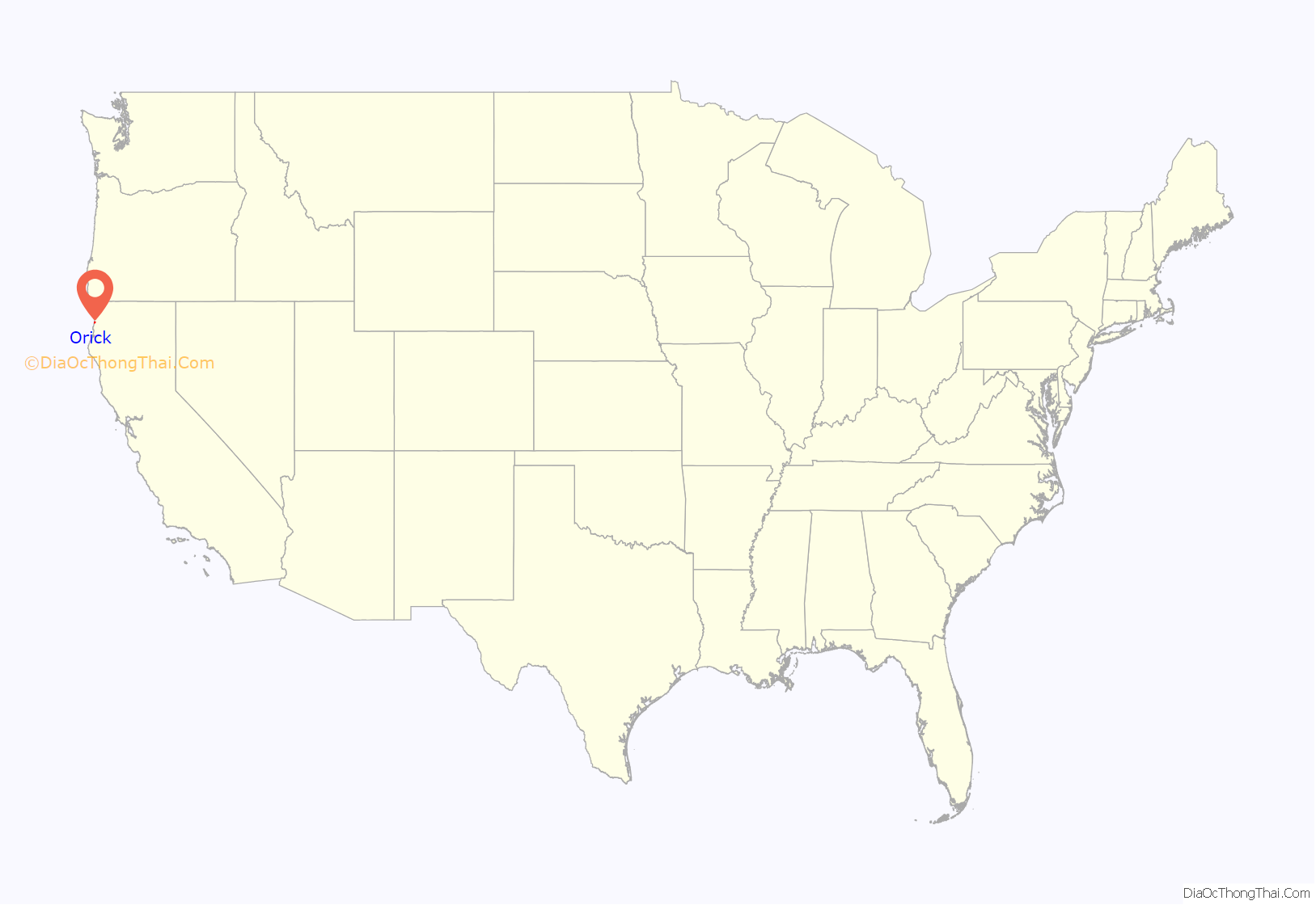
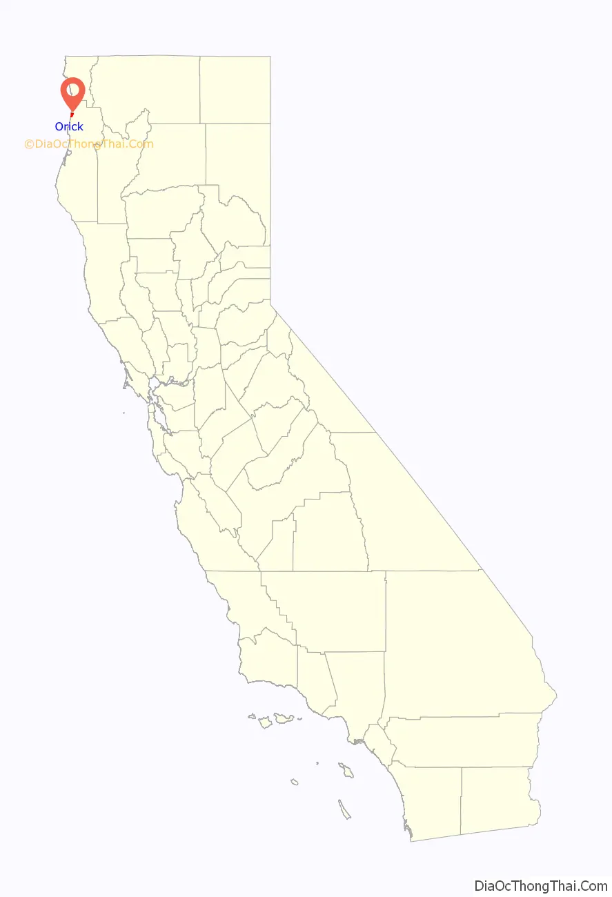
Orick location map. Where is Orick CDP?
History
O’rekw means “mouth of the river” in Yurok. Orick evolved from the original word. The Yurok people had 74 known villages in the area, O’rekw was one of five where jumping dances were held. At times spelled Or’eQw, it is important to note that there is no “Q” in the living Yurok people’s alphabet.
Non-native settlers arrived with the Gold Rush, beginning in 1850 after the Josiah Gregg expedition discovered Humboldt Bay. Orick was settled not only for being on the way to mining claims in the Trinity, but for five beach sand mining claims fronting several miles of beach in the Gold Bluff District. The gold sands did not produce well, and the local gold rush was over by the 1870s.
The first post office at Orick opened in 1887.
The earliest wagons traveled along the beaches, but in 1894 the county – that time covering both the modern Humboldt and Del Norte counties – finished a wagon road between Eureka and Crescent City.
Lumbering removed the trees in and around Orick and dairy farmers utilized the flood plain. Until a bridge was built in 1903, Redwood Creek was always crossed by Swan’s Ferry.
Robert Swan was a local rancher and businessman who owned the ferry and the local store, which was bought out by native Eurekan Elmer L. Devlin (August 1, 1877 – ?) who built the original Orick Inn. Devlin’s first building burned down in 1918 and was rebuilt by 1922. It was known for home cooked food, as well as hosting fishermen and notables including opera singer Madame Ernestine Schumann-Heink, actors Fred MacMurray and Ronald Colman and President Herbert Hoover.
In 1924, the Redwood Highway reached Orick and by the 1930s connected all the way from San Francisco to Oregon. Tourists arrived to see the giant redwoods.
After World War II, Orick became a lumber and timber mill town in response to the post-war demand for timber. The business boomed for about fifteen years until closed by the consolidation of mills in larger towns and foundation of the Redwood National Park.
Elephant Historical Plaque
On October 1, 1927, a circus elephant named “Big Diamond” collapsed five miles north of Orick after freeing ten “Honest Bill Animal Show” trucks mired in the new highway construction. Honest Bill told a highway contractor that the elephant’s skin was valuable and that the contractor could keep the money if he would remove the remains. The contractor skinned and buried the elephant, but the skin turned out to be useless. Many years later, the elephants bones were unearthed, and originally misidentified as a mammoth, but newspaper morgues found and repeated the story of Big Diamond’s demise. A memorial plaque was placed near where the bones were found in May 1993 by E Clampus Vitus Eureka Chapter 101.
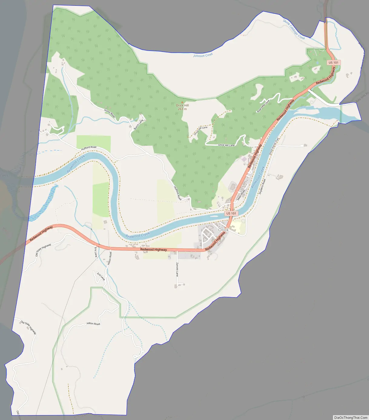
Orick Road Map
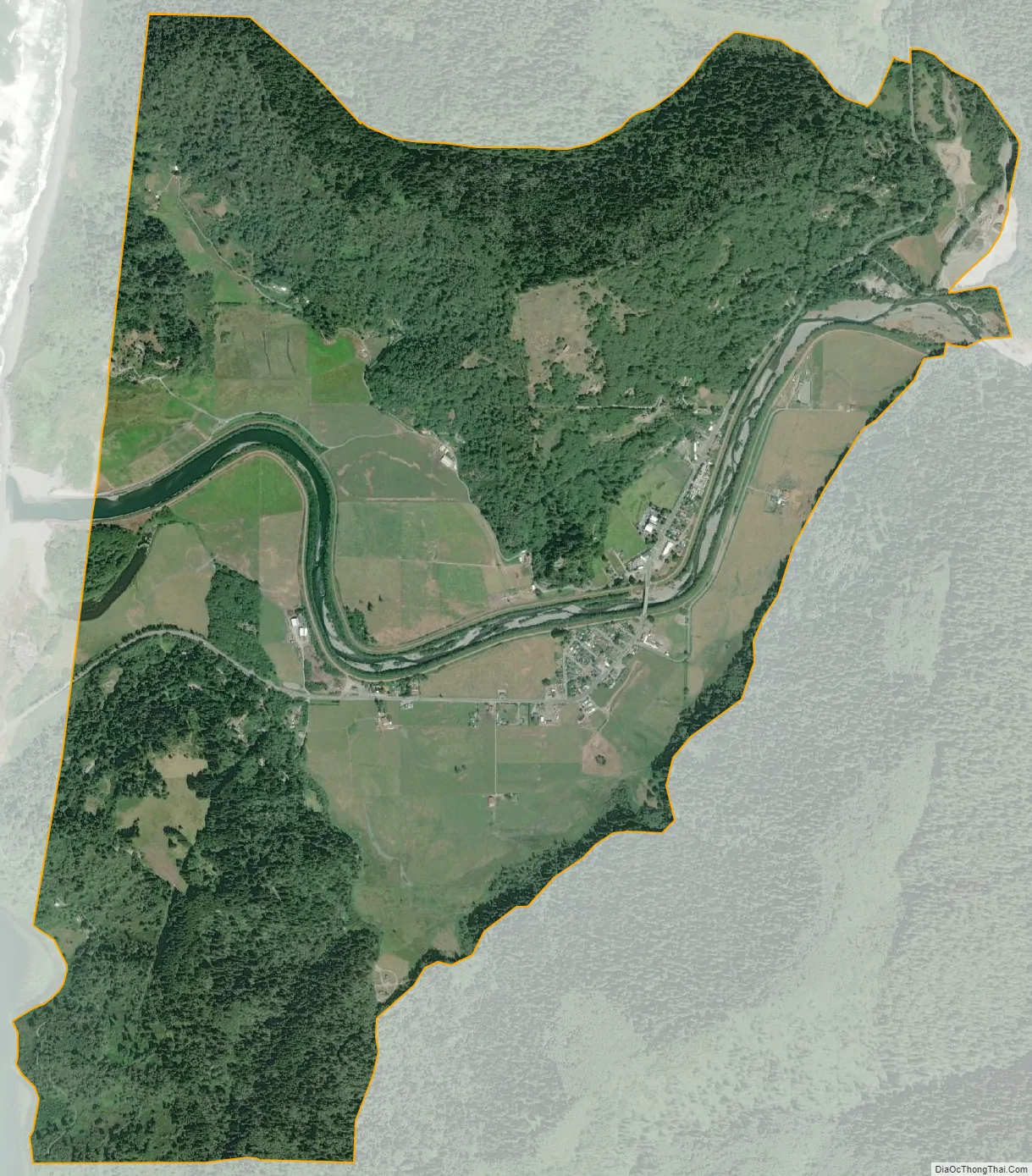
Orick city Satellite Map
Geography
Orick is part of the California Coast Range, lying close to the Pacific Ocean along U.S. 101. It is bisected by Redwood Creek. It is about 15 miles (24 km) south of the current northern border of Humboldt County and an equal distance north of the town of Trinidad.
The Orick/Gold Bluff Beach district runs about 10 miles (16 km) along the beach at Orick. Placer mining started in 1852 and continued until the 1880s during which time the district yielded more than $10 million value. Gold here is found in black sands at the beach and east of the beaches; its source may be sorted from materials brought down the Klamath River which arrives in the Pacific twenty miles north of Orick.
Redwood Creek Flood Control Project- Humboldt County
Floods in 1950, 1953, 1955 and 1964 resulted in channel enlargement, excavation and the construction of earthen levees along each side of the lower 3.4 miles (5.5 km) Redwood Creek (Humboldt County) by the U.S. Army Corps of Engineers during 1966 to 1968 to protect the community of Orick. An error was made within the construction. Fault was admitted shortly after the completion. Observation shows this design flaw invades the Redwood Creek estuary. This unwarranted annexation causes extreme damage to the ecosystem. The estuary sits at the western end of the flawed levee system known as the Redwood Creek Flood Control Project- Humboldt County (RCFCP- Humboldt County).The system is maintained by Humboldt County which determined that a general investigation is needed by USACE to consider reworking the system to a more natural condition while retaining flood control benefits.
See also
Map of California State and its subdivision:- Alameda
- Alpine
- Amador
- Butte
- Calaveras
- Colusa
- Contra Costa
- Del Norte
- El Dorado
- Fresno
- Glenn
- Humboldt
- Imperial
- Inyo
- Kern
- Kings
- Lake
- Lassen
- Los Angeles
- Madera
- Marin
- Mariposa
- Mendocino
- Merced
- Modoc
- Mono
- Monterey
- Napa
- Nevada
- Orange
- Placer
- Plumas
- Riverside
- Sacramento
- San Benito
- San Bernardino
- San Diego
- San Francisco
- San Joaquin
- San Luis Obispo
- San Mateo
- Santa Barbara
- Santa Clara
- Santa Cruz
- Shasta
- Sierra
- Siskiyou
- Solano
- Sonoma
- Stanislaus
- Sutter
- Tehama
- Trinity
- Tulare
- Tuolumne
- Ventura
- Yolo
- Yuba
- Alabama
- Alaska
- Arizona
- Arkansas
- California
- Colorado
- Connecticut
- Delaware
- District of Columbia
- Florida
- Georgia
- Hawaii
- Idaho
- Illinois
- Indiana
- Iowa
- Kansas
- Kentucky
- Louisiana
- Maine
- Maryland
- Massachusetts
- Michigan
- Minnesota
- Mississippi
- Missouri
- Montana
- Nebraska
- Nevada
- New Hampshire
- New Jersey
- New Mexico
- New York
- North Carolina
- North Dakota
- Ohio
- Oklahoma
- Oregon
- Pennsylvania
- Rhode Island
- South Carolina
- South Dakota
- Tennessee
- Texas
- Utah
- Vermont
- Virginia
- Washington
- West Virginia
- Wisconsin
- Wyoming


