Crescent City (Tolowa: Taa-’at-dvn; Yurok: Kohpey; Wiyot: Daluwagh) is the only incorporated city in Del Norte County, California; it is also the county seat. Named for the crescent-shaped stretch of sandy beach south of the city, Crescent City had a total population of 6,673 in the 2020 census, down from 7,643 in the 2010 census. The population includes inmates at Pelican Bay State Prison, also within the city limits, and the former census-designated place Crescent City North annexed to the city. The city is also the site of the Redwood National Park headquarters, as well as the historic Battery Point Light. Due to the richness of the local Pacific Ocean waters and the related catch, and ease of access, Crescent City Harbor serves as home port for numerous commercial fishing vessels.
The city is on the Pacific coast in the upper northwestern part of California, about 20 mi (32 km) south of the Oregon border. Crescent City’s offshore geography makes it unusually susceptible to tsunamis. Much of the city was destroyed by four tsunami waves generated by the Great Alaskan earthquake off Anchorage, Alaska in 1964. More recently, the city’s harbor suffered extensive damage and destruction from tsunamis generated by the March 11, 2011 earthquake off Sendai, Japan. Several dozen vessels and many of the docks they were moored to were destroyed as wave cycles related to the tsunamis exceeded 8 ft (2.4 m).
The climate of Crescent City is moderate, with cool summers for its latitude as a result of intense maritime moderation. Nearby inland areas behind the mountains have significantly warmer summer temperatures.
| Name: | Crescent City city |
|---|---|
| LSAD Code: | 25 |
| LSAD Description: | city (suffix) |
| State: | California |
| County: | Del Norte County |
| Incorporated: | April 13, 1854 |
| Elevation: | 43 ft (13 m) |
| Total Area: | 2.42 sq mi (6.25 km²) |
| Land Area: | 1.96 sq mi (5.09 km²) |
| Water Area: | 0.45 sq mi (1.17 km²) 18.7% |
| Total Population: | 6,673 |
| Population Density: | 3,399.39/sq mi (1,312.26/km²) |
| ZIP code: | 95531, 95532, 95538 |
| Area code: | 707 |
| FIPS code: | 0617022 |
| Website: | crescentcity.org |
Online Interactive Map
Click on ![]() to view map in "full screen" mode.
to view map in "full screen" mode.
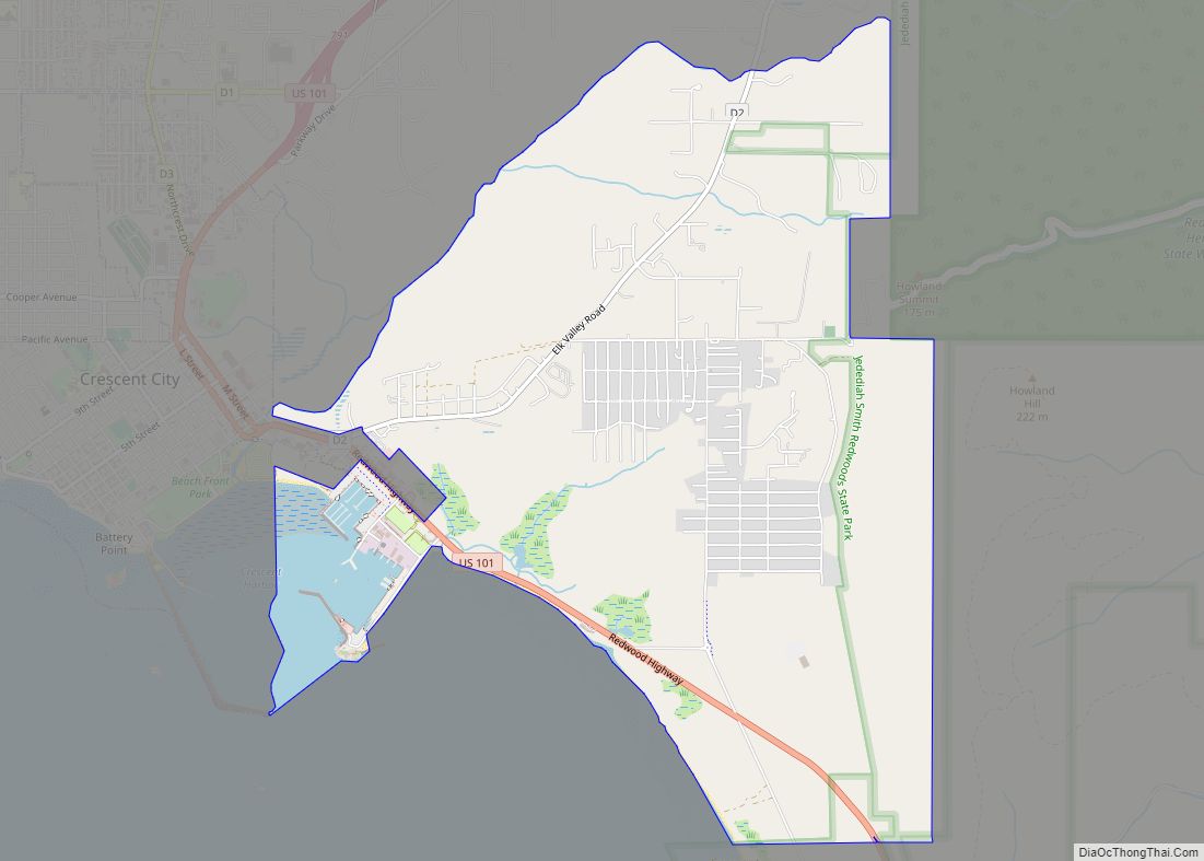
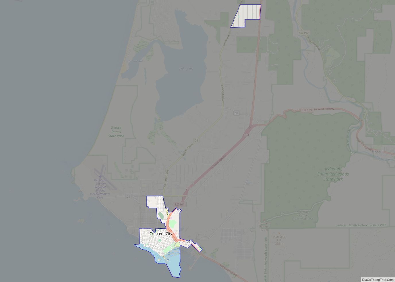
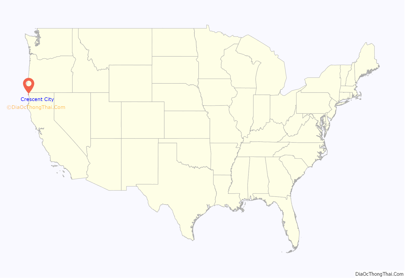
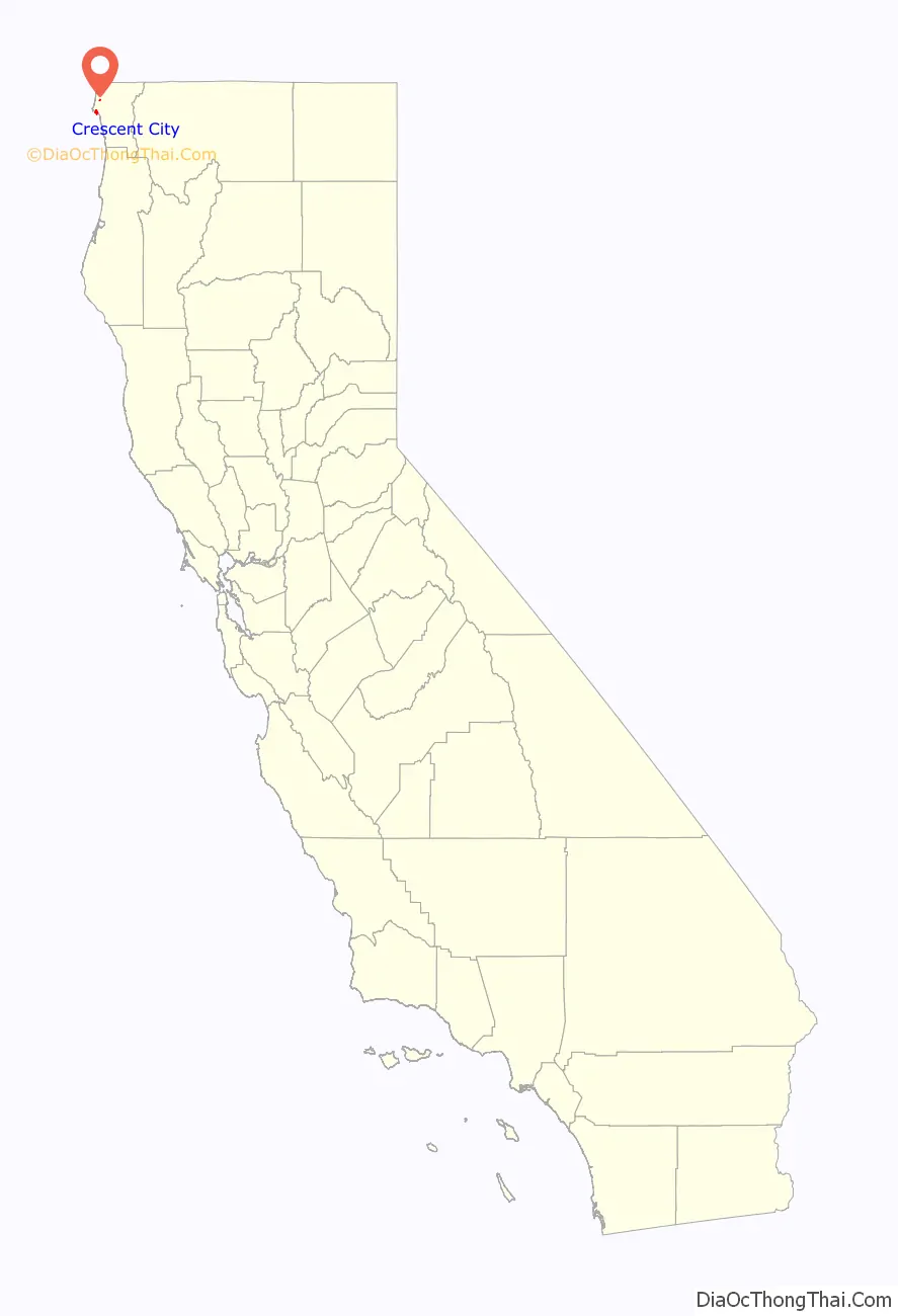
Crescent City location map. Where is Crescent City city?
History
The area that is now known as Del Norte County was and still is inhabited by the Yurok (Klamath River Indians) and Tolowa Nations of indigenous peoples. The first European American to explore this land was pioneer Jedediah Smith in the early 19th century. He was the first European American to reach the area overland on foot in a time before the European Americans knew anything about such a distant territory. For him it was literally “Land’s End” — where the American continent ended at the Pacific Ocean. In 1855, the U.S. Congress authorized the building of a lighthouse at “the battery point” (a high tide island on the coast of Crescent City) which is still functioning as a historical landmark.
European explorers first visited the area by ship in the late 1820s. Europeans began moving to the area in the 1850s. Crescent City was incorporated as a city in 1854.
Historic ships
- Crescent City was a 113 t (111 long tons; 125 short tons) schooner built in 1848 by Joshua T. Foster of Medford, Massachusetts.
- The Brother Jonathan, a paddle steamer, crashed on an uncharted rock near Point St. George, off the coast of Crescent City, California, on July 30, 1865.
- A 1906 ship named Crescent City was the former Jim Butler, a 701 t (690 long tons; 773 short tons) steam schooner built by Lindstrom Shipbuilding Company in Aberdeen, Washington, that wrecked in the Channel Islands, off Santa Cruz Island, in 1927.
- The SS Emidio, a 6,912 t (6,803 long tons; 7,619 short tons) tanker of the General Petroleum Corporation (later Mobil Oil), was the first casualty of the Imperial Japanese Navy’s submarine force action on California’s Pacific Coast on December 20, 1941. The damaged tanker broke up on the rocks off Crescent City. The remaining pieces of the ship are now California Historical Landmark #497.
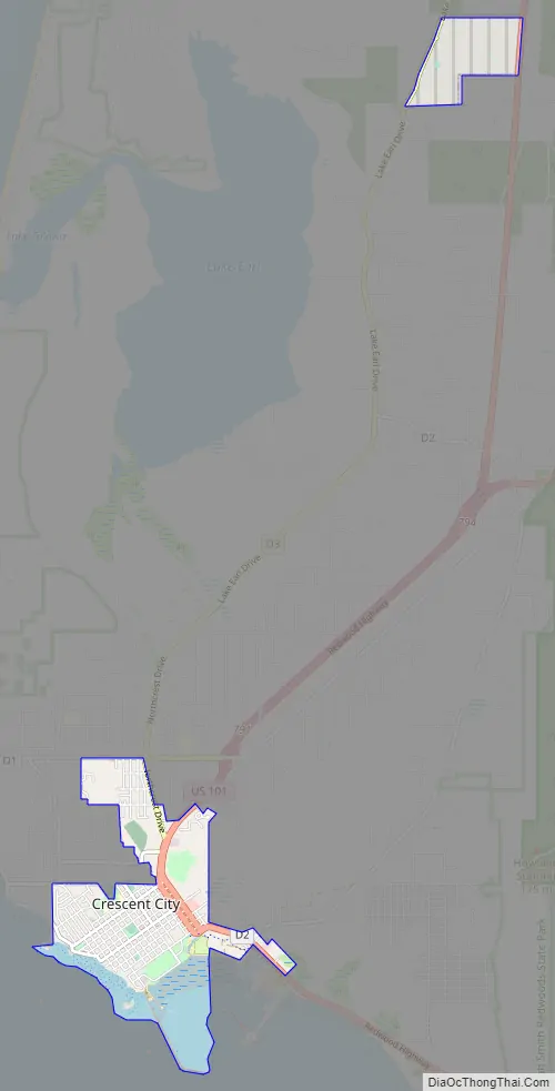
Crescent City Road Map
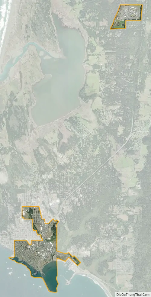
Crescent City city Satellite Map
Geography
According to the United States Census Bureau, the city has a total area of 2.415 sq mi (6.25 km), of which 1.963 sq mi (5.08 km) (81.3%) is land and 0.452 sq mi (1.17 km) (18.7%) is water. Fishing and crabbing, tourism, and timber are the major sources of income in Del Norte County. Elk Creek flows into the Pacific Ocean at Crescent City. Its nearest Californian place of any size to its interior is Happy Camp separated by roughly 42 mi (68 km) by air, but, due to the unsuitable terrain, it is much farther by road. The nearest city is fellow coastal city Brookings, Oregon, around 20 mi (32 km) to its north. The Humboldt Bay area encompassing Eureka and Arcata is more than 60 mi (97 km) to its south. Crescent City is as far north in latitude as Chicago, Middle Island in Ontario, Canada, as well as New England on the Atlantic side. It is as much as nine degrees latitude north of San Diego at the southern tip of the state. Crescent City is closer to Vancouver, Canada (838 km (521 mi)) than to Los Angeles (1,003 km (623 mi)).
Climate
Crescent City has a warm-summer Mediterranean climate (Köppen Csb), with moderation similar to an oceanic climate (Cfb). The wettest months are from October to March; the wettest month is December with 11.14 in or 283.0 mm and the driest month is July with 0.33 in or 8.4 mm. The average high and low temperatures in December are 55 °F or 12.8 °C and 41 °F or 5 °C. The average high and low temperatures in August are 64 °F or 17.8 °C and 53 °F or 12 °C. On average, four mornings each winter fall below 32 °F or 0 °C.
The highest temperature recorded in Crescent City was 97 °F (36 °C) on September 20, 1989 and September 21, 1939. The lowest temperature on record was 19 °F (−7 °C) on January 20, 1937 and December 21, 1990. The maximum monthly precipitation was 31.25 in (793.8 mm) in November 1973. The wettest year was 1904 when 107.61 in (2,733.3 mm) fell and the driest year was 2013 with 28.92 in (734.6 mm). The maximum 24-hour precipitation was 7.73 in (196.3 mm) on January 9, 1995. The highest snowfall recorded for any period in 24 hours was 6.0 in (0.15 m) on January 26, 1972. The 30-year average annual precipitation in Crescent City has decreased from 64 inches (1,630 mm) in the 1980–2010 period to about 58 inches (1,470 mm) over the 1990–2020 period.
The warmest ever overnight low was 68 °F (20 °C) in 1929 and the mean between 1991 and 2020 was at the modest 59 °F (15 °C). Cold winter days are also rare. The coldest daytime temperature was 30 °F (−1 °C) in 1924, which remains the last time Crescent City did not climb above the freezing point for 24 hours. Between 1991 and 2020, the coldest maximum temperature averaged 44 °F (7 °C).
Tsunamis
The topography of the sea floor surrounding Crescent City has the effect of focusing tsunamis. According to researchers at Humboldt State University and the University of Southern California, the city experienced tsunami conditions 31 times between the years 1933 and 2008. Although many of these incidents were barely perceptible, eleven events included wave measurements exceeding one meter, four events caused damage, and one event in particular is commonly cited as “the largest and most destructive recorded tsunami to strike the United States Pacific Coast.”
On March 27, 1964, the Great Alaskan earthquake off Anchorage, Alaska, set in motion local landslide tsunamis, as well as a trans-Pacific wave. The tsunami wave travel time to Crescent City was 4.1 hours after the earthquake, but it only produced localized flooding. The second and third waves to hit Crescent City were smaller, but the fourth wave struck with a height of approximately 20 ft (6.1 m) after having drawn the harbor out nearly dry. The next morning the damage was counted: 289 buildings and businesses had been destroyed; 1,000 cars and 25 large fishing vessels had been crushed; 12 people were confirmed dead, over 100 were injured, and more were missing; and 60 blocks had been inundated, with 30 city blocks destroyed. Although most of the missing were later accounted for, not all were tracked down. Insurance adjusters estimated that the city received more damage from the tsunami on a block-by-block basis than did Anchorage from the initial earthquake.
The tsunami raced down the West Coast with more deaths and destruction, but no other location was hit as hard. Crescent City bore the brunt, due to its offshore geography, position relative to the earthquake’s strike-line, underwater contours such as the Cobb Seamount, and the position of rivers near the city. Although houses, buildings, and infrastructure were later rebuilt, years passed before the city recovered from the devastation to lives, property, and its economy. Since the 1980s, the breakwater has been protected from normal storm waves by hundreds of Dolos armor units, 38 ton concrete shapes.
The city is deemed to be tsunami-ready today. Its preparedness was tested on June 14, 2005, when the 2005 Eureka earthquake measuring 7.2 on the moment magnitude scale hit 90 mi (145 km) offshore; much of the city (an estimated 6,000 people) was evacuated when a tsunami warning was issued, and a 26 cm (10 in) tsunami wave hit the area.
On November 15, 2006, a magnitude 8.3 earthquake struck off Simushir Island in the Kuril Islands in the western Pacific. A tsunami warning was issued but rescinded hours later. However, a surge from that quake did hit the harbor at Crescent City causing damage to three docks and several boats. Governor Arnold Schwarzenegger declared a county state of emergency. Upon that declaration, the area affected was eligible for federal emergency relief funding to repair the damage.
Parts of the city were evacuated on March 11, 2011, after a 9.0 earthquake struck Japan. Thirty-five boats were destroyed, and the harbor suffered major damage. The reported peak surge was over 8 ft (2.4 m) by 9:50am. Five were swept out to sea, and one person was killed.
See also
Map of California State and its subdivision:- Alameda
- Alpine
- Amador
- Butte
- Calaveras
- Colusa
- Contra Costa
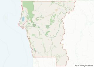
- Del Norte
- El Dorado
- Fresno
- Glenn
- Humboldt
- Imperial
- Inyo
- Kern
- Kings
- Lake
- Lassen
- Los Angeles
- Madera
- Marin
- Mariposa
- Mendocino
- Merced
- Modoc
- Mono
- Monterey
- Napa
- Nevada
- Orange
- Placer
- Plumas
- Riverside
- Sacramento
- San Benito
- San Bernardino
- San Diego
- San Francisco
- San Joaquin
- San Luis Obispo
- San Mateo
- Santa Barbara
- Santa Clara
- Santa Cruz
- Shasta
- Sierra
- Siskiyou
- Solano
- Sonoma
- Stanislaus
- Sutter
- Tehama
- Trinity
- Tulare
- Tuolumne
- Ventura
- Yolo
- Yuba
- Alabama
- Alaska
- Arizona
- Arkansas
- California
- Colorado
- Connecticut
- Delaware
- District of Columbia
- Florida
- Georgia
- Hawaii
- Idaho
- Illinois
- Indiana
- Iowa
- Kansas
- Kentucky
- Louisiana
- Maine
- Maryland
- Massachusetts
- Michigan
- Minnesota
- Mississippi
- Missouri
- Montana
- Nebraska
- Nevada
- New Hampshire
- New Jersey
- New Mexico
- New York
- North Carolina
- North Dakota
- Ohio
- Oklahoma
- Oregon
- Pennsylvania
- Rhode Island
- South Carolina
- South Dakota
- Tennessee
- Texas
- Utah
- Vermont
- Virginia
- Washington
- West Virginia
- Wisconsin
- Wyoming