Pismo Beach (Chumash: Pismuʔ) is a city in the southern portion of San Luis Obispo County, in the Central Coast area of California, United States. The estimated population was 8,072 at the 2020 census, up from 7,655 in the 2010 census. It is part of the Five Cities Area, a cluster of cities in that area of San Luis Obispo County. The “Five Cities” area historically is made up of Arroyo Grande, Grover City (now Grover Beach), Halcyon, Fair Oaks and Nipomo. Now most people refer to the Five Cities as Grover Beach, Pismo Beach, Shell Beach (which is actually a part of Pismo Beach), Arroyo Grande and Oceano (which is unincorporated county land serviced by the Oceano Community Services District).
| Name: | Pismo Beach city |
|---|---|
| LSAD Code: | 25 |
| LSAD Description: | city (suffix) |
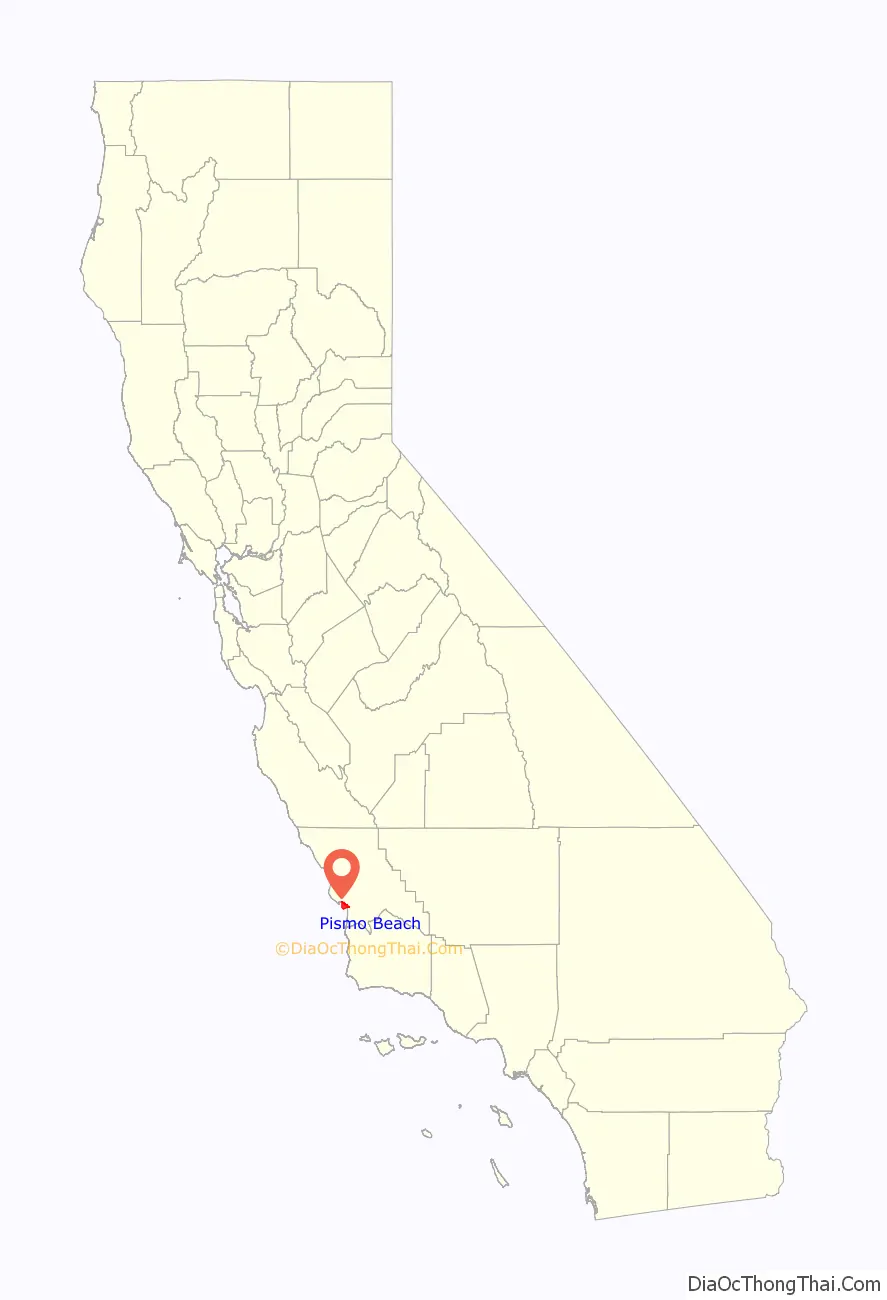
| State: | California |
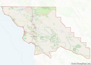
| County: | San Luis Obispo County |
| Incorporated: | April 25, 1946 |
| Elevation: | 56 ft (17 m) |
| Total Area: | 13.37 sq mi (34.64 km²) |
| Land Area: | 3.50 sq mi (9.06 km²) |
| Water Area: | 9.88 sq mi (25.58 km²) 73.29% |
| Total Population: | 8,072 |
| Population Density: | 600/sq mi (230/km²) |
| Area code: | 805 |
| FIPS code: | 0657414 |
| Website: | pismobeach.org |
Online Interactive Map
Click on ![]() to view map in "full screen" mode.
to view map in "full screen" mode.
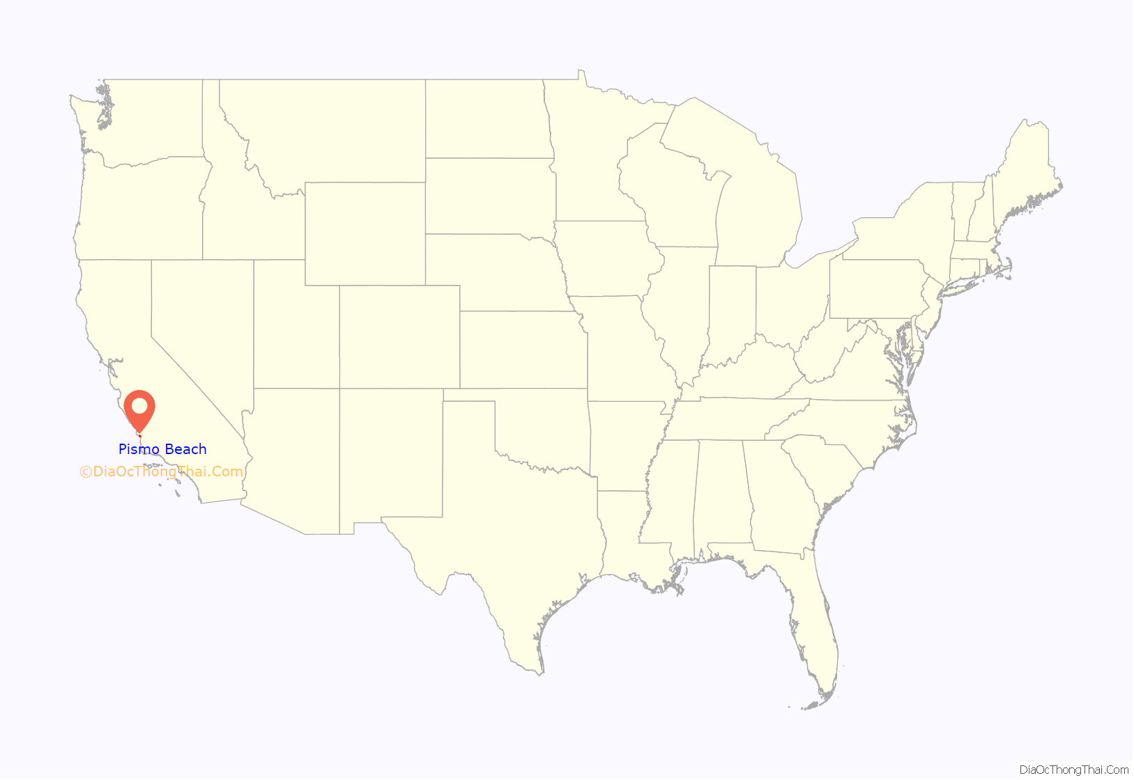
Pismo Beach location map. Where is Pismo Beach city?
History
The Chumash people are the historic inhabitants of the region, with Indigenous peoples having lived along the California coast for at least 11,000 years. The name Pismo comes from the Chumash language word for tar, pismuʔ, which was gathered from tar springs in Price Canyon near Pismo Beach. The tar was a valuable product which the Chumash used to caulk their seagoing canoes, called tomol, which traveled along the coast and out to the Channel Islands. The first European land exploration of Alta California, the Spanish Portolá expedition, passed through the area, traveling up Price Canyon from Pismo Beach, where they camped on September 4, 1769. Franciscan missionary and expedition member Juan Crespí noted in his diary that they found a Chumash village near the creek.
Pismo Beach is located on the Rancho Pismo Mexican land grant made to José Ortega, grandson of José Francisco Ortega, in 1840. In 1846 José Ortega sold Rancho Pismo to Isaac Sparks. John Michael Price bought most of the rancho from Sparks. Price established the town of Pismo Beach in 1891. His homestead is now Price Historical Park. His home is a registered historical landmark. Pismo is known as the clam capital of the world. Nearly over 2.5 million people visit Pismo Beach.
The first wharf at Pismo was built in 1882, followed by a full-length pier built in 1924 that was financed and constructed by William Woodrow Ward, who allowed full use of it by the public. After it suffered considerable storm damage, the pier was renovated again in 1985. Pismo State Beach is named for the city of Pismo Beach.
The neighborhoods of Shell Beach and Sunset Palisades were the site of a Chumash village, and significant archeological sites are located in both areas. Shell Beach became agricultural land, mostly pea fields. Developer Floyd Calvert bought and developed the area in 1926. At first it was a local resort area; after World War II it became primarily residential. Sunset Palisades, originally called Oilport, was the site of an oil refinery from 1907 until after World War II. It is now residential.
Clams
The Pismo clam was named for the long, wide beach where so many were once found, once in such abundance that they were harvested with plows. Clamming once drew thousands of clammers to Pismo during low tides, and is still legal; however, due to over-harvesting by humans and the protected sea otter (which feasts on clams), few clams are to be found.
Pismo Beach adopted the name “Clam Capital of the World” in the 1950s, though this motto is no longer used. The city still holds the Clam Festival every October, complete with clam chowder competitions and a clam-themed parade.
At the southern end of Price Street upon first entering Pismo Beach is a gigantic concrete clam statue. The oldest surf shop on the Central Coast (Pismo Beach Surf Shop) can be seen from the Pismo clam statue. The eight-inch (20 cm) shell of a Pismo clam (Tivela stultorum) is on display at the Pismo Beach Chamber of Commerce.
Pismo Beach Road Map
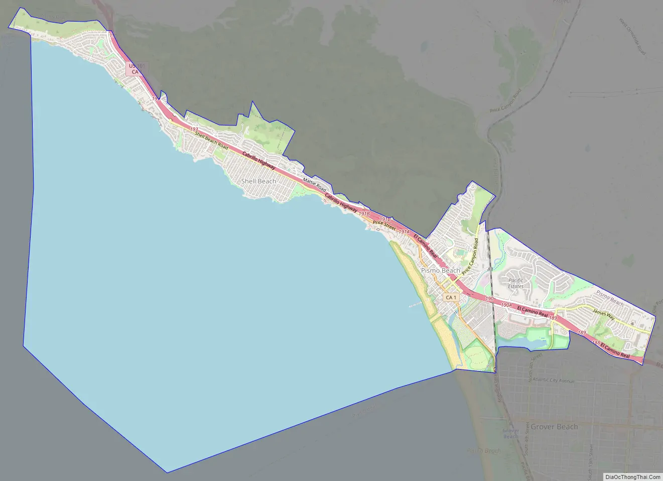
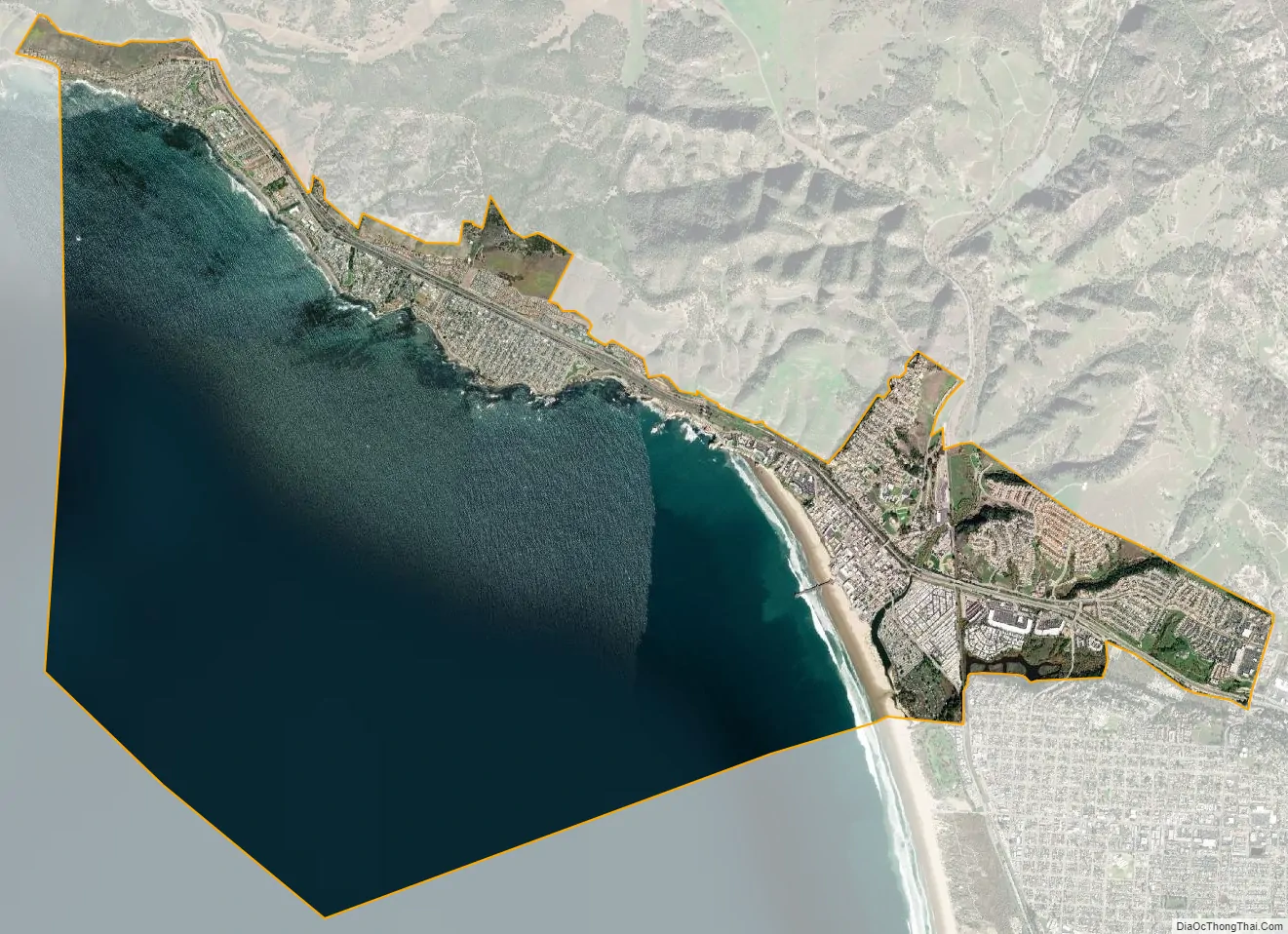
Pismo Beach city Satellite Map
Geography
According to the United States Census Bureau, the city has a total area of 13.5 square miles (35 km), of which 3.6 square miles (9.3 km) is land and 9.9 square miles (26 km) of it (comprising 73.29%) is water.
Pismo Creek enters the Pacific Ocean at Pismo Beach. The southern end of Pismo Beach runs alongside sand dunes, which are followed by eucalyptus trees that attract thousands of migrating monarch butterflies every November through February.
Meadow Creek is a short creek that runs through the Pismo Lake Ecological Reserve and hosts a variety of wildlife despite its urban surroundings, including beaver (Castor canadensis).
Climate
Pismo Beach has a warm-summer Mediterranean climate (Csb.) Despite the subtropical latitude (the same as Cape Hatteras, North Carolina,) summers are quite cool and the change in seasonal temperatures is quite small. The hardiness zone is 9b/10a, which is a full zone higher than Cape Hatteras.
See also
Map of California State and its subdivision:- Alameda
- Alpine
- Amador
- Butte
- Calaveras
- Colusa
- Contra Costa
- Del Norte
- El Dorado
- Fresno
- Glenn
- Humboldt
- Imperial
- Inyo
- Kern
- Kings
- Lake
- Lassen
- Los Angeles
- Madera
- Marin
- Mariposa
- Mendocino
- Merced
- Modoc
- Mono
- Monterey
- Napa
- Nevada
- Orange
- Placer
- Plumas
- Riverside
- Sacramento
- San Benito
- San Bernardino
- San Diego
- San Francisco
- San Joaquin
- San Luis Obispo
- San Mateo
- Santa Barbara
- Santa Clara
- Santa Cruz
- Shasta
- Sierra
- Siskiyou
- Solano
- Sonoma
- Stanislaus
- Sutter
- Tehama
- Trinity
- Tulare
- Tuolumne
- Ventura
- Yolo
- Yuba
- Alabama
- Alaska
- Arizona
- Arkansas
- California
- Colorado
- Connecticut
- Delaware
- District of Columbia
- Florida
- Georgia
- Hawaii
- Idaho
- Illinois
- Indiana
- Iowa
- Kansas
- Kentucky
- Louisiana
- Maine
- Maryland
- Massachusetts
- Michigan
- Minnesota
- Mississippi
- Missouri
- Montana
- Nebraska
- Nevada
- New Hampshire
- New Jersey
- New Mexico
- New York
- North Carolina
- North Dakota
- Ohio
- Oklahoma
- Oregon
- Pennsylvania
- Rhode Island
- South Carolina
- South Dakota
- Tennessee
- Texas
- Utah
- Vermont
- Virginia
- Washington
- West Virginia
- Wisconsin
- Wyoming