San Anselmo (Spanish for ‘Saint Anselm’) is an incorporated town in Marin County, California, United States. San Anselmo is located 1.5 miles (2.4 km) west of San Rafael, at an elevation of 46 feet (14 m). It is located about 20 miles (32 km) north of San Francisco. The town is bordered by San Rafael to the east, Fairfax to the west, and Ross to the south. Mount Tamalpais dominates the view to the south. The population was 12,830 at the 2020 census.
| Name: | San Anselmo town |
|---|---|
| LSAD Code: | 43 |
| LSAD Description: | town (suffix) |
| State: | California |
| County: | Marin County |
| Incorporated: | April 9, 1907 |
| Elevation: | 46 ft (14 m) |
| Total Area: | 2.68 sq mi (6.93 km²) |
| Land Area: | 2.68 sq mi (6.93 km²) |
| Water Area: | 0.00 sq mi (0.00 km²) 0% |
| Total Population: | 12,830 |
| Population Density: | 4,660.44/sq mi (1,799.41/km²) |
| FIPS code: | 0664434 |
| Website: | townofsananselmo.org |
Online Interactive Map
Click on ![]() to view map in "full screen" mode.
to view map in "full screen" mode.
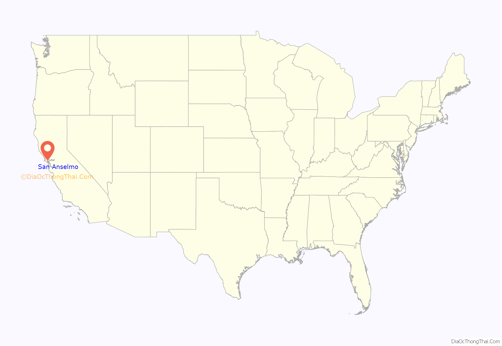
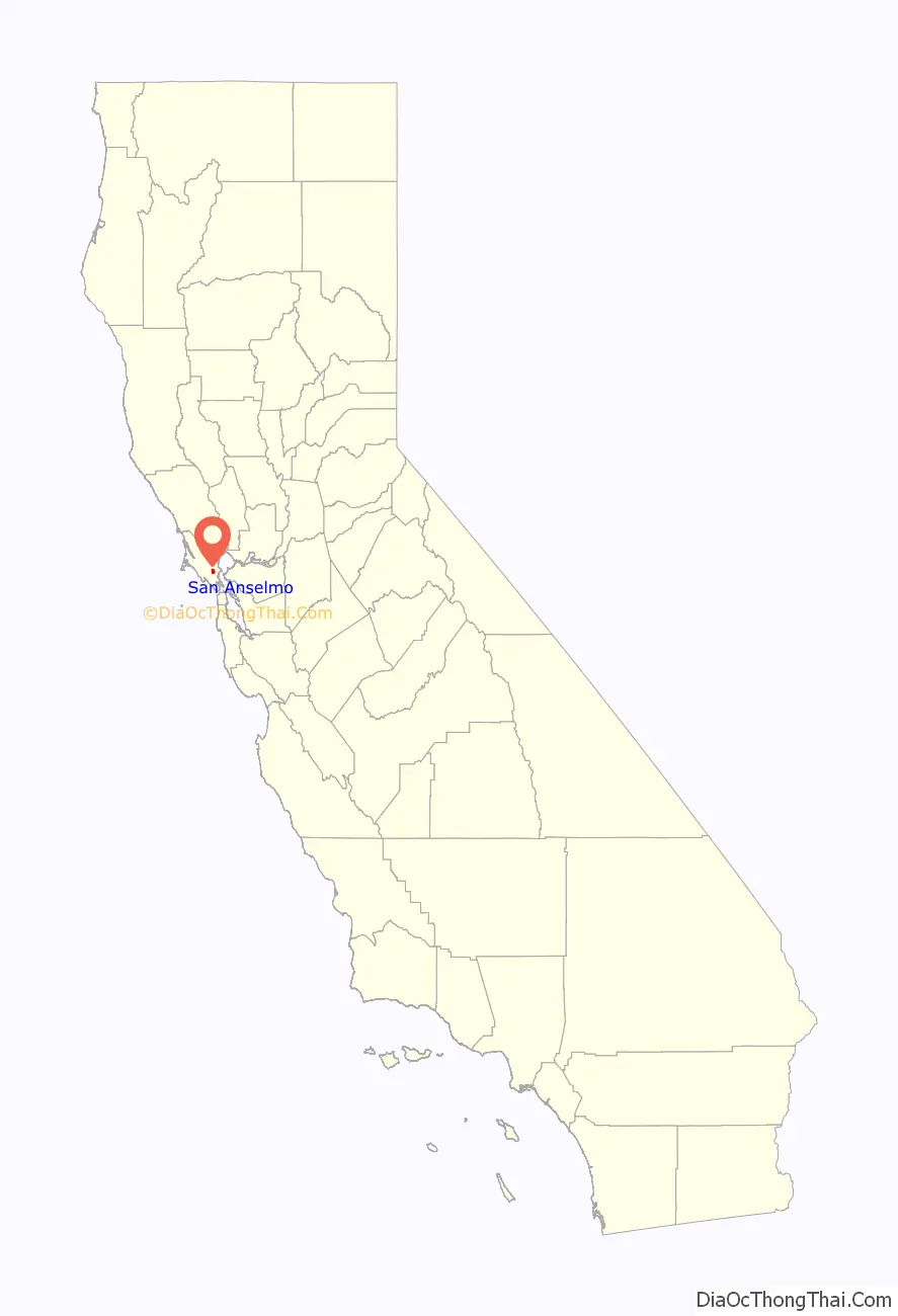
San Anselmo location map. Where is San Anselmo town?
History
Early history
The land in and around San Anselmo was mostly pastoral until 1874, when the North Pacific Coast Railroad (NPC) added to its line a spur track from San Anselmo to San Rafael. In 1875, the railroad completed a line from Sausalito to Tomales and north to Cazadero via San Anselmo. For a few years, the town was referred to on railroad maps as “Junction”, but in 1883 the name San Anselmo came back into use. The San Anselmo post office opened in 1892. Two postal substations were operated: Lansdale, from 1924 to 1962, and Yolanda, from 1924 to 1954.
From 1902 until the early 1940s, San Anselmo was part of Marin’s Northwestern Pacific (in 1907, investors formed the NWP) Electric Train system. The Miracle Mile’s and Center Boulevard’s current “raised roadbed” were the railroad’s right of way. Becoming unprofitable as a result of competition from the automobile and the opening of the Golden Gate Bridge, the railway was officially closed on March 1, 1941. The last of the major San Anselmo railroad station buildings was razed in 1963, according to the town’s timeline.
The 1913 electric train schedule shows a commute time from San Anselmo to the Sausalito Ferry to the Ferry Building in San Francisco of a mere 58 minutes, including the 32-minute ferry transit.
San Anselmo incorporated on April 9, 1907. Its name came from the Punta de Quintin land grant, which marked the valley as the Canada del Anselmo, or Valley of Anselm, Anselm being the name of a Native American who was buried in the area. San Anselmo was a silent film capital in the early 1900s.
World War II
During World War II, the Army based a small ammunition storage dump, known as ASP #2, about 2 miles (3.2 km) up Butterfield Road from Sir Francis Drake Blvd. The facility was located between the road and San Anselmo Creek and had 23 to 45 men stationed there. There were two batteries composed of four-inch antiaircraft cannon manned by five soldiers on a 24-hour basis. One battery was on Stuyvesant Drive and the other on Oak Springs Hill. During the war, the Sleepy Hollow Country Club, located in the old Hotaling mansion, was still open and provided a pleasant break from “grueling” guard duty, according to those stationed at the ammo dump.
During World War II, air raid wardens, like Zinnia and Alfred Heiden of San Francisco Blvd., patrolled their assigned neighborhood during nighttime air raid drills to notify neighbors of any light that showed out of their houses. Windows were covered with cloth or thick paper during the war to deny enemy bombers illuminated nighttime bombing targets.
In the late afternoon of November 2, 1941, five weeks before the US entered the war, San Anselmo residents were startled when two low-flying Curtiss P-40 warplanes roared up the valley at just above roof level and crashed into the east side of Bald Hill (often incorrectly reported as Mount Baldy or Bald Mountain) at 5:40pm.
Element leader Lt. Thomas “Bud” L. Truax and Lt. Russell E. Speckman were killed when their planes crashed, in low visibility, into Bald Hill, just shy of the peak. It was almost dark, was misty and they were under a low cloud ceiling. They were critically low on fuel and part of a larger training group that had gotten separated. They were under the wintertime marine layer of low clouds that are common in the Marin County area, searching for nearby Hamilton Field to land. Truax Field / Dane County Regional Airport, located in Madison, WI was named in memory of Lt. Truax.
A third pilot, Lt. Walter V. “Ramblin” Radovich, had left the formation over San Rafael, almost hit the city courthouse on 4th Street, circled the Forbes Hill radio beacon (37°58’44.73″N,122°32’50.78″W), clipped a tree and then turned northeast, towards Hamilton Field. Unsure of what the oncoming terrain would be and critically low on fuel, he decided to climb up though the typically thin marine cloud layer to 2,500 feet (760 m), trim the airplane for straight and level flight and bail out. According to USAAF accident reports, his left leg was broken when exiting the plane and he parachuted down, landing near Hwy 101 in Lucas Valley, reportedly near where Fireman’s Fund / Marin Commons is currently located (38° 1’10.66″N, 122°32’29.36″W). Ironically, after Lt. Radovich bailed out, the airplane slowly descended back down through the clouds and made a relatively smooth “gear-up” landing.
Post-WWII
On March 12, 1974, San Anselmo officially became a town. In 1963, a cast iron statue of a deer affectionately known as “Sugarfoot” by locals was donated to the town by Joeseph Dondero. This statue still stands today and children enjoy riding on his back after trips to the library next door.
The town features in the song “Snow in San Anselmo” by Irish-born singer/songwriter Van Morrison, about an unusual bout of winter weather that occurred when he was living in Fairfax, near San Anselmo, in the 1970s.
San Anselmo’s most prominent resident, movie director George Lucas, used some of the proceeds from his film American Graffiti to buy an old Victorian house in San Anselmo; his then-wife Marcia Lucas named it “Parkhouse.” Lucas worked on his Star Wars script for two and a half years, writing much of it at the back of his San Anselmo house in a room he shared with a gaudy Wurlitzer jukebox. In 1977, Lucas screened an early version of Star Wars, without completed special effects, at his San Anselmo home for a small group of Hollywood friends, including the producer Alan Ladd, Jr., directors Steven Spielberg, Brian DePalma, and Martin Scorsese, and screenwriters Jay Cocks, Willard Huyck, and Gloria Katz.
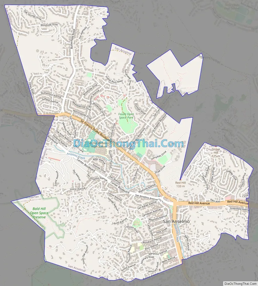
San Anselmo Road Map
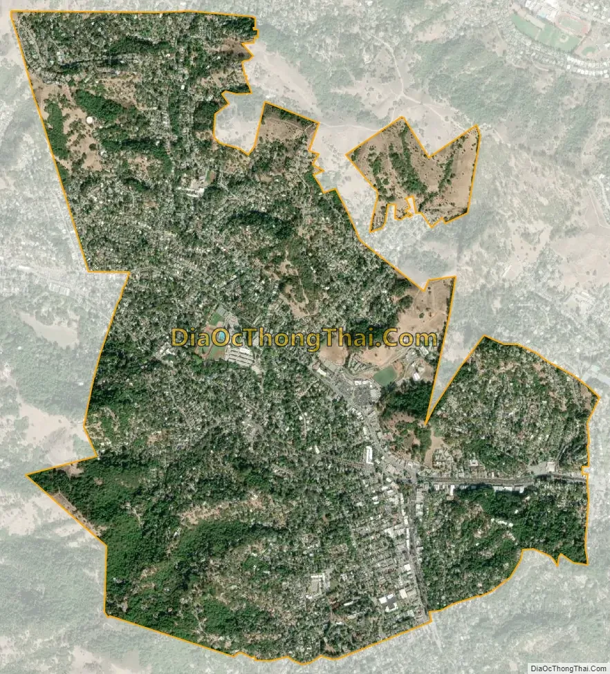
San Anselmo city Satellite Map
Geography
The average high temperature is 85 °F (29 °C), in July, and the average low temperature is 41 °F (5 °C), in January and December. The record high was 111 °F (44 °C) in July 1972, and record low was 18 °F (−8 °C) in December 1990. Average rainfall is 47.47 inches (1,206 mm), with the rainiest month being January.
All but a sliver of San Anselmo lies within the 28-square-mile (73 km) Ross Valley Watershed that flows into San Francisco Bay. The principal waterway of the town’s portion of the watershed is San Anselmo Creek, a branch of Corte Madera Creek. Two of San Anselmo Creek’s tributaries, Sleepy Hollow Creek and Sorich Creek, also flow through the town, as do East Fork Creek and West Fork Creek, Sorich Creek’s two tributaries.
There are three main roads running through San Anselmo. Their junction is known locally as the Hub, which lies near the central business district. Sir Francis Drake Boulevard runs north from Ross, turns north-west at the Hub, and then proceeds west to Fairfax. Red Hill Avenue (also called “The Miracle Mile”) runs west from San Rafael, after 4th Street and 3rd Street merge, and into the Hub where it becomes Center Boulevard. Center Boulevard runs northwest from the Hub to Fairfax and Sir Francis Drake parallels Center Boulevard to Fairfax, offset to the north.
The town’s natural skyline is dominated by the hills of Ross Valley. To the north are Red Hill and Grove Hill. To the southwest is Bald Hill. To the east is Moore Hill. In the distance to the south is Mount Tamalpais.
A large part of southern and western San Anselmo is built on a natural floodplain. About every 15–23 years, heavy rains cause San Anselmo Creek to flood the center of town by up to 4 feet – 1925, 1940 (11.38″ rainfall in 3 days), 1963, January 1982, as well as December 30/31, 2005. The worst flood, on Jan 2, 1982, (the highest creek water level, according to interviews with longtime creek-side residents) was preceded by a rainfall amount that exceeded 8″ in 12 hours.
San Anselmo’s historic raised railroad bed (now Center Boulevard), acts as a dike, providing some flood protection to the west-side houses, upstream of the business district.
A number of homes on the floodplain (called the “Flatlands” by the Town) as far back as at least 1920, have been built with raised foundations to accommodate the minor periodic floods.
Most of the downtown antique and boutique stores and restaurants, for which San Anselmo is well known, are along the banks of San Anselmo Creek.
See also
Map of California State and its subdivision:- Alameda
- Alpine
- Amador
- Butte
- Calaveras
- Colusa
- Contra Costa
- Del Norte
- El Dorado
- Fresno
- Glenn
- Humboldt
- Imperial
- Inyo
- Kern
- Kings
- Lake
- Lassen
- Los Angeles
- Madera
- Marin
- Mariposa
- Mendocino
- Merced
- Modoc
- Mono
- Monterey
- Napa
- Nevada
- Orange
- Placer
- Plumas
- Riverside
- Sacramento
- San Benito
- San Bernardino
- San Diego
- San Francisco
- San Joaquin
- San Luis Obispo
- San Mateo
- Santa Barbara
- Santa Clara
- Santa Cruz
- Shasta
- Sierra
- Siskiyou
- Solano
- Sonoma
- Stanislaus
- Sutter
- Tehama
- Trinity
- Tulare
- Tuolumne
- Ventura
- Yolo
- Yuba
- Alabama
- Alaska
- Arizona
- Arkansas
- California
- Colorado
- Connecticut
- Delaware
- District of Columbia
- Florida
- Georgia
- Hawaii
- Idaho
- Illinois
- Indiana
- Iowa
- Kansas
- Kentucky
- Louisiana
- Maine
- Maryland
- Massachusetts
- Michigan
- Minnesota
- Mississippi
- Missouri
- Montana
- Nebraska
- Nevada
- New Hampshire
- New Jersey
- New Mexico
- New York
- North Carolina
- North Dakota
- Ohio
- Oklahoma
- Oregon
- Pennsylvania
- Rhode Island
- South Carolina
- South Dakota
- Tennessee
- Texas
- Utah
- Vermont
- Virginia
- Washington
- West Virginia
- Wisconsin
- Wyoming


