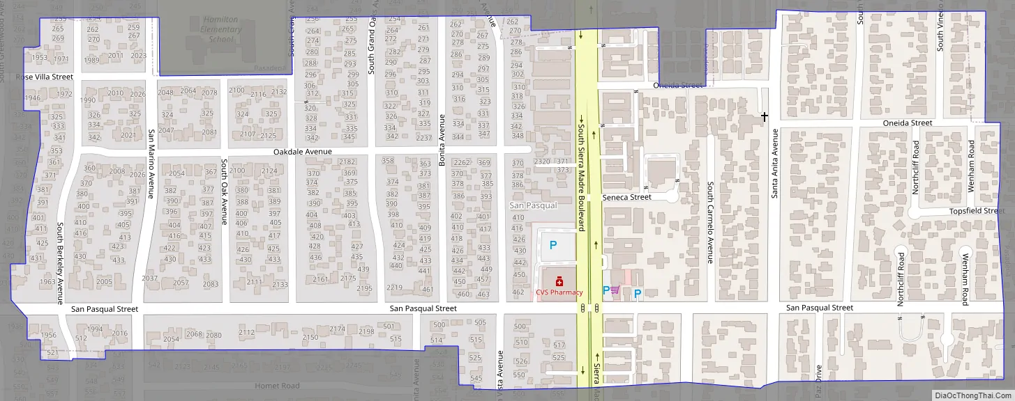
San Pasqual (pronunciation) is a census-designated place in Los Angeles County, California. It lies between San Marino and Pasadena. The major streets in San Pasqual are San Pasqual Street, South Sierra Madre Blvd., and Oakdale Street. San Pasqual is served by the Pasadena post office responsible for ZIP code 91107, and thus locations there are properly addressed with the final line reading “Pasadena, CA 91107”. The population was 2,041 at the 2010 census.
The name comes from the Rancho San Pascual, of which San Pasqual is one of the remaining unincorporated areas.
| Name: | San Pasqual CDP |
|---|---|
| LSAD Code: | 57 |
| LSAD Description: | CDP (suffix) |
| State: | California |
| County: | Los Angeles County |
| Elevation: | 696 ft (212 m) |
| Total Area: | 0.255 sq mi (0.661 km²) |
| Land Area: | 0.255 sq mi (0.661 km²) |
| Water Area: | 0 sq mi (0 km²) 0% |
| Total Population: | 2,041 |
| Population Density: | 8,000/sq mi (3,100/km²) |
| ZIP code: | 91107 |
| FIPS code: | 0668308 |
Online Interactive Map
Click on ![]() to view map in "full screen" mode.
to view map in "full screen" mode.
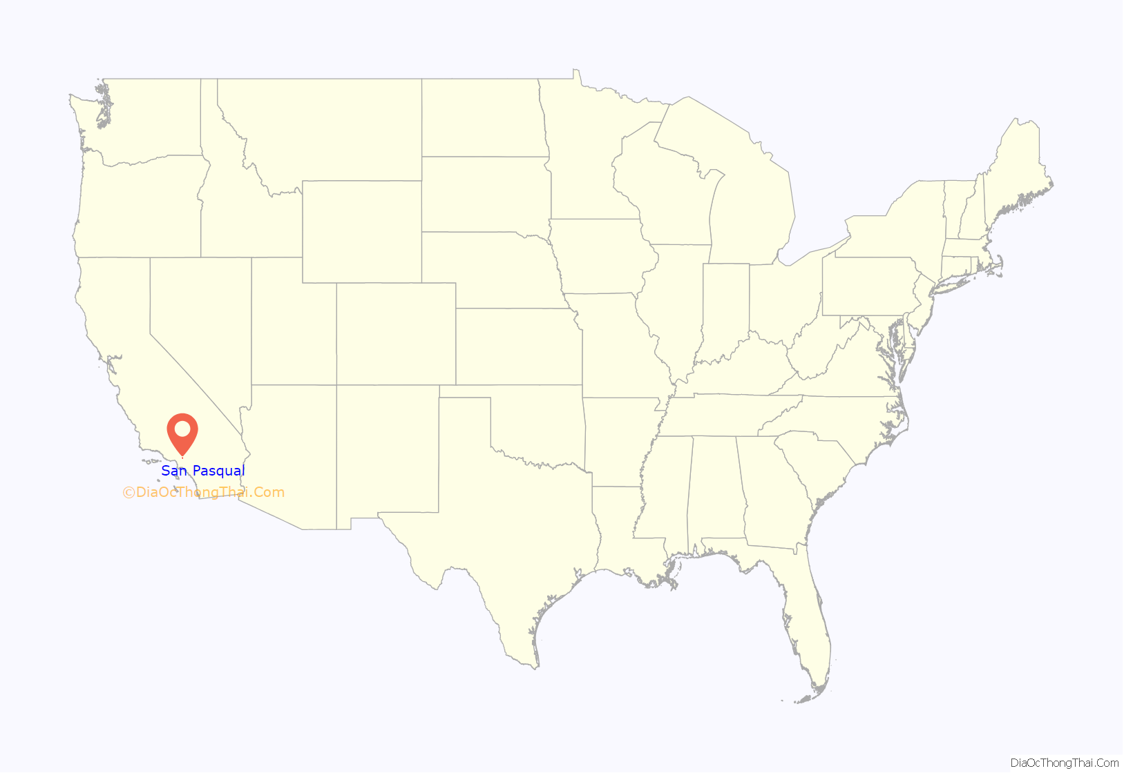
San Pasqual location map. Where is San Pasqual CDP?
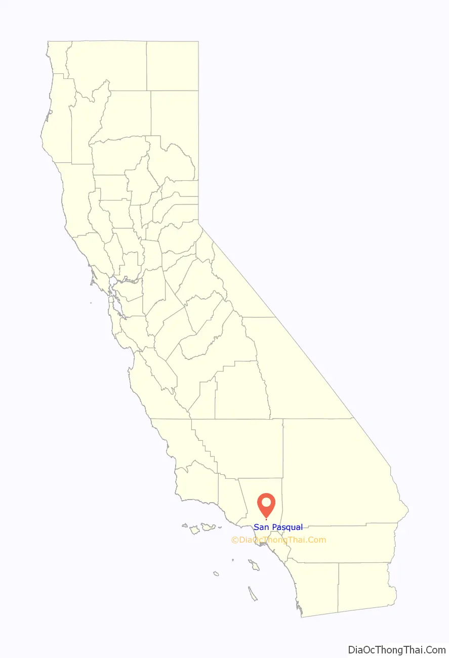
San Pasqual Road Map
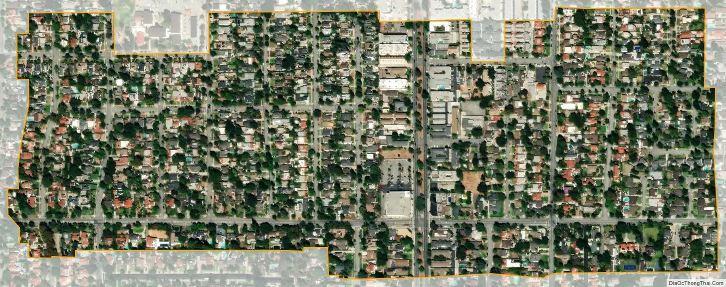
San Pasqual city Satellite Map
Geography
According to the United States Census Bureau, the CDP has a total area of 0.3 square miles (0.7 km), all of it land.
See also
Map of California State and its subdivision:- Alameda
- Alpine
- Amador
- Butte
- Calaveras
- Colusa
- Contra Costa
- Del Norte
- El Dorado
- Fresno
- Glenn
- Humboldt
- Imperial
- Inyo
- Kern
- Kings
- Lake
- Lassen
- Los Angeles
- Madera
- Marin
- Mariposa
- Mendocino
- Merced
- Modoc
- Mono
- Monterey
- Napa
- Nevada
- Orange
- Placer
- Plumas
- Riverside
- Sacramento
- San Benito
- San Bernardino
- San Diego
- San Francisco
- San Joaquin
- San Luis Obispo
- San Mateo
- Santa Barbara
- Santa Clara
- Santa Cruz
- Shasta
- Sierra
- Siskiyou
- Solano
- Sonoma
- Stanislaus
- Sutter
- Tehama
- Trinity
- Tulare
- Tuolumne
- Ventura
- Yolo
- Yuba
- Alabama
- Alaska
- Arizona
- Arkansas
- California
- Colorado
- Connecticut
- Delaware
- District of Columbia
- Florida
- Georgia
- Hawaii
- Idaho
- Illinois
- Indiana
- Iowa
- Kansas
- Kentucky
- Louisiana
- Maine
- Maryland
- Massachusetts
- Michigan
- Minnesota
- Mississippi
- Missouri
- Montana
- Nebraska
- Nevada
- New Hampshire
- New Jersey
- New Mexico
- New York
- North Carolina
- North Dakota
- Ohio
- Oklahoma
- Oregon
- Pennsylvania
- Rhode Island
- South Carolina
- South Dakota
- Tennessee
- Texas
- Utah
- Vermont
- Virginia
- Washington
- West Virginia
- Wisconsin
- Wyoming


