Santa Clarita (/ˌsæntə kləˈriːtə/; Spanish for “Little St. Clare”) is a city in northwestern Los Angeles County in the U.S. state of California. With a 2020 census population of 228,673, it is the third-largest city by population in Los Angeles County, the 17th-largest in California, and the 99th-largest city in the United States. It is located about 30 miles (48 km) northwest of downtown Los Angeles, and occupies 70.75 square miles (183.2 km) of land in the Santa Clarita Valley, along the Santa Clara River. It is a classic example of a U.S. edge city, satellite city, or boomburb.
Human settlement of the Santa Clarita Valley dates back to the arrival of the Chumash people, who were displaced by the Tataviam circa 450 AD. After Spanish colonists arrived in Alta California, the Rancho San Francisco was established, covering much of the Santa Clarita Valley. Henry Mayo Newhall purchased the Rancho San Francisco in 1875 and established the towns of Saugus and Newhall. The Newhall Land and Farming Company played a major role in the city’s development. In December 1987, the city of Santa Clarita was incorporated, encompassing the communities of Canyon Country, Newhall, Saugus, and Valencia. The four communities retain separate identities, and residents commonly refer to one of them when asked where they are from. Santa Clarita is bounded on the west by the Golden State Freeway (I-5). The Antelope Valley Freeway (CA-14) runs northeast–southwest forming part of the city’s irregular east boundary. The two freeways meet at Newhall Pass, near the city’s southernmost point.
Santa Clarita is home to three institutions of higher education: California Institute of the Arts, an internationally renowned art university; The Master’s University, a Christian liberal arts university; and College of the Canyons, a community college. Companies headquartered in or near the city include Princess Cruises, Sunkist, Remo, and the Newhall Land and Farming Company. The unincorporated communities of Castaic and Stevenson Ranch, located to the north and west of the Santa Clarita city limits, respectively, are closely associated with the city. Six Flags Magic Mountain, though commonly thought to be in the Valencia part of Santa Clarita, is also west of Interstate 5 and outside of the Santa Clarita city limits.
| Name: | Santa Clarita city |
|---|---|
| LSAD Code: | 25 |
| LSAD Description: | city (suffix) |
| State: | California |
| County: | Los Angeles County |
| Incorporated: | December 15, 1987 |
| Elevation: | 1,207 ft (368 m) |
| Land Area: | 70.75 sq mi (183.26 km²) |
| Water Area: | 0.06 sq mi (0.16 km²) 0.099% |
| Population Density: | 3,232/sq mi (1,250/km²) |
| Area code: | 661 |
| FIPS code: | 0669088 |
| Website: | santa-clarita.com |
Online Interactive Map
Click on ![]() to view map in "full screen" mode.
to view map in "full screen" mode.
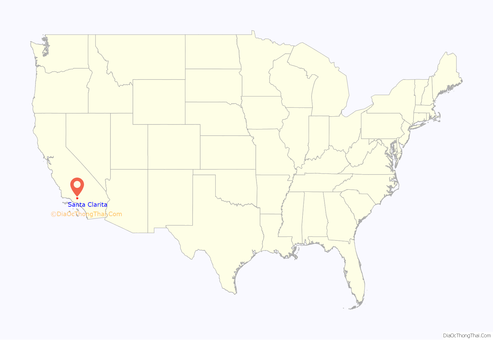
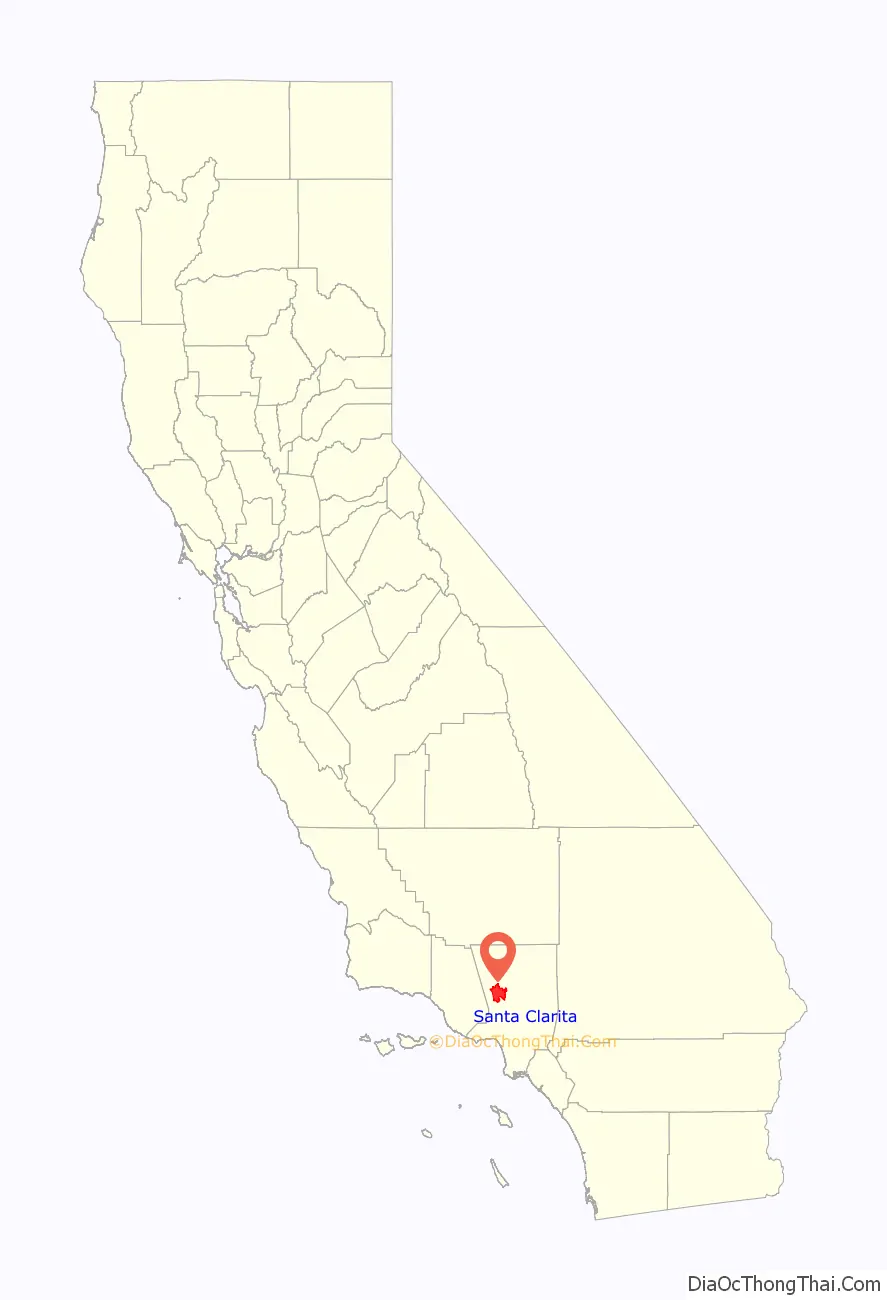
Santa Clarita location map. Where is Santa Clarita city?
History
Pre-Columbian and Spanish colonial eras
The Santa Clarita Valley has been settled for millennia before European arrival. The oldest archaeological site in the area dates back to roughly 3000 BC. About AD 450, the Tataviam arrived, displacing the Chumash people who previously inhabited the area. The Tataviam lived in approximately 20 villages in the valley and surrounding areas including Piru, Agua Dulce, Elizabeth Lake, and Tochonanga.
In the 18th century, Spanish colonists arrived in southern California including Santa Clarita, founding mission settlements. The Mission San Fernando was founded in 1797 in present-day Mission Hills, just 9.5 miles (15.3 km) south of downtown Newhall. In 1822, Alta California, which included most of the present-day southwestern United States including all of California, became a territory of the newly independent country of Mexico.
The 48,612-acre (196.73 km) Rancho San Francisco land grant was issued by Juan Bautista Alvarado, governor of Alta California, to Mexican army officer Antonio del Valle. It was an agricultural area serving the nearby Mission San Fernando.
1822–1899: Gold discovery, Mentryville, and Henry Mayo Newhall
In 1842, Francisco Lopez discovered gold in Placerita Canyon—the first documented discovery of gold in California. The discovery is commemorated in an 1842 mining claim issued by Governor Alvarado. The Oak of the Golden Dream, which marks the site of the discovery, remains an attraction for tourists. Several places throughout Santa Clarita carry the “Golden Oak” name, including Golden Oak Road in Saugus; Golden Oak Lane, Golden Oak Ranch, and Golden Oak Adult School in Newhall; and Golden Oak Community School in Canyon Country.
The United States acquired California in 1848, after winning the Mexican–American War. The community of Newhall is named after Henry Newhall, an American businessman who made his fortune during the California Gold Rush. He founded the H.M. Newhall & Company, a successful auction house in San Francisco. Newhall had also invested in rail companies that would connect San Francisco to other cities and became president of the San Francisco and San Jose Railroad. In 1870, he and his partners sold the company to Southern Pacific Railroad, and he served on Southern Pacific’s board of directors.
From 1858 to 1861, the Santa Clarita Valley was used as a transportation corridor for the Butterfield Overland Mail stagecoach service as part of its first division, stretching from San Francisco to Los Angeles. Two Butterfield Overland Mail stations were located in the area: Lyons Station in Newhall, and King’s Station in San Francisquito Canyon. Beale’s Cut was constructed in 1859 through what is now known as the Newhall Pass.
After railroads, Newhall turned to real estate and ranching. He purchased a number of the former Spanish and Mexican land grants in the state, amassing a total of 143,000 acres (58,000 ha) between Monterey and Los Angeles counties. The most significant portion was the Rancho San Francisco, which he purchased for $2/acre. It became known as Newhall Ranch after Newhall’s death. Within this territory, Newhall granted a right-of-way to Southern Pacific through what is now Newhall Pass. He also sold the railroad part of the land, upon which the company built the town of Newhall, founded just north of the present-day intersection of Magic Mountain Parkway and Railroad Avenue. He moved the town south in 1879, and the original townsite was named Saugus, after Henry Newhall’s hometown of Saugus, Massachusetts.
After his death, Newhall’s heirs incorporated the Newhall Land and Farming Company in 1883. Since its founding, it has overseen the development of the communities that comprise present-day Santa Clarita, including the master-planned community of Valencia (in which it is headquartered), Canyon Country, Newhall, and Saugus. The company also manages farm land elsewhere in the state.
On September 5, 1876, Charles Crocker, president of the Southern Pacific Company, hammered a ceremonial spike into a railroad tie at Lang Southern Pacific Station in what is now far eastern Canyon Country, marking the completion of the San Joaquin Valley line of the Southern Pacific Railroad, connecting Los Angeles to San Francisco and the rest of the nation for the first time.
In the 1850s and 1860s, businessmen and political leaders such as Andrés Pico, Sanford Lyon, Henry Clay Wiley, Darius Towsley, and Christopher Leaming came to the Santa Clarita Valley for its oil reserves. On September 26, 1876, the town of Mentryville was founded by French immigrant Charles Alexander Mentry near present-day Stevenson Ranch. Mentryville’s Pico Number 4 oil well was the first commercially successful oil well in the western United States. Oil from Mentryville was refined at Pioneer Oil Refinery in Newhall, the first viable oil refinery in the state. (Pioneer Oil Refinery is currently the only site on the National Register of Historic Places within the city limits of Santa Clarita.) By the early 1900s, most of Pico Canyon’s richest oil reserves had been depleted, although Pico Number 4 continued to operate until 1990. Many of the aforementioned oil pioneers have lent their names to streets in the valley, such as Pico Canyon Road, Lyons Avenue, Wiley Canyon Road, and Towsley Canyon Road. Drilling continues to occur in Santa Clarita at the Honor Rancho Oil Field and in the area between Placerita Canyon Road and Golden Valley High School.
The Saugus Cafe was established in 1886 near the present-day intersection of Railroad Avenue and Magic Mountain Parkway. It is the oldest continuously operating restaurant in Los Angeles County.
1900–1987
Los Angeles studios began filming in Santa Clarita shortly after the turn of the 20th century. Actors in these early films included William S. Hart, Tom Mix, Harry Carey, and a young John Wayne. Many movie ranches (see section below) were developed in the Santa Clarita Valley. Hart and Carey made their homes in the valley; today both their former estates are operated as county parks.
One major contributor to the valley’s early development was the Whittaker-Bermite Corporation. From 1934 to 1987, the corporation manufactured, stored, and tested explosives, including bombs and bottle rockets, on a 996-acre site south of Soledad Canyon Road, east of Railroad Avenue, northeast of the Circle J Ranch community, southwest of Centre Pointe Parkway, and west of Golden Valley Road. The first housing tract in the area consisted of company homes along Walnut Street in Newhall. In modern times, the California Department of Toxic Substances Control has made efforts to clean the area of perchlorate and other toxic chemicals left behind by decades of munitions testing. Today, the area persists as a gap in the urban development of Santa Clarita.
The Santa Clarita Valley was the scene of the second deadliest disaster in California’s history, known as the “worst civil engineering failure of the 20th century.” Shortly before midnight on March 12, 1928, the St. Francis Dam collapsed. Water from the St. Francis Reservoir coursed through San Francisquito Canyon and the Santa Clara River in a wave up to 140 feet (43 m) high and 2 miles (3.2 km) wide, destroying buildings in its path. By the time the floodwaters reached the Pacific Ocean near Ventura five hours later, 411 people had died. Some buildings in Newhall became makeshift morgues. After the disaster, engineer William Mulholland resigned from his position as superintendent of the Los Angeles Bureau of Water Works and Supply (now the Department of Water and Power).
On December 27, 1936, United Airlines Trip 34 crashed into a hilltop in Rice Canyon which is near Newhall, killing all twelve people on board.
In 1945, the Santa Clarita Union High School District was created. The following year it was renamed William S. Hart Union High School District after William S. Hart. The district’s first high school was William S. Hart High School in Newhall.
The first official use of the name “Santa Clarita” in a housing development appeared in the Rancho Santa Clarita housing tract in Saugus, built in 1947.
On September 17, 1966, William V. Fowler, Grand Cyclops (leader) of the California Knights of the Ku Klux Klan, organized a reactivation rally in Soledad Canyon, on Capra Road around 2 miles (3.2 km) east of the present-day Soledad Canyon Road exit on State Route 14. Fowler sought to reactivate the KKK in California, where it was banned by law since 1946. Estimates of the rally’s size range from 30 to 100 people, far fewer than the 5,000 to 10,000 Fowler expected. The rally took place on United States Forest Service property and included a fake cross burning. Just one person was arrested at the rally — for assaulting a police officer he mistook for a Klansman.
On April 5, 1970, four CHP officers were shot dead by two heavily armed career criminals at a Standard Gas Station in present-day Valencia. The shootout was the deadliest attack on law enforcement in California history. As Valencia had barely been developed, it came to be known as the Newhall incident. One of the perpetrators was sentenced to life in prison; the other committed suicide. In the aftermath of the incident, policing was transformed nationwide—police training and weaponry were improved and bullet proof vests became widespread.
In the early morning of July 23, 1982, a helicopter crash occurred at the Indian Dunes amusement park in Valencia during the making of Twilight Zone: The Movie, killing three people.
1987–present: City of Santa Clarita
After multiple failed attempts to form a city and at least two failed attempts to form a separate county, residents of the Santa Clarita Valley finally incorporated the City of Santa Clarita on December 15, 1987. The proposal passed by a margin of two to one in that year’s general election. Other proposed names for the city were “City of the Canyons” and “La Mancha” (“blemish” in Spanish); “Santa Clarita” narrowly defeated “City of the Canyons.” The city’s first mayor was future Congressman Buck McKeon.
In 1990, the federal government awarded Cemex a contract to mine millions of tons of sand and gravel in Soledad Canyon, just east of the city. The proposed mine caused controversy due to its potential for air pollution, traffic congestion, and environmental damage to the Angeles National Forest and Santa Clara River. The city of Santa Clarita fought for decades to prevent mining in the canyon. In 2019, the Interior Board of Land Appeals (part of the United States Department of the Interior) upheld a 2015 decision by the Bureau of Land Management, permanently preventing Cemex from mining in Soledad Canyon. Cemex had never mined any sand or gravel in the canyon.
Santa Clarita was devastated by the 1994 Northridge earthquake. The Newhall Pass interchange of I-5 and CA-14 collapsed, and Sierra Highway became the only route in and out of the valley; Sierra Highway was soon closed as well. Several surface streets throughout the city were closed due to structural damage. The Four Corners oil spill led to contamination of the Santa Clara River. Electricity was temporarily shut off for the entire valley, and schools were closed. Shelters opened in Newhall, Saugus, and Canyon Country. The National Guard was sent to the area, and City Hall was temporarily relocated. Water distribution points were set up as residents lost access to running water. The city suffered an estimated $76.8 million in damages.
Santa Clarita was ranked in 2006 by Money magazine as 18th of the 100 best places to live in the United States.
On November 14, 2019, a mass shooting occurred at Saugus High School. That morning, Nathaniel Berhow, a 16-year-old junior at the school, used a semi-automatic pistol to shoot five other students, killing two of them, before turning his gun on himself. The shooting lasted 16 seconds. Survivors were reunited with their parents at nearby Central Park, and injured students were sent to Henry Mayo Hospital in Valencia and Providence Holy Cross Medical Center in Mission Hills. The shooter succumbed to his self-inflicted injuries the following day in the hospital. A vigil honoring the victims was held at Central Park the next day.
In the 21st century, the city’s developed area has expanded significantly as Lennar, Tri Pointe Homes, and KB Home have constructed housing developments in the area. Recent developments within the city limits include Five Knolls, Aliento, Skyline Ranch, Vista Canyon, West Creek, West Hills, River Village, and Toll Brothers at Plum Canyon; just outside the city, the large FivePoint Valencia subdivision is in construction. Some of these developments, such as River Village, Villa Metro, and Five Knolls, were constructed near the city center, while others were constructed near the city’s edges and later annexed into the city.
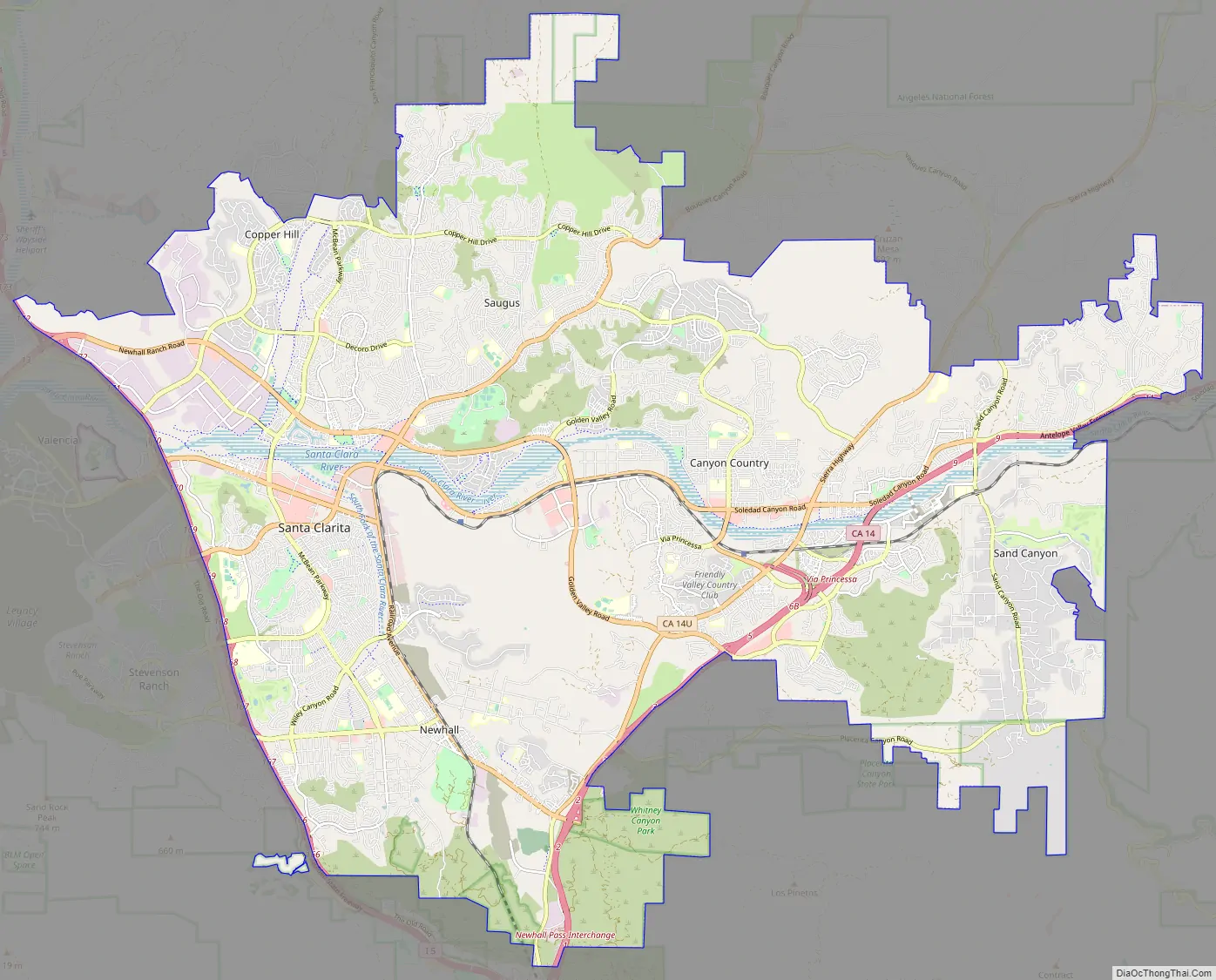
Santa Clarita Road Map
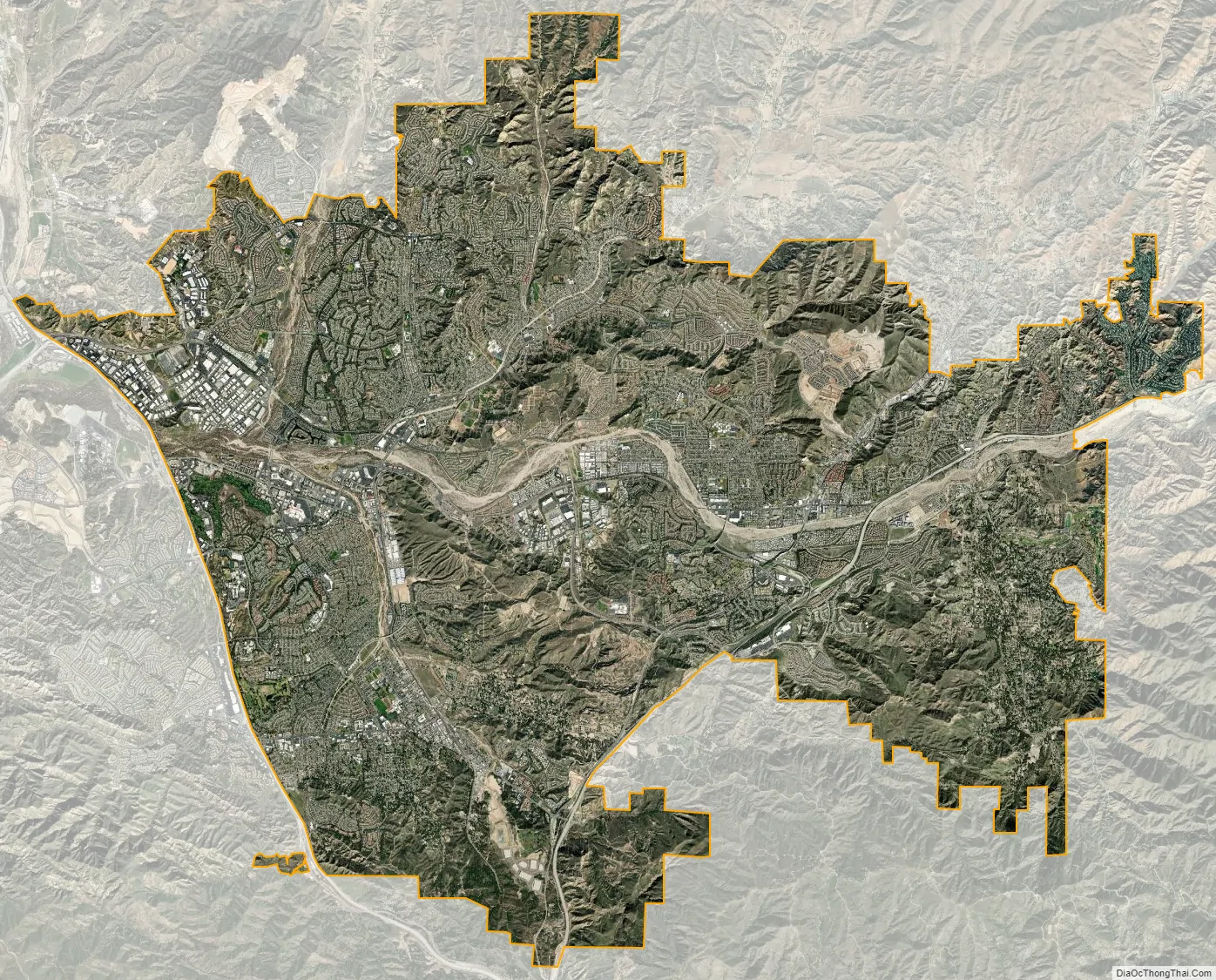
Santa Clarita city Satellite Map
Geography
Santa Clarita, according to the United States Census Bureau, covers an area of 70.82 square miles (183.4 km), of which 70.75 square miles (183.2 km) is land and 0.07 square miles (0.18 km) (0.10%) is water. Nearly half of the city’s land area has been acquired via annexations; the city’s area at the time of incorporation was just 39.09 square miles (101.2 km). The Newhall Pass is located at the southern end of the city, south of Newhall and north of the San Fernando Valley communities of Granada Hills and Sylmar.
Santa Clarita lies within the Santa Clarita Valley, bounded by the San Gabriel Mountains to the east, the Santa Susana Mountains to the south and west, and the Sierra Pelona Mountains to the north, all part of the Transverse Ranges.
The broad Santa Clara River passes through the city from east to west. Though usually dry, the river exhibits significant surface flow during seasonal episodes of heavy rainfall. The river’s numerous tributaries incise the hilly terrain of the valley to form steep canyons after which many of the city’s major streets are named. The largest of these canyons are Bouquet Canyon, San Francisquito Canyon, Sand Canyon, and Soledad Canyon.
City limits
Currently, the city is bounded by Interstate 5 to the west, extending east to include almost all developed areas of the Santa Clarita Valley east of the freeway. Part of the city’s eastern boundary follows California State Route 14, although the city limits extend beyond Route 14 to include the communities of Aliento, Fair Oaks Ranch, Vista Canyon, and Sand Canyon; the Plaza at Golden Valley shopping center; and the Whitney Canyon, Elsmere Canyon, Golden Valley Ranch, Walker Ranch, and East Walker Ranch open spaces. Santa Clarita extends as far east as the eastern end of Shenandoah Lane, east of Shadow Pines Boulevard in Canyon Country. The city limits also include a small exclave west of Interstate 5 in Towsley Canyon Park. The Angeles National Forest forms part of the city’s northern and eastern boundaries, although parts of northern Saugus (north of Copper Hill Drive and Haskell Canyon Road) and Canyon Country (south of Placerita and Sand Canyon Roads) extend into the national forest.
Topography
The official elevation of the city is 1,207 feet (368 m), the elevation of the historic Newhall Airport which was northwest of Via Princessa and Railroad Avenue from the 1930s through the 1950s. Elevation varies substantially throughout the city. The lowest point in Santa Clarita is near the junction of CA-126 and I-5 (34°26′32″N 118°36′10″W / 34.4422°N 118.6029°W / 34.4422; -118.6029), at an elevation of 1,024 feet (312 m). The highest point is in the San Gabriel Mountains south of Placerita and Sand Canyon Roads (34°21′36″N 118°24′22″W / 34.3599°N 118.4062°W / 34.3599; -118.4062) at an elevation of 3,048 feet (929 m). Most populated areas in the city are 1,100–1,700 feet (340–520 m) above sea level. The highest residential areas of Canyon Country, north of Skyline Ranch Road and east of Shadow Pines Boulevard, exceed 2,000 feet (610 m).
Geology
Santa Clarita is near the San Fernando fault zone and has been affected by the 1971 San Fernando earthquake and 1994 Northridge earthquake (see above), both of which had epicenters in the San Fernando Valley.
See also
Map of California State and its subdivision:- Alameda
- Alpine
- Amador
- Butte
- Calaveras
- Colusa
- Contra Costa
- Del Norte
- El Dorado
- Fresno
- Glenn
- Humboldt
- Imperial
- Inyo
- Kern
- Kings
- Lake
- Lassen
- Los Angeles
- Madera
- Marin
- Mariposa
- Mendocino
- Merced
- Modoc
- Mono
- Monterey
- Napa
- Nevada
- Orange
- Placer
- Plumas
- Riverside
- Sacramento
- San Benito
- San Bernardino
- San Diego
- San Francisco
- San Joaquin
- San Luis Obispo
- San Mateo
- Santa Barbara
- Santa Clara
- Santa Cruz
- Shasta
- Sierra
- Siskiyou
- Solano
- Sonoma
- Stanislaus
- Sutter
- Tehama
- Trinity
- Tulare
- Tuolumne
- Ventura
- Yolo
- Yuba
- Alabama
- Alaska
- Arizona
- Arkansas
- California
- Colorado
- Connecticut
- Delaware
- District of Columbia
- Florida
- Georgia
- Hawaii
- Idaho
- Illinois
- Indiana
- Iowa
- Kansas
- Kentucky
- Louisiana
- Maine
- Maryland
- Massachusetts
- Michigan
- Minnesota
- Mississippi
- Missouri
- Montana
- Nebraska
- Nevada
- New Hampshire
- New Jersey
- New Mexico
- New York
- North Carolina
- North Dakota
- Ohio
- Oklahoma
- Oregon
- Pennsylvania
- Rhode Island
- South Carolina
- South Dakota
- Tennessee
- Texas
- Utah
- Vermont
- Virginia
- Washington
- West Virginia
- Wisconsin
- Wyoming


