Santa Susana (Spanish for “St. Susan”) is a former railroad town located mostly within the City of Simi Valley. A small portion of the community, outside the Simi Valley city limits to the south of the Ventura County Metrolink rail line, is an unincorporated area and census-designated place (CDP). The community is in the eastern part of the Simi Valley.
The town by the Santa Susana Mountains in the Simi Valley was founded in 1903, shortly after the Southern Pacific Company built the Santa Susana Depot. It is also spelled Santa Susanna, while it is currently more commonly referred to as the Santa Susana Knolls, which is the officially designated name, or the Simi Knolls. The name of Santa Susana is now more generally applied to a larger area at the very east end of the Simi Valley (often called east of East Simi Valley) in easternmost Ventura County, which was the name of the early settlement located at Tapo Street and East Los Angeles Avenue that is now within the city limits. The historic Santa Susana Depot was located there before being moved farther east along the coast route railroad and made into a museum. The Simi Valley train station opened in 1993 about midway between the historic site and the museum location next to Santa Susana Knolls. The 2010 United States census reported the Santa Susana CDP’s population as 1,037. It is a sparsely populated rural area with rustic housing and no set-houses, in a hilly and relatively forested part of the valley.
The area was inhabited by the Chumash Indians as early as 500 AD and there have been numerous Chumash artifacts found in the area, in addition to the pictographs in Burro Flats Painted Cave. In the 1920s, the Knolls became home to brothels and also a religious cult. During the late 1960s Charles Manson and the Manson Family partially lived at Spahn’s Movie Ranch. During the 1950s and ’60s, the Corriganville Movie Ranch and other areas was utilized as movie sets for Western movies. Films and TV-series filmed here includes Gunsmoke, Bonanza, The Lone Ranger, Adventures of Superman, The Adventures of Robin Hood (1938), The Three Musketeers, Tales of the Texas Rangers, Billy the Kid Versus Dracula, Fort Apache, Star Trek, Wagon Train, and hundreds of other mostly Western-inspired movies and TV-shows.
The rural Santa Susana is home to numerous species of native wildlife, including large amounts of snakes, coyotes, hawks and mountain lions.
| Name: | Santa Susana CDP |
|---|---|
| LSAD Code: | 57 |
| LSAD Description: | CDP (suffix) |
| State: | California |
| County: | Ventura County |
| Elevation: | 1,165 ft (355 m) |
| Total Area: | 1.113 sq mi (2.883 km²) |
| Land Area: | 1.113 sq mi (2.883 km²) |
| Water Area: | 0 sq mi (0 km²) 0% |
| Total Population: | 1,037 |
| Population Density: | 930/sq mi (360/km²) |
| FIPS code: | 0670140 |
| GNISfeature ID: | 2585445 |
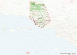
Online Interactive Map
Click on ![]() to view map in "full screen" mode.
to view map in "full screen" mode.
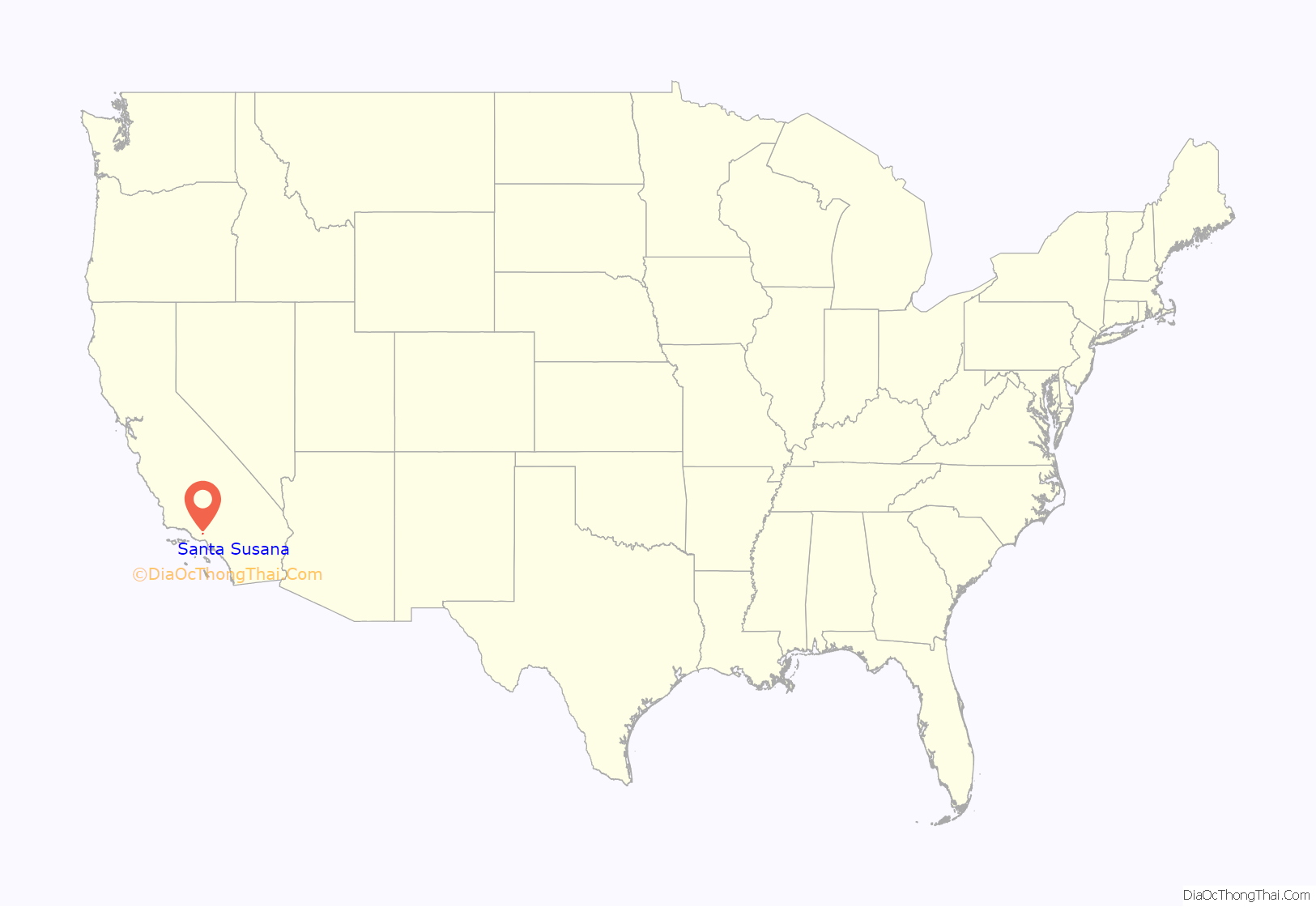
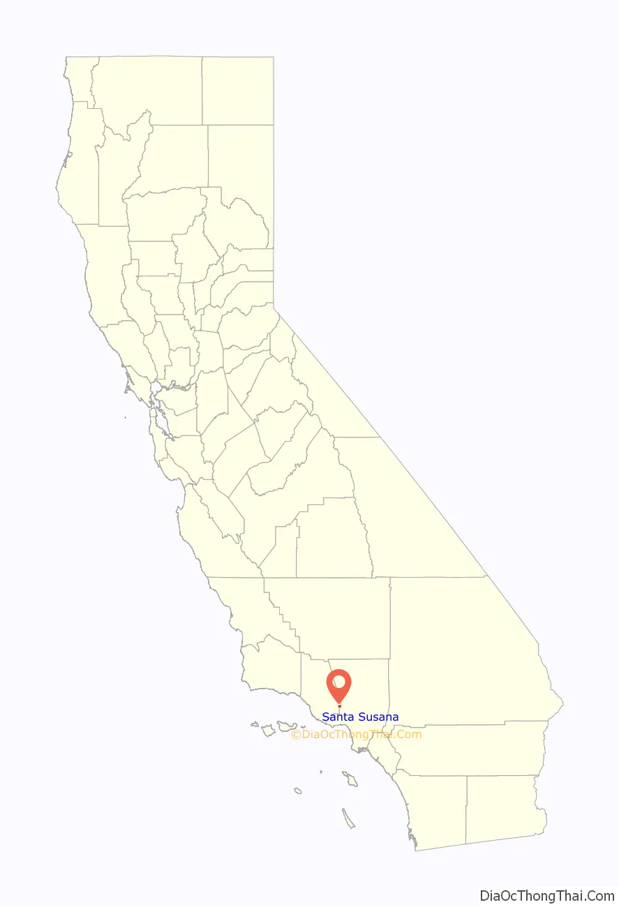
Santa Susana location map. Where is Santa Susana CDP?
History
Pre-colonial period
The hills of and immediate foots of the Santa Susana Mountains have been inhabited for thousands of years, proven by Chumash artifacts found by the Santa Susana Depot and Chumash pictographs dating to 500 AD in the Burro Flats Painted Cave. The area has likely been populated by Native-American peoples for as much as 8,000 years-12,000 years ago The Burro Flats Painted Cave, now situated on the protected private Santa Susana Field Laboratory property, was the setting for a winter solstice ritual for the Ventureño Chumash people. The cave, which is on the back wall of a sandstone shelter about 16 ft long and 4 ft high, was discovered at the turn of the 20th century The Chumash of Santa Susana were unlike other settlements in the Simi Valley not only located near other Ventureño Chumash settlements, but the Chumash here traded with the Tataviam people who also settled in the Santa Susana Mountains, as well as the Gabrielino people who inhabited the opposite side of the Santa Susana Pass.
Township period
In 1887, the Simi Valley Land and Water Company first surveyed the area to sell parcels as ranches. With the Santa Susana Depot establishment by the Southern Pacific Company in 1903 as its cornerstone, the town of Santa Susana a few miles east of Simi Valley in the Simi Valley was founded. Before this train station, all residents of the Simi Valley had to travel to San Fernando for the closest railroad station. The first businesses surrounding the new train station was also vital for the town’s establishment, and the discovery of oil on El Rancho Tapo in 1910 brought a population boom to the little town. A general merchandise store on the opposite side of Los Angeles Avenue from the railroad station was the first store established in town, established by Horace Crinklaw and his wife in 1909. In 1914, the town was home to eight buildings: Four owned by the Crinklaw family, a schoolhouse, the Santa Susana Depot, the Southern Pacific Warehouse and a blacksmith shop. Oil production was started by the Scarab Oil Company in 1910 and opened with a production of 300 barrels of oil per day. The little town soon became well known as a filming location for Western movies with its rural and rugged surroundings with plentiful sand rock formations; Western films were filmed here as early as in 1920 on the main street of Santa Susana. By 1918, there were 101 registered voters in Santa Susana.
In 1929, the town was used as a set in the movie Welcome Danger The Santa Susana Airport started as a dirt landing strip in a tomato field in the late 1930s, and later became a paved landing site for hundreds of airplanes in the 1970s. It was officially designed by the FAA in 1944. During all of the 1930s and 1940s, the Corriganville Movie Ranch functioned as a Western movie set for hundreds of Western films and TV series, and later an amusement park for visitors to explore the Western film sets. Films shot here include for instance Jungle Jim, the Jungle Boy TV-series, Lawman, Gunfight at the O.K. Corral, Adventures of Robin Hood, Adventures of Superman, Fort Apache, Rin-Tin-Tin TV-show, and hundreds of others. The ranch became a tourist attraction in 1949 and drew thousands from across America and was rated among the “10 most interesting places in America”. The first larger housing developments started in 1958.
The area has been home to numerous cults, including the Pisgah Grande (in Las Llajas Canyon, seven miles northeast of town) and May Otis Blackburn’s “Divine Order of the Royal Arms of the Great Eleven”, sometimes referred to as “the Sixth Cult”, high up in the Susana Knolls. In 1949, messiah Krishna Venta’s cult “WKFL Foundation of the World” lived in Box Canyon right by the Santa Susana Pass. Krishna was killed in 1958, when former members exploded twenty dynamites in a suicide attack against Krishna and other cult members. It was also here that Charles Manson and the Manson Family partially lived during the late 1960s. The Santa Susana Nuclear Disaster in July 1959 was the worst in American history, and was kept hidden by the United States Atomic Energy Commission for more than twenty years when it was exposed by students from UCLA in the LA Times.
By a 2-1 margin in 1969, voters decided to be incorporated in the City of Simi Valley. On October 10, 1969, the majority of Santa Susana went from being an unincorporated town in the Simi Valley to a part of the city of Simi Valley, which now comprised most of the eponymous valley.
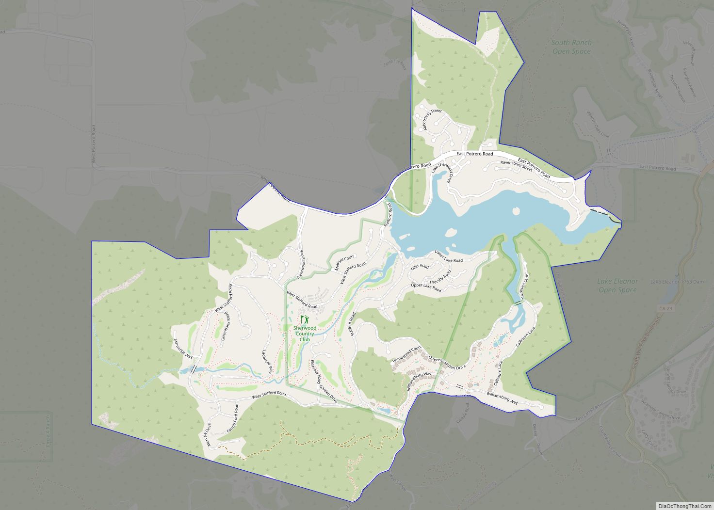
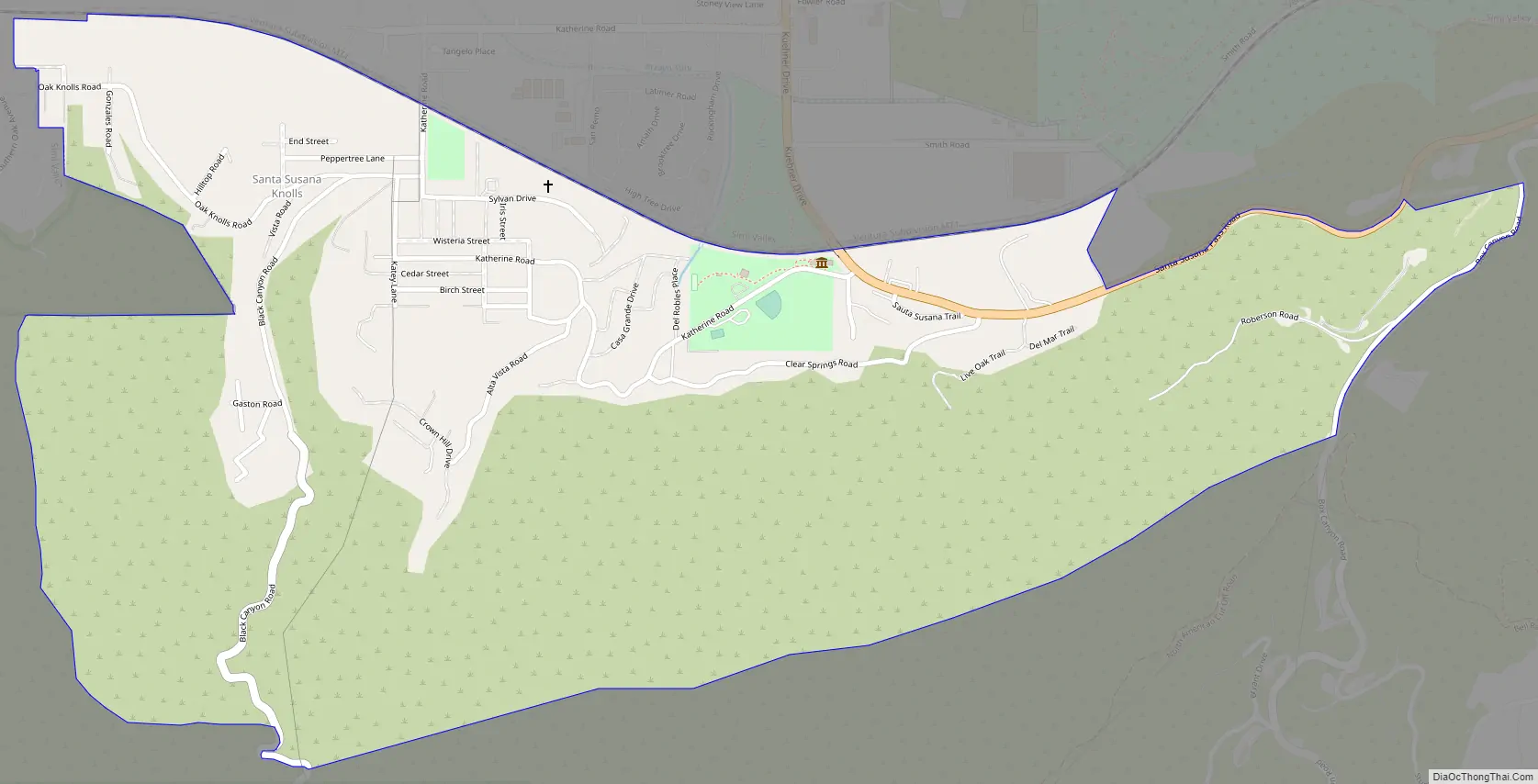
The remaining unincorporated part of Santa Susana is currently mostly known as the Susana Knolls and occupies the hilly, rustic, and rural areas southeast of eastern Simi Valley proper. This area includes the Santa Susana Field Laboratory, a government facility previously used for research and design of rocket engines and nuclear reactors.
Santa Susana Road Map
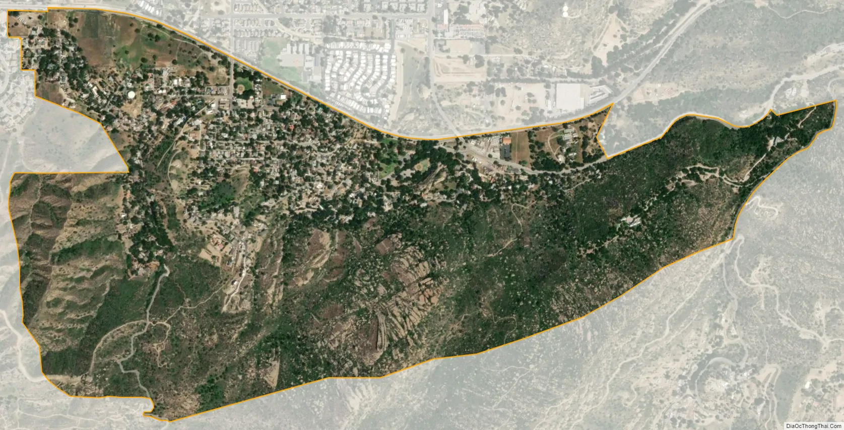
Santa Susana city Satellite Map
Geography
The CDP is nestled up against the northern slope of the Simi Hills and surrounds the Santa Susana Mountains at an average elevation of 1,165 feet (355 m). It is a hilly and mountainous area, with trees and sand rock formations separating custom-designed homes. It is situated in the easternmost part of Simi Valley in Ventura County. According to the United States Census Bureau, the CDP covers an area of 1.1 square miles (2.9 km), all land. It is an unincorporated area, sometimes referred to as a neighborhood, community, village or settlement. The northern border of the CDP follows the Metrolink Ventura County line, across which is the city of Simi Valley. The CDP extends roughly from Rainey Road in the west to Box Canyon Road in the east, and extends south to the limits of development on the lower slopes of the Simi Hills.
There are numerous open-space nature areas near Santa Susana and in the northern Santa Susana Mountains, including Rocky Peak, Santa Susana Pass State Historic Park, Sage Ranch Park, Corriganville Park, Indian Springs Open Space, and other parks and open-space nature areas. Rancho Simi Recreation and Park District administers most parks in Simi Valley’s outlying areas, including in Santa Susana Knolls, Bell Canyon, and Oak Park. The Santa Monica Mountains Conservancy operates certain open-space parks, including Sage Ranch Park by the Santa Susana Field Laboratory.
See also
Map of California State and its subdivision:- Alameda
- Alpine
- Amador
- Butte
- Calaveras
- Colusa
- Contra Costa
- Del Norte
- El Dorado
- Fresno
- Glenn
- Humboldt
- Imperial
- Inyo
- Kern
- Kings
- Lake
- Lassen
- Los Angeles
- Madera
- Marin
- Mariposa
- Mendocino
- Merced
- Modoc
- Mono
- Monterey
- Napa
- Nevada
- Orange
- Placer
- Plumas
- Riverside
- Sacramento
- San Benito
- San Bernardino
- San Diego
- San Francisco
- San Joaquin
- San Luis Obispo
- San Mateo
- Santa Barbara
- Santa Clara
- Santa Cruz
- Shasta
- Sierra
- Siskiyou
- Solano
- Sonoma
- Stanislaus
- Sutter
- Tehama
- Trinity
- Tulare
- Tuolumne
- Ventura
- Yolo
- Yuba
- Alabama
- Alaska
- Arizona
- Arkansas
- California
- Colorado
- Connecticut
- Delaware
- District of Columbia
- Florida
- Georgia
- Hawaii
- Idaho
- Illinois
- Indiana
- Iowa
- Kansas
- Kentucky
- Louisiana
- Maine
- Maryland
- Massachusetts
- Michigan
- Minnesota
- Mississippi
- Missouri
- Montana
- Nebraska
- Nevada
- New Hampshire
- New Jersey
- New Mexico
- New York
- North Carolina
- North Dakota
- Ohio
- Oklahoma
- Oregon
- Pennsylvania
- Rhode Island
- South Carolina
- South Dakota
- Tennessee
- Texas
- Utah
- Vermont
- Virginia
- Washington
- West Virginia
- Wisconsin
- Wyoming