Templeton is a census-designated place (CDP) in San Luis Obispo County, California. The population was 7,674 at the 2010 census, up from 4,687 at the 2000 census.
| Name: | Templeton CDP |
|---|---|
| LSAD Code: | 57 |
| LSAD Description: | CDP (suffix) |
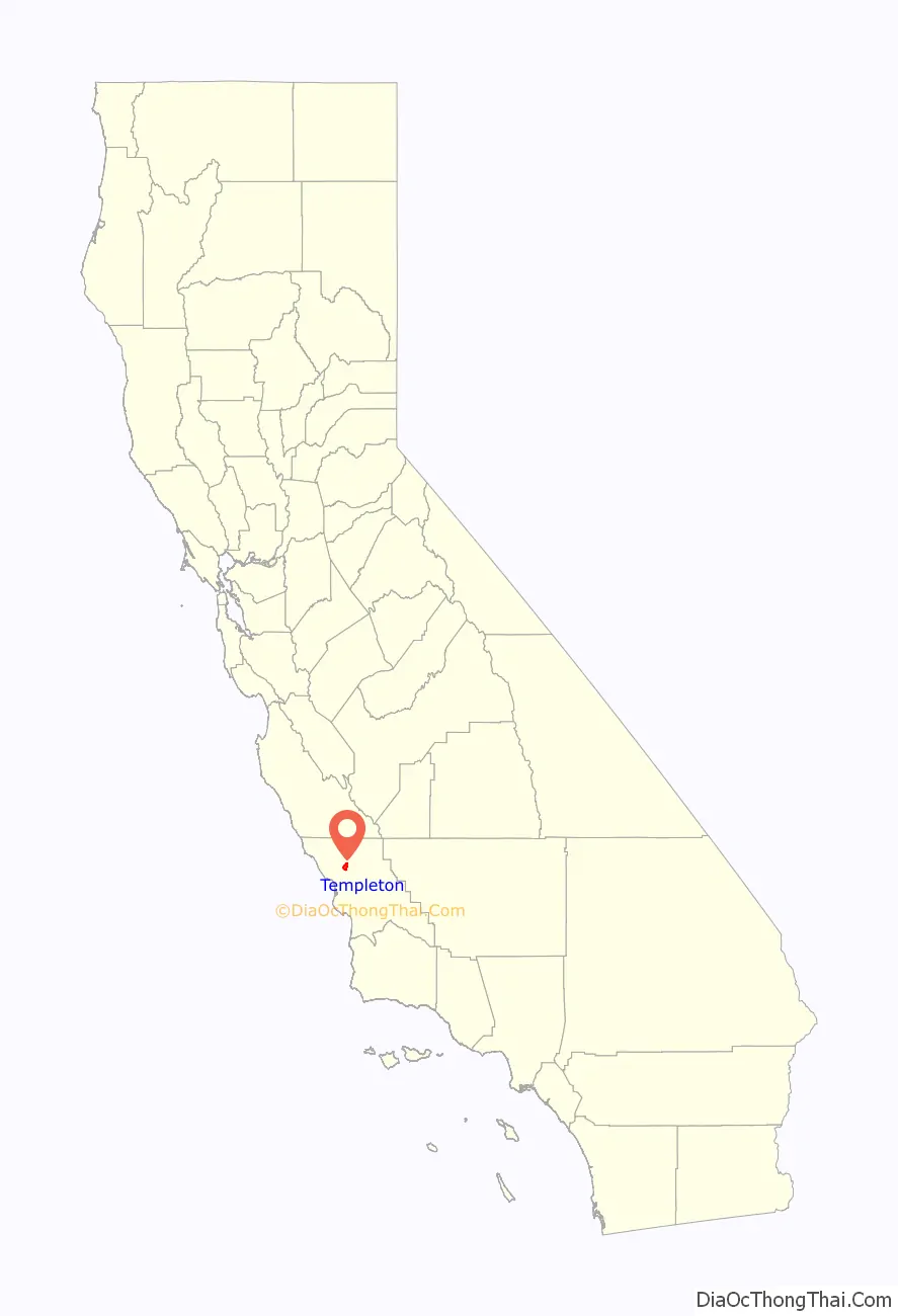
| State: | California |
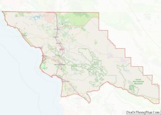
| County: | San Luis Obispo County |
| Elevation: | 807 ft (246 m) |
| Total Area: | 7.766 sq mi (20.115 km²) |
| Land Area: | 7.717 sq mi (19.988 km²) |
| Water Area: | 0.049 sq mi (0.127 km²) 0.63% |
| Total Population: | 7,674 |
| Population Density: | 990/sq mi (380/km²) |
| ZIP code: | 93465 |
| Area code: | 805 |
| FIPS code: | 0678162 |
Online Interactive Map
Click on ![]() to view map in "full screen" mode.
to view map in "full screen" mode.
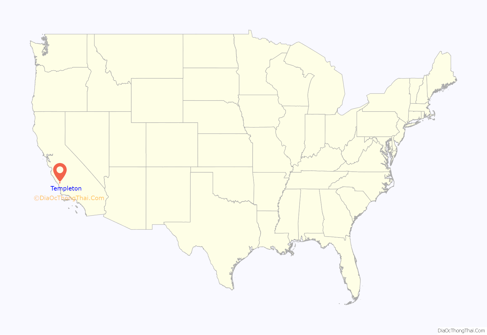
Templeton location map. Where is Templeton CDP?
History
Templeton is located within the former Rancho Paso de Robles Mexican land grant and was founded in 1886 when Chauney Hatch Phillips of the West Coast Land Company sent R.R. Harris to survey 160 acres (0.65 km) set aside for a town to exist south of Paso Robles as part of the company’s larger purchase of 63,000 acres (250 km). These 160 acres were to be laid out in business and residential lots with 5–12 acre parcels, with the town to be named “Crocker” after a Vice President of the Southern Pacific Railroad, Charles F. Crocker; however, Crocker instead chose to name the town “Templeton,” after his two-year-old son, Charles Templeton Crocker.
The town was briefly the end of the line for passengers travelling south via the Southern Pacific Railroad from northern California; passengers disembarked at Templeton and were then carried by stagecoach south to San Luis Obispo. In 1889, the railroad was continued 14 miles (23 km) south to Santa Margarita and the town was reclassified to a flag stop. Currently, the railroad stops in nearby Paso Robles before continuing on, and Templeton is classified as a bypass.
In 1898, a fire destroyed most of the original wooden buildings of the business district along Main Street, prompting this section of the town to be rebuilt with brick, although on a somewhat smaller scale than before.
2010
The 2010 United States Census reported that Templeton had a population of 7,674. The population density was 988.1 inhabitants per square mile (381.5/km). The racial makeup of Templeton was 6,833 (89.0%) White, 59 (0.8%) African American, 80 (1.0%) Native American, 123 (1.6%) Asian, 10 (0.1%) Pacific Islander, 337 (4.4%) from other races, and 232 (3.0%) from two or more races. Hispanic or Latino of any race were 1,171 persons (15.3%).
The Census reported that 7,580 people (98.8% of the population) lived in households, 1 (0%) lived in non-institutionalized group quarters and 93 (1.2%) were institutionalized.
There were 2,830 households, of which 1,121 (39.6%) had children under the age of 18 living in them, 1,572 (55.5%) were opposite-sex married couples living together, 363 (12.8%) had a female householder with no husband present, 127 (4.5%) had a male householder with no wife present. There were 117 (4.1%) unmarried opposite-sex partnerships and 29 (1.0%) same-sex married couples or partnerships. 654 households (23.1%) were made up of individuals, and 352 (12.4%) had someone living alone who was 65 years of age or older. The average household size was 2.68. There were 2,062 families (72.9% of all households); the average family size was 3.14.
2,049 people (26.7%) of the population were under the age of 18, 598 people (7.8%) aged 18 to 24, 1,627 people (21.2%) aged 25 to 44, 2,288 people (29.8%) aged 45 to 64, and 1,112 people (14.5%) who were 65 years of age or older. The median age was 40.8 years. For every 100 females, there were 89.1 males. For every 100 females age 18 and over, there were 84.6 males.
There were 3,006 housing units at an average density of 387.1 per square mile (149.5/km), of which 2,002 (70.7%) were owner-occupied, and 828 (29.3%) were occupied by renters. The homeowner vacancy rate was 1.2%; the rental vacancy rate was 6.9%. 5,453 people (71.1% of the population) lived in owner-occupied housing units and 2,127 people (27.7%) lived in rental housing units.
2000
At the 2000 census, there were 4,687 people, 1,548 households and 1,247 families residing in the CDP. The population density was 989.2 inhabitants per square mile (381.9/km). There were 1,588 housing units at an average density of 335.2 per square mile (129.4/km). The racial makeup of the CDP was 90.36% White, 1.17% African American, 0.70% Native American, 0.92% Asian, 0.09% Pacific Islander, 3.63% from other races, and 3.14% from two or more races. Hispanic or Latino of any race were 11.82% of the population.
There were 1,548 households, of which 49.7% had children under the age of 18 living with them, 65.4% were married couples living together, 11.5% had a female householder with no husband present, and 19.4% were non-families. 15.6% of all households were made up of individuals, and 7.8% had someone living alone who was 65 years of age or older. The average household size was 2.98 and the average family size was 3.33.
33.7% of the population were under the age of 18, 5.9% from 18 to 24, 29.8% from 25 to 44, 19.2% from 45 to 64, and 11.5% who were 65 years of age or older. The median age was 36 years. For every 100 females, there were 93.2 males. For every 100 females age 18 and over, there were 88.4 males.
The median household income was $53,438 and the median family income was $58,750. Males had a median income of $41,268 compared with $32,034 for females. The per capita income for the CDP was $19,671. About 6.3% of families and 9.1% of the population were below the poverty line, including 11.5% of those under age 18 and 4.7% of those age 65 or over.
Templeton Road Map
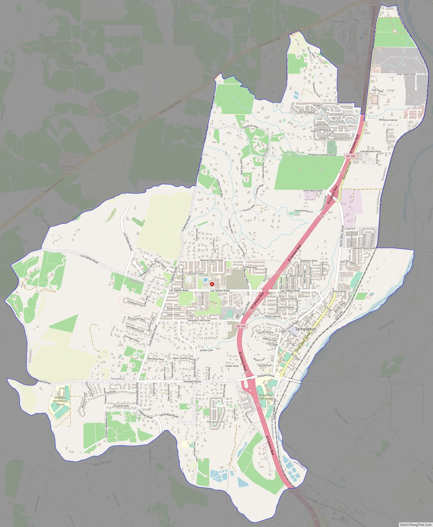
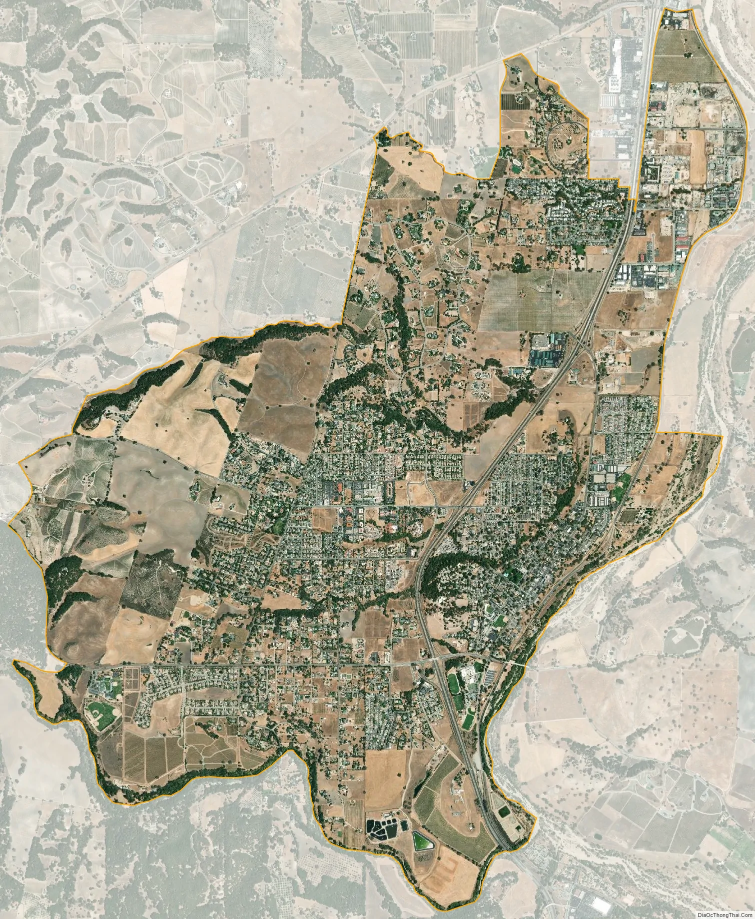
Templeton city Satellite Map
Geography
Geography
Templeton is located at 35°33′14″N 120°42′34″W / 35.55389°N 120.70944°W / 35.55389; -120.70944 (35.553847, −120.709469). It is approximately five miles (8 km) south of Paso Robles and five miles north of Atascadero along U.S. 101. State Route 46 intersects U.S. 101 on the north edge of the town.
According to the United States Census Bureau, the CDP has a total area of 7.8 square miles (20 km), 99.37% of it land and 0.63% water. However, much of the surrounding unincorporated area between Atascadero and Paso Robles is considered as part of Templeton, with most U.S. mail for this area addressed as such.
Climate
Templeton has a Mediterranean climate that is characterized by mild winters and dry summers. The area usually has low humidity. Rain generally falls only between November and March, with the rainy season tapering off almost completely by the end of April. Temperature lows can reach from 20 to 25 °F (−7 to −4 °C) in the winter, and highs can reach 100 °F (38 °C) in the summer, with the highest recorded temperature being 115 °F (46 °C).
Like much of the nearby area, Templeton occasionally receives significant but temporary fog through parts of the year. In summer, Templeton will occasionally receive fog due to its proximity with the California Coastal Range, Pacific Ocean, and the higher valley temperatures of Templeton itself; the differential in density between the warm rising air in the valley causes it to be displaced with the descent of the cooler marine air layer via the Templeton Gap in the Santa Lucia Range. Similarly, in winter, Templeton will occasionally receive morning fog due to the temperature differential with the Central Valley.
Although it is rare to see snow in Templeton, it did snow on December 15, 1988, leaving between 5 and 8 inches (13 and 20 cm) of total snowfall.
See also
Map of California State and its subdivision:- Alameda
- Alpine
- Amador
- Butte
- Calaveras
- Colusa
- Contra Costa
- Del Norte
- El Dorado
- Fresno
- Glenn
- Humboldt
- Imperial
- Inyo
- Kern
- Kings
- Lake
- Lassen
- Los Angeles
- Madera
- Marin
- Mariposa
- Mendocino
- Merced
- Modoc
- Mono
- Monterey
- Napa
- Nevada
- Orange
- Placer
- Plumas
- Riverside
- Sacramento
- San Benito
- San Bernardino
- San Diego
- San Francisco
- San Joaquin
- San Luis Obispo
- San Mateo
- Santa Barbara
- Santa Clara
- Santa Cruz
- Shasta
- Sierra
- Siskiyou
- Solano
- Sonoma
- Stanislaus
- Sutter
- Tehama
- Trinity
- Tulare
- Tuolumne
- Ventura
- Yolo
- Yuba
- Alabama
- Alaska
- Arizona
- Arkansas
- California
- Colorado
- Connecticut
- Delaware
- District of Columbia
- Florida
- Georgia
- Hawaii
- Idaho
- Illinois
- Indiana
- Iowa
- Kansas
- Kentucky
- Louisiana
- Maine
- Maryland
- Massachusetts
- Michigan
- Minnesota
- Mississippi
- Missouri
- Montana
- Nebraska
- Nevada
- New Hampshire
- New Jersey
- New Mexico
- New York
- North Carolina
- North Dakota
- Ohio
- Oklahoma
- Oregon
- Pennsylvania
- Rhode Island
- South Carolina
- South Dakota
- Tennessee
- Texas
- Utah
- Vermont
- Virginia
- Washington
- West Virginia
- Wisconsin
- Wyoming