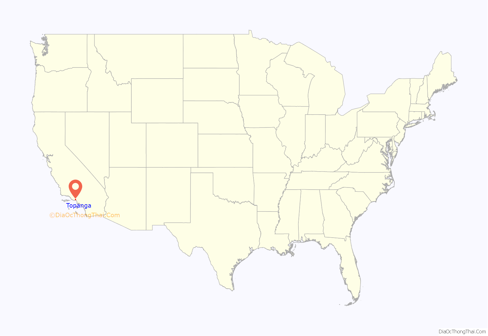
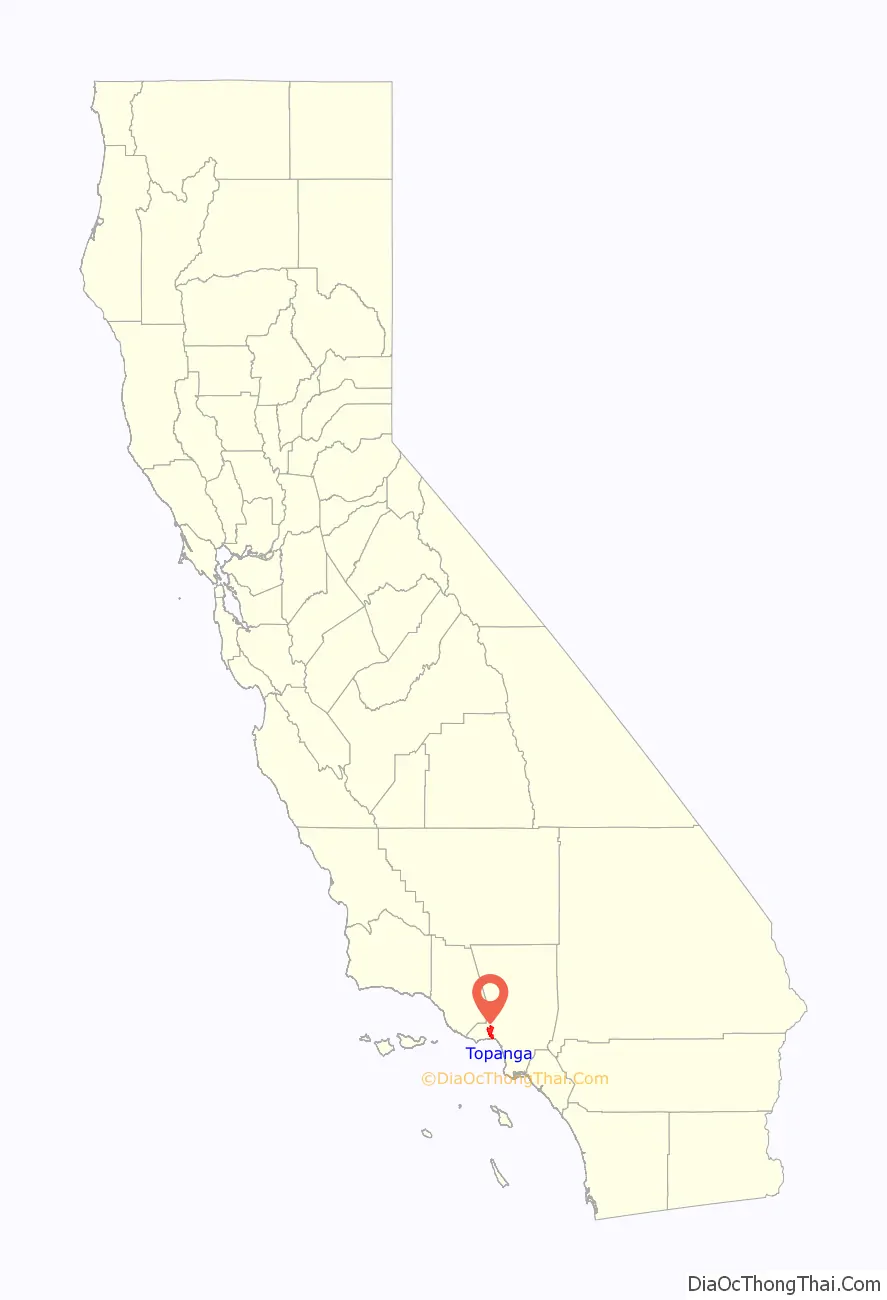
Topanga (pronunciation) (Tongva: Topaa’nga) is a census-designated place (CDP) in western Los Angeles County, California, United States. Located in the Santa Monica Mountains, the community exists in Topanga Canyon and the surrounding hills. The narrow southern portion of Topanga at the coast is between the city of Malibu and the Los Angeles neighborhood of Pacific Palisades. As of the 2020 census the population of the Topanga CDP was 8,560. The ZIP code is 90290 and the area code is primarily 310, with 818 only at the north end of the canyon. It is in the 3rd County Supervisorial district.
| Name: | Topanga CDP |
|---|---|
| LSAD Code: | 57 |
| LSAD Description: | CDP (suffix) |
| State: | California |
| County: | Los Angeles County |
| Elevation: | 1,084 ft (330 m) |
| Total Area: | 19.137 sq mi (49.563 km²) |
| Land Area: | 19.129 sq mi (49.543 km²) |
| Water Area: | 0.008 sq mi (0.020 km²) 0.04% |
| Total Population: | 8,560 |
| Population Density: | 450/sq mi (170/km²) |
| ZIP code: | 90290 |
| Area code: | 310/424, 747/818 |
| FIPS code: | 0678960 |
| GNISfeature ID: | 2583164 |
Online Interactive Map
Click on ![]() to view map in "full screen" mode.
to view map in "full screen" mode.
Topanga location map. Where is Topanga CDP?
History
Topanga is the name given to the area by the Native American indigenous Tongva tribe, and may mean “where the mountain meets the sea” or “a place above.” The name in the Tongva language, Topaa’nga, has a root topaa’- that likely comes from the Chumash language. It was the western border of their territory, abutting the Chumash tribe that occupied the coast from Malibu northwards. Bedrock mortars can be found carved into rock outcroppings in many locations.
Topanga was then colonized by Mexicans in 1839. In the 1920s, Topanga Canyon became a weekend getaway for Hollywood stars with several cottages built for that purpose. The rolling hills and ample vegetation served to provide both privacy and attractive surroundings for the rich and famous. During the 1960s, Topanga Canyon became a magnet to many new artists. In 1965 Wallace Berman settled in the area. For a time, Neil Young lived in Topanga, first living with producer David Briggs then later buying his own house. He recorded most of his After the Gold Rush album in his basement studio in 1970. Charles Manson had previously been living in Topanga, where he had briefly befriended both Neil Young and Dennis Wilson of The Beach Boys. Members of the Manson Family began their campaign of murder on July 31, 1969, with the murder of Topanga resident Gary Hinman, a music teacher who had opened his home to anyone needing shelter.
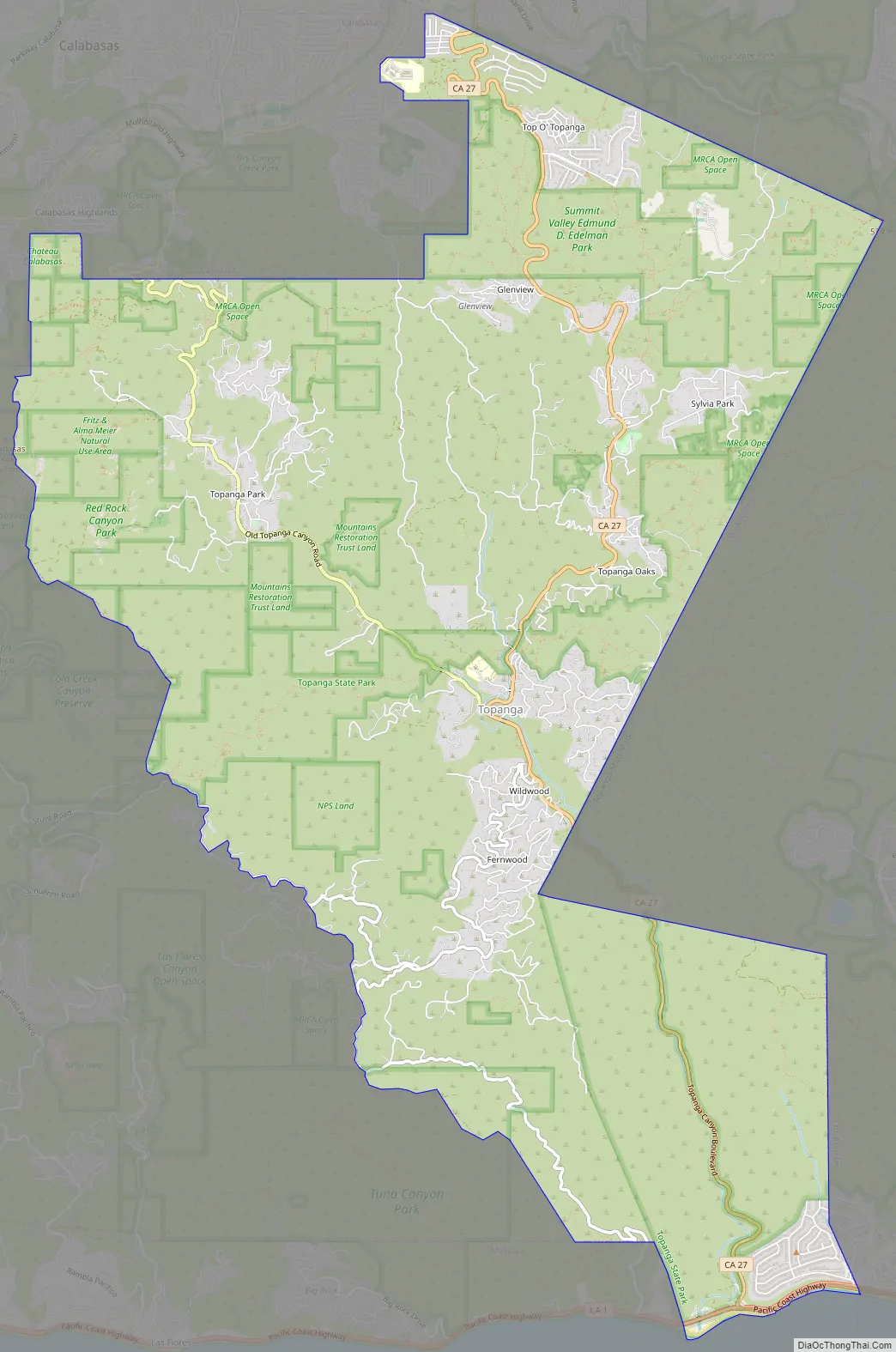
Topanga Road Map
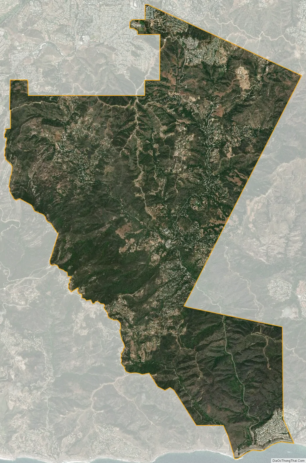
Topanga city Satellite Map
Geography
Topanga Canyon
Topanga Creek drains Topanga Canyon and is the third largest watershed entering the Santa Monica Bay. The creek is one of the few remaining undammed waterways in the area, and is a spawning ground for steelhead trout. The area typically receives about 22 inches (560 mm) of rain annually. Topanga Beach lies on the coast at the outlet of Topanga Creek. Topanga Canyon Boulevard, State Route 27, is the principal thoroughfare, connecting the Ventura Freeway (US 101) to the north with Pacific Coast Highway (SR 1) on the south. The southern portion of the boulevard largely follows Topanga Creek. North of the Old Topanga Canyon Road intersection, the boulevard traverses the Santa Monica Mountains.
Topanga Canyon contains lands of Topanga State Park, the largest park in the Santa Monica Mountains and one of the largest open space preserves surrounded by a city in the world, as well as the Santa Monica Mountains Conservancy. It is part of the Santa Monica Mountains National Recreation Area. It primarily represents a California coastal sage and chaparral ecoregion, with large areas of the California oak woodland plant community, and a wide variety of native plants.
Climate
This region experiences warm (but not hot) and dry summers, with no average monthly temperatures above 71.6 °F (22.0 °C). According to the Köppen Climate Classification system, Topanga has a warm-summer Mediterranean climate, abbreviated “Csb” on climate maps.
See also
Map of California State and its subdivision:- Alameda
- Alpine
- Amador
- Butte
- Calaveras
- Colusa
- Contra Costa
- Del Norte
- El Dorado
- Fresno
- Glenn
- Humboldt
- Imperial
- Inyo
- Kern
- Kings
- Lake
- Lassen
- Los Angeles
- Madera
- Marin
- Mariposa
- Mendocino
- Merced
- Modoc
- Mono
- Monterey
- Napa
- Nevada
- Orange
- Placer
- Plumas
- Riverside
- Sacramento
- San Benito
- San Bernardino
- San Diego
- San Francisco
- San Joaquin
- San Luis Obispo
- San Mateo
- Santa Barbara
- Santa Clara
- Santa Cruz
- Shasta
- Sierra
- Siskiyou
- Solano
- Sonoma
- Stanislaus
- Sutter
- Tehama
- Trinity
- Tulare
- Tuolumne
- Ventura
- Yolo
- Yuba
- Alabama
- Alaska
- Arizona
- Arkansas
- California
- Colorado
- Connecticut
- Delaware
- District of Columbia
- Florida
- Georgia
- Hawaii
- Idaho
- Illinois
- Indiana
- Iowa
- Kansas
- Kentucky
- Louisiana
- Maine
- Maryland
- Massachusetts
- Michigan
- Minnesota
- Mississippi
- Missouri
- Montana
- Nebraska
- Nevada
- New Hampshire
- New Jersey
- New Mexico
- New York
- North Carolina
- North Dakota
- Ohio
- Oklahoma
- Oregon
- Pennsylvania
- Rhode Island
- South Carolina
- South Dakota
- Tennessee
- Texas
- Utah
- Vermont
- Virginia
- Washington
- West Virginia
- Wisconsin
- Wyoming


