Malibu (/ˈmælɪbuː/ MAL-ih-boo; Spanish: Malibú; Chumash: Humaliwo) is a beach city in the Santa Monica Mountains region of Los Angeles County, California, situated about 30 miles (48 km) west of Downtown Los Angeles. It is known for its Mediterranean climate and its 21-mile (34 km) strip of the Pacific coast, incorporated in 1991 into the city. The exclusive Malibu Colony has been historically home to Hollywood celebrities. People in the entertainment industry and other affluent residents live throughout the city, yet many residents are middle class. Most Malibu residents live from a half-mile (0.8 km) to within a few hundred yards of Pacific Coast Highway (State Route 1), which traverses the city, with some residents living up to one mile (1.6 km) away from the beach up narrow canyons. As of the 2020 census, the city‘s population was 10,654.
Nicknamed “the ‘Bu” by surfers and locals, beaches along the Malibu coast include: Topanga Beach, Big Rock Beach, Las Flores Beach, La Costa Beach, Surfrider Beach, Dan Blocker Beach, Malibu Beach, Zuma Beach, Broad Beach, Point Dume Beach, and County Line. State parks and beaches on the Malibu coast include Malibu Creek State Park, Leo Carrillo State Beach and Park, Point Mugu State Park, and Robert H. Meyer Memorial State Beach, with individual beaches: El Pescador, La Piedra and El Matador. The many parks within the Santa Monica Mountains National Recreation Area lie along the ridges above the city along with local parks that include Malibu Bluffs Park (formerly Malibu Bluffs State Park), Trancas Canyon Park, Las Flores Creek Park, and Legacy Park.
Signs around the city proclaim “21 miles of scenic beauty”, referring to the incorporated city limits. The city updated the signs in 2017 from the historical 27-mile (43 km) length of the Malibu coast spanning from Tuna Canyon on the southeast to Point Mugu in Ventura County on the northwest. For many residents of the unincorporated canyon areas, Malibu has the closest commercial centers and they are included in the Malibu ZIP Codes. The city is bounded by Topanga on the east, the Santa Monica Mountains (Agoura Hills, Calabasas, and Woodland Hills) to the north, the Pacific Ocean to the south, and Solromar in Ventura County to the west.
| Name: | Malibu city |
|---|---|
| LSAD Code: | 25 |
| LSAD Description: | city (suffix) |
| State: | California |
| County: | Los Angeles County |
| Elevation: | 105 ft (32 m) |
| Total Area: | 19.90 sq mi (51.54 km²) |
| Land Area: | 19.86 sq mi (51.45 km²) |
| Water Area: | 0.03 sq mi (0.09 km²) 0.22% |
| Total Population: | 10,654 |
| Population Density: | 540/sq mi (210/km²) |
| Area code: | 310/424 |
| FIPS code: | 0645246 |
| Website: | www.malibucity.org |
Online Interactive Map
Click on ![]() to view map in "full screen" mode.
to view map in "full screen" mode.
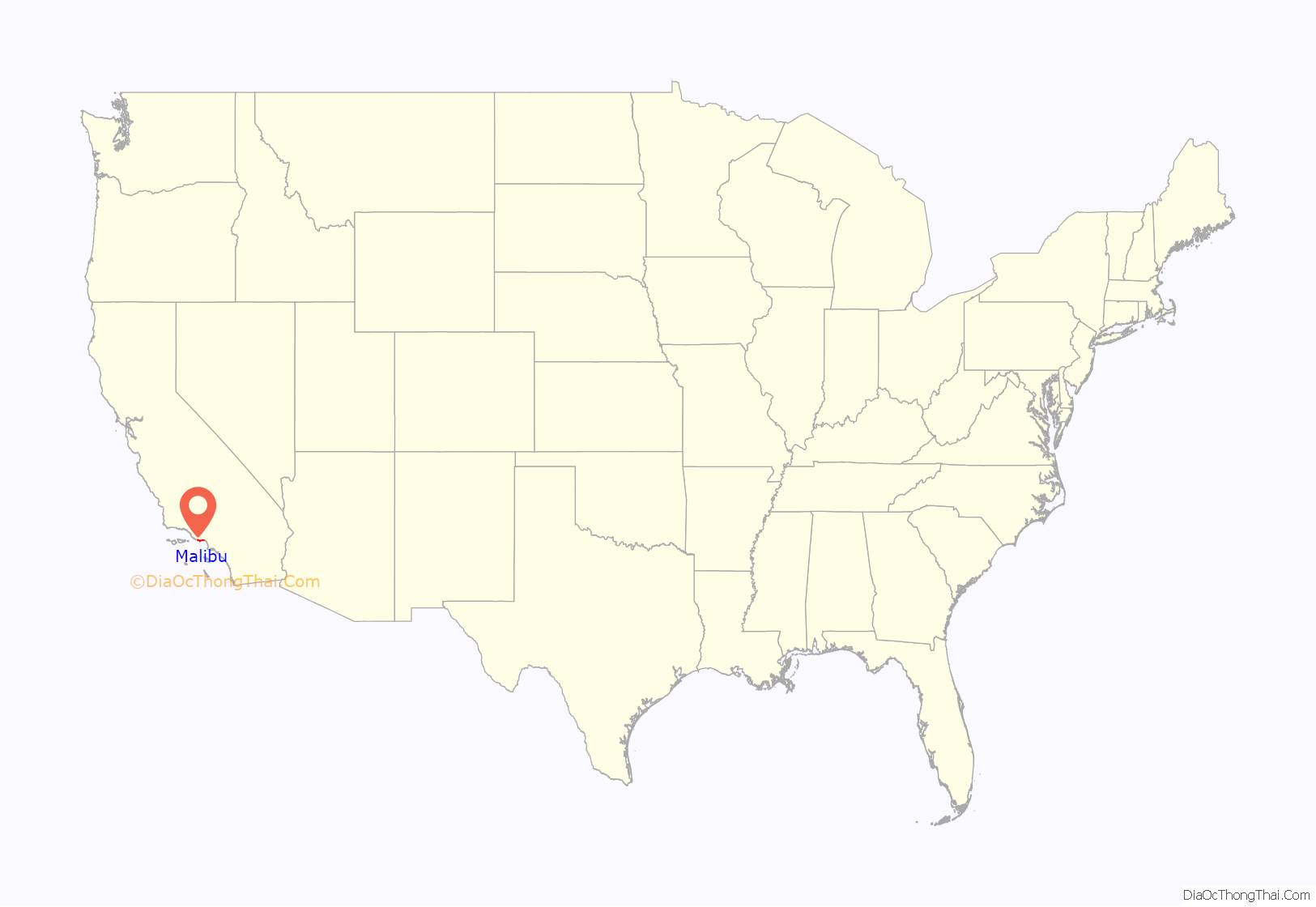
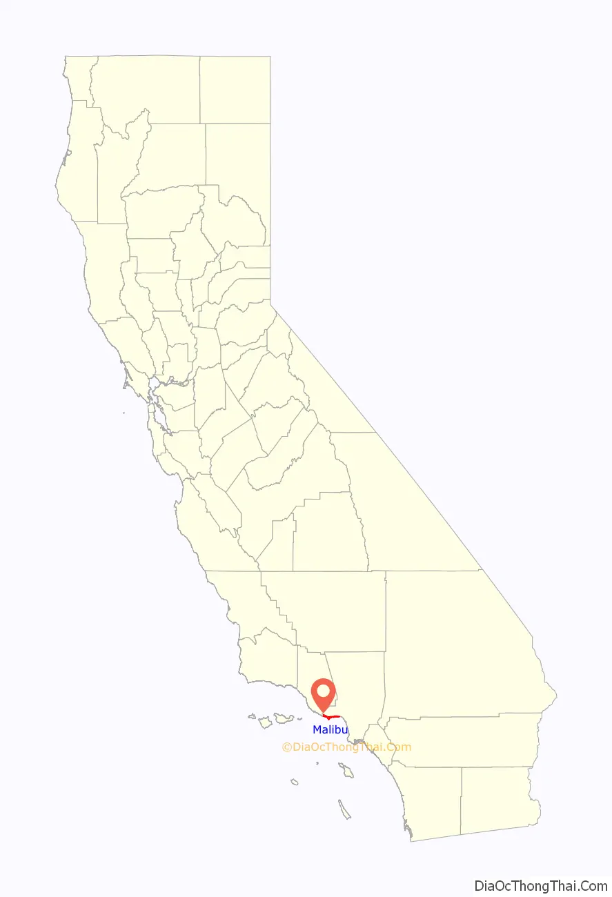
Malibu location map. Where is Malibu city?
History
The area is within the Chumash territory which extended from the San Joaquin Valley to San Luis Obispo to Malibu, as well as several islands off the southern coast of California. The Chumash called the settlement Humaliwo or “the surf sounds loudly”. The city’s name derives from this, as the “Hu” syllable is not stressed.
Humaliwo was next to Malibu Lagoon and was an important regional center in prehistoric times. The village, which is identified as CA-LAN-264, was occupied from approximately 2500 BCE. It was the second-largest Chumash coastal settlement by the Santa Monica Mountains, after Muwu (Point Mugu). Baptismal records list 118 individuals from Humaliwo. Humaliwo was considered an important political center, but there were additional minor settlements in the area. One village, Ta’lopop, was located few miles up Malibu Canyon from Malibu Lagoon. Research shows that Humaliwo had ties to other pre-colonial villages, including Hipuk (in Westlake Village), Lalimanux (by Conejo Grade) and Huwam (in Bell Canyon).
Explorer Juan Rodríguez Cabrillo is believed to have moored at Malibu Lagoon, at the mouth of Malibu Creek, to obtain fresh water in 1542. The Spanish presence returned with the California mission system, and the area was part of Rancho Topanga Malibu Sequit—a 13,000-acre (53 km) land grant—in 1802. That ranch passed intact to Frederick Hastings Rindge in 1891. He and his wife, Rhoda May Knight Rindge, were very staunch about protecting their land. After his death, Rhoda May guarded their property zealously by hiring guards to evict all trespassers and fighting a lengthy court battle to prevent the building of a Southern Pacific railroad line through the ranch. Interstate Commerce Commission regulations would not support a railroad condemning property in order to build tracks that paralleled an existing line, so Frederick H. Rindge decided to build his own railroad through his property first. He died, and May Rindge followed through with the plans, building the Hueneme, Malibu and Port Los Angeles Railway. The line started at Carbon Canyon, just inside the ranch’s property eastern boundary, and ran 15 miles westward, past Pt. Dume.
Few roads even entered the area before 1929, when the state won another court case and built what is now known as the Pacific Coast Highway. By then May Rindge was forced to divide her property and begin selling and leasing lots. The Rindge house, known as the Adamson House (a National Register of Historic Places site and California Historical Landmark), is now part of Malibu Creek State Park and is situated between Malibu Lagoon State Beach and Surfrider Beach, beside the Malibu Pier that was used to provide transportation to/from the ranch, including construction materials for the Rindge railroad, and to tie up the family’s yacht.
In 1926, in an effort to avoid selling land to stave off insolvency, May K. Rindge created a small ceramic tile factory. At its height, Malibu Potteries employed over 100 workers, and produced decorative tiles which furnish many Los Angeles-area public buildings and Beverly Hills residences. The factory, located one-half-mile east of the pier, was ravaged by a fire in 1931. Although the factory partially reopened in 1932, it could not recover from the effects of the Great Depression and a steep downturn in Southern California construction projects. A distinct hybrid of Moorish and Arts and crafts designs, Malibu tile is considered highly collectible. Fine examples of the tiles may be seen at the Adamson House and Serra Retreat, a 50-room mansion that was started in the 1920s as the main Rindge home on a hill overlooking the lagoon. The unfinished building was sold to the Franciscan Order in 1942 and is operated as a retreat facility, Serra Retreat. It burned in the 1970 fire and was rebuilt using many of the original tiles.
Most of the Big Rock Drive area was bought in 1936 by William Randolph Hearst, who considered building an estate on the property. He sold the lower half of his holdings there in 1944 to Art Jones. Jones was one of the prominent early realtors in Malibu, starting with the initial leases of Rindge land in Malibu Colony. He was also the owner/part-owner of the Malibu Inn, Malibu Trading Post and the Big Rock Beach Cafe (which is now Moonshadows restaurant). Philiip McAnany owned 80 acres (32 ha) in the upper Big Rock area, which he had purchased in 1919, and had two cabins there, one of which burned in a brush fire that swept through the area in 1959, and the other in the 1993 Malibu fire. McAnany Way is named after him.
Malibu Colony
Malibu Colony was one of the first areas with private homes after Malibu was opened to development in 1926 by May K. Ringe. Her husband, Frederick Hastings Rindge paid $10 an acre in 1890. As one of Malibu’s most famous districts, it is located south of Malibu Road and the Pacific Coast Highway, west of Malibu Lagoon State Beach, east of Malibu Bluffs Park (formerly a state park) and across from the Malibu Civic Center. May Rindge allowed prominent Hollywood movie stars to build vacation homes in the Colony as a defensive public relations wedge against the Southern Pacific from taking her property under eminent domain for a coastal train route. The action forced the Southern Pacific to route their northbound line inland then return to the coast in Ventura. However, the long legal battle to protect her beloved Malibu coast had been costly and she eventually died penniless. Long known as a popular private enclave for wealthy celebrities, the Malibu Colony is a gated community, with multimillion-dollar homes on small lots. The Colony has views of the Pacific Ocean, with coastline views stretching from Santa Monica to Rancho Palos Verdes to the south (known locally as the Queen’s Necklace) and the bluffs of Point Dume to the north.
High technology in Malibu
The first working model of a laser was demonstrated by Theodore Maiman in 1960 in Malibu at the Hughes Research Laboratory (now known as HRL Laboratories LLC). In the 1990s HRL Laboratories developed the FastScat computer code. TRW built a laboratory in Solstice Canyon without any structural steel to test magnetic detectors for satellites and medical devices.
Incorporation
In 1991 most of the Malibu land grant was incorporated as a city to allow local control of the area (as cities under California law, they are not subject to the same level of county government oversight). Prior to achieving municipal status, the local residents had fought several county-proposed developments, including an offshore freeway, a nuclear power plant, and several plans to replace septic tanks with sewer lines to protect the ocean from seepage that pollutes the marine environment. The incorporation drive gained impetus in 1986, when the Los Angeles County Board of Supervisors approved plans for a regional sewer that would have been large enough to serve 400,000 people in the western Santa Monica Mountains. Residents were incensed that they would be assessed taxes and fees to pay for the sewer project, and feared that the Pacific Coast Highway would need to be widened into a freeway to accommodate growth that they did not want. The supervisors fought the incorporation drive and prevented the residents from voting, a decision that was overturned in the courts.
The city councils that were elected in the 1990s were unable to write a Local Coastal Plan (LCP) that preserved enough public access to satisfy the California Coastal Commission, as required by the California Coastal Act. The state Legislature eventually passed a Malibu-specific law that allowed the Coastal Commission to write an LCP for Malibu, thus limiting the city’s ability to control many aspects of land use. Because of the failure to adequately address sewage disposal problems in the heart of the city, the local water board ordered Malibu in November 2009 to build a sewage plant for the Civic Center area (23555 Civic Center Way). The city council has objected to that solution. On 2 February 2007, Civic Center Stormwater Treatment Facility opened. On 29 June 2016, City of Malibu Civic Center Wasterwater Treatment Facility, Phase 1, broke ground.
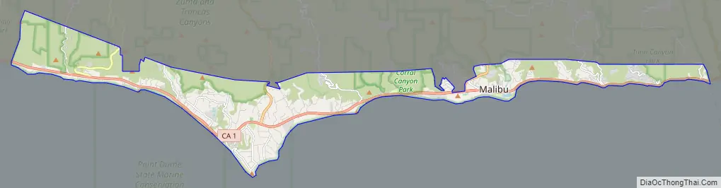
Malibu Road Map
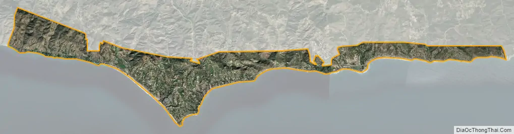
Malibu city Satellite Map
Geography
Malibu is located at 34°1′50″N 118°46′43″W / 34.03056°N 118.77861°W / 34.03056; -118.77861 (Malibu, California (GNIS point)) (34.030450, −118.778612). Its City Hall building is located at 23825 Stuart Ranch Road (34°02′21″N 118°41′35″W / 34.03917°N 118.69306°W / 34.03917; -118.69306). The eastern end of the city borders the Topanga CDP, which separates it from the city of Los Angeles.
According to the United States Census Bureau, the city has a total area of 19.8 square miles (51 km), over 99% of it land.
Malibu’s dry brush and steep clay slopes make it prone to fires, floods, and mudslides.
Carbon Beach, Surfrider Beach, Westward Beach, Escondido Beach, Paradise Cove, Point Dume, Pirates Cove, Zuma Beach, Trancas and Encinal Bluffs are places along the coast in Malibu. Point Dume forms the northern end of the Santa Monica Bay, and Point Dume Headlands Park affords a vista stretching to the Palos Verdes Peninsula and Santa Catalina Island. Directly below the park, on the western side of the point, is Pirates Cove. Because of its relative seclusion, Pirates Cove was previously used as a nude beach, but since nudity is now illegal on all beaches in Los Angeles County, nude sunbathers are subject to fines and/or arrest.
Like all California beaches, Malibu beaches are technically public land below the mean high tide line. Many large public beaches (Zuma Beach, Surfrider Beach) are easily accessible, but such access is sometimes limited for some of the smaller and more remote beaches. Some Malibu beaches are private, such as Paradise Cove, which charges an entrance fee to keep the crowds at bay.
Climate
This region experiences warm and dry summers, with no average monthly temperatures above 71.6 °F (22 °C). According to the Köppen Climate Classification system, Malibu has a warm-summer Mediterranean climate, abbreviated “Csb” on climate maps. The city’s climate is influenced by the Pacific Ocean, resulting in far more moderate temperatures than locations further inland experience. Snow in Malibu is extremely rare, but flurries with higher accumulations in the nearby mountains occurred on January 17, 2007. More recently, snow fell in the city on January 25, 2021. The record high temperature of 104 °F (40 °C) was observed on September 27, 2010, while the record low temperature of 26 °F (–3 °C) was observed on January 14, 2007.
See also
Map of California State and its subdivision:- Alameda
- Alpine
- Amador
- Butte
- Calaveras
- Colusa
- Contra Costa
- Del Norte
- El Dorado
- Fresno
- Glenn
- Humboldt
- Imperial
- Inyo
- Kern
- Kings
- Lake
- Lassen
- Los Angeles
- Madera
- Marin
- Mariposa
- Mendocino
- Merced
- Modoc
- Mono
- Monterey
- Napa
- Nevada
- Orange
- Placer
- Plumas
- Riverside
- Sacramento
- San Benito
- San Bernardino
- San Diego
- San Francisco
- San Joaquin
- San Luis Obispo
- San Mateo
- Santa Barbara
- Santa Clara
- Santa Cruz
- Shasta
- Sierra
- Siskiyou
- Solano
- Sonoma
- Stanislaus
- Sutter
- Tehama
- Trinity
- Tulare
- Tuolumne
- Ventura
- Yolo
- Yuba
- Alabama
- Alaska
- Arizona
- Arkansas
- California
- Colorado
- Connecticut
- Delaware
- District of Columbia
- Florida
- Georgia
- Hawaii
- Idaho
- Illinois
- Indiana
- Iowa
- Kansas
- Kentucky
- Louisiana
- Maine
- Maryland
- Massachusetts
- Michigan
- Minnesota
- Mississippi
- Missouri
- Montana
- Nebraska
- Nevada
- New Hampshire
- New Jersey
- New Mexico
- New York
- North Carolina
- North Dakota
- Ohio
- Oklahoma
- Oregon
- Pennsylvania
- Rhode Island
- South Carolina
- South Dakota
- Tennessee
- Texas
- Utah
- Vermont
- Virginia
- Washington
- West Virginia
- Wisconsin
- Wyoming


