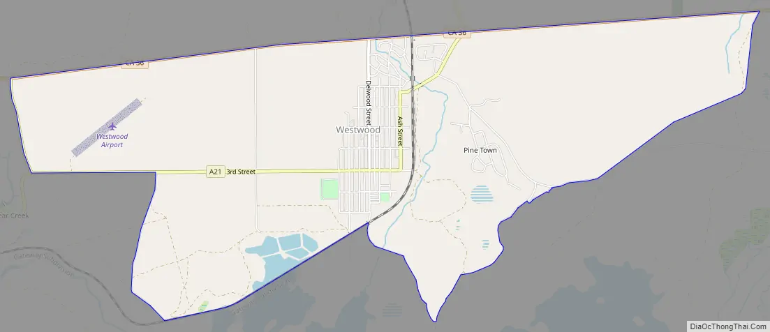
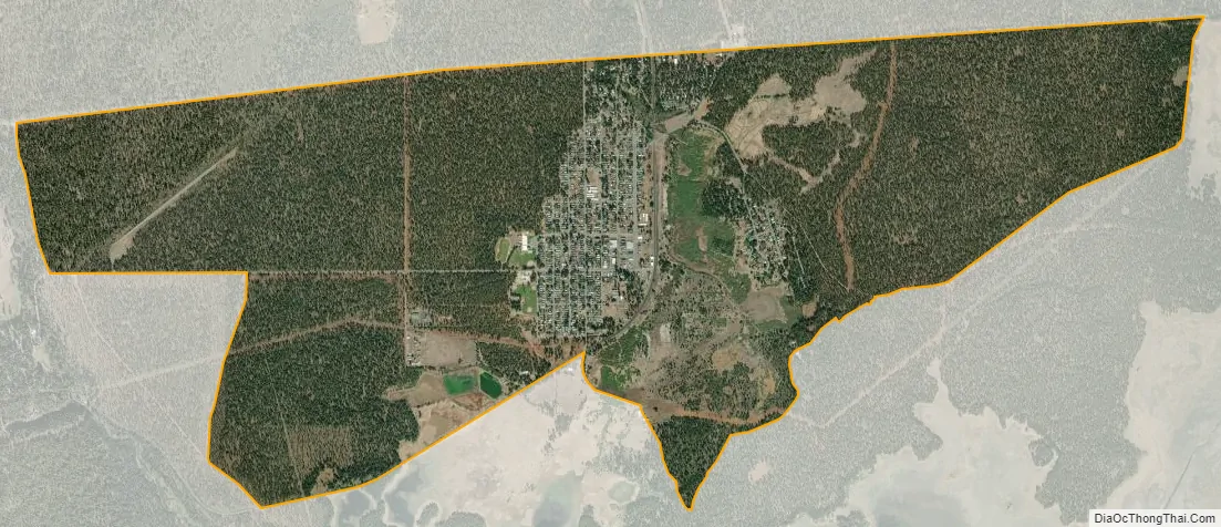
Westwood is a census-designated place (CDP) in Lassen County, California, United States. Westwood is located 20 miles (32 km) west-southwest of Susanville, at an elevation of 5,128 feet (1,563 m). Its population is 1,541 as of the 2020 census, down from 1,647 from the 2010 census..
| Name: | Westwood CDP |
|---|---|
| LSAD Code: | 57 |
| LSAD Description: | CDP (suffix) |
| State: | California |
| County: | Lassen County |
| Elevation: | 5,128 ft (1,563 m) |
| Total Area: | 5.510 sq mi (14.270 km²) |
| Land Area: | 5.436 sq mi (14.079 km²) |
| Water Area: | 0.074 sq mi (0.191 km²) 1.34% |
| Total Population: | 1,541 |
| Population Density: | 280/sq mi (110/km²) |
| ZIP code: | 96137 |
| Area code: | 530 |
| FIPS code: | 0684928 |
| GNISfeature ID: | 1660156 |
Online Interactive Map
Click on ![]() to view map in "full screen" mode.
to view map in "full screen" mode.
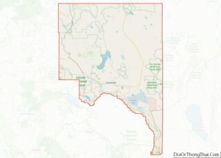
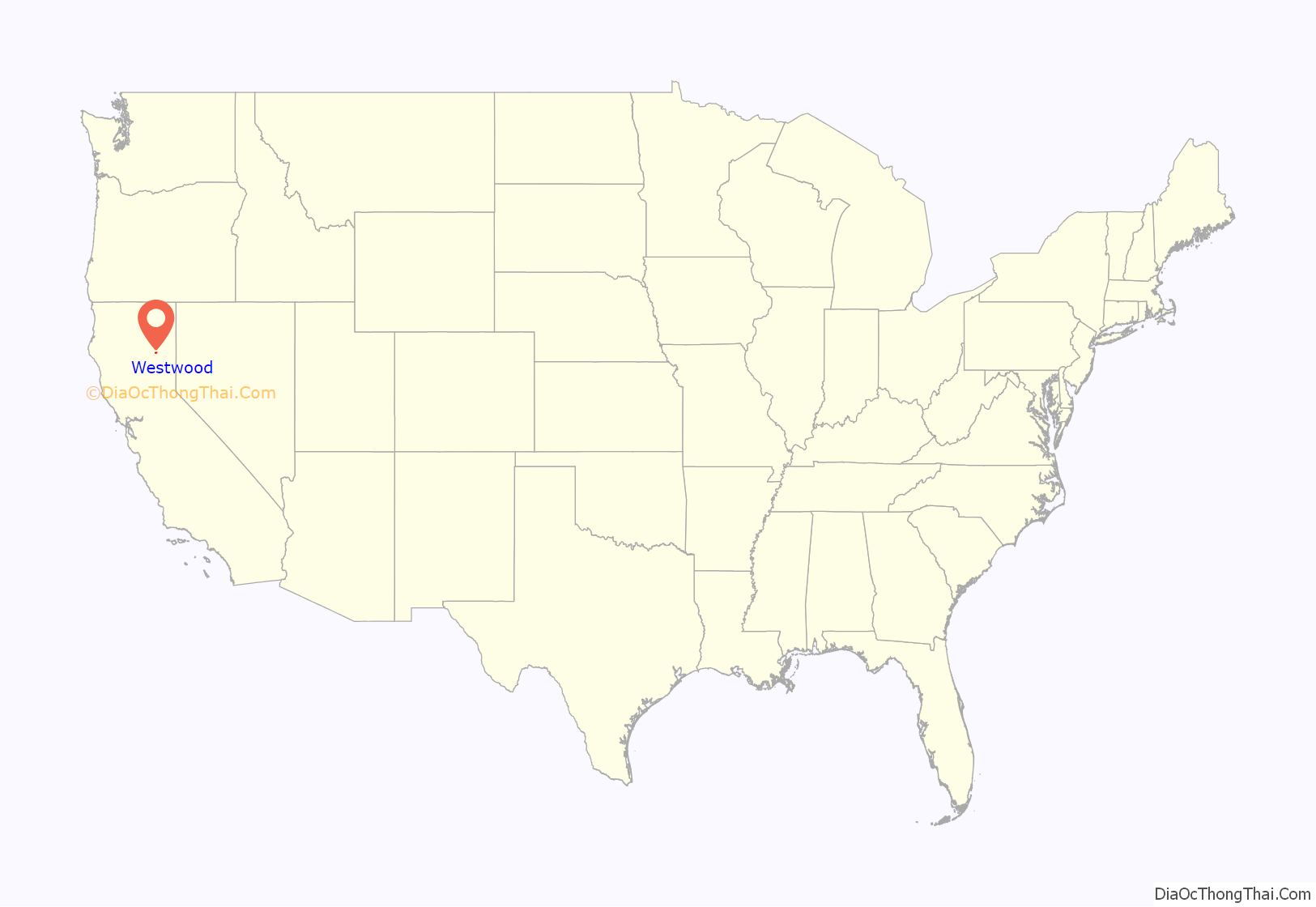
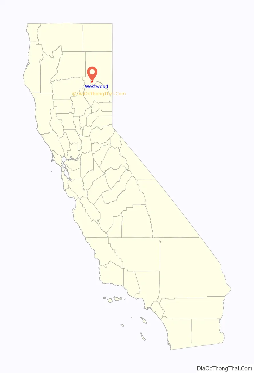
Westwood location map. Where is Westwood CDP?
History
Westwood was built by T. B. Walker to be the operations center for the Red River Lumber Company in 1913, and serviced by the Fernley and Lassen Railway built in 1912–14. The first post office opened in 1913. The Red River Lumber Company is credited as being “the world’s largest electrical sawmill of the times.” Red River Lumber Company also operated one of the first electric railways in the state built in 1927. The mill was equipped with the most modern equipment for its time; and the surrounding territory was crisscrossed by forest railways bringing logs to the mill. The railway shop at Westwood was home to 2-8-0 No. 102 and 2-8-2 No. 104 when forest railway operations ceased in the early 1950s. The four woods engines scrapped in 1953 were 2-6-0 number 1, 2-6-2 number 2, 2-8-2 number 3, and 3-truck Shay locomotive number 4.
William Laughead, an advertising copywriter who had once worked in lumber camps, took the stories of an old lumberjack and reworked them into the modern character. He sold the stories of Paul Bunyan and his Blue Ox “Babe” to the Red River Lumber Company, which published “Introducing Mr. Paul Bunyan of Westwood, California” in 1916 as an advertising pamphlet. Among other things, Laughead gave the name “Babe” to the blue ox, originated the idea that Paul Bunyan and Babe were of enormous size, and created the first pictorial representation of Bunyan.
The Red River Lumber Company’s electric mill at Westwood made wooden Venetian blinds, plywood, boxes, doors and windows which were shipped all over the U.S. and the world. The Westwood mill set a world record in 1942 by sawing 212 million board feet.
Westwood High School’s nickname is the Lumberjacks. Westwood had a very large indoor shopping mall as far back as the 1930s, as well as a large theater, skating rink and club for the mill workers. The town was sold in 1944 to the Fruit Growers Supply Company (sister cooperative of Sunkist Growers). The plant closed in 1956, and the town was sold to residents and developers.
Westwood also had a very early form of cable television. The owner of the local variety store took it upon himself to provide television service to the community. At the time three channels were available to view in Westwood, Channel 3, the NBC affiliate in Sacramento, Channel 7, the ABC affiliate in Redding and Channel 12, the CBS affiliate in Chico. Multiple antennae were mounted outside of town and coax cable was laid up and down the alleys. For a small monthly fee a home could have television service without having three separate antennae on the roof.
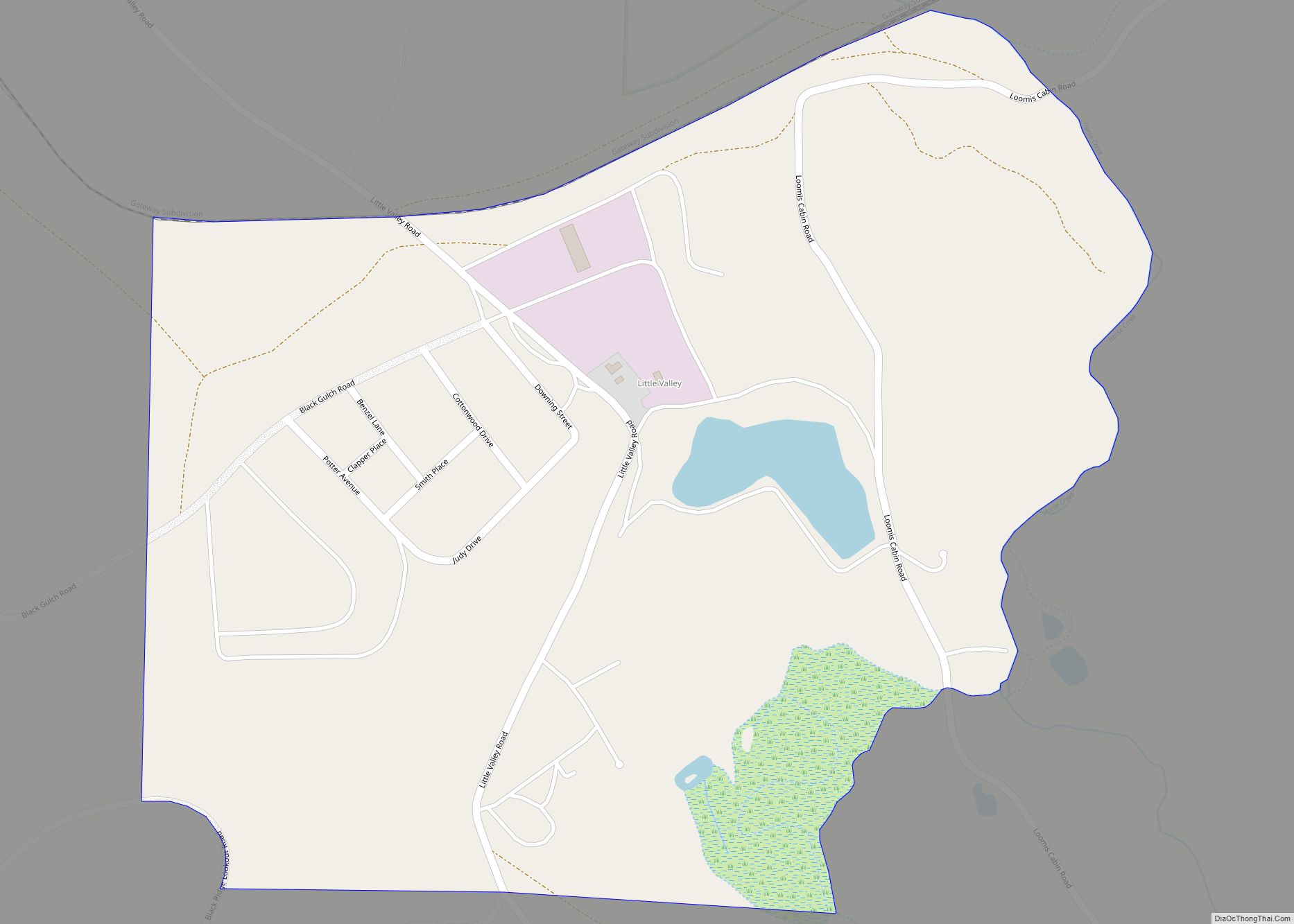
Westwood Road Map
Westwood city Satellite Map
Geography
Westwood is built upon lava flows from Cascade Mountain Range volcanoes to the north. Keddie Ridge is considered to be at the northern end of the Sierra Nevada Mountain Range.
According to the United States Census Bureau, the CDP has a total area of 5.5 square miles (14 km), of which 5.4 square miles (14 km) is land and 0.1 square miles (0.26 km) (1.34%) is water.
See also
Map of California State and its subdivision:- Alameda
- Alpine
- Amador
- Butte
- Calaveras
- Colusa
- Contra Costa
- Del Norte
- El Dorado
- Fresno
- Glenn
- Humboldt
- Imperial
- Inyo
- Kern
- Kings
- Lake
- Lassen
- Los Angeles
- Madera
- Marin
- Mariposa
- Mendocino
- Merced
- Modoc
- Mono
- Monterey
- Napa
- Nevada
- Orange
- Placer
- Plumas
- Riverside
- Sacramento
- San Benito
- San Bernardino
- San Diego
- San Francisco
- San Joaquin
- San Luis Obispo
- San Mateo
- Santa Barbara
- Santa Clara
- Santa Cruz
- Shasta
- Sierra
- Siskiyou
- Solano
- Sonoma
- Stanislaus
- Sutter
- Tehama
- Trinity
- Tulare
- Tuolumne
- Ventura
- Yolo
- Yuba
- Alabama
- Alaska
- Arizona
- Arkansas
- California
- Colorado
- Connecticut
- Delaware
- District of Columbia
- Florida
- Georgia
- Hawaii
- Idaho
- Illinois
- Indiana
- Iowa
- Kansas
- Kentucky
- Louisiana
- Maine
- Maryland
- Massachusetts
- Michigan
- Minnesota
- Mississippi
- Missouri
- Montana
- Nebraska
- Nevada
- New Hampshire
- New Jersey
- New Mexico
- New York
- North Carolina
- North Dakota
- Ohio
- Oklahoma
- Oregon
- Pennsylvania
- Rhode Island
- South Carolina
- South Dakota
- Tennessee
- Texas
- Utah
- Vermont
- Virginia
- Washington
- West Virginia
- Wisconsin
- Wyoming