Wildomar is a city in southwest Riverside County, California, United States. The city was incorporated on July 1, 2008. As of the 2020 census, the population was 36,875. The community has grown very quickly during the early twenty-first century; the population has more than doubled since the 2000 census, when the community was still an unincorporated census-designated place.
| Name: | Wildomar city |
|---|---|
| LSAD Code: | 25 |
| LSAD Description: | city (suffix) |
| State: | California |
| County: | Riverside County |
| Incorporated: | July 1, 2008 |
| Elevation: | 1,270 ft (387 m) |
| Total Area: | 23.70 sq mi (61.39 km²) |
| Land Area: | 23.70 sq mi (61.39 km²) |
| Water Area: | 0.00 sq mi (0.00 km²) 0% |
| Total Population: | 36,875 |
| Population Density: | 1,555.91/sq mi (606.44/km²) |
| ZIP code: | 92595 |
| Area code: | 951 |
| FIPS code: | 0685446 |
| Website: | www.cityofwildomar.org |
Online Interactive Map
Click on ![]() to view map in "full screen" mode.
to view map in "full screen" mode.
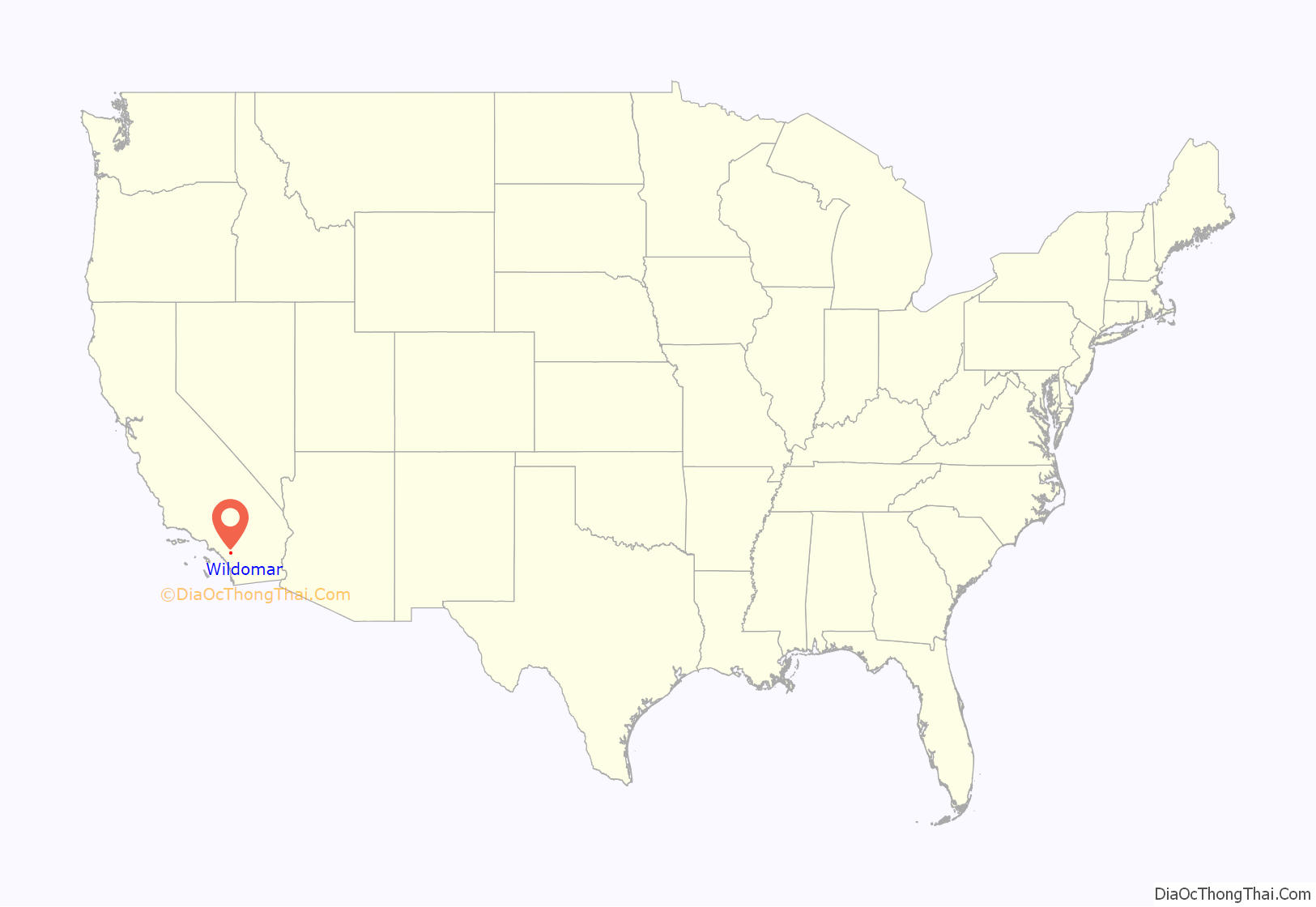
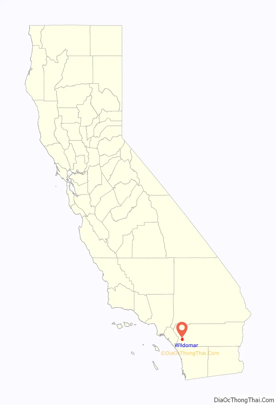
Wildomar location map. Where is Wildomar city?
History
In the summer of 1880 when, looking down from the peak of Mt. Baldy, Franklin Heald of Pasadena first noticed Lake Elsinore, then known as La Laguna. A few months later, in October, Frank Kimbal of San Diego signed an agreement with the Atchison, Topeka and Santa Fe Railroad to build a rail line past the lake from San Diego to Barstow, then known as Waterman.
The next winter, Heald traveled by buggy to see La Laguna (Lake Elsinore) at the same time work commenced on the rail line from San Diego skirting the lakeshore. The new line was to be known as the California Southern Railroad. Rails and spikes were brought from Antwerp, Belgium, and locomotives came from the Eastern Seaboard. The line was completed as far as Colton on August 14, 1882. The new train service was destined to bring development to the Wildomar area, then known as the southern portion of the Rancho La Laguna.
Heald found that the Rancho La Laguna could be purchased, with the exception of some 500 acres (2.0 km) owned by the Machado family, from the London and San Francisco Bank for $24,000. On July 3, 1883, Heald paid $1,000 as a down payment on the area. He then brought in William Collier and Donald Graham as partners. On September 24 of that year, the three men purchased the 12,832 acres (51.93 km) of Rancho La Laguna with an additional payment of $7,000 advanced by William Collier. The remaining debt was paid off shortly thereafter.
The railroad placed a boxcar, known as “Car B”, off to the north-west side of the mainline near what is now Clinton Keith Road on January 1, 1884. For a number of years, this served as the railroad depot for the area that was to become Wildomar.
Heavy rains in the winter of 1884 left as much as 60 inches (1,500 mm) washing out the railroad tracks below Temecula as well as along the San Jacinto River and Railroad Canyon near the shore of Lake Elsinore. Flood damage broke the California Southern Railroad financially. The Santa Fe Railroad came to the rescue. Santa Fe took over the rail line and rebuilt it by the beginning of 1885. The rail line through Wildomar became part of the Atchison, Topeka and Santa Fe Railroad.
In January 1885, Collier, Graham, and Heald made a map of Blocks K, L and M of the Elsinore area, recording the maps with San Diego County in October of that year. In February 1885, Collier and Graham purchased Franklin Heald’s one-third interest in the 2,600 acres (11 km) of unsold land south-east of Corydon Road. Heald took full interest in the unsold land to the north-west of the Corydon Road line.
Collier and Graham made a map of the Wildomar townsite in December 1885, recording it with San Diego County on November 20, 1886. The name Wildomar was derived by combining the names of the new town’s founders, Wil for William Collier, do for Donald Graham, and mar for Margaret Collier Graham, wife of Donald Graham and sister of William Collier.
In 1886 a new school was built, along with a post office and railroad depot. By 1887, Wildomar could boast a large hotel, livery stable, blacksmith shop, numerous stores, a lumber yard, and a park. A Methodist-Episcopalian church was built in 1888 across from the new school just north-west of Central Avenue. In October 1887, Collier and Graham made a map of the Santa Rosa addition to Wildomar, an addition of about 1,500 acres (6.1 km) purchased from Parker Dear, owner of the Rancho Santa Rosa who was attempting to develop a town he called Linda Rosa further south on the rail-line. This new map was recorded February 10, 1892, in the San Diego County records.
By the start of the 20th century, Wildomar even had its own newspaper, The Transcript. The railroad, however, continued to be plagued by washouts and within a few years, the rail connection south from Temecula to San Diego were abandoned. With fewer trains, Wildomar’s development slowed. Then, in 1935, rail service to Wildomar was abandoned and the rails were pulled up back to Pinacate. Wildomar was almost a forgotten community. Then, in 1985, the Temecula Valley Freeway (I-15) was completed, bringing with it a new wave of interest in the area. Once again, Wildomar had begun to grow and experience new prosperity.
The citizens of Wildomar and Sedco Hills voted on February 5, 2008, to incorporate. Wildomar became the 25th city in Riverside County on July 1, 2008.
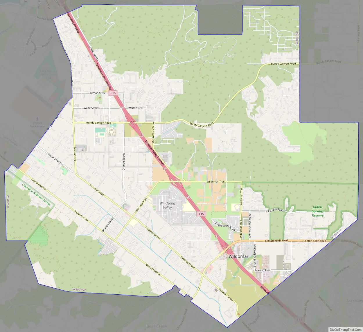
Wildomar Road Map
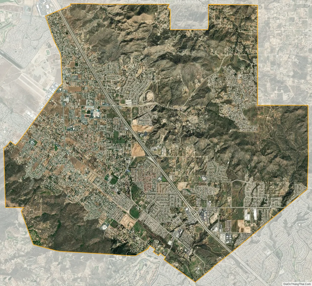
Wildomar city Satellite Map
Geography
Wildomar is located at 33°36′27″N 117°15′37″W / 33.60750°N 117.26028°W / 33.60750; -117.26028 (33.607460, -117.260193).
According to the United States Census Bureau, the community has a total area of 23.7 square miles (61 km), all of it land.
See also
Map of California State and its subdivision:- Alameda
- Alpine
- Amador
- Butte
- Calaveras
- Colusa
- Contra Costa
- Del Norte
- El Dorado
- Fresno
- Glenn
- Humboldt
- Imperial
- Inyo
- Kern
- Kings
- Lake
- Lassen
- Los Angeles
- Madera
- Marin
- Mariposa
- Mendocino
- Merced
- Modoc
- Mono
- Monterey
- Napa
- Nevada
- Orange
- Placer
- Plumas
- Riverside
- Sacramento
- San Benito
- San Bernardino
- San Diego
- San Francisco
- San Joaquin
- San Luis Obispo
- San Mateo
- Santa Barbara
- Santa Clara
- Santa Cruz
- Shasta
- Sierra
- Siskiyou
- Solano
- Sonoma
- Stanislaus
- Sutter
- Tehama
- Trinity
- Tulare
- Tuolumne
- Ventura
- Yolo
- Yuba
- Alabama
- Alaska
- Arizona
- Arkansas
- California
- Colorado
- Connecticut
- Delaware
- District of Columbia
- Florida
- Georgia
- Hawaii
- Idaho
- Illinois
- Indiana
- Iowa
- Kansas
- Kentucky
- Louisiana
- Maine
- Maryland
- Massachusetts
- Michigan
- Minnesota
- Mississippi
- Missouri
- Montana
- Nebraska
- Nevada
- New Hampshire
- New Jersey
- New Mexico
- New York
- North Carolina
- North Dakota
- Ohio
- Oklahoma
- Oregon
- Pennsylvania
- Rhode Island
- South Carolina
- South Dakota
- Tennessee
- Texas
- Utah
- Vermont
- Virginia
- Washington
- West Virginia
- Wisconsin
- Wyoming


