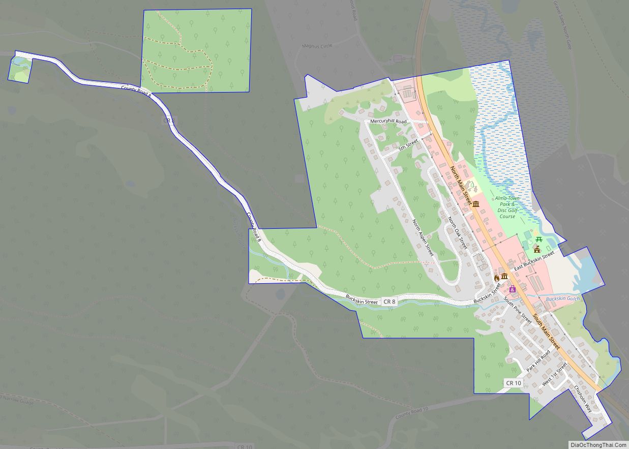
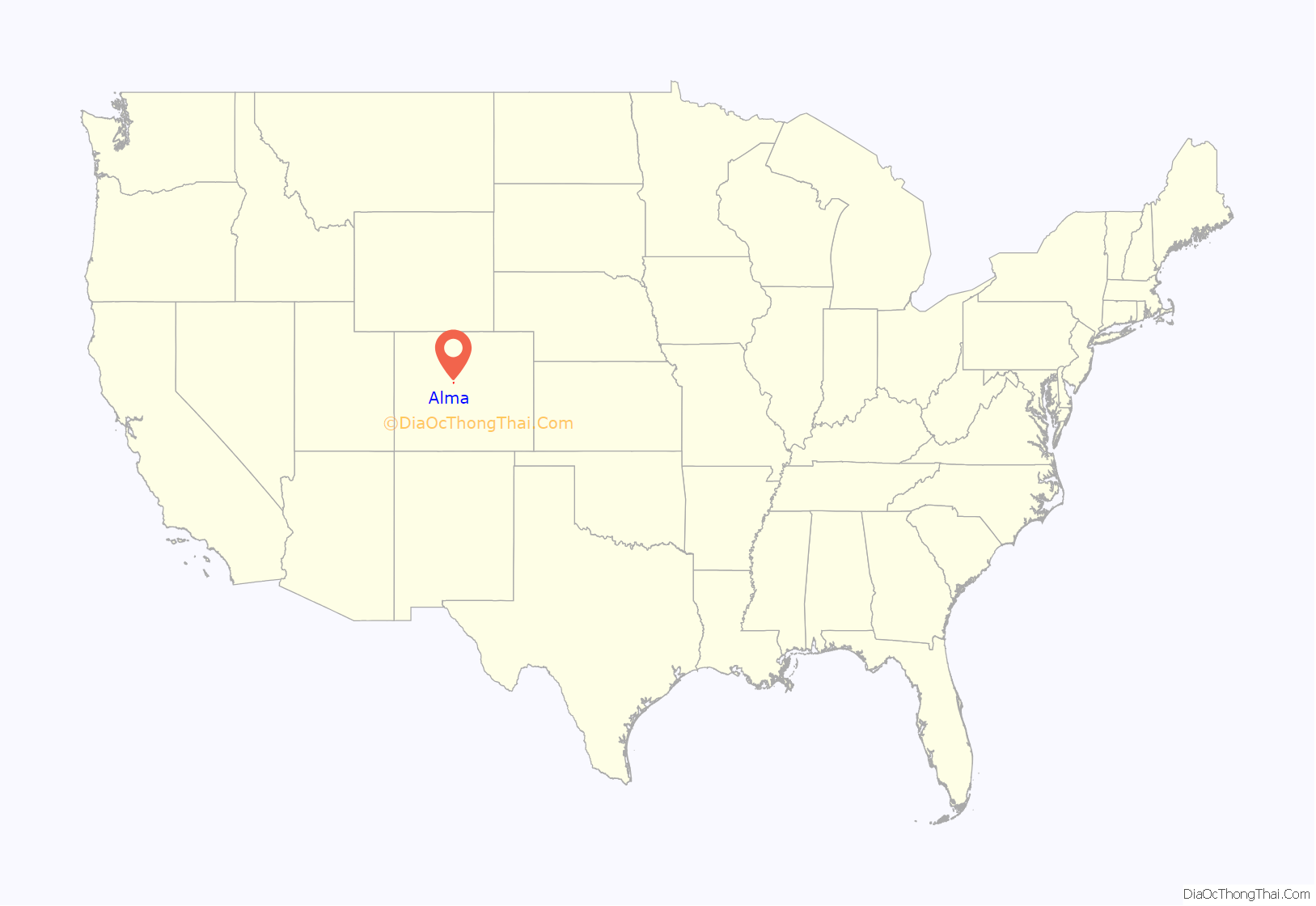
Alma is a statutory town in Park County, Colorado, United States. The town population was 296 at the 2020 United States Census. Alma is located West and South of the Denver-Aurora-Lakewood, CO Metropolitan Statistical Area and the Front Range Urban Corridor.
| Name: | Alma town |
|---|---|
| LSAD Code: | 43 |
| LSAD Description: | town (suffix) |
| State: | Colorado |
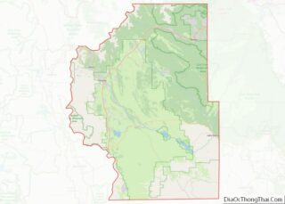
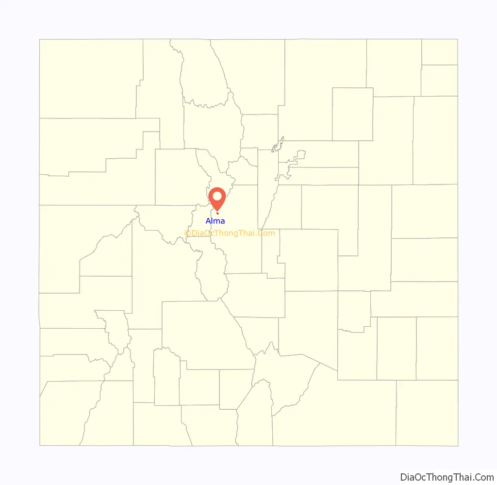
| County: | Park County |
| Incorporated: | 1873-12-02 |
| Elevation: | 10,361 ft (3,158 m) |
| Land Area: | 0.43 sq mi (1.12 km²) |
| Water Area: | 0.00 sq mi (0.01 km²) |
| Population Density: | 682.03/sq mi (263.55/km²) |
| ZIP code: | 80420 |
| Area code: | 719 |
| FIPS code: | 0801530 |
| GNISfeature ID: | 0180003 |
| Website: | townofalma.com |
Online Interactive Map
Click on ![]() to view map in "full screen" mode.
to view map in "full screen" mode.
Alma location map. Where is Alma town?
History
The town was named by a merchant named Mr. James, after his wife. Another tradition states the town was named for the daughter of a resident.
Mines
Alma grew as a town around the Buckskin Gulch, where gold was first discovered in the area. As hard rock mines opened on Mount Bross, Mount Lincoln, and Mount Democrat, the population of the area continued to grow. In the 1870s, Alma’s population peaked at around 10,000 people. The area around Alma contains 17,452 mining sites, mostly placer mines.
Approximately two miles from Alma are the remains of the defunct Orphan Boy mine (founded 1861), which produced gold, silver, lead, and zinc over a number of decades.
The historic Sweet Home Mine near Alma, formerly a silver mine, now produces the mineral rhodochrosite.
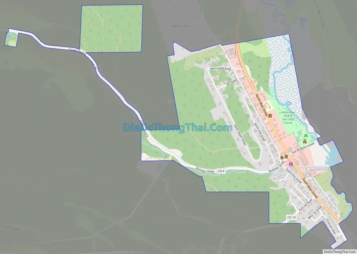
Alma Road Map
Alma city Satellite Map
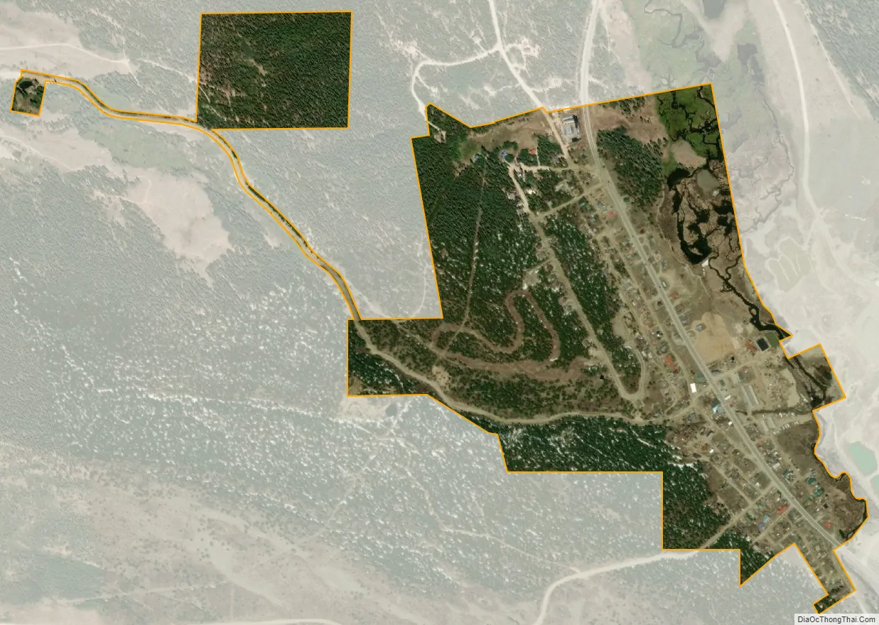
Geography
Alma is located along State Highway 9.
At the 2020 United States Census, the town had a total area of 279 acres (1.129 km) including 1.5 acres (0.006 km) of water.
Climate
Alma has a subarctic climate (Dfc), or what could be called a subalpine climate due to its elevation, with only two months above the 50° isotherm. Alma is the coldest inhabited town in the Lower 48, having a lower yearly mean than other towns known for their extreme cold temperatures, such as Embarrass, Minnesota. Summers are pleasant, with mild days and chilly nights and have no real growing season due to frosts and occasional summer snow. The wettest months are July and August due to thunderstorm activity. Spring and Autumn are both short, but pleasant overall with cool days and cold nights below freezing. Winters are very cold and snowy, lasting from the end of October to well into April some years. Winter highs are almost always below freezing and lows remaining around zero for 1/3 of the year. Alma’s snowpack is usually established during October or very early November and lasts into June most years due to heavy snowfall and low night temperatures allowing the snowpack to keep re-freezing overnight. Alma’s high elevation and location helps to limit both extreme minima and maxima. April averages the most snowfall out of any month of the year.
See also
Map of Colorado State and its subdivision:- Adams
- Alamosa
- Arapahoe
- Archuleta
- Baca
- Bent
- Boulder
- Broomfield
- Chaffee
- Cheyenne
- Clear Creek
- Conejos
- Costilla
- Crowley
- Custer
- Delta
- Denver
- Dolores
- Douglas
- Eagle
- El Paso
- Elbert
- Fremont
- Garfield
- Gilpin
- Grand
- Gunnison
- Hinsdale
- Huerfano
- Jackson
- Jefferson
- Kiowa
- Kit Carson
- La Plata
- Lake
- Larimer
- Las Animas
- Lincoln
- Logan
- Mesa
- Mineral
- Moffat
- Montezuma
- Montrose
- Morgan
- Otero
- Ouray
- Park
- Phillips
- Pitkin
- Prowers
- Pueblo
- Rio Blanco
- Rio Grande
- Routt
- Saguache
- San Juan
- San Miguel
- Sedgwick
- Summit
- Teller
- Washington
- Weld
- Yuma
- Alabama
- Alaska
- Arizona
- Arkansas
- California
- Colorado
- Connecticut
- Delaware
- District of Columbia
- Florida
- Georgia
- Hawaii
- Idaho
- Illinois
- Indiana
- Iowa
- Kansas
- Kentucky
- Louisiana
- Maine
- Maryland
- Massachusetts
- Michigan
- Minnesota
- Mississippi
- Missouri
- Montana
- Nebraska
- Nevada
- New Hampshire
- New Jersey
- New Mexico
- New York
- North Carolina
- North Dakota
- Ohio
- Oklahoma
- Oregon
- Pennsylvania
- Rhode Island
- South Carolina
- South Dakota
- Tennessee
- Texas
- Utah
- Vermont
- Virginia
- Washington
- West Virginia
- Wisconsin
- Wyoming