The Town of Cheraw is a Statutory Town located in Otero County, Colorado, United States. The town population was 237 at the 2020 United States Census.
| Name: | Cheraw town |
|---|---|
| LSAD Code: | 43 |
| LSAD Description: | town (suffix) |
| State: | Colorado |
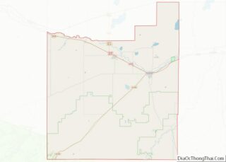
| County: | Otero County |
| Incorporated: | April 17, 1917 |
| Elevation: | 4,131 ft (1,259 m) |
| Total Area: | 0.183 sq mi (0.474 km²) |
| Land Area: | 0.180 sq mi (0.467 km²) |
| Water Area: | 0.003 sq mi (0.007 km²) |
| Total Population: | 237 |
| Population Density: | 1,314/sq mi (507/km²) |
| ZIP code: | 81030 |
| Area code: | 719 |
| FIPS code: | 0813460 |
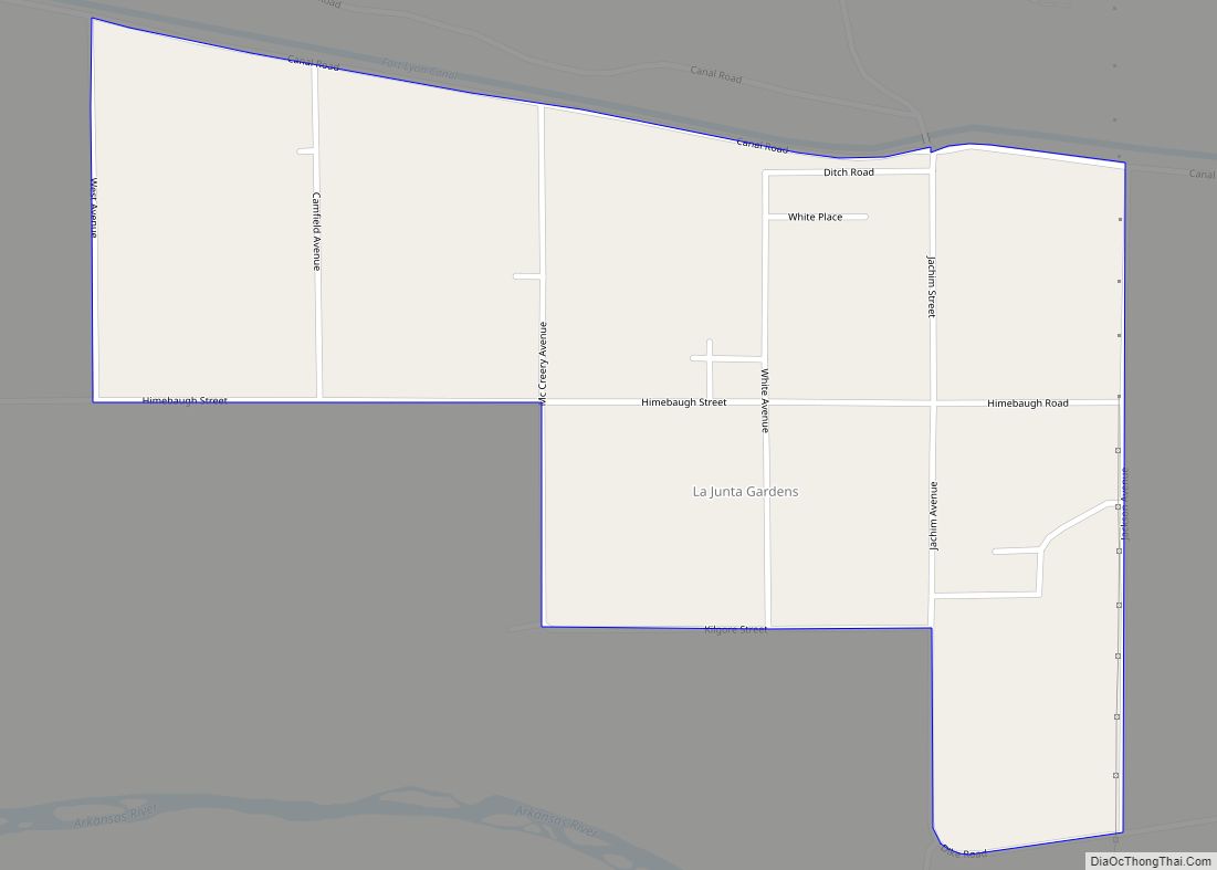
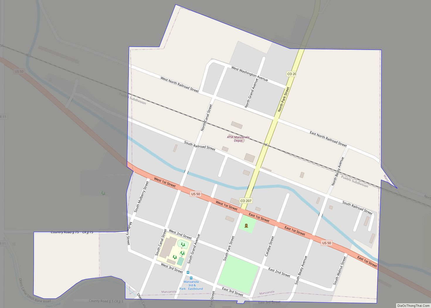
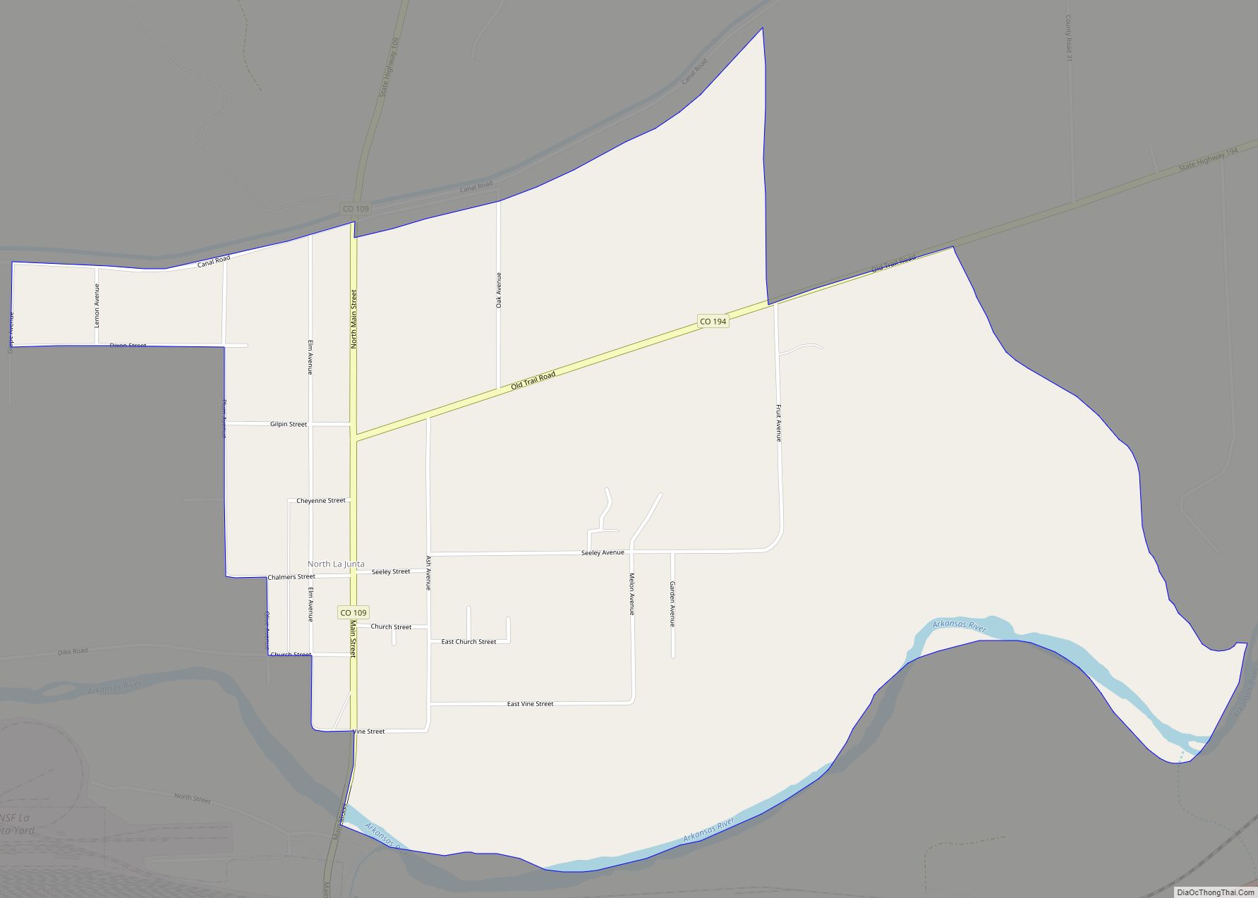
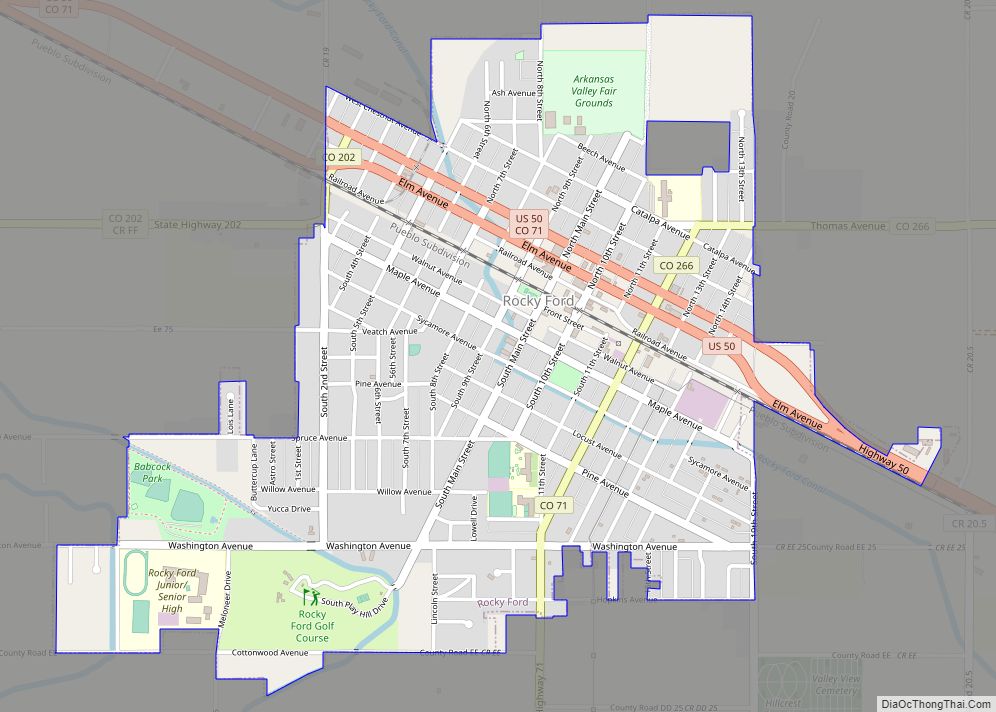
Online Interactive Map
Click on ![]() to view map in "full screen" mode.
to view map in "full screen" mode.
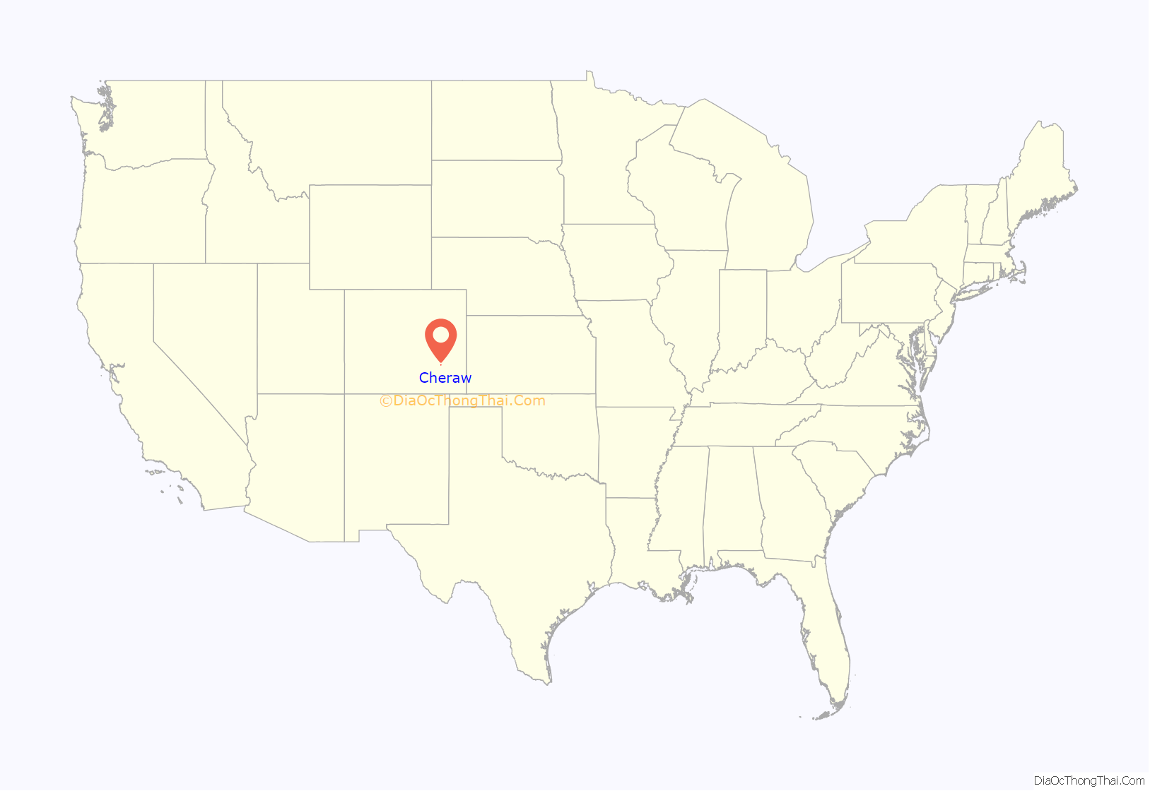
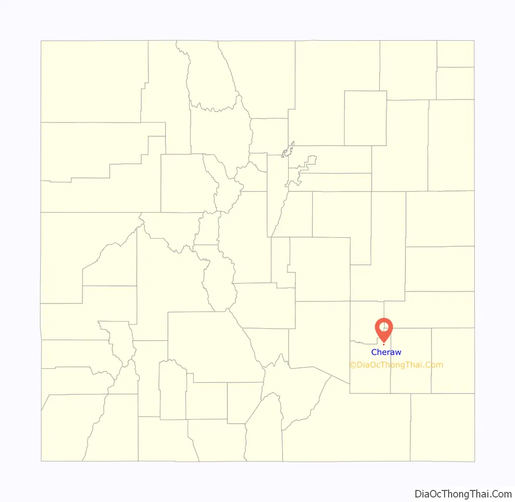
Cheraw location map. Where is Cheraw town?
History
In 1917, Cheraw was the smallest town in the world with a regimental band. Cheraw had a population of 80, half of whom were men serving in the Colorado National Guard Second Regiment Band under the leadership of Sergeant Luther D. Armstrong, attached to the regiment of General Cameron and the 115th Ammunition Train commanded by Colonel Danks.
In 1920, the U.S. census of the town of Cheraw reported a population of 186 in 49 households within the town limits. Fewer than ten of the town’s adults had been born in Colorado; most were from the Midwest. The largest demographic group, 15 percent of the population, were resident aliens who had immigrated from Mexico within the previous decade.
The men’s occupations in 1920 included blacksmith, salesman, publisher, lumberyard manager, retail merchant, laborer, wagon driver, bank cashier, barber, physician, druggist, teacher, minister, carpenter, farmer and farm laborers, alfalfa mill manager and laborers, bank bookkeeper, railroad depot operator, [illegible] at pool hall, railroad laborer, and auto mechanic. Women were employed at paying occupations as saleslady, teacher, manager of the telephone exchange, postal workers, and postmistress. The census taker was also a woman.
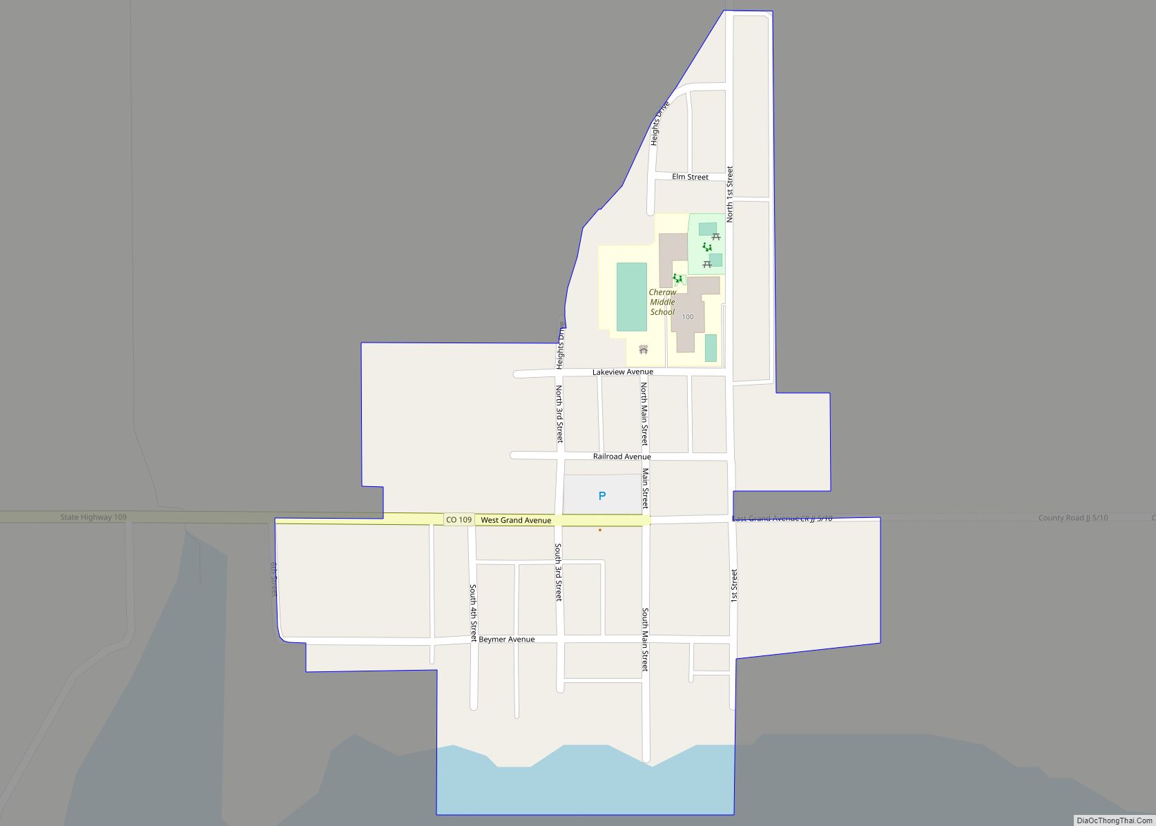
Cheraw Road Map
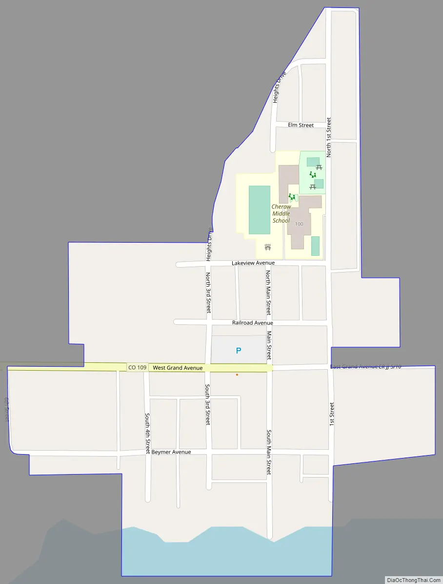
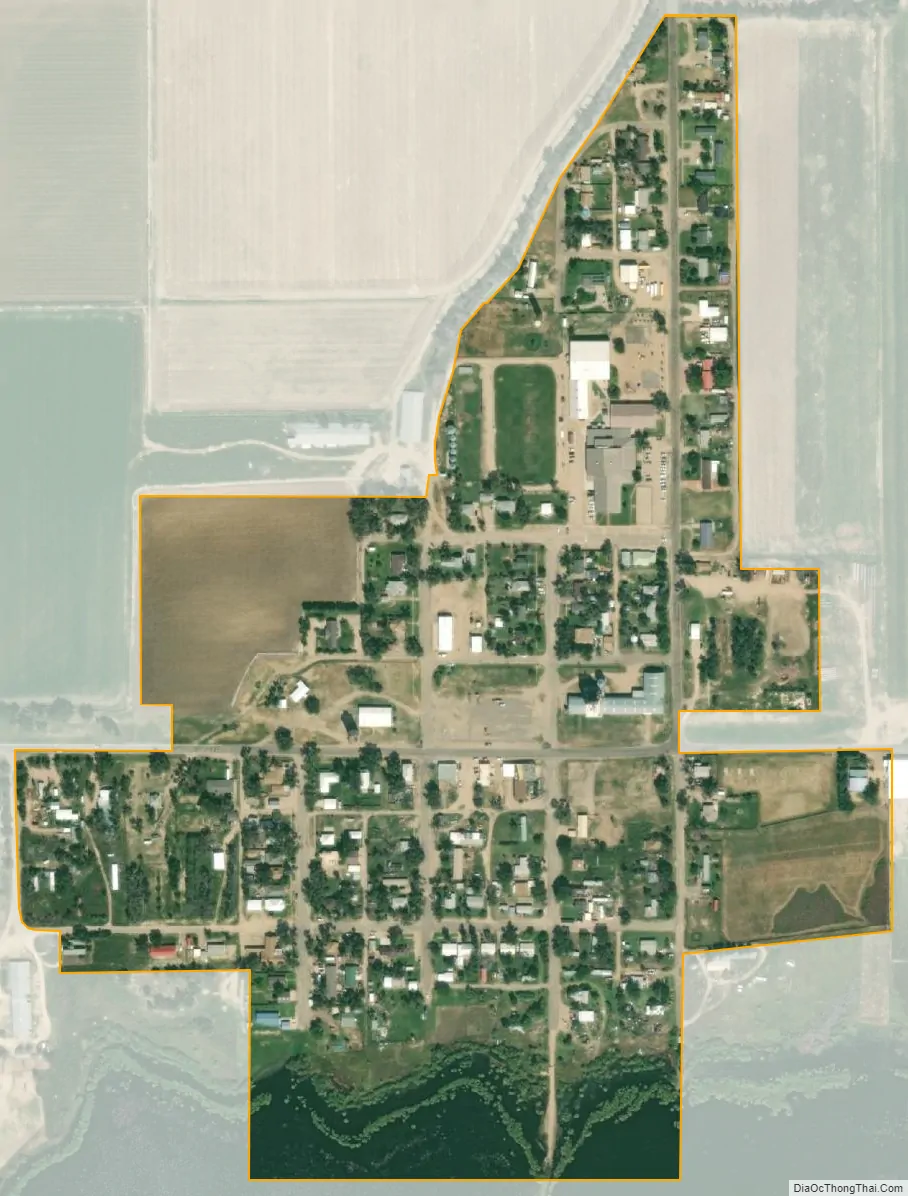
Cheraw city Satellite Map
Geography
Cheraw is located at 38°6′28″N 103°30′40″W / 38.10778°N 103.51111°W / 38.10778; -103.51111 (38.107901, -103.511137).
At the 2020 United States Census, the town had a total area of 117 acres (0.474 km) including 1.7 acres (0.007 km) of water.
See also
Map of Colorado State and its subdivision:- Adams
- Alamosa
- Arapahoe
- Archuleta
- Baca
- Bent
- Boulder
- Broomfield
- Chaffee
- Cheyenne
- Clear Creek
- Conejos
- Costilla
- Crowley
- Custer
- Delta
- Denver
- Dolores
- Douglas
- Eagle
- El Paso
- Elbert
- Fremont
- Garfield
- Gilpin
- Grand
- Gunnison
- Hinsdale
- Huerfano
- Jackson
- Jefferson
- Kiowa
- Kit Carson
- La Plata
- Lake
- Larimer
- Las Animas
- Lincoln
- Logan
- Mesa
- Mineral
- Moffat
- Montezuma
- Montrose
- Morgan
- Otero
- Ouray
- Park
- Phillips
- Pitkin
- Prowers
- Pueblo
- Rio Blanco
- Rio Grande
- Routt
- Saguache
- San Juan
- San Miguel
- Sedgwick
- Summit
- Teller
- Washington
- Weld
- Yuma
- Alabama
- Alaska
- Arizona
- Arkansas
- California
- Colorado
- Connecticut
- Delaware
- District of Columbia
- Florida
- Georgia
- Hawaii
- Idaho
- Illinois
- Indiana
- Iowa
- Kansas
- Kentucky
- Louisiana
- Maine
- Maryland
- Massachusetts
- Michigan
- Minnesota
- Mississippi
- Missouri
- Montana
- Nebraska
- Nevada
- New Hampshire
- New Jersey
- New Mexico
- New York
- North Carolina
- North Dakota
- Ohio
- Oklahoma
- Oregon
- Pennsylvania
- Rhode Island
- South Carolina
- South Dakota
- Tennessee
- Texas
- Utah
- Vermont
- Virginia
- Washington
- West Virginia
- Wisconsin
- Wyoming