The Town of Dolores is a Statutory Town located in Montezuma County, Colorado, United States. The town population was 885 at the 2020 United States Census.
| Name: | Dolores town |
|---|---|
| LSAD Code: | 43 |
| LSAD Description: | town (suffix) |
| State: | Colorado |
| County: | Montezuma County |
| Incorporated: | July 19, 1900 |
| Elevation: | 6,936 ft (2,114 m) |
| Total Area: | 0.664 sq mi (1.721 km²) |
| Land Area: | 0.664 sq mi (1.721 km²) |
| Water Area: | 0.000 sq mi (0.000 km²) |
| Total Population: | 885 |
| Population Density: | 1,332/sq mi (514/km²) |
| ZIP code: | 81323 |
| Area code: | 970 |
| FIPS code: | 0820770 |
| Website: | townofdolores.colorado.gov |
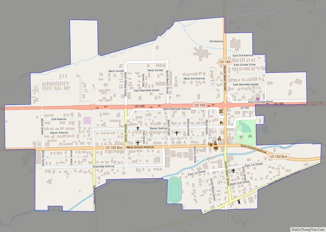
Online Interactive Map
Click on ![]() to view map in "full screen" mode.
to view map in "full screen" mode.
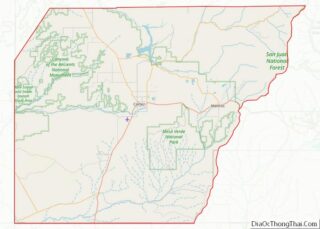
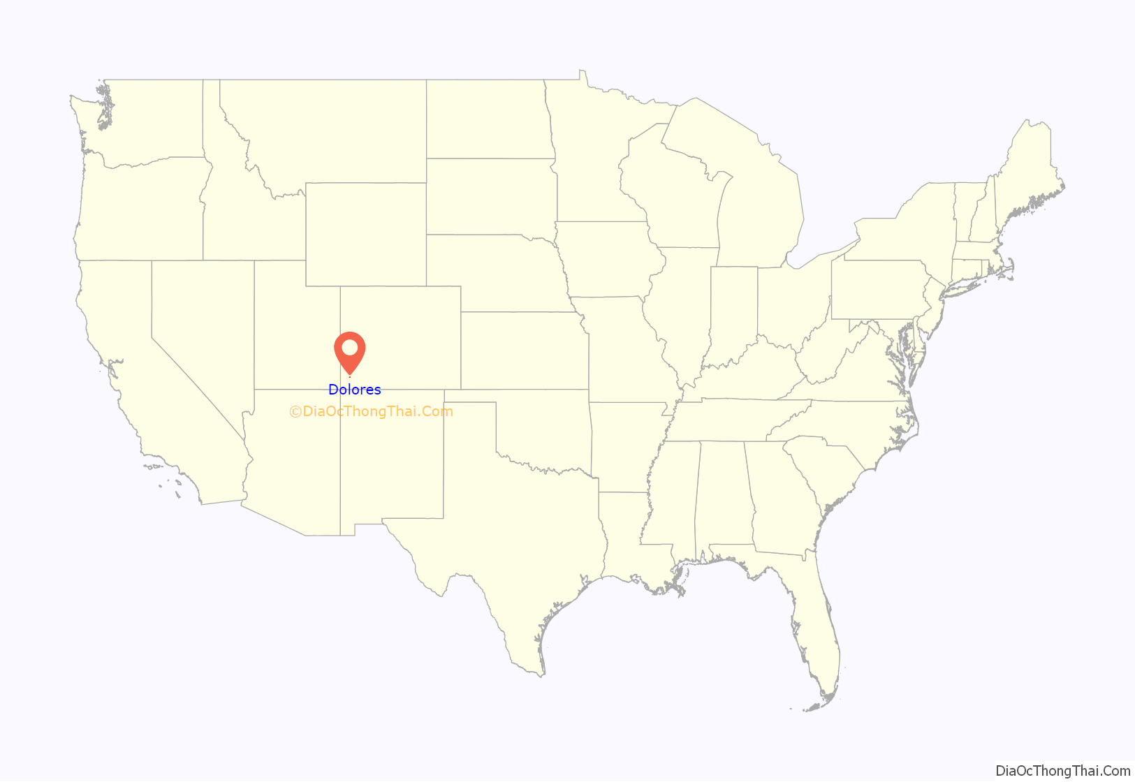
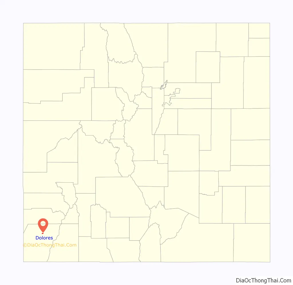
Dolores location map. Where is Dolores town?
History
The following are Dolores area historic sites of the Ancient Pueblo People:
- The Canyons of the Ancients Visitor Center and Museum, and the on-site Domniguez and Escalante Pueblos are listed on the Colorado State Register of Historic Properties and the National Register of Historic Places listings in Montezuma County, Colorado.
- Canyons of the Ancients National Monument
- O’Brien Site, an Ancient Pueblo settlement of 11 pueblos occupied between AD 1075 – 1150.
Other historic sites added to the Colorado State Register of Historic Properties and National Register of Historic Places include:
- Lebanon School, also known as the Lebanon Schoolhouse
- Southern Hotel, also known as Benny’s Hogan and the Rio Grande Southern Hotel
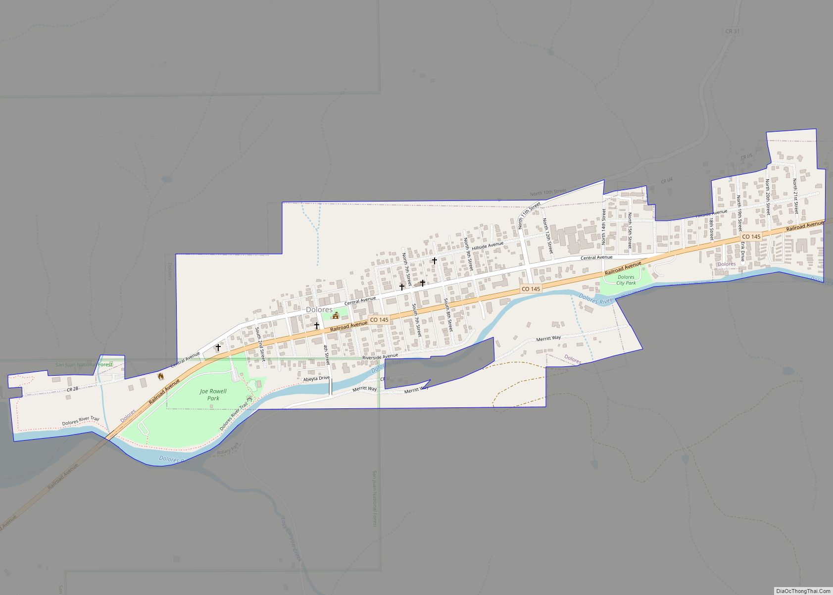
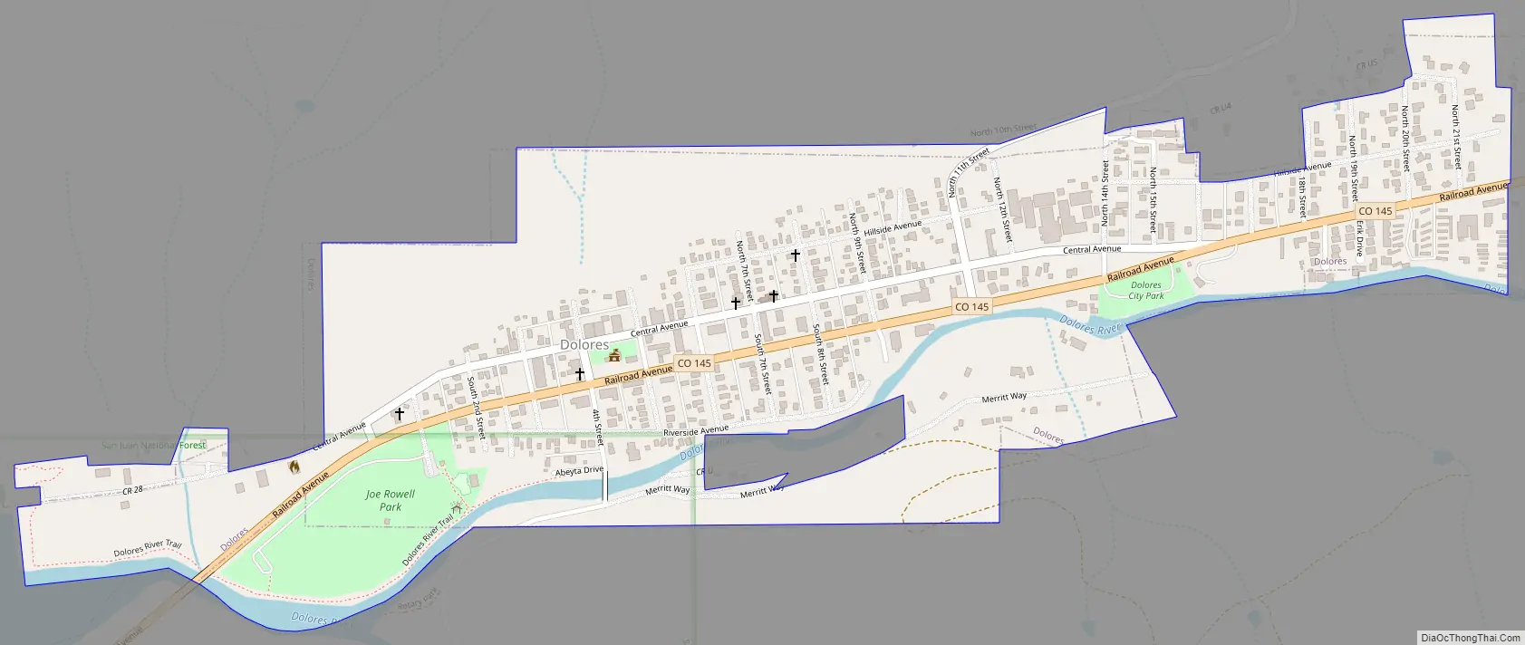
Dolores Road Map
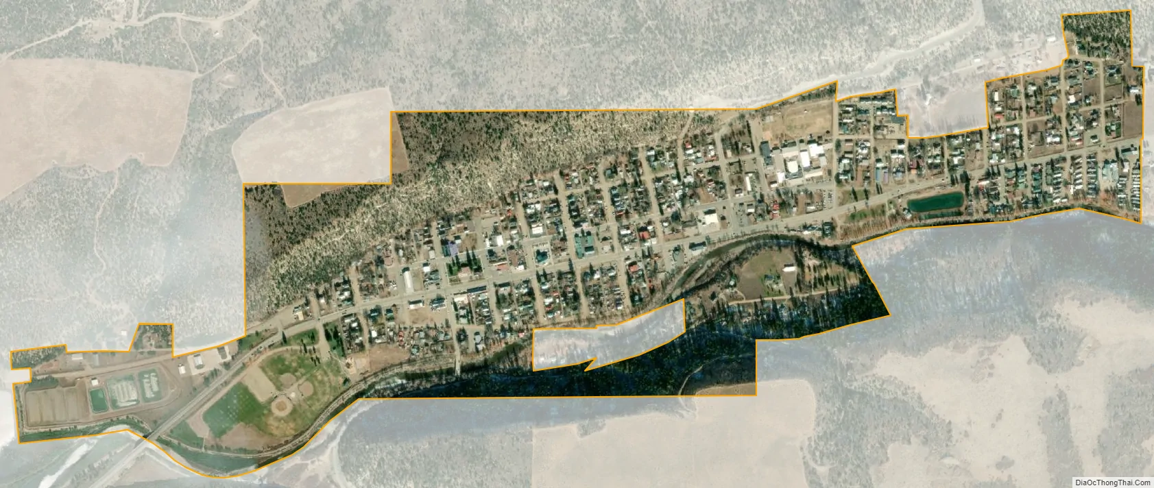
Dolores city Satellite Map
Geography
Dolores is located at 37°28′28″N 108°29′54″W / 37.47444°N 108.49833°W / 37.47444; -108.49833 (37.474540, -108.498294).
At the 2020 United States Census, the town had a total area of 425 acres (1.721 km), all of it land.
The town is confined to a narrow valley bottom along the Dolores River near the point where the river turns from flowing southward out of the San Juan Mountains to the north. Built-up areas outside the town limits include extensive residential, commercial, and minor-industrial areas upstream in the valley floor, on Summit Ridge to the south-southwest, and on high ground to the west, at the intersections of Colorado Highways 145 and 184.
See also
Map of Colorado State and its subdivision:- Adams
- Alamosa
- Arapahoe
- Archuleta
- Baca
- Bent
- Boulder
- Broomfield
- Chaffee
- Cheyenne
- Clear Creek
- Conejos
- Costilla
- Crowley
- Custer
- Delta
- Denver
- Dolores
- Douglas
- Eagle
- El Paso
- Elbert
- Fremont
- Garfield
- Gilpin
- Grand
- Gunnison
- Hinsdale
- Huerfano
- Jackson
- Jefferson
- Kiowa
- Kit Carson
- La Plata
- Lake
- Larimer
- Las Animas
- Lincoln
- Logan
- Mesa
- Mineral
- Moffat
- Montezuma
- Montrose
- Morgan
- Otero
- Ouray
- Park
- Phillips
- Pitkin
- Prowers
- Pueblo
- Rio Blanco
- Rio Grande
- Routt
- Saguache
- San Juan
- San Miguel
- Sedgwick
- Summit
- Teller
- Washington
- Weld
- Yuma
- Alabama
- Alaska
- Arizona
- Arkansas
- California
- Colorado
- Connecticut
- Delaware
- District of Columbia
- Florida
- Georgia
- Hawaii
- Idaho
- Illinois
- Indiana
- Iowa
- Kansas
- Kentucky
- Louisiana
- Maine
- Maryland
- Massachusetts
- Michigan
- Minnesota
- Mississippi
- Missouri
- Montana
- Nebraska
- Nevada
- New Hampshire
- New Jersey
- New Mexico
- New York
- North Carolina
- North Dakota
- Ohio
- Oklahoma
- Oregon
- Pennsylvania
- Rhode Island
- South Carolina
- South Dakota
- Tennessee
- Texas
- Utah
- Vermont
- Virginia
- Washington
- West Virginia
- Wisconsin
- Wyoming