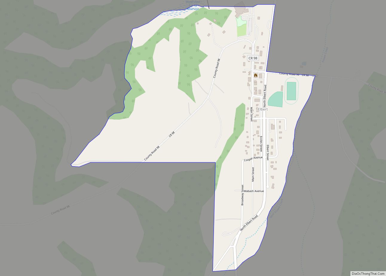
Elbert is an unincorporated town, a post office, and a census-designated place (CDP) located in and governed by Elbert County, Colorado, United States. The CDP is a part of the Denver–Aurora–Lakewood, CO Metropolitan Statistical Area. The Elbert post office has the ZIP Code 80106. At the United States Census 2020, the population of the Elbert CDP was 188.
| Name: | Elbert CDP |
|---|---|
| LSAD Code: | 57 |
| LSAD Description: | CDP (suffix) |
| State: | Colorado |
| County: | Elbert County |
| Elevation: | 6,840 ft (2,085 m) |
| Total Area: | 0.474 sq mi (1.227 km²) |
| Land Area: | 0.474 sq mi (1.227 km²) |
| Water Area: | 0.000 sq mi (0.000 km²) |
| Total Population: | 188 |
| Population Density: | 400/sq mi (150/km²) |
| ZIP code: | 80106 |
| FIPS code: | 0823520 |
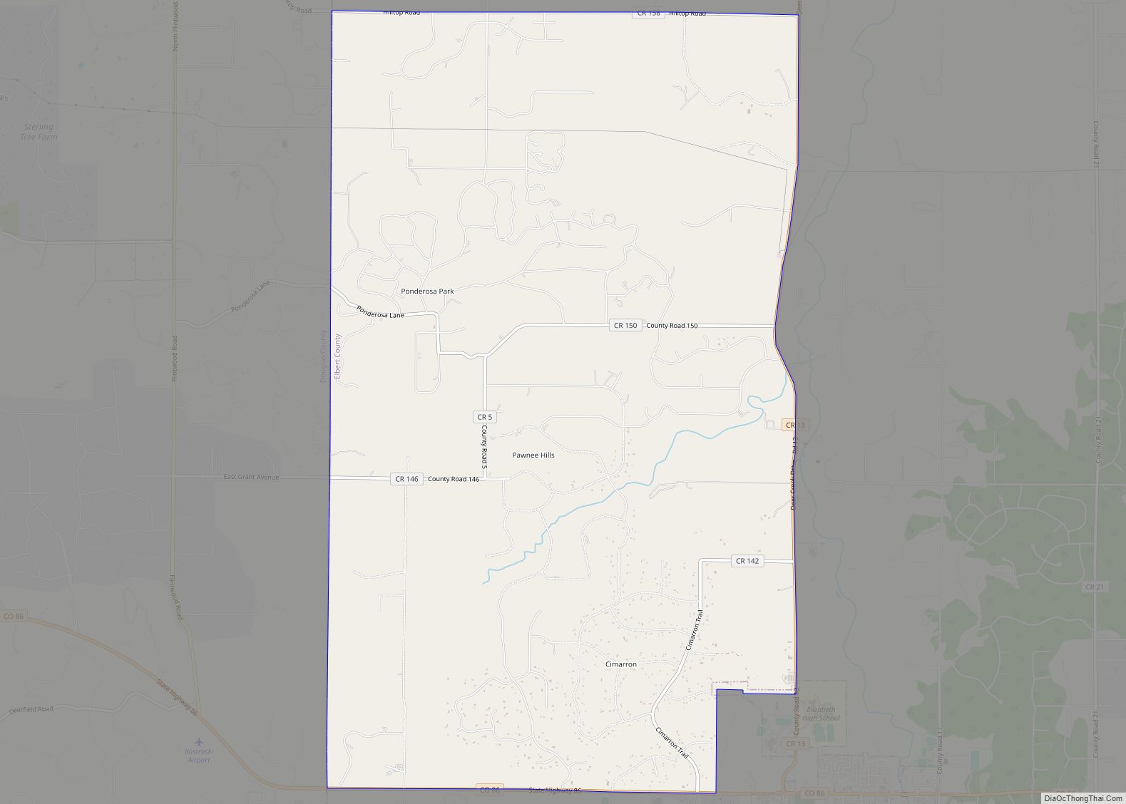
Online Interactive Map
Click on ![]() to view map in "full screen" mode.
to view map in "full screen" mode.
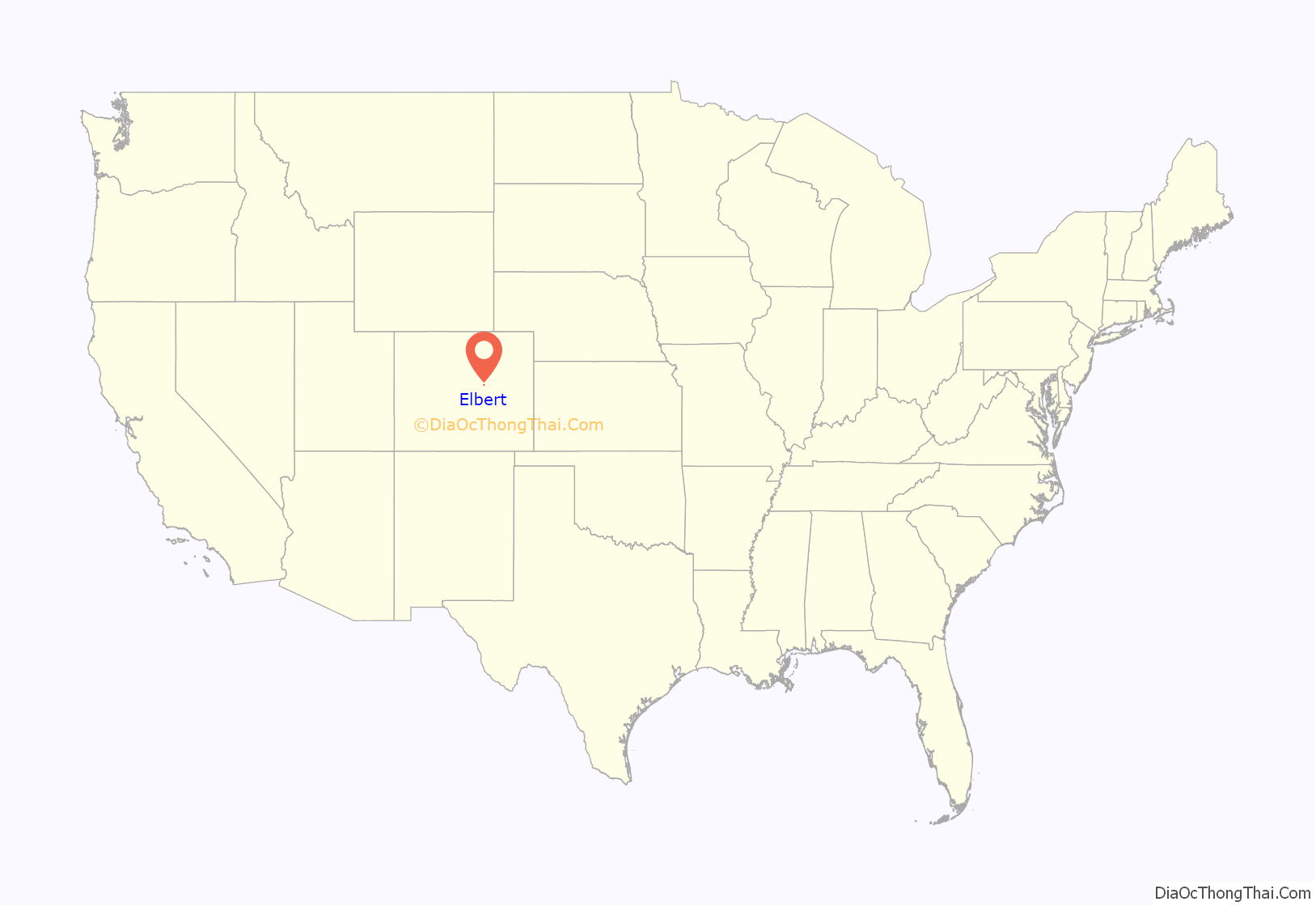
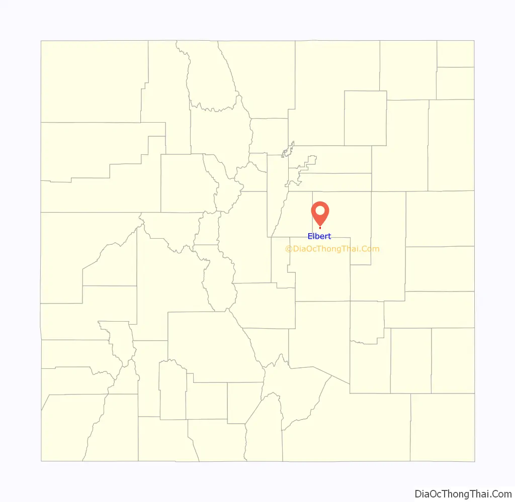
Elbert location map. Where is Elbert CDP?
History
The Elbert post office has been in operation since 1875. The community takes its name from Elbert County.
The most significant flood events in Elbert County occurred in 1935, 1965, 1997, and 1999. The most damaging flood was in 1935, when flooding on Kiowa Creek destroyed three-fourths of the structures location in Elbert and resulted in nine deaths, seven of them in Elbert. All bridges were lost, 59 buildings were destroyed, water was 8 to 15 feet (2.4 to 4.6 m) deep, and there were 5 feet (1.5 m) of sand. Three-fourths of the town of Elbert was destroyed and not rebuilt.
On 11 January 1998 a fireball was seen over Elbert County. On 4 March 2000 a stone of 680.5 g was found in a field by the five year old Dustin Riffel on the property of his family. It was officially named “Elbert” and it was classified as an ordinary chondrite LL6.
On June 15, 2009, at 1:46 pm, a large three quarter mile-wide, EF2 tornado touched down in rural fields west of the town. The tornado came within 2 miles (3 km) of the town at its closest. The tornado destroyed a barn at a farm and damaged an airplane hangar.
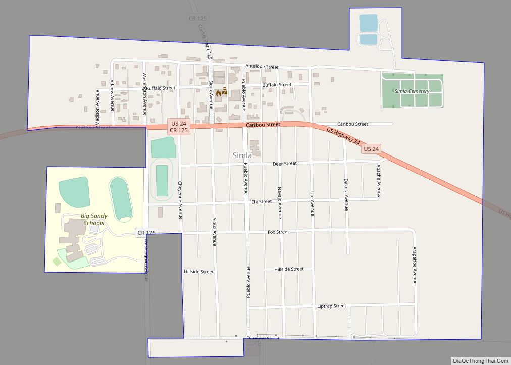
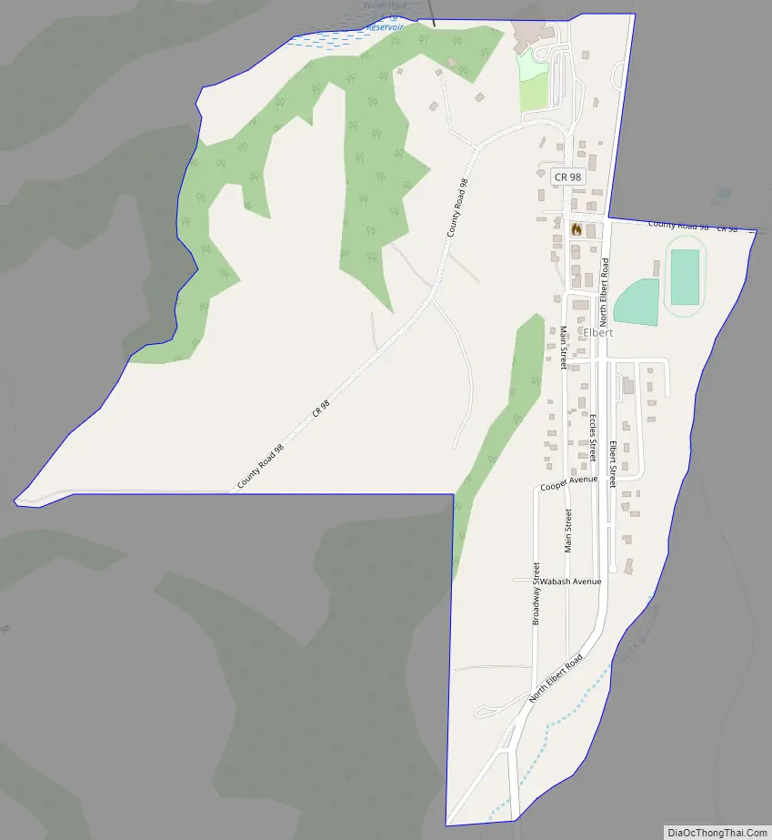
Elbert Road Map
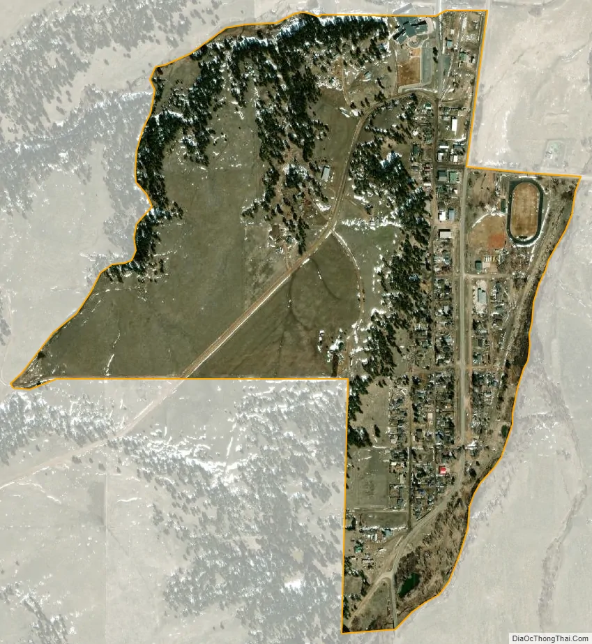
Elbert city Satellite Map
Geography
Elbert is located in the valley of Kiowa Creek. Elbert Road leads north 10 miles (16 km) to Kiowa and south 11 miles (18 km) to Eastonville. Colorado Springs is 37 miles (60 km) to the southwest via Elbert Road and U.S. Route 24.
During the summer, Elbert is much busier due to a nearby Boy Scout camp, Peaceful Valley Scout Ranch, which has 10,000 visitors annually. 2.8 miles (4.5 km) south of Elbert lies the JCC Ranch Camp, a Jewish camp owned by the Denver Jewish Community Center.
The Elbert CDP has an area of 303 acres (1.227 km), all land.
See also
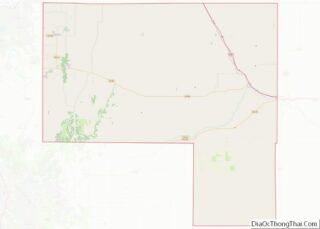
Map of Colorado State and its subdivision:- Adams
- Alamosa
- Arapahoe
- Archuleta
- Baca
- Bent
- Boulder
- Broomfield
- Chaffee
- Cheyenne
- Clear Creek
- Conejos
- Costilla
- Crowley
- Custer
- Delta
- Denver
- Dolores
- Douglas
- Eagle
- El Paso
- Elbert
- Fremont
- Garfield
- Gilpin
- Grand
- Gunnison
- Hinsdale
- Huerfano
- Jackson
- Jefferson
- Kiowa
- Kit Carson
- La Plata
- Lake
- Larimer
- Las Animas
- Lincoln
- Logan
- Mesa
- Mineral
- Moffat
- Montezuma
- Montrose
- Morgan
- Otero
- Ouray
- Park
- Phillips
- Pitkin
- Prowers
- Pueblo
- Rio Blanco
- Rio Grande
- Routt
- Saguache
- San Juan
- San Miguel
- Sedgwick
- Summit
- Teller
- Washington
- Weld
- Yuma
- Alabama
- Alaska
- Arizona
- Arkansas
- California
- Colorado
- Connecticut
- Delaware
- District of Columbia
- Florida
- Georgia
- Hawaii
- Idaho
- Illinois
- Indiana
- Iowa
- Kansas
- Kentucky
- Louisiana
- Maine
- Maryland
- Massachusetts
- Michigan
- Minnesota
- Mississippi
- Missouri
- Montana
- Nebraska
- Nevada
- New Hampshire
- New Jersey
- New Mexico
- New York
- North Carolina
- North Dakota
- Ohio
- Oklahoma
- Oregon
- Pennsylvania
- Rhode Island
- South Carolina
- South Dakota
- Tennessee
- Texas
- Utah
- Vermont
- Virginia
- Washington
- West Virginia
- Wisconsin
- Wyoming