The City of Greenwood Village is a home rule municipality located in Arapahoe County, Colorado, United States. The city population was 15,691 at the 2020 United States Census. Greenwood Village is a part of the Denver–Aurora–Lakewood, CO Metropolitan Statistical Area and the Front Range Urban Corridor.
| Name: | Greenwood Village city |
|---|---|
| LSAD Code: | 25 |
| LSAD Description: | city (suffix) |
| State: | Colorado |
| County: | Arapahoe County |
| Incorporated: | September 19, 1950 |
| Elevation: | 5,422 ft (1,666 m) |
| Total Area: | 8.280 sq mi (21.444 km²) |
| Land Area: | 8.267 sq mi (21.412 km²) |
| Water Area: | 0.012 sq mi (0.032 km²) |
| Total Population: | 15,691 |
| Population Density: | 1,898/sq mi (733/km²) |
| ZIP code: | 80110-80112 & 80121 & 80155 (PO Box) |
| Area code: | Both 303 and 720 |
| FIPS code: | 0833035 |
| GNISfeature ID: | 0185037 |
| Website: | www.greenwoodvillage.com |
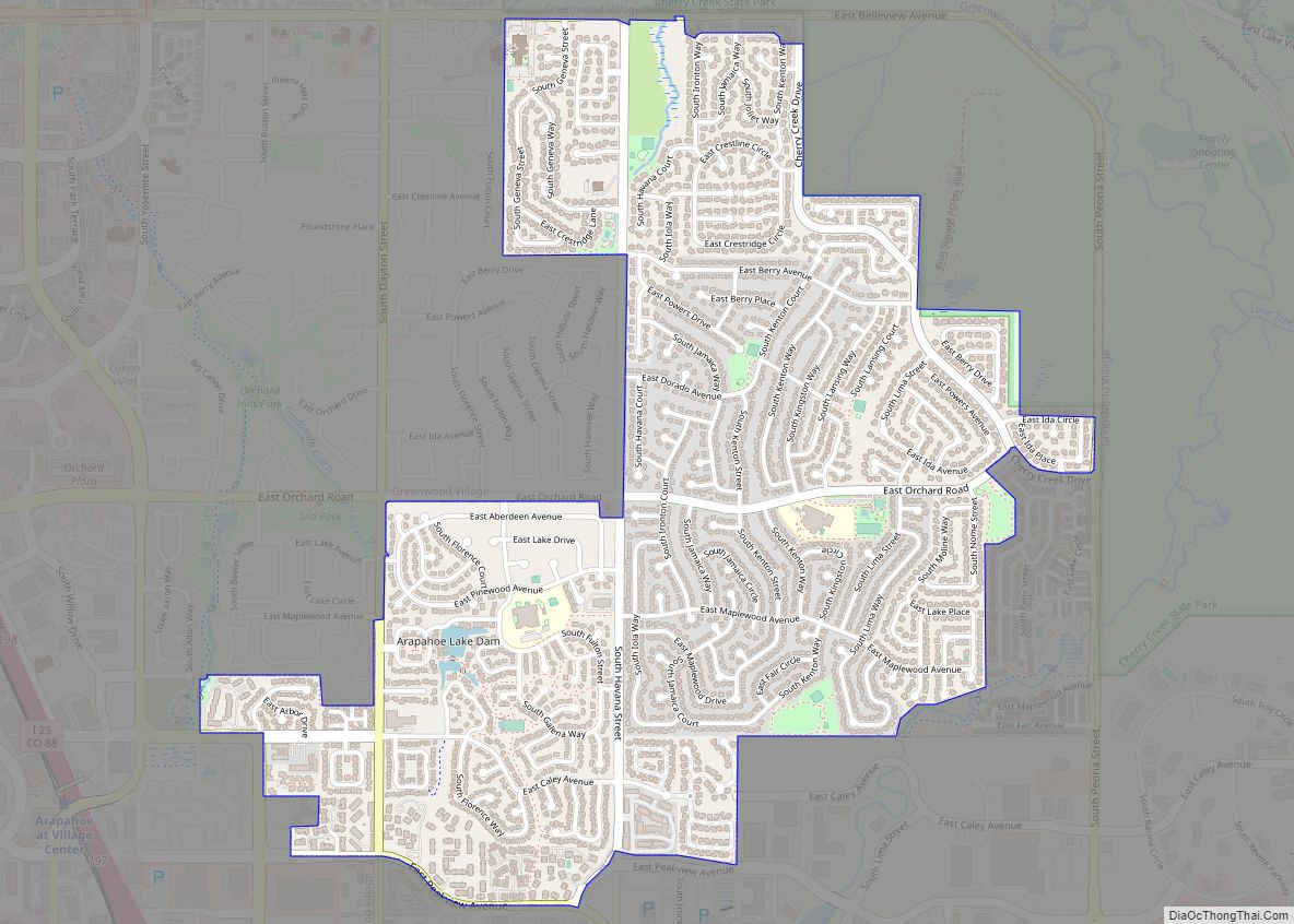
Online Interactive Map
Click on ![]() to view map in "full screen" mode.
to view map in "full screen" mode.
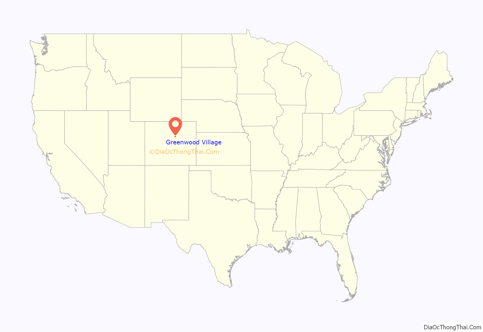
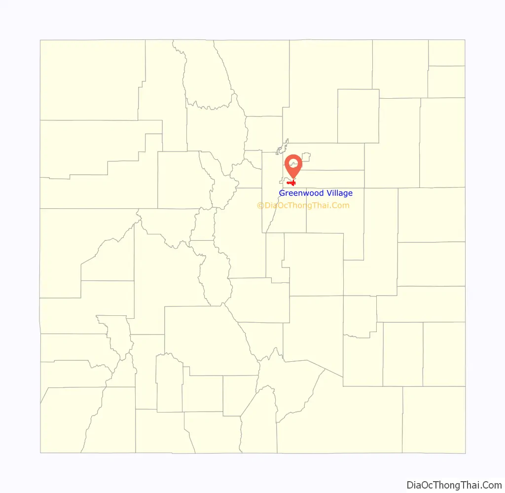
Greenwood Village location map. Where is Greenwood Village city?
History
The town was named for the Greenwood Ranch. It was developed during the 1860s when settlers came from the East and Midwest looking for gold. By the early 1900s, it had become a farming community.
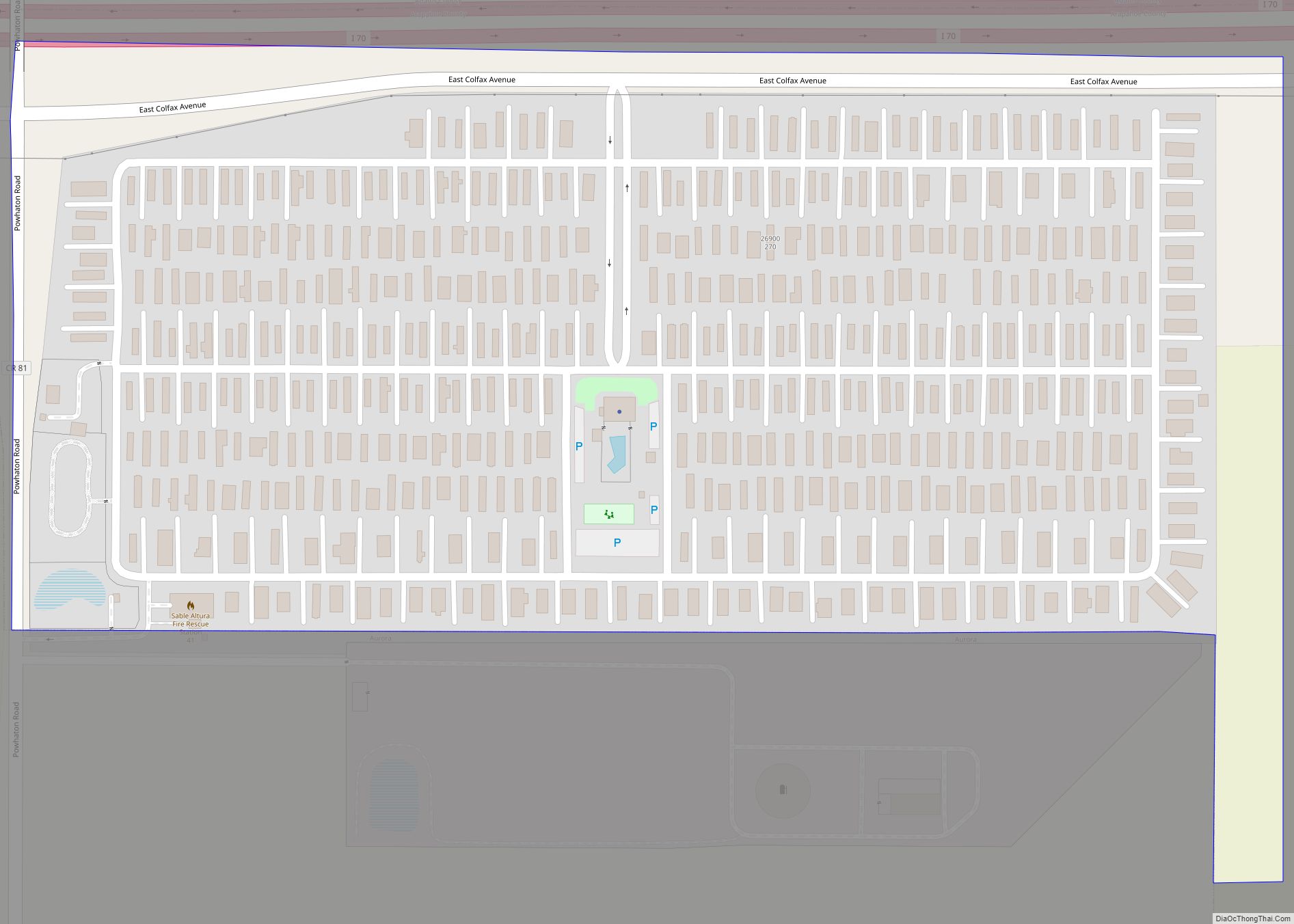
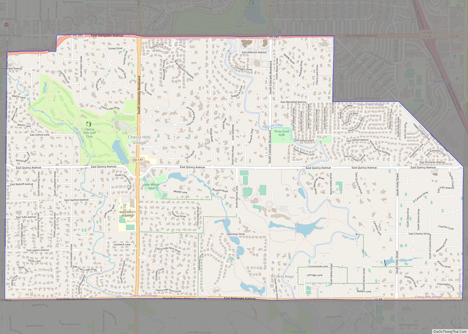
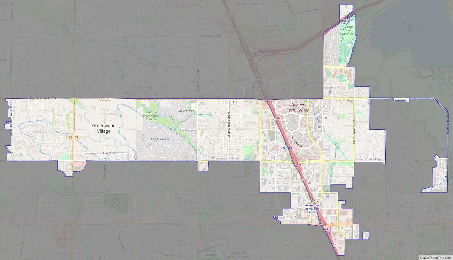
Greenwood Village Road Map
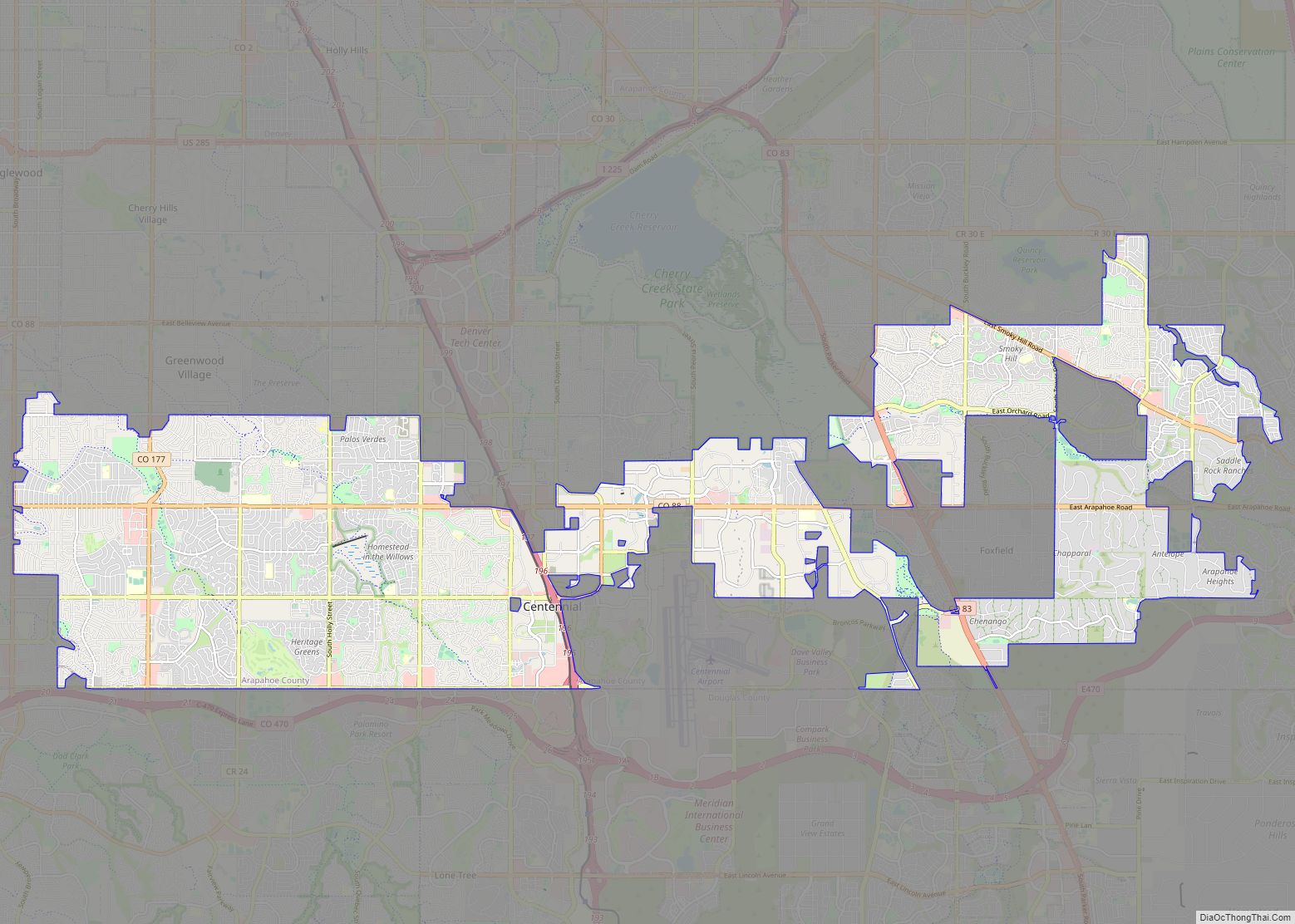
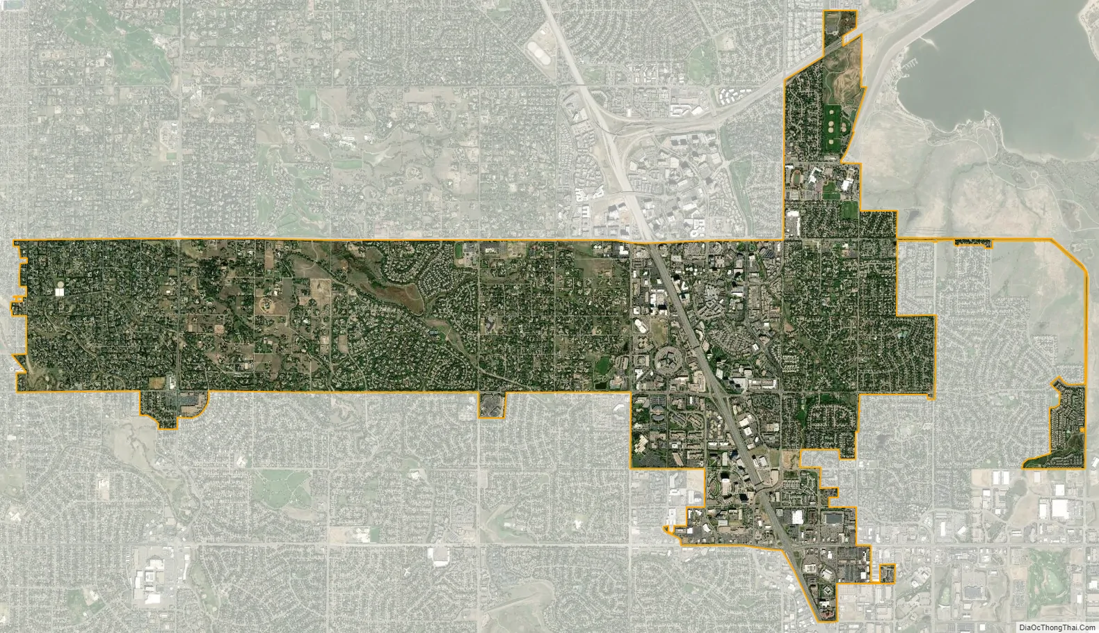
Greenwood Village city Satellite Map
Geography
At the 2020 United States Census, the town had a total area of 5,299 acres (21.444 km) including 7.9 acres (0.032 km) of water.
See also
Map of Colorado State and its subdivision:- Adams
- Alamosa
- Arapahoe
- Archuleta
- Baca
- Bent
- Boulder
- Broomfield
- Chaffee
- Cheyenne
- Clear Creek
- Conejos
- Costilla
- Crowley
- Custer
- Delta
- Denver
- Dolores
- Douglas
- Eagle
- El Paso
- Elbert
- Fremont
- Garfield
- Gilpin
- Grand
- Gunnison
- Hinsdale
- Huerfano
- Jackson
- Jefferson
- Kiowa
- Kit Carson
- La Plata
- Lake
- Larimer
- Las Animas
- Lincoln
- Logan
- Mesa
- Mineral
- Moffat
- Montezuma
- Montrose
- Morgan
- Otero
- Ouray
- Park
- Phillips
- Pitkin
- Prowers
- Pueblo
- Rio Blanco
- Rio Grande
- Routt
- Saguache
- San Juan
- San Miguel
- Sedgwick
- Summit
- Teller
- Washington
- Weld
- Yuma
- Alabama
- Alaska
- Arizona
- Arkansas
- California
- Colorado
- Connecticut
- Delaware
- District of Columbia
- Florida
- Georgia
- Hawaii
- Idaho
- Illinois
- Indiana
- Iowa
- Kansas
- Kentucky
- Louisiana
- Maine
- Maryland
- Massachusetts
- Michigan
- Minnesota
- Mississippi
- Missouri
- Montana
- Nebraska
- Nevada
- New Hampshire
- New Jersey
- New Mexico
- New York
- North Carolina
- North Dakota
- Ohio
- Oklahoma
- Oregon
- Pennsylvania
- Rhode Island
- South Carolina
- South Dakota
- Tennessee
- Texas
- Utah
- Vermont
- Virginia
- Washington
- West Virginia
- Wisconsin
- Wyoming