The Town of Iliff is a Statutory Town located in Logan County, Colorado, United States. The population was 246 at the 2020 United States Census.
| Name: | Iliff town |
|---|---|
| LSAD Code: | 43 |
| LSAD Description: | town (suffix) |
| State: | Colorado |
| County: | Logan County |
| Elevation: | 3,835 ft (1,169 m) |
| Total Area: | 0.19 sq mi (0.49 km²) |
| Land Area: | 0.19 sq mi (0.49 km²) |
| Water Area: | 0.00 sq mi (0.00 km²) |
| Total Population: | 246 |
| Population Density: | 1,300/sq mi (500/km²) |
| ZIP code: | 80736 |
| Area code: | 970 |
| FIPS code: | 0838590 |
| GNISfeature ID: | 171118 |
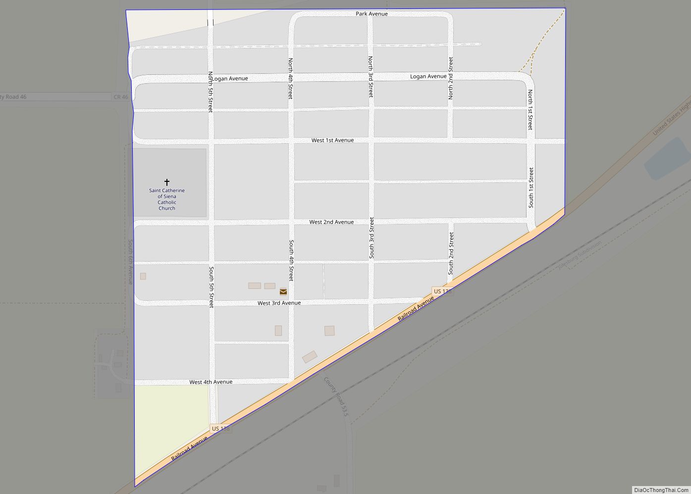
Online Interactive Map
Click on ![]() to view map in "full screen" mode.
to view map in "full screen" mode.
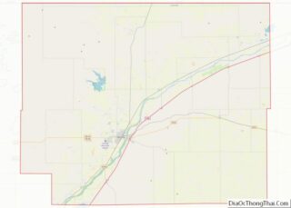
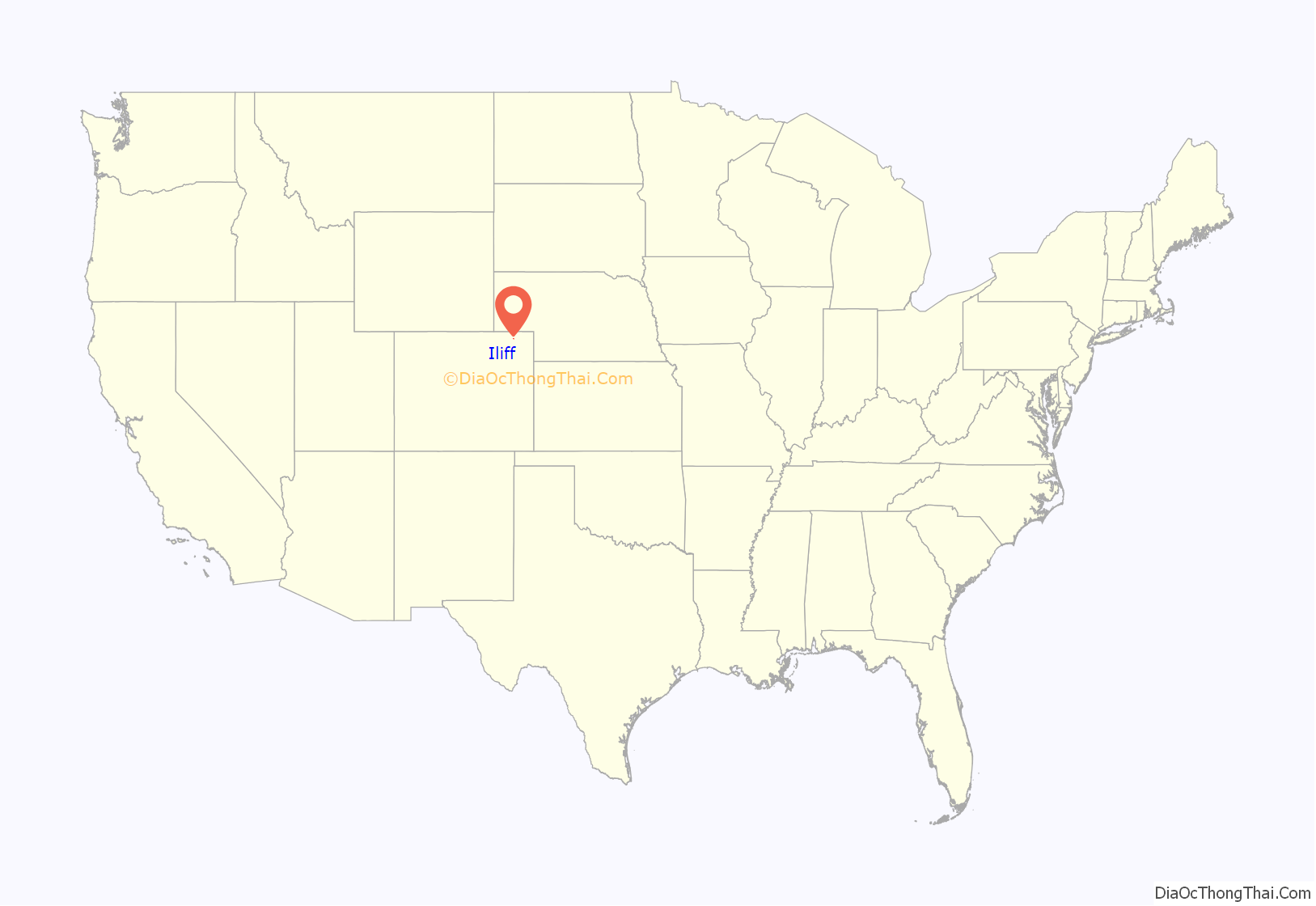
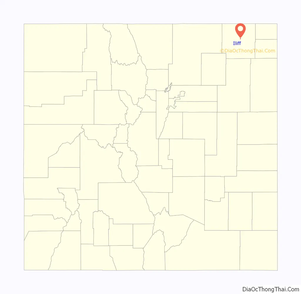
Iliff location map. Where is Iliff town?
History
The town was named for John Wesley Iliff, a cattleman who owned a ranch near the town site.
The people of Iliff have proven to be a resilient folk, surviving a blizzard in 1949 and a flood in 1968. Iliff resides on the fertile banks of the South Platte River. The South Platte has been a cornerstone to the community.
The first building constructed was a Post Office and Real Estate Office in 1870. On Jan. 6, 1885 the city was surveyed and on May 4 of that year, a school district was organized. By 1887 a grocery store and lumber yard were in business. The Iliff Bank was established in 1907. By 1915 there was a Baptist Church and a John Deer Implement Dealership added to the town. The Farmer’s Alfalfa Milling Company started in 1918. There were also two doctors, Daniels and Houff, who owned a drug store. In 1920 the Glory Park Theater opened. In 1923 a town Marshall was hired and an old rail boxcar was used as a jail. In 1928 the Catholic Church was built.
The growth declined during the depression, and again during World War II. In 1957 there were eleven businesses that slowly diminished with more people willing drive 12 miles to Sterling, CO and the opening of Interstate 76, which took all but local travelers off of state highway 138.
Iliff is home to the 2002 World Champion Livestock Auctioneer John Korrey.
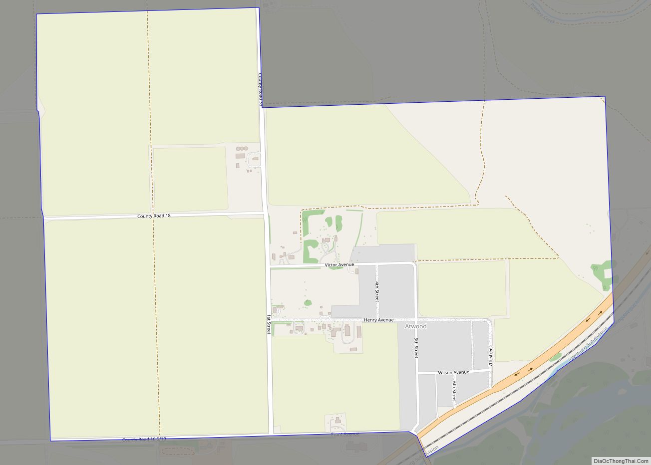
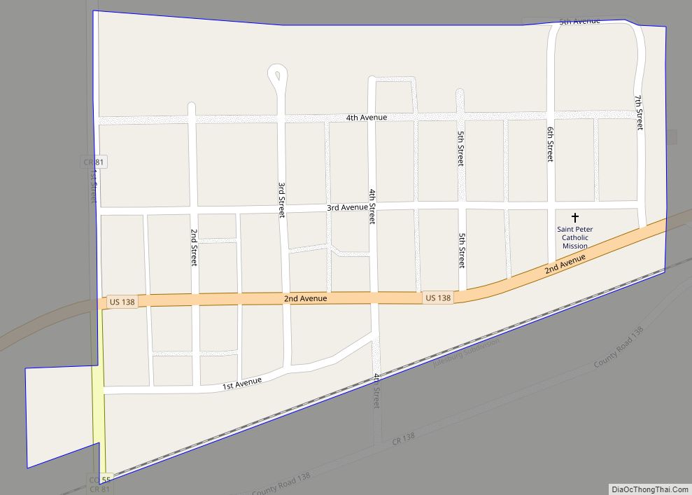
Iliff Road Map
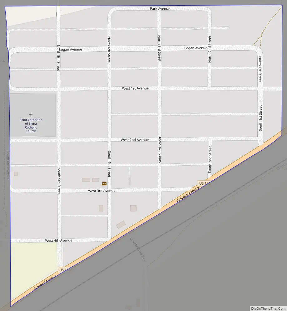
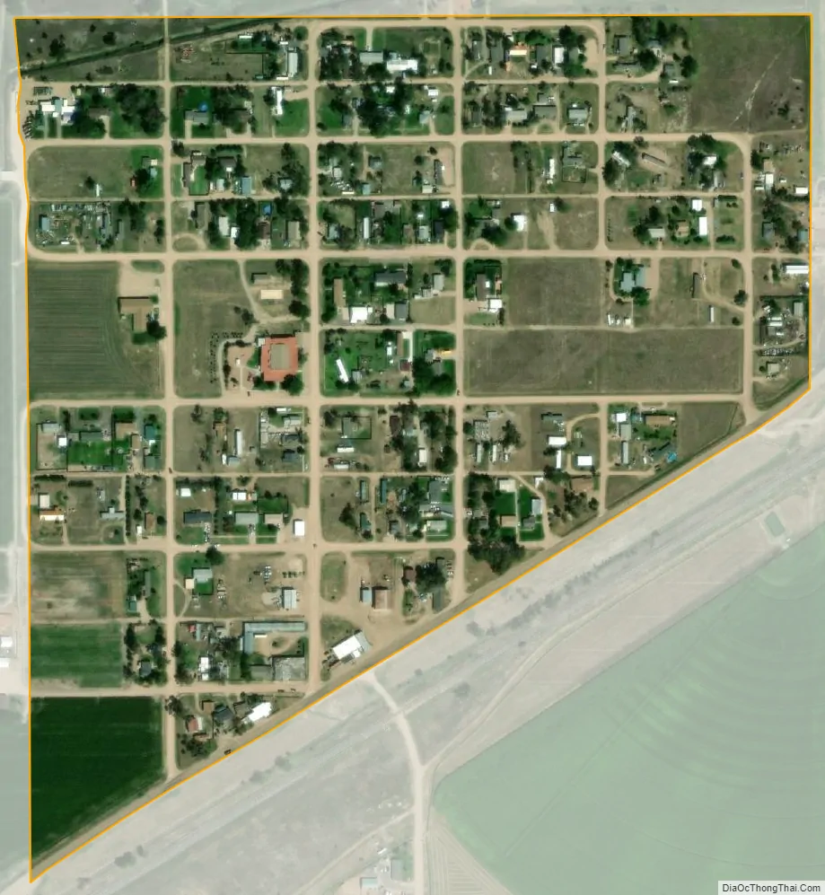
Iliff city Satellite Map
Geography
Iliff is located at 40°45′32″N 103°03′57″W / 40.758911°N 103.065841°W / 40.758911; -103.065841.
According to the United States Census Bureau, the town has a total area of 0.2 square miles (0.52 km), all of it land.
See also
Map of Colorado State and its subdivision:- Adams
- Alamosa
- Arapahoe
- Archuleta
- Baca
- Bent
- Boulder
- Broomfield
- Chaffee
- Cheyenne
- Clear Creek
- Conejos
- Costilla
- Crowley
- Custer
- Delta
- Denver
- Dolores
- Douglas
- Eagle
- El Paso
- Elbert
- Fremont
- Garfield
- Gilpin
- Grand
- Gunnison
- Hinsdale
- Huerfano
- Jackson
- Jefferson
- Kiowa
- Kit Carson
- La Plata
- Lake
- Larimer
- Las Animas
- Lincoln
- Logan
- Mesa
- Mineral
- Moffat
- Montezuma
- Montrose
- Morgan
- Otero
- Ouray
- Park
- Phillips
- Pitkin
- Prowers
- Pueblo
- Rio Blanco
- Rio Grande
- Routt
- Saguache
- San Juan
- San Miguel
- Sedgwick
- Summit
- Teller
- Washington
- Weld
- Yuma
- Alabama
- Alaska
- Arizona
- Arkansas
- California
- Colorado
- Connecticut
- Delaware
- District of Columbia
- Florida
- Georgia
- Hawaii
- Idaho
- Illinois
- Indiana
- Iowa
- Kansas
- Kentucky
- Louisiana
- Maine
- Maryland
- Massachusetts
- Michigan
- Minnesota
- Mississippi
- Missouri
- Montana
- Nebraska
- Nevada
- New Hampshire
- New Jersey
- New Mexico
- New York
- North Carolina
- North Dakota
- Ohio
- Oklahoma
- Oregon
- Pennsylvania
- Rhode Island
- South Carolina
- South Dakota
- Tennessee
- Texas
- Utah
- Vermont
- Virginia
- Washington
- West Virginia
- Wisconsin
- Wyoming