The historic Town of Jamestown is a Statutory Town in Boulder County, Colorado, United States. The population was 274 at the 2010 United States Census. It was named for James Smith, an early discoverer of gold. Jamestown was hit hard by the September 2013 Colorado floods when the town was isolated due to road damage from the rains and the flooding of James Creek. Under a mandatory evacuation order, most residents were airlifted to safety under the direction of the Colorado National Guard to nearby Boulder.
| Name: | Jamestown town |
|---|---|
| LSAD Code: | 43 |
| LSAD Description: | town (suffix) |
| State: | Colorado |
| County: | Boulder County |
| Elevation: | 6,946 ft (2,117 m) |
| Total Area: | 0.63 sq mi (1.62 km²) |
| Land Area: | 0.63 sq mi (1.62 km²) |
| Water Area: | 0.00 sq mi (0.00 km²) |
| Total Population: | 274 |
| Population Density: | 397.76/sq mi (153.66/km²) |
| ZIP code: | 80455 |
| Area code: | 303 |
| FIPS code: | 0839195 |
| Website: | www.jamestownco.org |
Online Interactive Map
Click on ![]() to view map in "full screen" mode.
to view map in "full screen" mode.
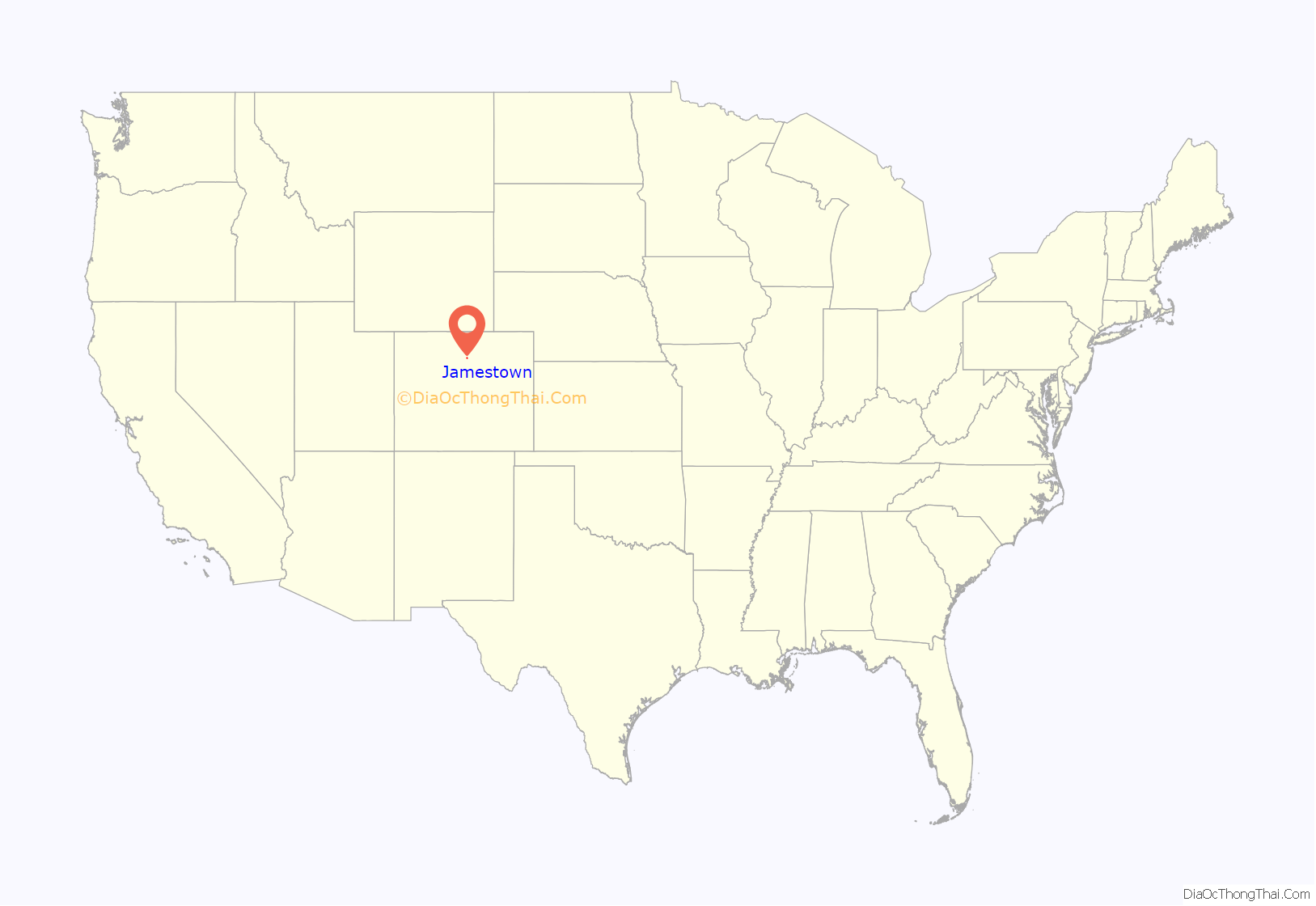
Jamestown location map. Where is Jamestown town?
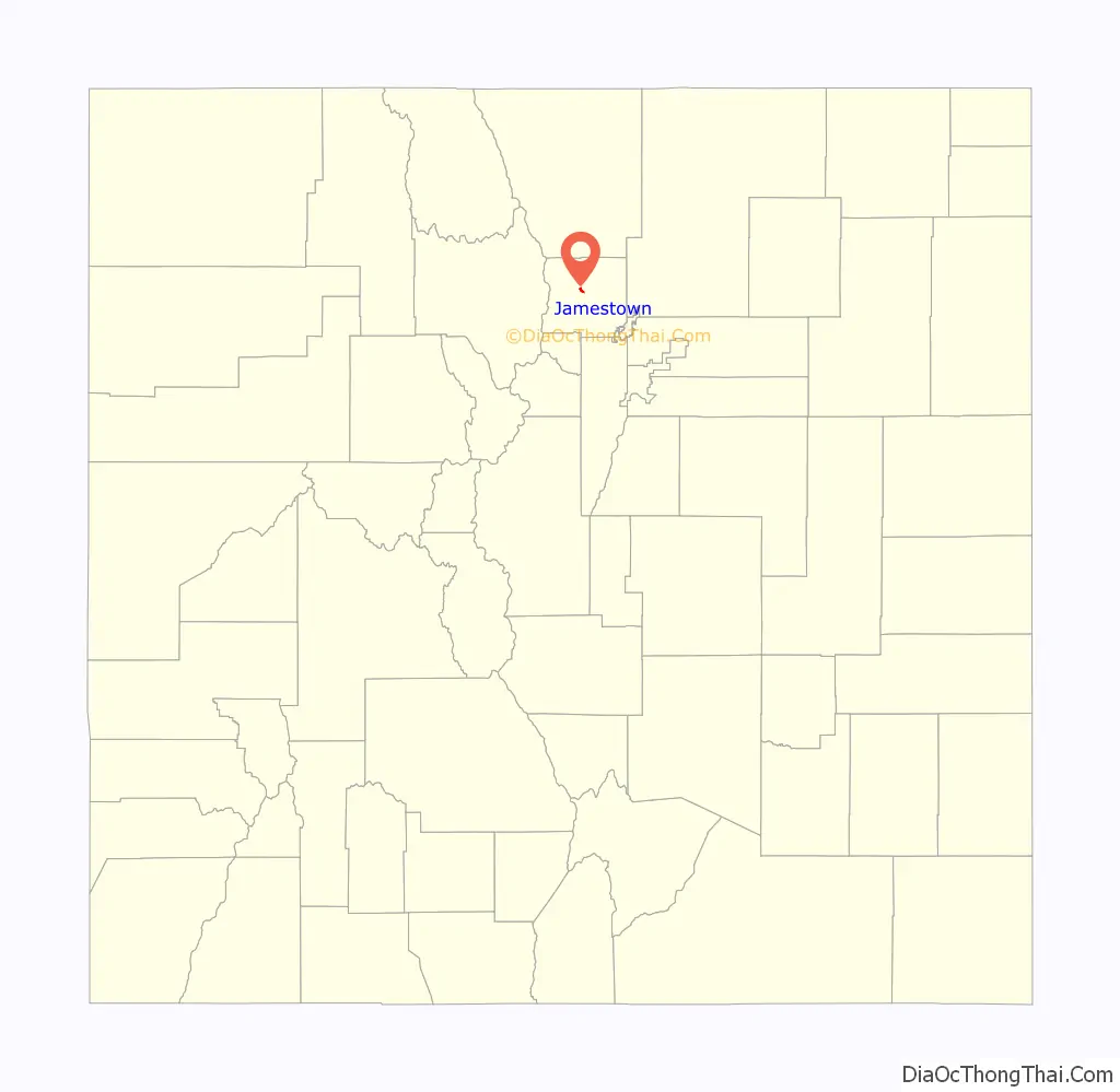
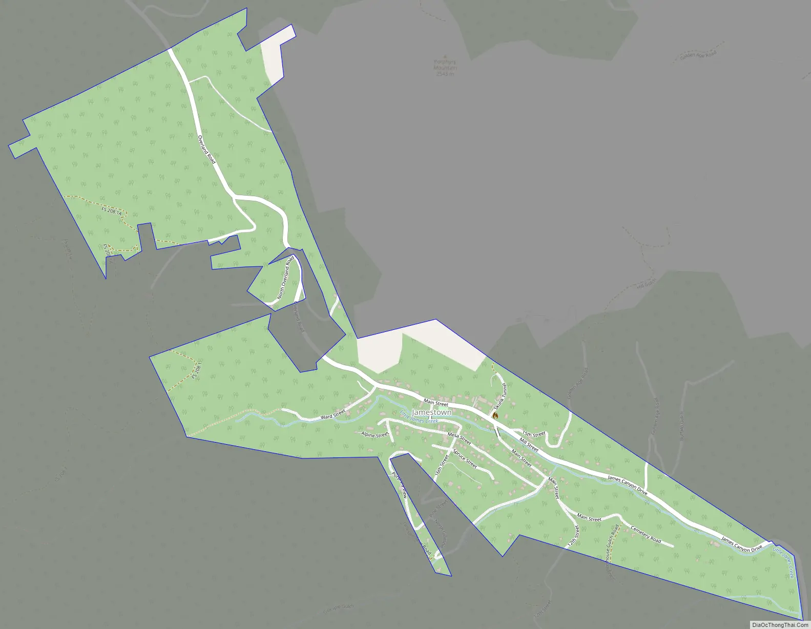
Jamestown Road Map
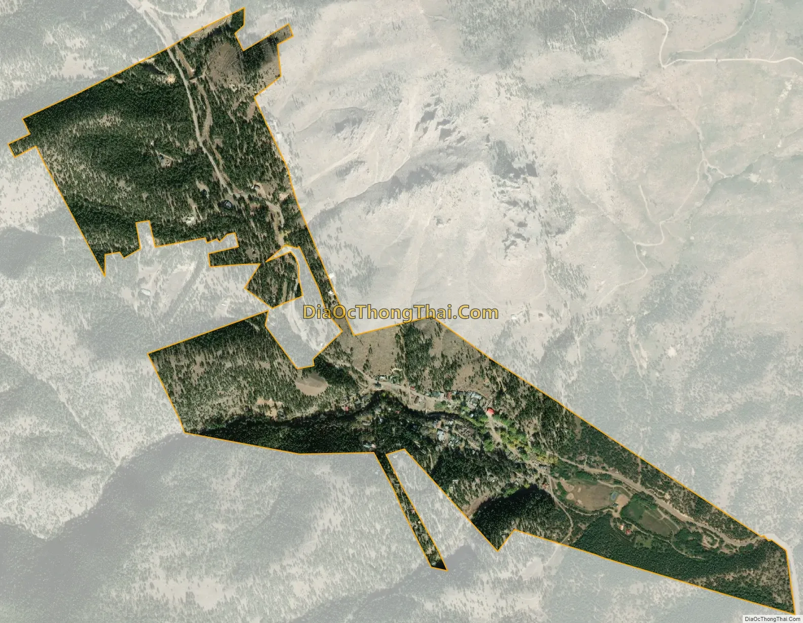
Jamestown city Satellite Map
Geography
Jamestown is in central Boulder County at 40°6′56″N 105°23′15″W / 40.11556°N 105.38750°W / 40.11556; -105.38750 (40.115485, −105.387531). It lies along James Creek within the Front Range of the Colorado Rockies, with access via James Canyon Drive, which leads east 8 miles (13 km) to U.S. Highway 36 in Altona and west 6.5 miles (10.5 km) to State Highway 72 (the Peak to Peak Highway) near Peaceful Valley. Jamestown’s elevation is 6,920 feet (2,110 m) above sea level.
According to the United States Census Bureau, the town has an area of 0.62 square miles (1.6 km), all of it land.
See also
Map of Colorado State and its subdivision:- Adams
- Alamosa
- Arapahoe
- Archuleta
- Baca
- Bent
- Boulder
- Broomfield
- Chaffee
- Cheyenne
- Clear Creek
- Conejos
- Costilla
- Crowley
- Custer
- Delta
- Denver
- Dolores
- Douglas
- Eagle
- El Paso
- Elbert
- Fremont
- Garfield
- Gilpin
- Grand
- Gunnison
- Hinsdale
- Huerfano
- Jackson
- Jefferson
- Kiowa
- Kit Carson
- La Plata
- Lake
- Larimer
- Las Animas
- Lincoln
- Logan
- Mesa
- Mineral
- Moffat
- Montezuma
- Montrose
- Morgan
- Otero
- Ouray
- Park
- Phillips
- Pitkin
- Prowers
- Pueblo
- Rio Blanco
- Rio Grande
- Routt
- Saguache
- San Juan
- San Miguel
- Sedgwick
- Summit
- Teller
- Washington
- Weld
- Yuma
- Alabama
- Alaska
- Arizona
- Arkansas
- California
- Colorado
- Connecticut
- Delaware
- District of Columbia
- Florida
- Georgia
- Hawaii
- Idaho
- Illinois
- Indiana
- Iowa
- Kansas
- Kentucky
- Louisiana
- Maine
- Maryland
- Massachusetts
- Michigan
- Minnesota
- Mississippi
- Missouri
- Montana
- Nebraska
- Nevada
- New Hampshire
- New Jersey
- New Mexico
- New York
- North Carolina
- North Dakota
- Ohio
- Oklahoma
- Oregon
- Pennsylvania
- Rhode Island
- South Carolina
- South Dakota
- Tennessee
- Texas
- Utah
- Vermont
- Virginia
- Washington
- West Virginia
- Wisconsin
- Wyoming


