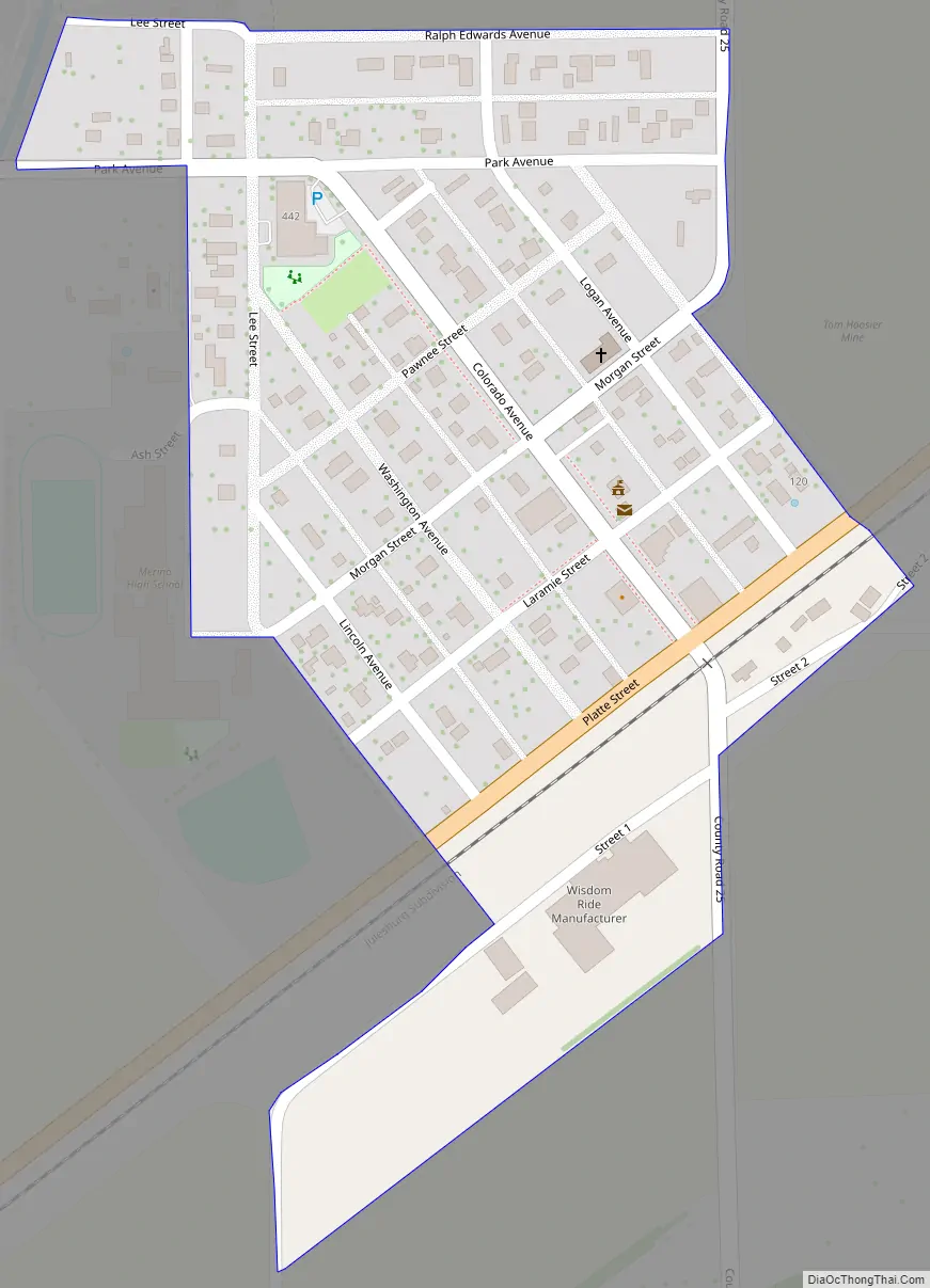
The Town of Merino is a Statutory Town in Logan County, Colorado, United States. The town population was 281 at the 2020 United States Census.
The town was named for the merino sheep which grazed there.
| Name: | Merino town |
|---|---|
| LSAD Code: | 43 |
| LSAD Description: | town (suffix) |
| State: | Colorado |
| County: | Logan County |
| Elevation: | 4,035 ft (1,230 m) |
| Total Area: | 0.15 sq mi (0.39 km²) |
| Land Area: | 0.15 sq mi (0.39 km²) |
| Water Area: | 0.00 sq mi (0.00 km²) |
| Total Population: | 281 |
| Population Density: | 1,900/sq mi (720/km²) |
| ZIP code: | 80741 |
| Area code: | 970 |
| FIPS code: | 0850040 |
| GNISfeature ID: | 0204720 |
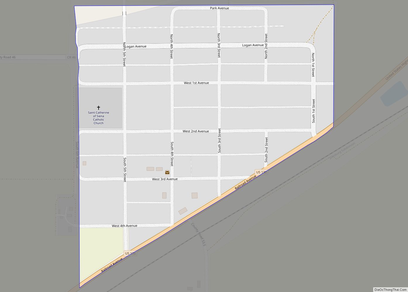
Online Interactive Map
Click on ![]() to view map in "full screen" mode.
to view map in "full screen" mode.
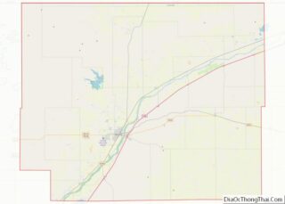
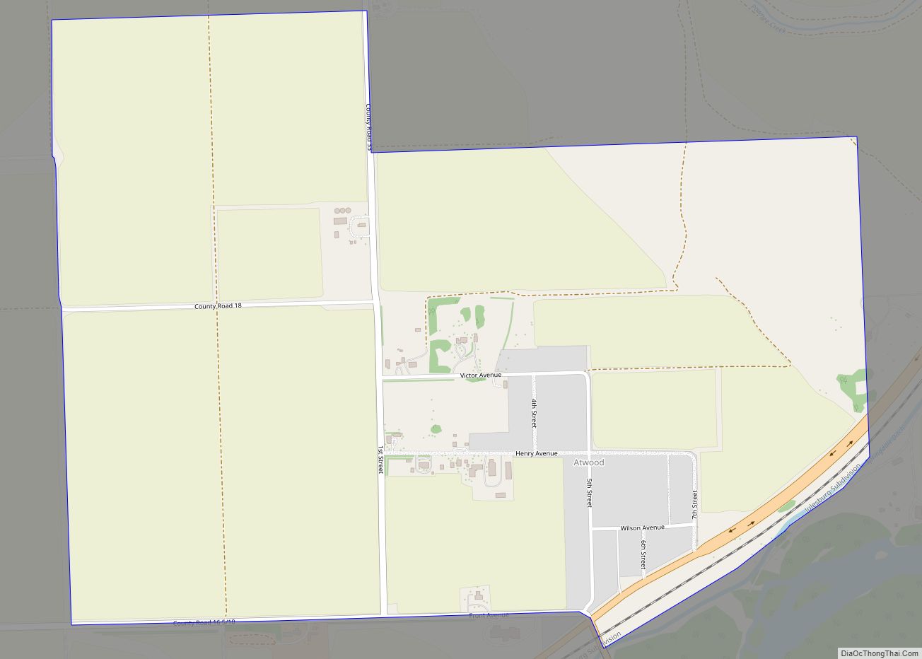
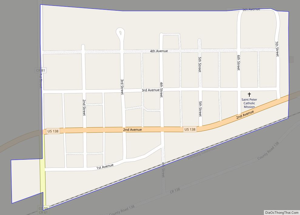
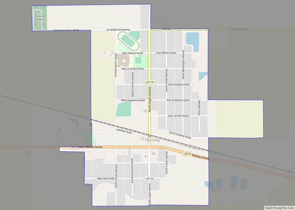
Merino location map. Where is Merino town?
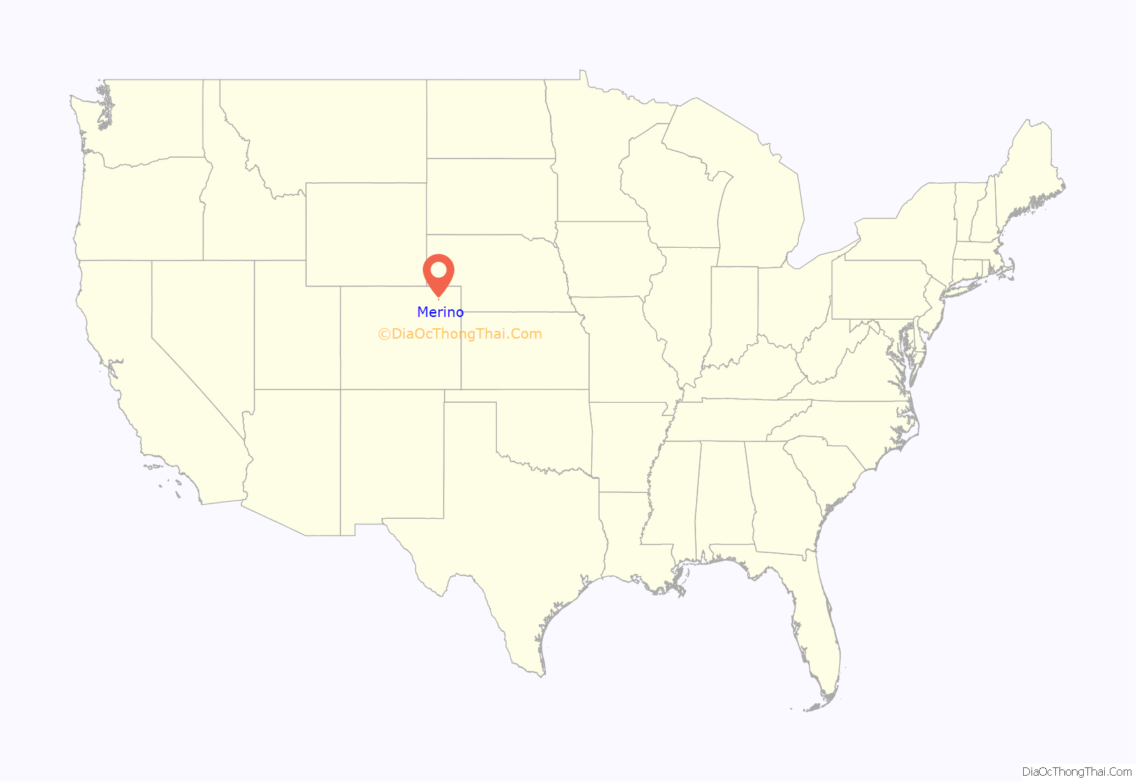
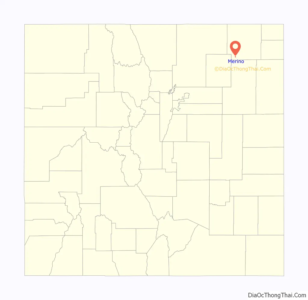
Merino Road Map
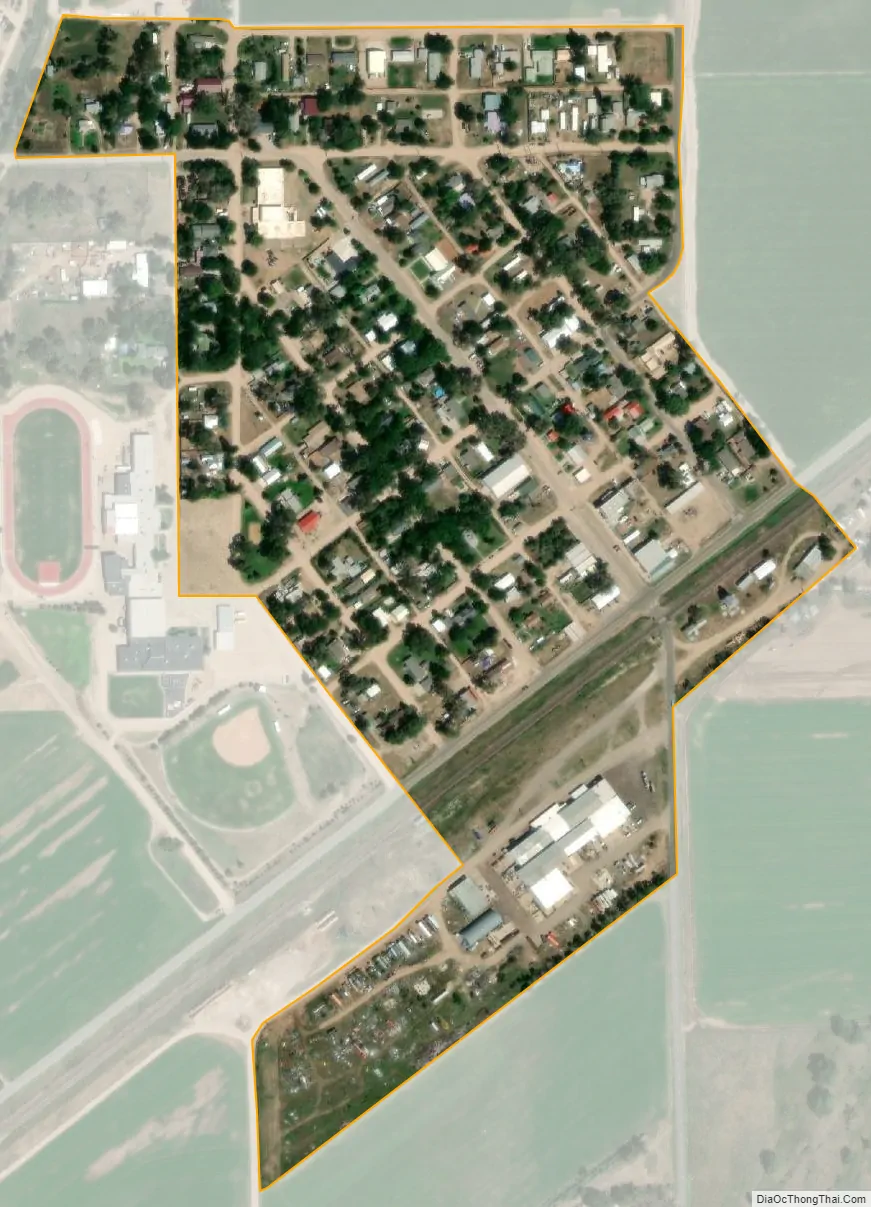
Merino city Satellite Map
Geography
Merino is located at 40°29′4″N 103°21′13″W / 40.48444°N 103.35361°W / 40.48444; -103.35361 (40.484418, -103.353691).
According to the United States Census Bureau, the town has a total area of 0.152 square miles (0.39 km), all of it land.
See also
Map of Colorado State and its subdivision:- Adams
- Alamosa
- Arapahoe
- Archuleta
- Baca
- Bent
- Boulder
- Broomfield
- Chaffee
- Cheyenne
- Clear Creek
- Conejos
- Costilla
- Crowley
- Custer
- Delta
- Denver
- Dolores
- Douglas
- Eagle
- El Paso
- Elbert
- Fremont
- Garfield
- Gilpin
- Grand
- Gunnison
- Hinsdale
- Huerfano
- Jackson
- Jefferson
- Kiowa
- Kit Carson
- La Plata
- Lake
- Larimer
- Las Animas
- Lincoln
- Logan
- Mesa
- Mineral
- Moffat
- Montezuma
- Montrose
- Morgan
- Otero
- Ouray
- Park
- Phillips
- Pitkin
- Prowers
- Pueblo
- Rio Blanco
- Rio Grande
- Routt
- Saguache
- San Juan
- San Miguel
- Sedgwick
- Summit
- Teller
- Washington
- Weld
- Yuma
- Alabama
- Alaska
- Arizona
- Arkansas
- California
- Colorado
- Connecticut
- Delaware
- District of Columbia
- Florida
- Georgia
- Hawaii
- Idaho
- Illinois
- Indiana
- Iowa
- Kansas
- Kentucky
- Louisiana
- Maine
- Maryland
- Massachusetts
- Michigan
- Minnesota
- Mississippi
- Missouri
- Montana
- Nebraska
- Nevada
- New Hampshire
- New Jersey
- New Mexico
- New York
- North Carolina
- North Dakota
- Ohio
- Oklahoma
- Oregon
- Pennsylvania
- Rhode Island
- South Carolina
- South Dakota
- Tennessee
- Texas
- Utah
- Vermont
- Virginia
- Washington
- West Virginia
- Wisconsin
- Wyoming