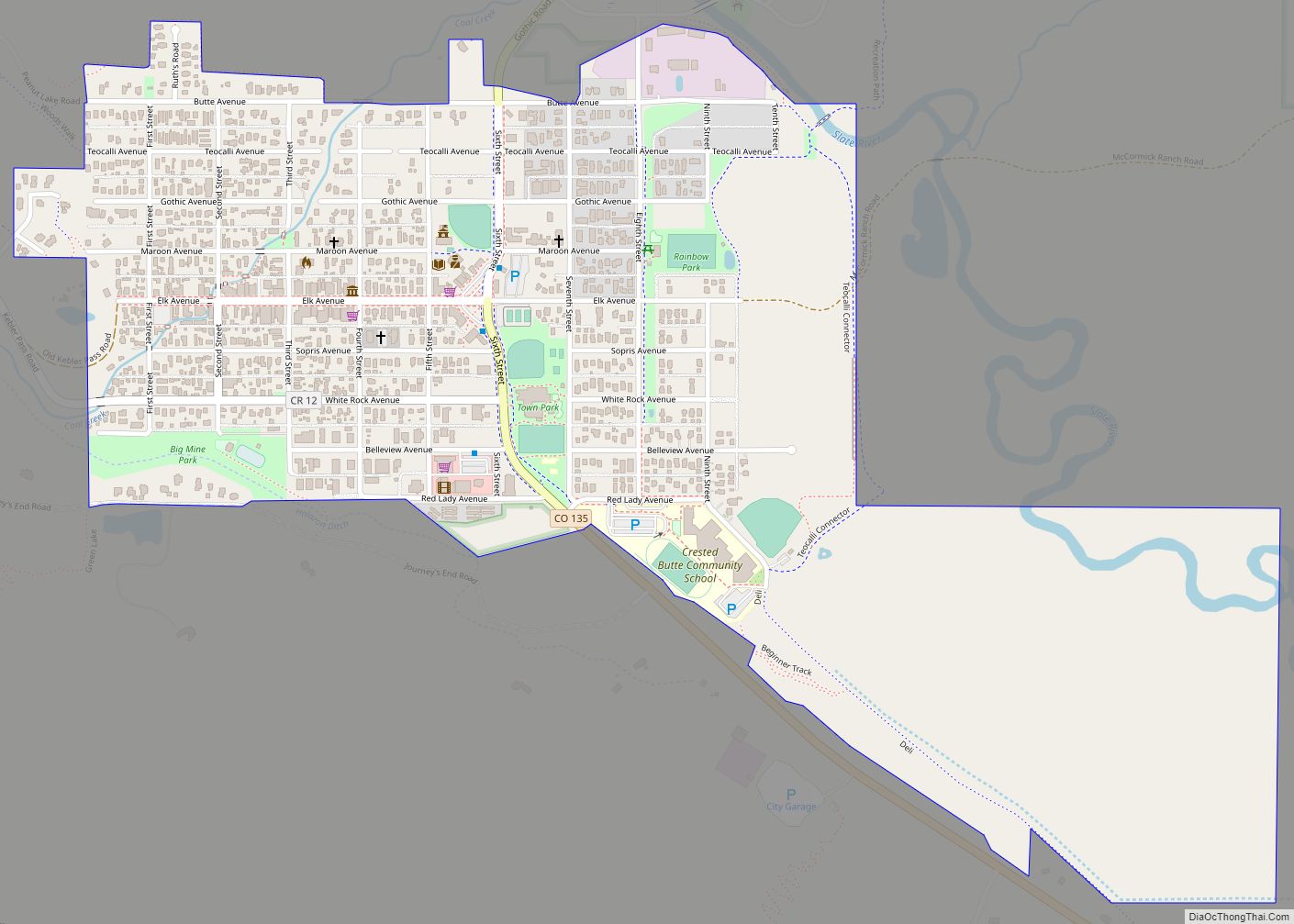
Mt. Crested Butte is a home rule municipality in Gunnison County, Colorado, United States. Mount Crested Butte is the home of the Crested Butte Mountain Resort. The population was 941 at the 2020 census. ZIP code 81225 serves post office boxes for Mount Crested Butte and for neighboring Crested Butte; mail must be addressed to Crested Butte.
| Name: | Mount Crested Butte town |
|---|---|
| LSAD Code: | 43 |
| LSAD Description: | town (suffix) |
| State: | Colorado |
| County: | Gunnison County |
| Elevation: | 9,498 ft (2,895 m) |
| Total Area: | 2.05 sq mi (5.30 km²) |
| Land Area: | 2.05 sq mi (5.30 km²) |
| Water Area: | 0.00 sq mi (0.00 km²) |
| Total Population: | 941 |
| Population Density: | 460/sq mi (180/km²) |
| ZIP code: | 81225 (Crested Butte PO Box) |
| Area code: | 970 |
| FIPS code: | 0852570 |
| Website: | www.mtcrestedbuttecolorado.us |
Online Interactive Map
Click on ![]() to view map in "full screen" mode.
to view map in "full screen" mode.
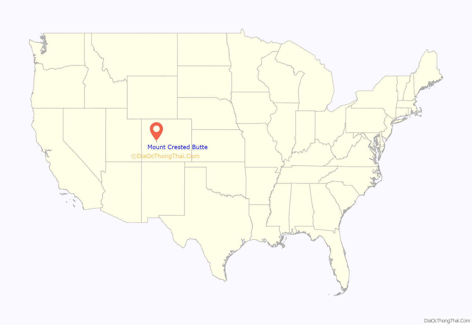
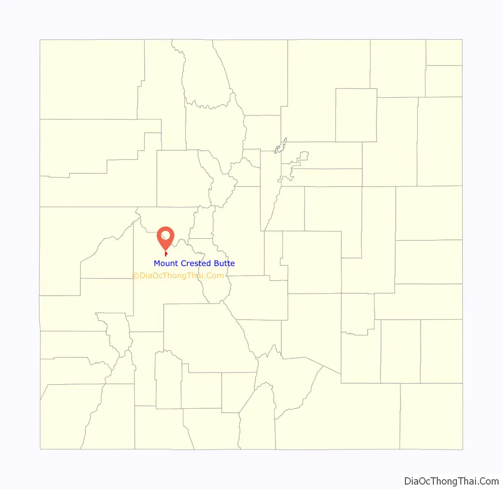
Mount Crested Butte location map. Where is Mount Crested Butte town?
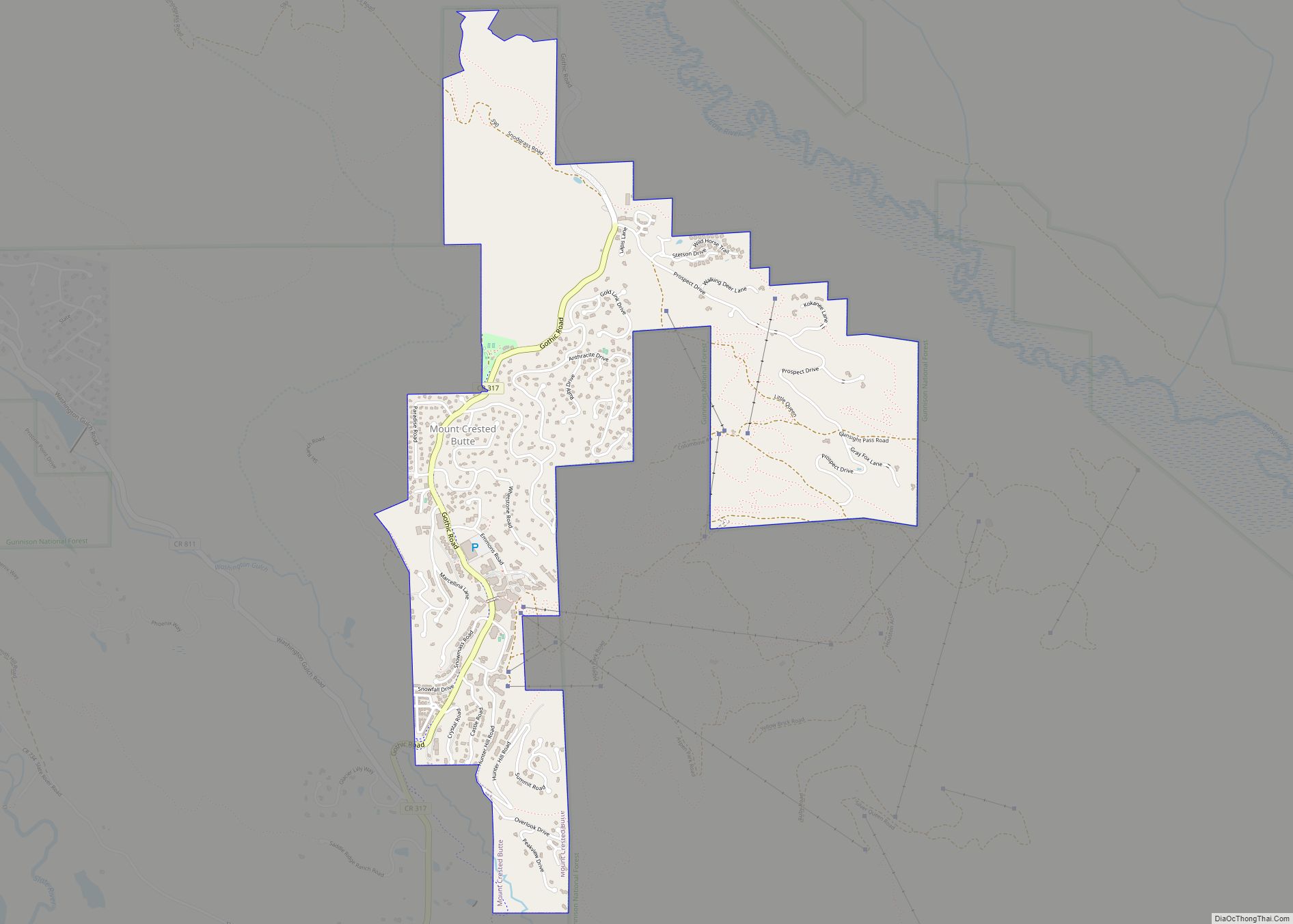
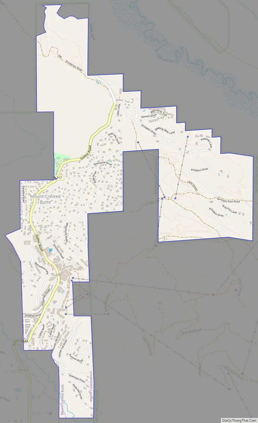
Mount Crested Butte Road Map
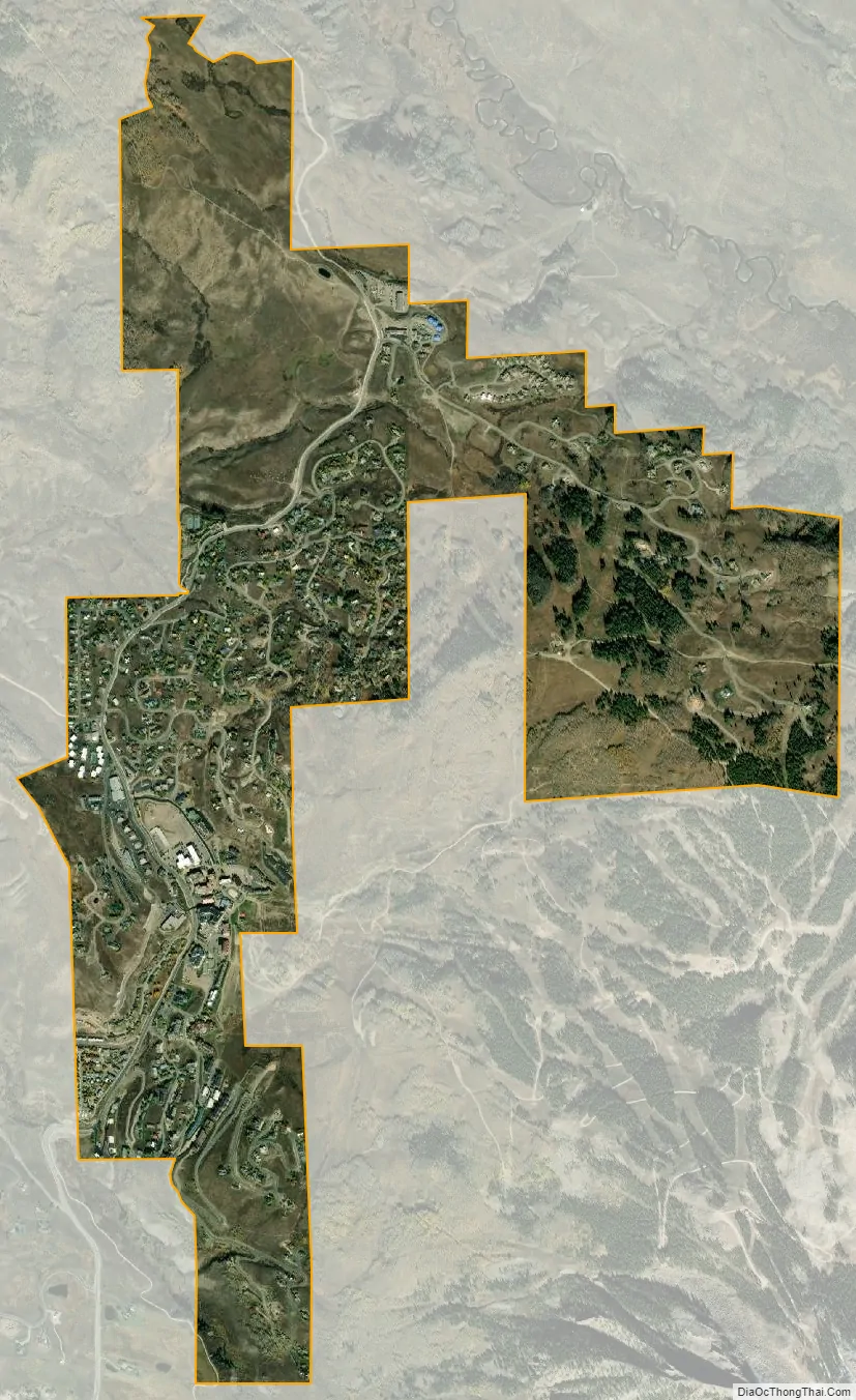
Mount Crested Butte city Satellite Map
Geography
Mt. Crested Butte is in north-central Gunnison County at 38°54′6″N 106°58′3″W / 38.90167°N 106.96750°W / 38.90167; -106.96750 (38.901649, -106.967554) in the Gunnison National Forest, 2 miles (3 km) north of the town of Crested Butte on Gothic Road. The town sits at the northern and western base of Crested Butte, a 12,162-foot (3,707 m) summit that is the site of the Crested Butte Mountain Resort.
According to the United States Census Bureau, the town of Mt. Crested Butte covers a total area of 2.22 square miles (5.75 km), all of it land.
See also
Map of Colorado State and its subdivision:- Adams
- Alamosa
- Arapahoe
- Archuleta
- Baca
- Bent
- Boulder
- Broomfield
- Chaffee
- Cheyenne
- Clear Creek
- Conejos
- Costilla
- Crowley
- Custer
- Delta
- Denver
- Dolores
- Douglas
- Eagle
- El Paso
- Elbert
- Fremont
- Garfield
- Gilpin
- Grand
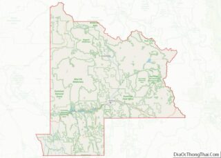
- Gunnison
- Hinsdale
- Huerfano
- Jackson
- Jefferson
- Kiowa
- Kit Carson
- La Plata
- Lake
- Larimer
- Las Animas
- Lincoln
- Logan
- Mesa
- Mineral
- Moffat
- Montezuma
- Montrose
- Morgan
- Otero
- Ouray
- Park
- Phillips
- Pitkin
- Prowers
- Pueblo
- Rio Blanco
- Rio Grande
- Routt
- Saguache
- San Juan
- San Miguel
- Sedgwick
- Summit
- Teller
- Washington
- Weld
- Yuma
- Alabama
- Alaska
- Arizona
- Arkansas
- California
- Colorado
- Connecticut
- Delaware
- District of Columbia
- Florida
- Georgia
- Hawaii
- Idaho
- Illinois
- Indiana
- Iowa
- Kansas
- Kentucky
- Louisiana
- Maine
- Maryland
- Massachusetts
- Michigan
- Minnesota
- Mississippi
- Missouri
- Montana
- Nebraska
- Nevada
- New Hampshire
- New Jersey
- New Mexico
- New York
- North Carolina
- North Dakota
- Ohio
- Oklahoma
- Oregon
- Pennsylvania
- Rhode Island
- South Carolina
- South Dakota
- Tennessee
- Texas
- Utah
- Vermont
- Virginia
- Washington
- West Virginia
- Wisconsin
- Wyoming