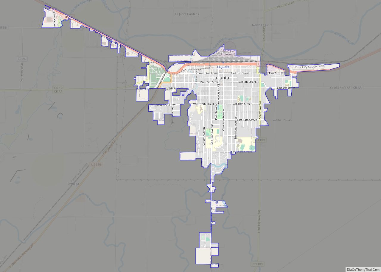
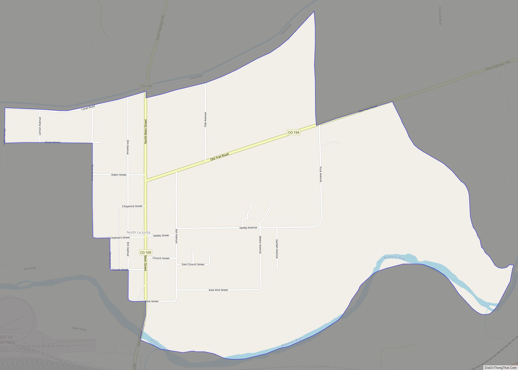
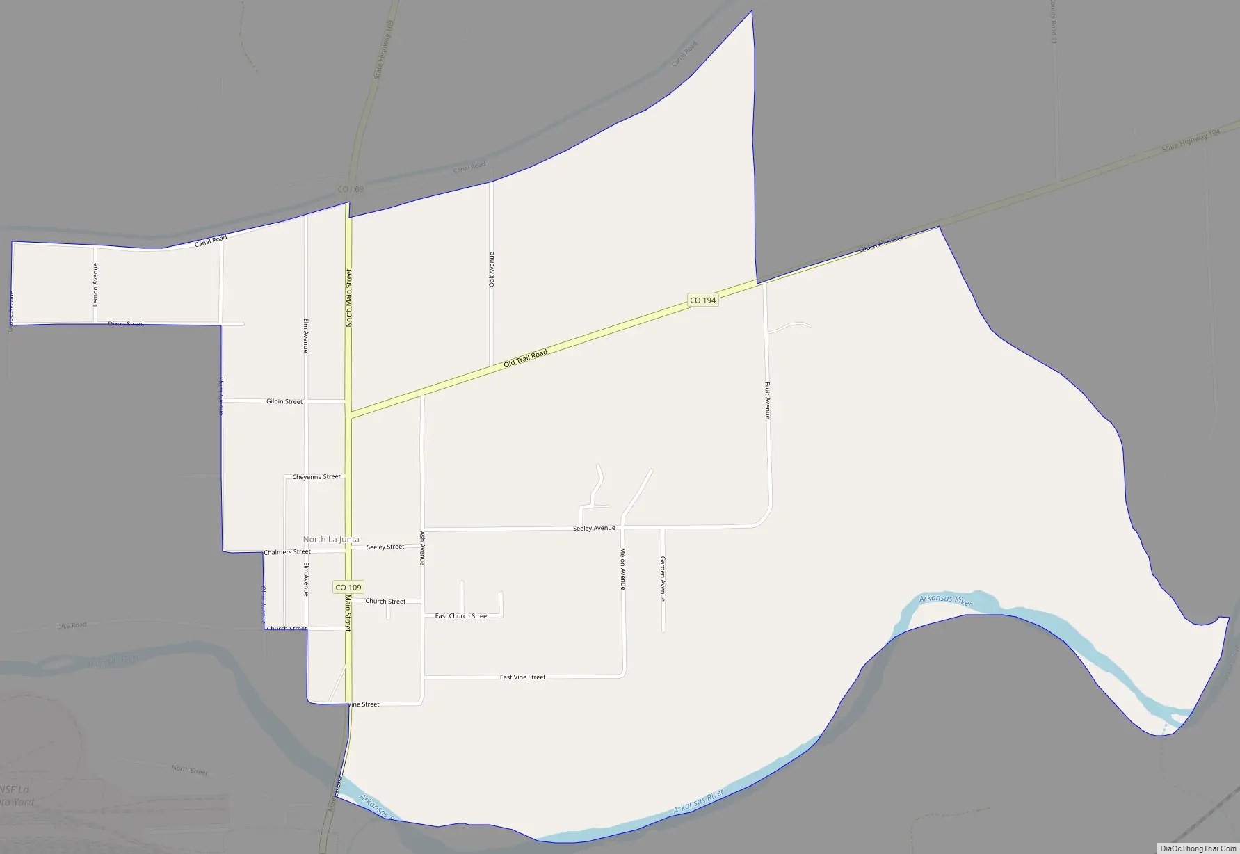
North La Junta is a census-designated place (CDP) in and governed by Otero County, Colorado, United States. The population of the North La Junta CDP was 482 at the United States Census 2020. The La Junta post office (Zip Code 81050) serves the area.
| Name: | North La Junta CDP |
|---|---|
| LSAD Code: | 57 |
| LSAD Description: | CDP (suffix) |
| State: | Colorado |
| County: | Otero County |
| Elevation: | 4,045 ft (1,233 m) |
| Total Area: | 1.391 sq mi (3.602 km²) |
| Land Area: | 1.360 sq mi (3.523 km²) |
| Water Area: | 0.031 sq mi (0.079 km²) |
| Total Population: | 482 |
| Population Density: | 350/sq mi (130/km²) |
| ZIP code: | La Junta 81050 |
| FIPS code: | 0854495 |
Online Interactive Map
Click on ![]() to view map in "full screen" mode.
to view map in "full screen" mode.
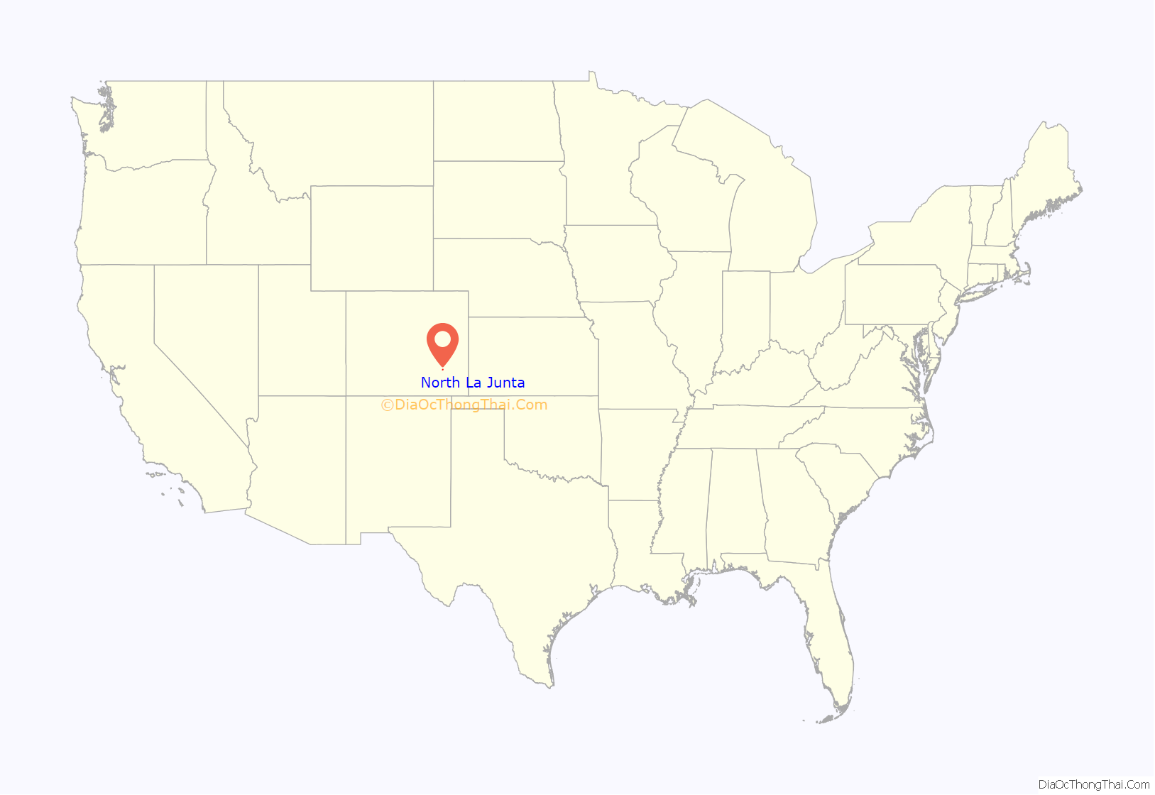
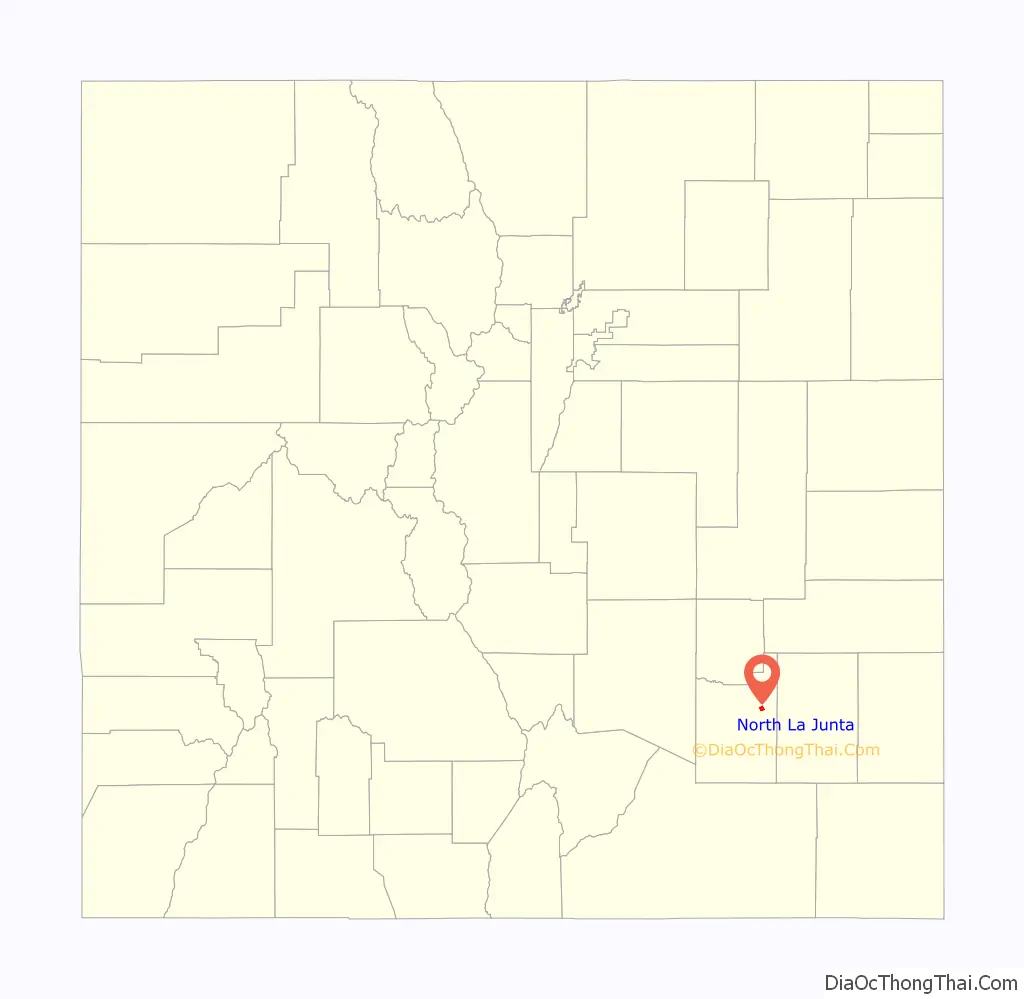
North La Junta location map. Where is North La Junta CDP?
History
The North La Junta School is listed on the National Register of Historic Places.
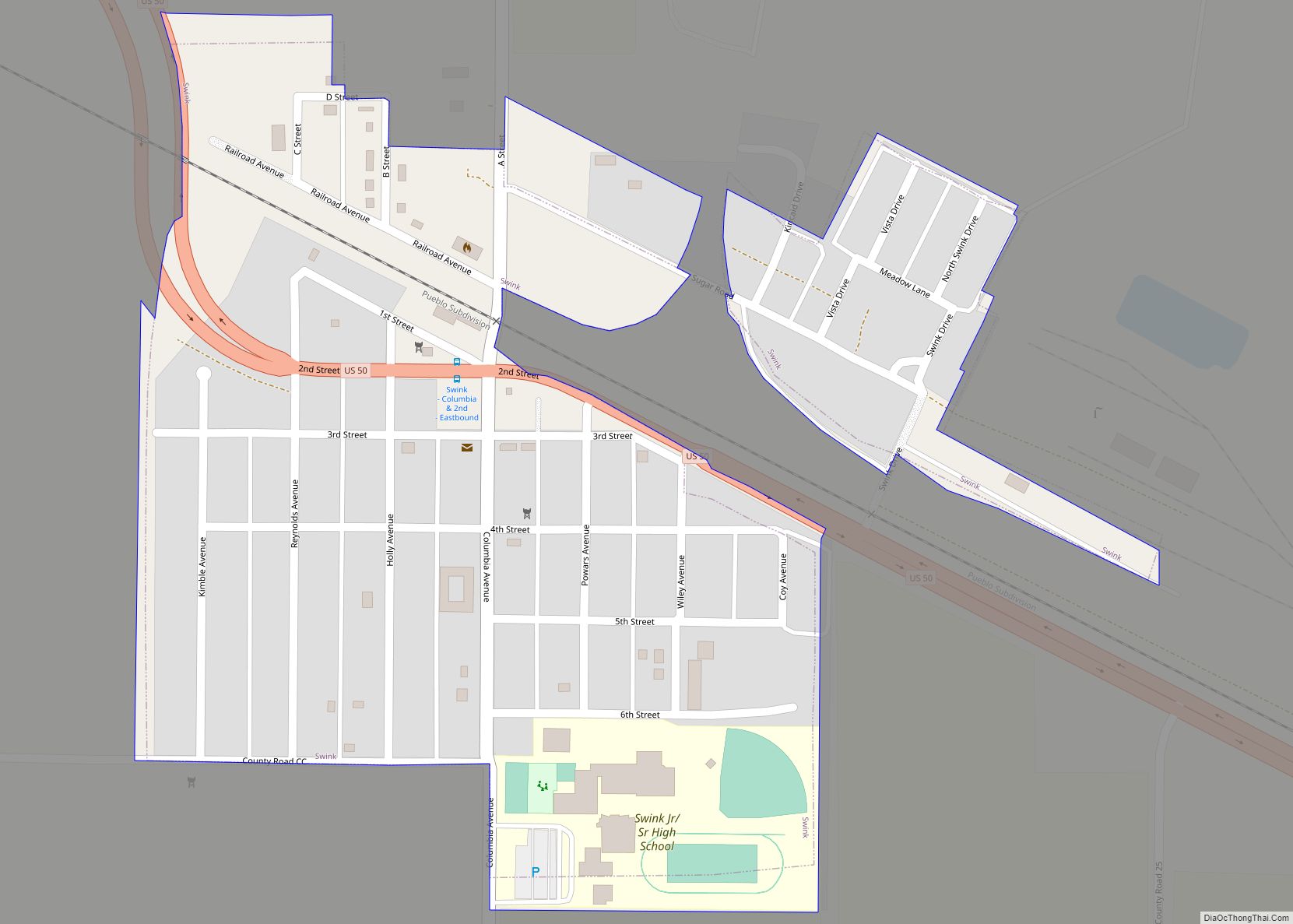
North La Junta Road Map
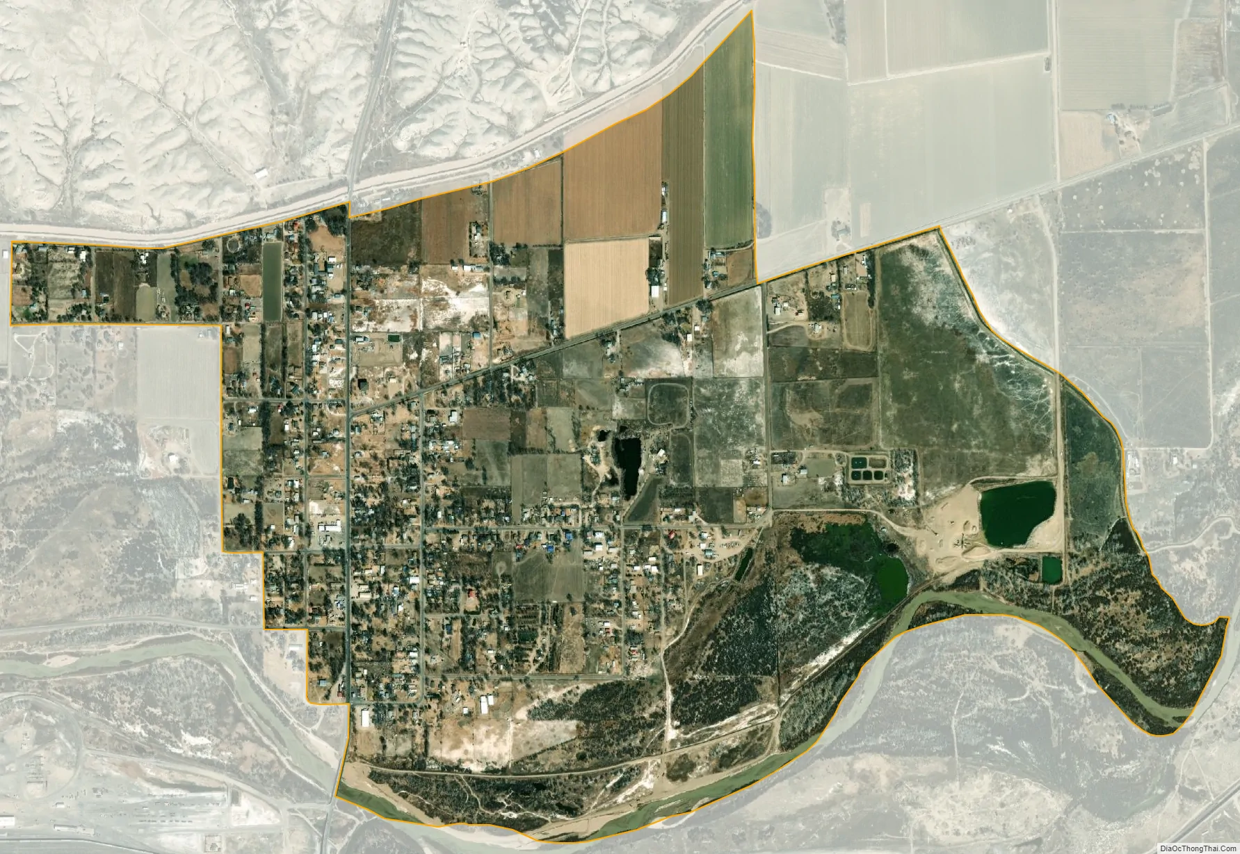
North La Junta city Satellite Map
Geography
North La Junta is located just across the Arkansas River from the larger City of La Junta.
The North La Junta CDP has an area of 890 acres (3.602 km), including 20 acres (0.079 km) of water.
See also
Map of Colorado State and its subdivision:- Adams
- Alamosa
- Arapahoe
- Archuleta
- Baca
- Bent
- Boulder
- Broomfield
- Chaffee
- Cheyenne
- Clear Creek
- Conejos
- Costilla
- Crowley
- Custer
- Delta
- Denver
- Dolores
- Douglas
- Eagle
- El Paso
- Elbert
- Fremont
- Garfield
- Gilpin
- Grand
- Gunnison
- Hinsdale
- Huerfano
- Jackson
- Jefferson
- Kiowa
- Kit Carson
- La Plata
- Lake
- Larimer
- Las Animas
- Lincoln
- Logan
- Mesa
- Mineral
- Moffat
- Montezuma
- Montrose
- Morgan
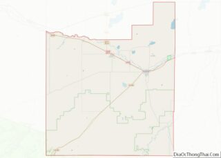
- Otero
- Ouray
- Park
- Phillips
- Pitkin
- Prowers
- Pueblo
- Rio Blanco
- Rio Grande
- Routt
- Saguache
- San Juan
- San Miguel
- Sedgwick
- Summit
- Teller
- Washington
- Weld
- Yuma
- Alabama
- Alaska
- Arizona
- Arkansas
- California
- Colorado
- Connecticut
- Delaware
- District of Columbia
- Florida
- Georgia
- Hawaii
- Idaho
- Illinois
- Indiana
- Iowa
- Kansas
- Kentucky
- Louisiana
- Maine
- Maryland
- Massachusetts
- Michigan
- Minnesota
- Mississippi
- Missouri
- Montana
- Nebraska
- Nevada
- New Hampshire
- New Jersey
- New Mexico
- New York
- North Carolina
- North Dakota
- Ohio
- Oklahoma
- Oregon
- Pennsylvania
- Rhode Island
- South Carolina
- South Dakota
- Tennessee
- Texas
- Utah
- Vermont
- Virginia
- Washington
- West Virginia
- Wisconsin
- Wyoming