Orchard is an unincorporated town, a post office, and a census-designated place (CDP) located in and governed by Morgan County, Colorado, United States. The CDP is a part of the Fort Morgan, CO Micropolitan Statistical Area. The Orchard post office has the ZIP Code 80649. As of the 2020 census, the population of the Orchard CDP was 76.
| Name: | Orchard CDP |
|---|---|
| LSAD Code: | 57 |
| LSAD Description: | CDP (suffix) |
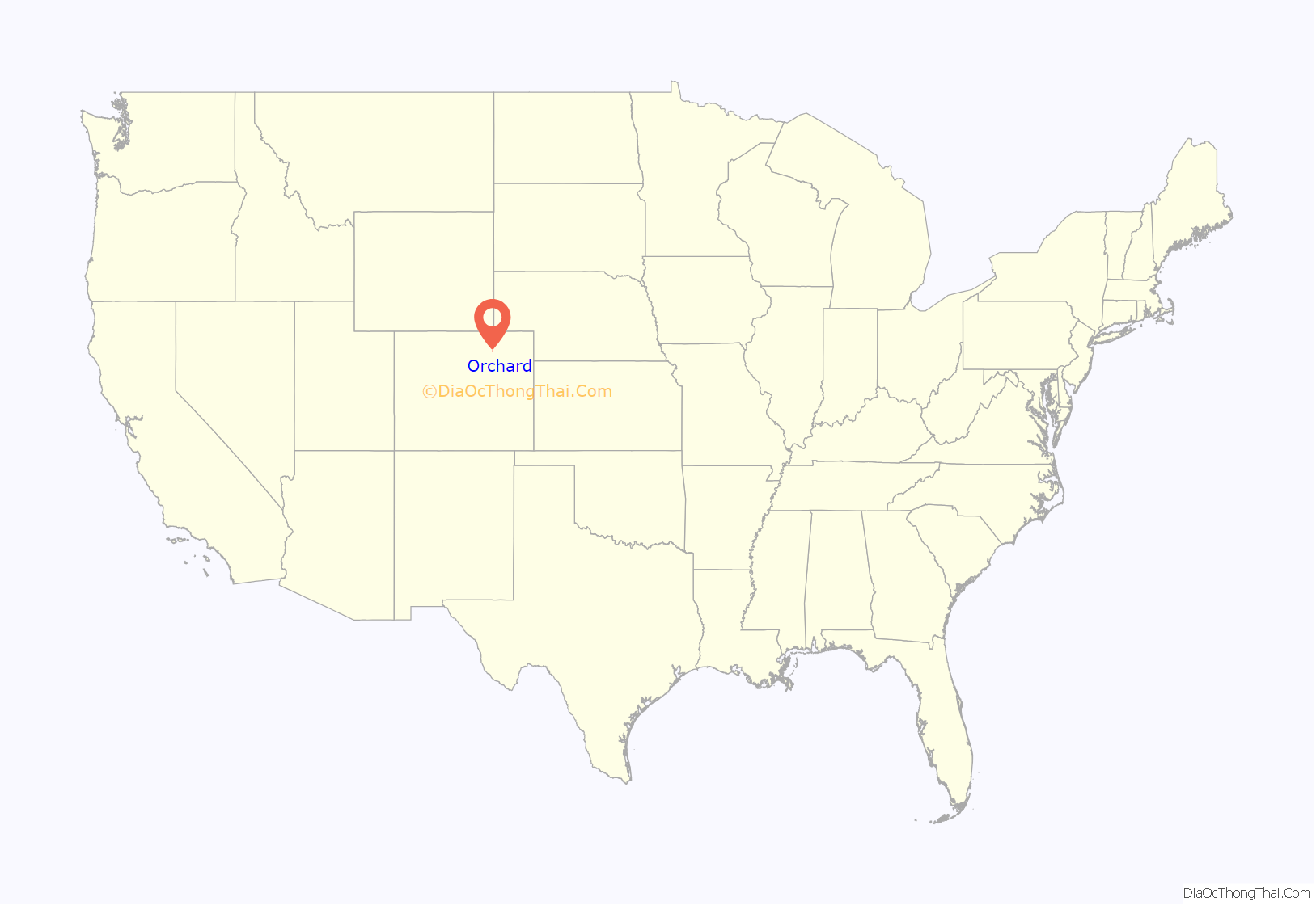
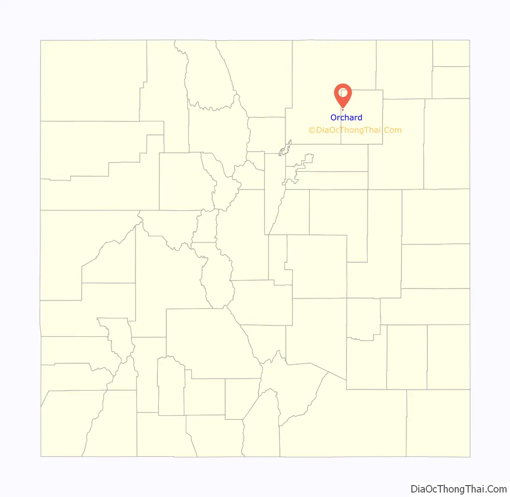
| State: | Colorado |
| County: | Morgan County |
| Elevation: | 4,409 ft (1,344 m) |
| Total Area: | 0.160 sq mi (0.41 km²) |
| Land Area: | 0.160 sq mi (0.41 km²) |
| Water Area: | 0.0 sq mi (0 km²) |
| Total Population: | 76 |
| Population Density: | 475.0/sq mi (183.4/km²) |
| ZIP code: | 80649 |
| Area code: | 970 |
| FIPS code: | 0855925 |
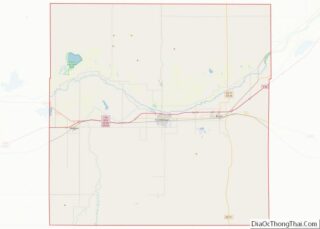
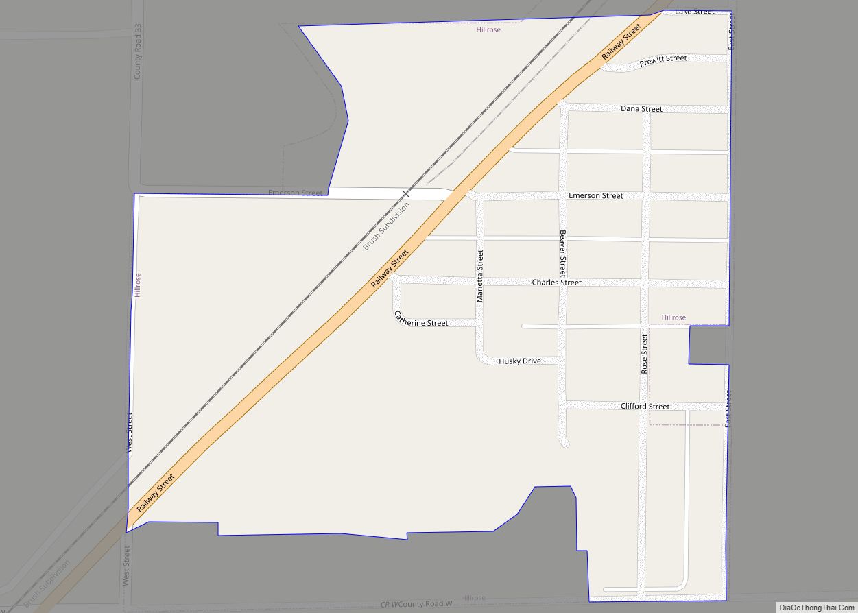
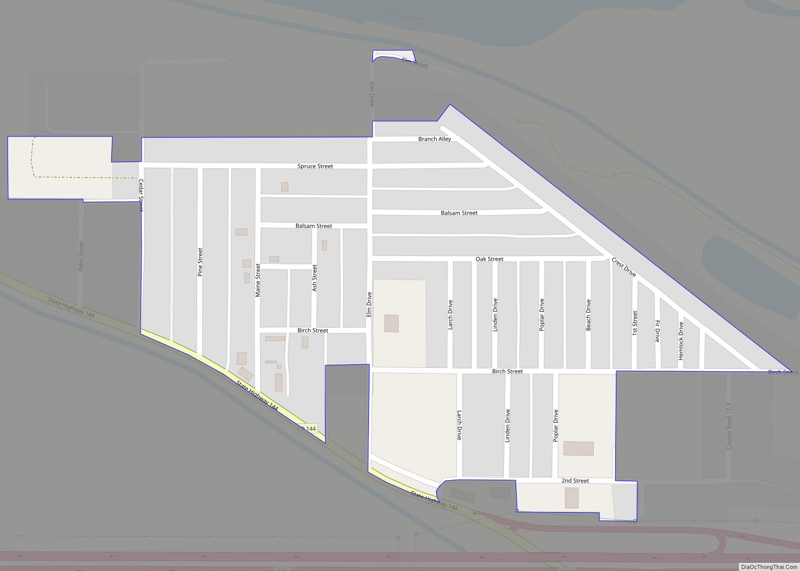
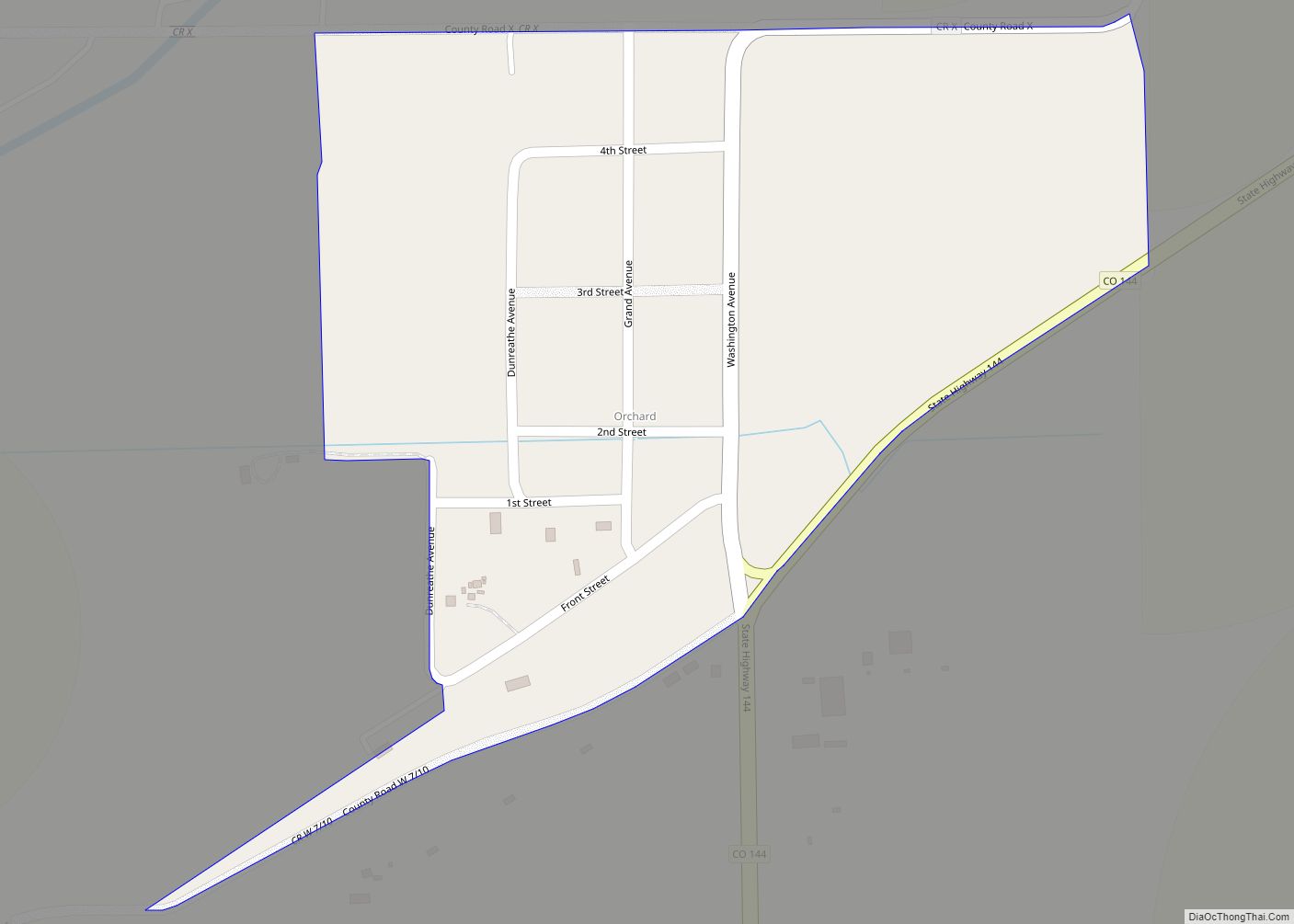
Online Interactive Map
Click on ![]() to view map in "full screen" mode.
to view map in "full screen" mode.
Orchard location map. Where is Orchard CDP?
History
The Orchard post office has been in operation since 1882. The community was named for a grove of cottonwood trees near the original town site.
Orchard is the town that was used to film James Michener’s miniseries Centennial. Most if not all of the remnants of the production sets are now gone.
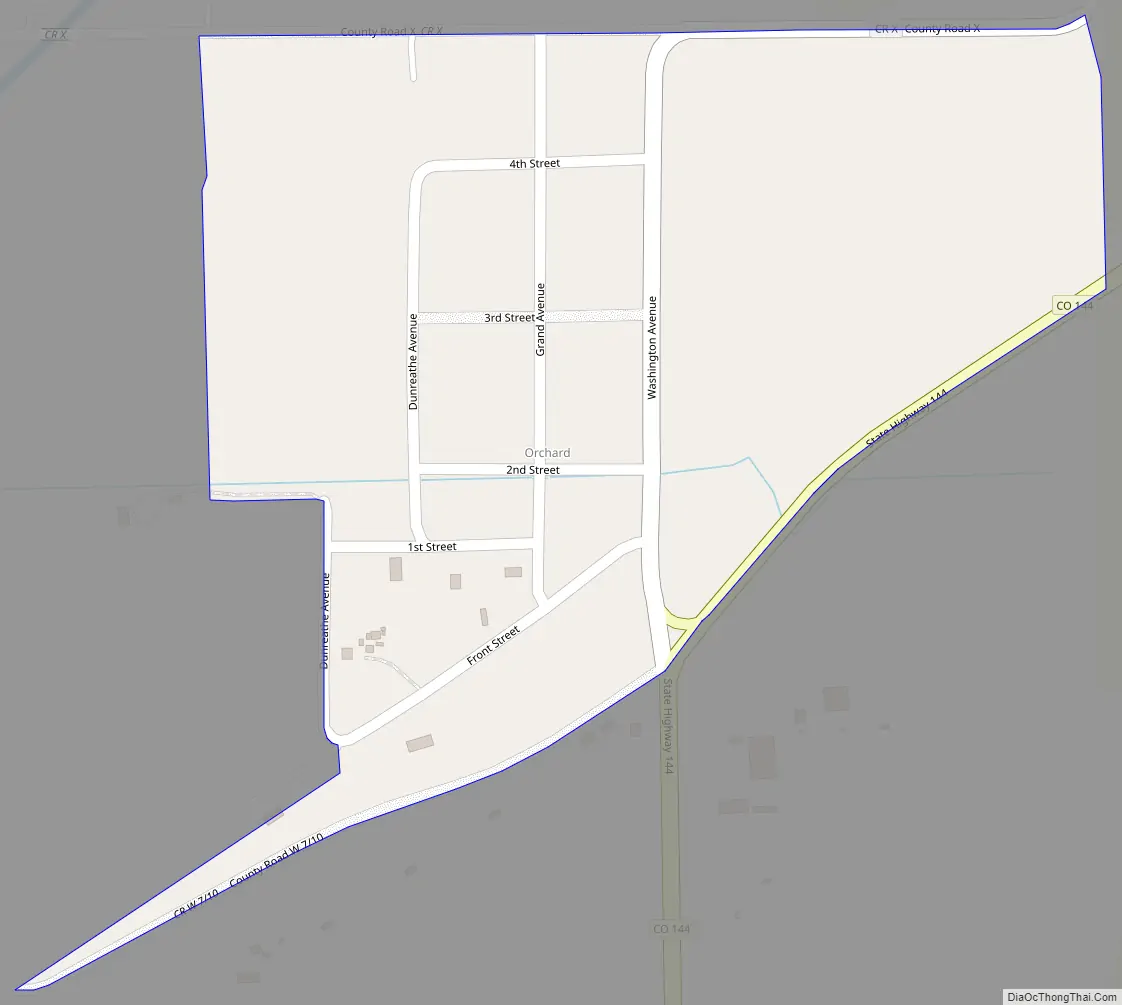
Orchard Road Map
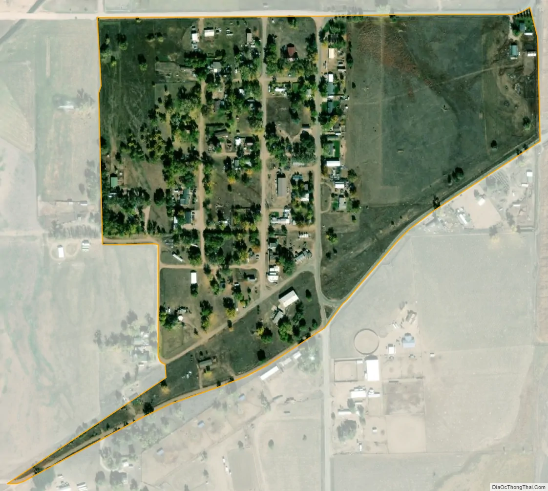
Orchard city Satellite Map
Geography
Orchard is in western Morgan County along Colorado State Highway 144, north of the South Platte River. Highway 144 leads northeast, then southeast down the South Platte valley 23 miles (37 km) to Fort Morgan, the Morgan county seat, and south 4 miles (6 km) to U.S. Route 34. The Orchard CDP has an area of 0.16 square miles (0.41 km), all land.
See also
Map of Colorado State and its subdivision:- Adams
- Alamosa
- Arapahoe
- Archuleta
- Baca
- Bent
- Boulder
- Broomfield
- Chaffee
- Cheyenne
- Clear Creek
- Conejos
- Costilla
- Crowley
- Custer
- Delta
- Denver
- Dolores
- Douglas
- Eagle
- El Paso
- Elbert
- Fremont
- Garfield
- Gilpin
- Grand
- Gunnison
- Hinsdale
- Huerfano
- Jackson
- Jefferson
- Kiowa
- Kit Carson
- La Plata
- Lake
- Larimer
- Las Animas
- Lincoln
- Logan
- Mesa
- Mineral
- Moffat
- Montezuma
- Montrose
- Morgan
- Otero
- Ouray
- Park
- Phillips
- Pitkin
- Prowers
- Pueblo
- Rio Blanco
- Rio Grande
- Routt
- Saguache
- San Juan
- San Miguel
- Sedgwick
- Summit
- Teller
- Washington
- Weld
- Yuma
- Alabama
- Alaska
- Arizona
- Arkansas
- California
- Colorado
- Connecticut
- Delaware
- District of Columbia
- Florida
- Georgia
- Hawaii
- Idaho
- Illinois
- Indiana
- Iowa
- Kansas
- Kentucky
- Louisiana
- Maine
- Maryland
- Massachusetts
- Michigan
- Minnesota
- Mississippi
- Missouri
- Montana
- Nebraska
- Nevada
- New Hampshire
- New Jersey
- New Mexico
- New York
- North Carolina
- North Dakota
- Ohio
- Oklahoma
- Oregon
- Pennsylvania
- Rhode Island
- South Carolina
- South Dakota
- Tennessee
- Texas
- Utah
- Vermont
- Virginia
- Washington
- West Virginia
- Wisconsin
- Wyoming