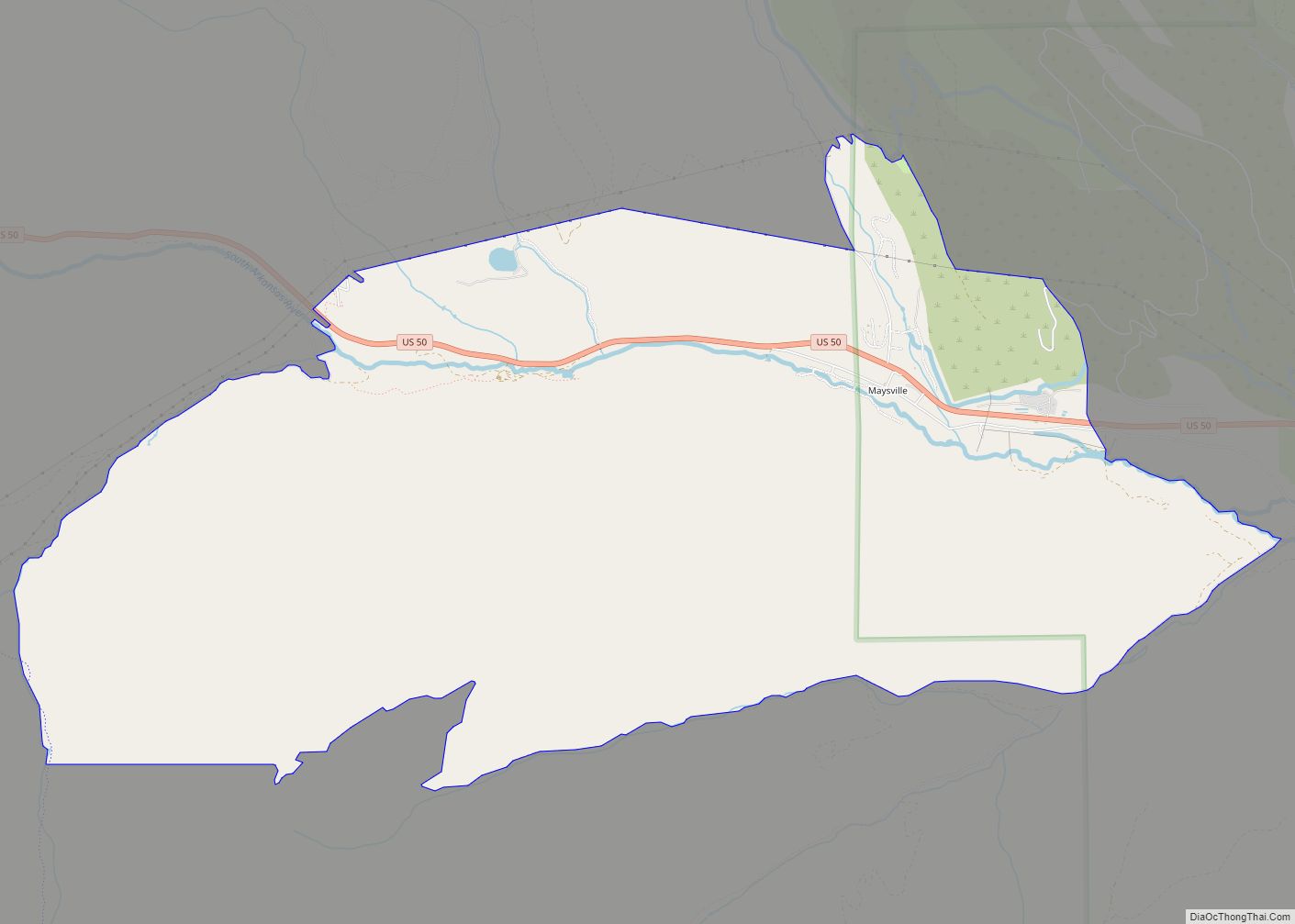
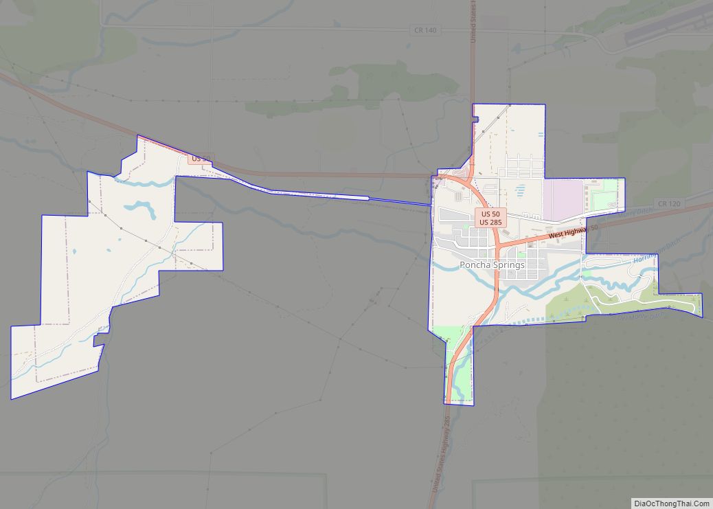
Poncha Springs is a statutory Town in Chaffee County, Colorado, United States. The population was 925 at the 2020 census.
| Name: | Poncha Springs town |
|---|---|
| LSAD Code: | 43 |
| LSAD Description: | town (suffix) |
| State: | Colorado |
| County: | Chaffee County |
| Elevation: | 7,464 ft (2,275 m) |
| Total Area: | 2.98 sq mi (7.73 km²) |
| Land Area: | 2.98 sq mi (7.73 km²) |
| Water Area: | 0.00 sq mi (0.00 km²) |
| Total Population: | 925 |
| Population Density: | 310/sq mi (120/km²) |
| ZIP code: | 81242 (PO Box) |
| Area code: | 719 |
| FIPS code: | 0860600 |
| GNISfeature ID: | 0189428 |
| Website: | www.ponchaspringscolorado.us |
Online Interactive Map
Click on ![]() to view map in "full screen" mode.
to view map in "full screen" mode.
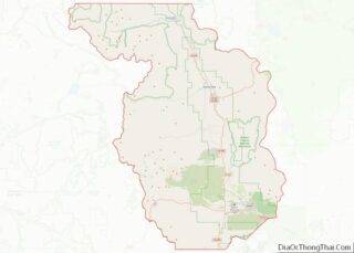
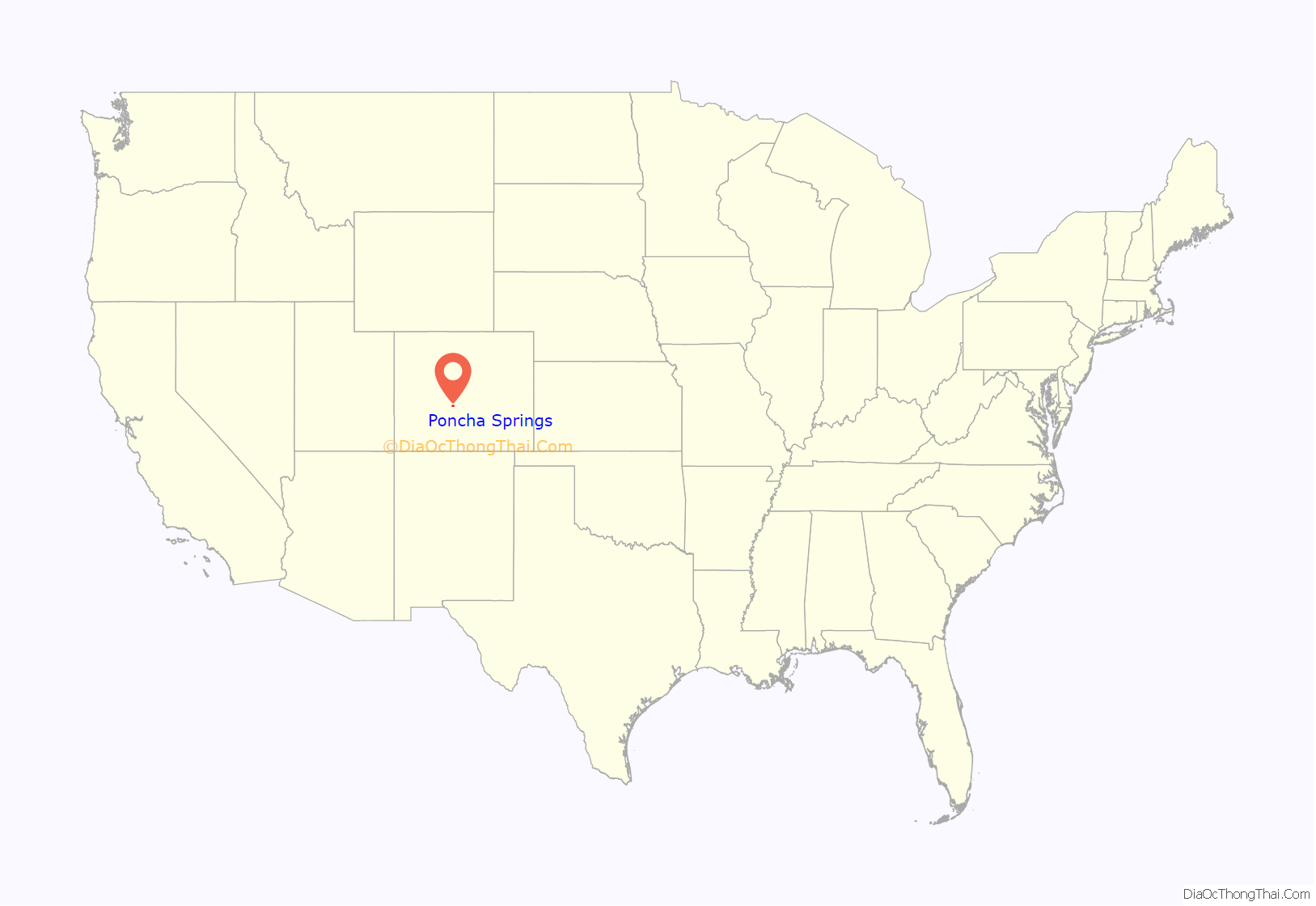
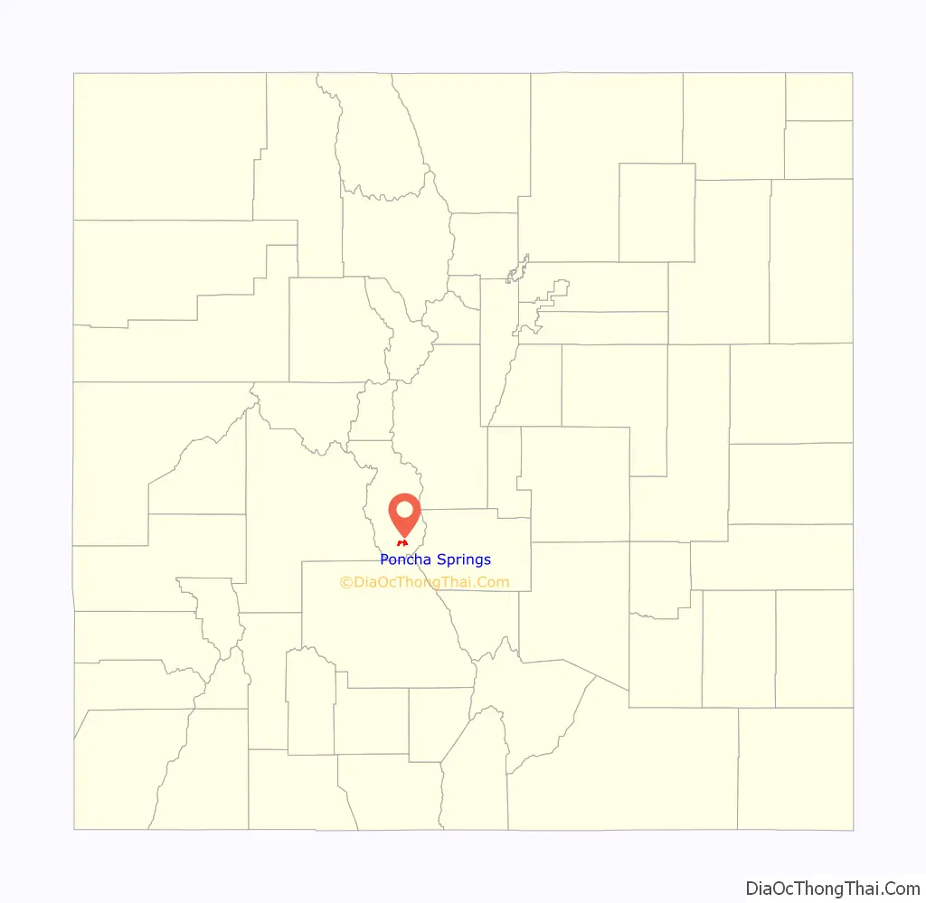
Poncha Springs location map. Where is Poncha Springs town?
History
The first human inhabitants of the Poncha Springs area were Ute people, who used the region as camping grounds during the winter months. Juan Bautista de Anza led a military expedition over Poncha Pass in 1779, which is about 6 miles (10 km) south of the present-day town. Following the Spanish exploration, French trappers and fur traders moved in. In 1855, Colonel Thomas T. Fauntleroy and the 1st Cavalry Regiment marched over Poncha Pass and engaged a group of Utes between present day Salida and Poncha Springs, during the Ute Wars.
Around 1860, prospectors began arriving, including Bob Hendricks and Nat Rich, who built the first cabin in town, which is still standing. Nat Rich’s son, James, was the first white person born in Poncha Springs in 1867. That same year Poncha Springs was designated as an election precinct.
Indian agent John Burnett homesteaded with his wife, Minerva Maxwell Burnett, who was an early schoolteacher in Poncha Springs. In 1866, Burnett constructed a log building on his ranch to serve as an Indian trading post. The Hutchinson and McPherson families also homesteaded the area around the same time. John McPherson purchased Nat Rich’s squatting rights from Joe Hutchinson and built a grocery store.
Poncha Springs began to grow in the 1870s, and was incorporated on December 8, 1880. The Poncha Springs Schoolhouse, which is listed on the National Register of Historic Places and now serves as town hall, was completed in 1883.
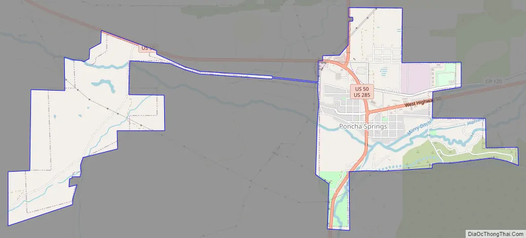
Poncha Springs Road Map
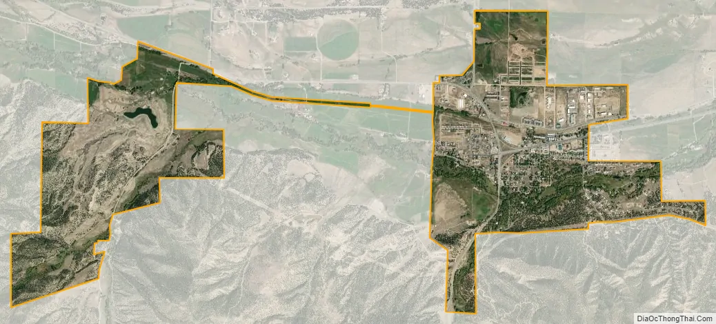
Poncha Springs city Satellite Map
Geography
Poncha Springs is located in southern Chaffee County at 38°30′48″N 106°4′32″W / 38.51333°N 106.07556°W / 38.51333; -106.07556 (38.513451, -106.075607).
According to the United States Census Bureau, the town has a total area of 2.7 square miles (7.0 km), all of it land.
See also
Map of Colorado State and its subdivision:- Adams
- Alamosa
- Arapahoe
- Archuleta
- Baca
- Bent
- Boulder
- Broomfield
- Chaffee
- Cheyenne
- Clear Creek
- Conejos
- Costilla
- Crowley
- Custer
- Delta
- Denver
- Dolores
- Douglas
- Eagle
- El Paso
- Elbert
- Fremont
- Garfield
- Gilpin
- Grand
- Gunnison
- Hinsdale
- Huerfano
- Jackson
- Jefferson
- Kiowa
- Kit Carson
- La Plata
- Lake
- Larimer
- Las Animas
- Lincoln
- Logan
- Mesa
- Mineral
- Moffat
- Montezuma
- Montrose
- Morgan
- Otero
- Ouray
- Park
- Phillips
- Pitkin
- Prowers
- Pueblo
- Rio Blanco
- Rio Grande
- Routt
- Saguache
- San Juan
- San Miguel
- Sedgwick
- Summit
- Teller
- Washington
- Weld
- Yuma
- Alabama
- Alaska
- Arizona
- Arkansas
- California
- Colorado
- Connecticut
- Delaware
- District of Columbia
- Florida
- Georgia
- Hawaii
- Idaho
- Illinois
- Indiana
- Iowa
- Kansas
- Kentucky
- Louisiana
- Maine
- Maryland
- Massachusetts
- Michigan
- Minnesota
- Mississippi
- Missouri
- Montana
- Nebraska
- Nevada
- New Hampshire
- New Jersey
- New Mexico
- New York
- North Carolina
- North Dakota
- Ohio
- Oklahoma
- Oregon
- Pennsylvania
- Rhode Island
- South Carolina
- South Dakota
- Tennessee
- Texas
- Utah
- Vermont
- Virginia
- Washington
- West Virginia
- Wisconsin
- Wyoming