Rangely is a Statutory Town in Rio Blanco County, Colorado, United States. The population was 2,299 at the 2020 census.
| Name: | Rangely town |
|---|---|
| LSAD Code: | 43 |
| LSAD Description: | town (suffix) |
| State: | Colorado |
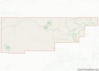
| County: | Rio Blanco County |
| Elevation: | 5,297 ft (1,615 m) |
| Total Area: | 4.30 sq mi (11.15 km²) |
| Land Area: | 4.30 sq mi (11.15 km²) |
| Water Area: | 0.00 sq mi (0.00 km²) |
| Total Population: | 2,299 |
| Population Density: | 530/sq mi (210/km²) |
| ZIP code: | 81648 |
| Area code: | 970 |
| FIPS code: | 0862880 |
| GNISfeature ID: | 0171670 |
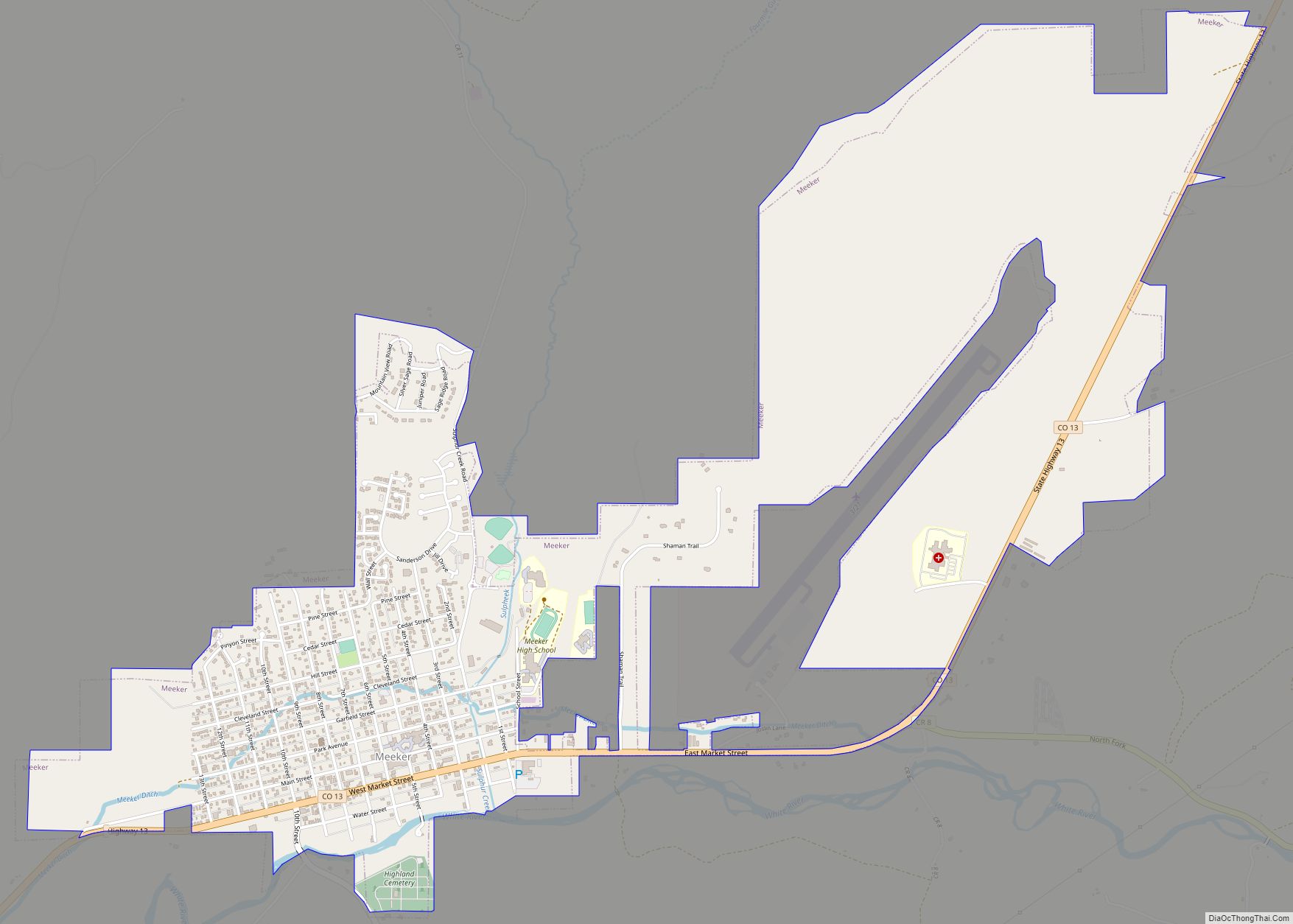
Online Interactive Map
Click on ![]() to view map in "full screen" mode.
to view map in "full screen" mode.
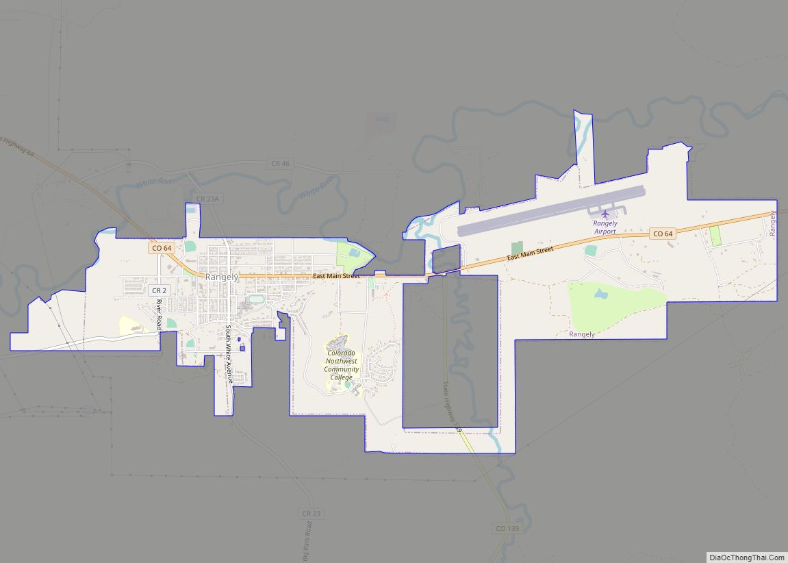
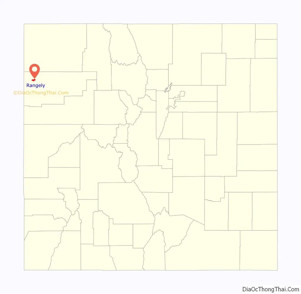
Rangely location map. Where is Rangely town?
History
The land is what makes the town of Rangely’s history interesting. The land is the base from which all human events unfold, whether it is the geology that brought the miners and oil men, or the water that brought the Fremonts, the Utes, the explorers, the ranchers.
To tell the story we must start back in the earlier history of the earth when a shallow sea encompassed most of the area around Rangely, 300 million years ago in what is labeled as the Pennsylvania and Permian geologic periods. During this time marine creatures would become fossils and can actually still be discovered around Rangely. Huge dunes were formed on the edges of this sea and became porous rock that is now known as the Weber formation. This formed what is called an “anticline.” Anticline is a ridge-shaped fold of stratified rock in which the strata slope downward from the crest. Then, as the sea receded, dinosaurs left bones and the extensive plant growth became oil and coal.
The innumerable canyons, draws, and gullies of the area held creeks, rivers and streams which attracted the early Fremont and Ute peoples. The Fremont people migrated to the Rangely area from the Great Basin in south-central Utah between 400 B.C. – 650 A.D. What we know about the Fremont comes from the artifacts they left in the area and from their homes and campsites which we find in the nearby canyons. Evidence of the Fremont people is plentiful in and around Rangely; for example, the rock art on Colorado 139 and Dragon Trail are both examples of Fremont Art. A Fremont dwelling in Texas Creek Overlook was an atypical dwelling for the Fremont people.
In many places around Rangely the art echoes images from other sites in the southwest. The art of the historical Utes records their history of conflict with the white settlers who began moving into the area in the 1800s. Their art is also the first to include horses originally brought by the Spanish.
The first recorded white settlers making a permanent home in the area were Mr. Joseph Studer and C.P. Hill who came in 1882, the same year the Ute people were to be confined to reservations in southern Colorado and eastern Utah. Some time later Mr. Hill was joined by his relatives, among them a cousin, Lee S. Chase, who named the town after Rangeley, Maine. Mr. Hil l began ranching and opened a trading post. All supplies were freighted—first from Salt Lake City, Utah, by team and wagon, then from Grand Junction, Colorado, via Douglas Pass. By 1913 there were enough ranching and farming families in the area to necessitate the building of a large one-room school house (now located in the Rangely Outdoor Museum).
Interestingly, the Utes had long been aware of oil in the area. The first shallow wells drilled in 1903 produced about 10 barrels of oil per day. Chevron arrived in 1931. In 1932, after a year of drilling Raven A-1, the first deep oil well, successfully reached the vast pocket of crude in the Weber formation at a depth of more than 6,000 feet, but there was no market for the 230 barrels it produced each day; however, the well was known as the most productive oil well of all time. The well was capped until everything changed for this sleepy little town with the large demand for oil required during the Second World War. Chevron reopened the Raven A-1 well and Rangely became a booming oil camp.
By 1946 raising cattle and sheep, farming, shallow oil well drilling, and mining coal were no longer the principle industries. Deep well drilling was king. Tents, trolley cars, crude cabins and trailers took over the dozen homes. The one store, post office, filling station, library, pool hall, Red Cross first aid station, and hotel suddenly had competition from a slew of businesses, including motels, cafes, bars, cleaners, movie theater, bowling alley, and more. The school had been accredited up to three years of high school with senior year taken elsewhere, usually Meeker, or forfeited. Company camps were built in many places in the valley, and in 1947 Rangely was incorporated as a town with Fred Nichols voted in as Mayor. In the 1960s the Rangely oil field was a major producer in the country and deemed such an important strategic asset that bomb shelters were built at the college and supplied with coats, blankets, food and water.
By 1949 there were 478 wells across 30 miles in the Weber formation. The peak rate of the area was 82,000 by 1956. Rangely’s oil field was known as the Rangely Weber Sand Unit by 1998 and recovered more than 815 million barrels of oil, making it the largest field in the Rocky Mountain Region. This Region has 406 producing wells, 351 injection wells and produces about one third of Colorado’s oil production coming out to a huge 20,000 barrels a day. The Weber Basin, has recovered an additional 12 million barrels of oil from the shallower Mancos Shale at depths less than 2000 feet. The Sand Unit is a unitized field so is owned by many, but only Chevron USA Production operates the field. Major oil companies, smaller independent oil companies, trust and individuals numbering almost 30 share the expenses and the benefits of the field today. The Unit provides jobs for approximately 300 individuals and makes up about 70 percent of the property tax revenue for Rio Blanco County.
In 2015, Colorado Northwestern Community College, Rangely Campus, began the excavation of an important fossil dig of the bones and very rare skin and tendons of a Duckbill Dinosaur which was located in Rangely. The Duckbill Dinosaur, which ultimately took on the name of Walter, was excavated and the fossils were airlifted to a federal repository on Colorado Northwestern Coummunity College’s Craig Campus on Thursday, July 11, 2019. With this event, along with the formation of the town, one can see how the past continues to link with the present to make Rangely’s story interesting and ongoing.
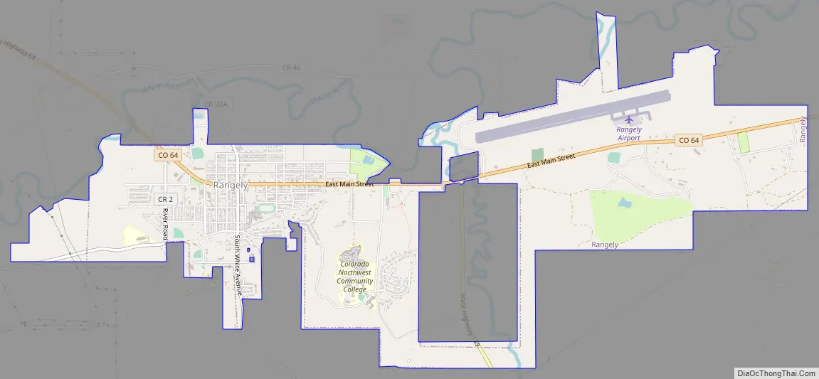
Rangely Road Map
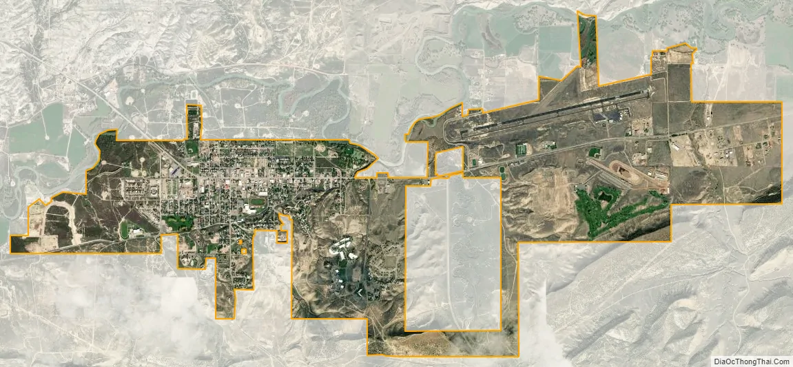
Rangely city Satellite Map
Geography
Rangely is located at 40°5′10″N 108°47′53″W / 40.08611°N 108.79806°W / 40.08611; -108.79806 (40.086181, -108.797944).
According to the United States Census Bureau, the town has a total area of 4.0 square miles (10 km), all of it land.
The terrain is mountain desert and is dry for most of the year.
Climate
According to the Köppen Climate Classification system, Rangely has a cold semi-arid climate, abbreviated “BSk” on climate maps. The hottest temperature recorded in Rangely was 108 °F (42.2 °C) on June 21, 1974, while the coldest temperature recorded was −37 °F (−38.3 °C) on February 15, 1895 and January 2, 1952.
See also
Map of Colorado State and its subdivision:- Adams
- Alamosa
- Arapahoe
- Archuleta
- Baca
- Bent
- Boulder
- Broomfield
- Chaffee
- Cheyenne
- Clear Creek
- Conejos
- Costilla
- Crowley
- Custer
- Delta
- Denver
- Dolores
- Douglas
- Eagle
- El Paso
- Elbert
- Fremont
- Garfield
- Gilpin
- Grand
- Gunnison
- Hinsdale
- Huerfano
- Jackson
- Jefferson
- Kiowa
- Kit Carson
- La Plata
- Lake
- Larimer
- Las Animas
- Lincoln
- Logan
- Mesa
- Mineral
- Moffat
- Montezuma
- Montrose
- Morgan
- Otero
- Ouray
- Park
- Phillips
- Pitkin
- Prowers
- Pueblo
- Rio Blanco
- Rio Grande
- Routt
- Saguache
- San Juan
- San Miguel
- Sedgwick
- Summit
- Teller
- Washington
- Weld
- Yuma
- Alabama
- Alaska
- Arizona
- Arkansas
- California
- Colorado
- Connecticut
- Delaware
- District of Columbia
- Florida
- Georgia
- Hawaii
- Idaho
- Illinois
- Indiana
- Iowa
- Kansas
- Kentucky
- Louisiana
- Maine
- Maryland
- Massachusetts
- Michigan
- Minnesota
- Mississippi
- Missouri
- Montana
- Nebraska
- Nevada
- New Hampshire
- New Jersey
- New Mexico
- New York
- North Carolina
- North Dakota
- Ohio
- Oklahoma
- Oregon
- Pennsylvania
- Rhode Island
- South Carolina
- South Dakota
- Tennessee
- Texas
- Utah
- Vermont
- Virginia
- Washington
- West Virginia
- Wisconsin
- Wyoming