Redvale is an unincorporated town, a post office, and a census-designated place (CDP) located in and governed by Montrose County, Colorado, United States. The CDP is a part of the Montrose, CO Micropolitan Statistical Area. The Redvale post office has the ZIP Code 81431. At the 2020 census, the population of the Redvale CDP was 172, down from 236 in 2010.
| Name: | Redvale CDP |
|---|---|
| LSAD Code: | 57 |
| LSAD Description: | CDP (suffix) |
| State: | Colorado |
| County: | Montrose County |
| Total Area: | 4.680 sq mi (12.121 km²) |
| Land Area: | 4.680 sq mi (12.121 km²) |
| Water Area: | 0.000 sq mi (0.000 km²) |
| Total Population: | 172 |
| Population Density: | 37/sq mi (14.2/km²) |
| ZIP code: | 81431 |
| Area code: | 970 |
| FIPS code: | 0863705 |
Online Interactive Map
Click on ![]() to view map in "full screen" mode.
to view map in "full screen" mode.
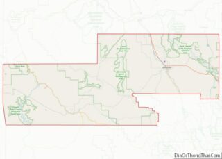
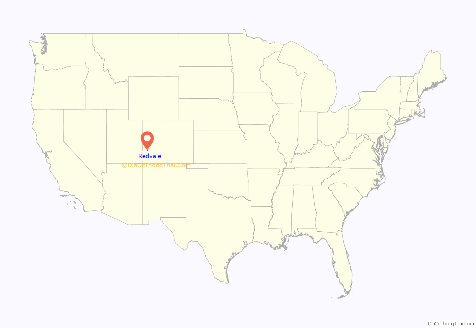
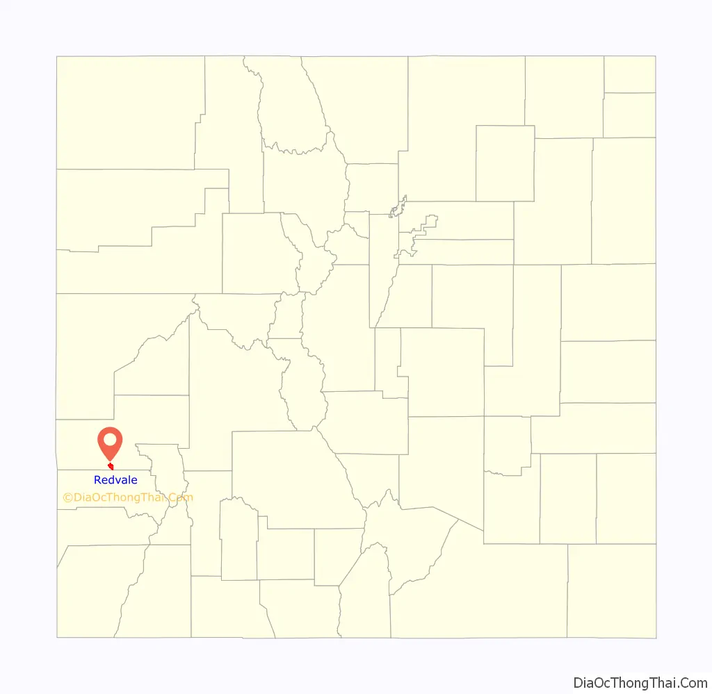
Redvale location map. Where is Redvale CDP?
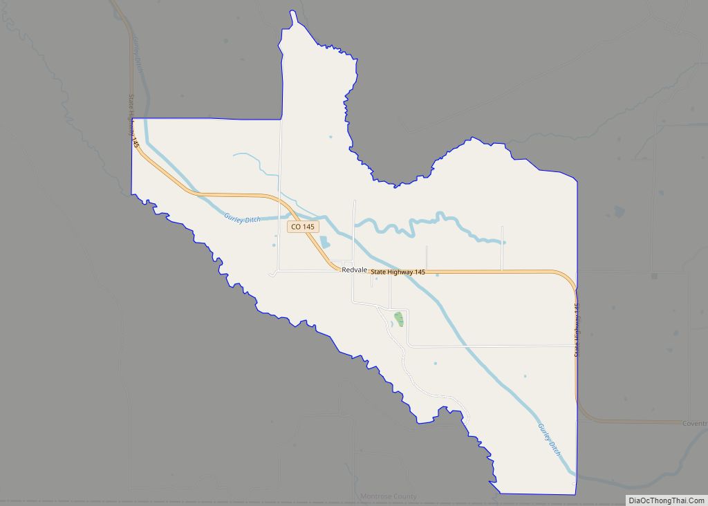
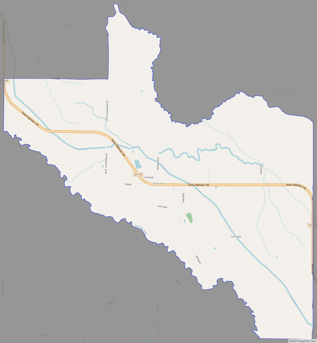
Redvale Road Map
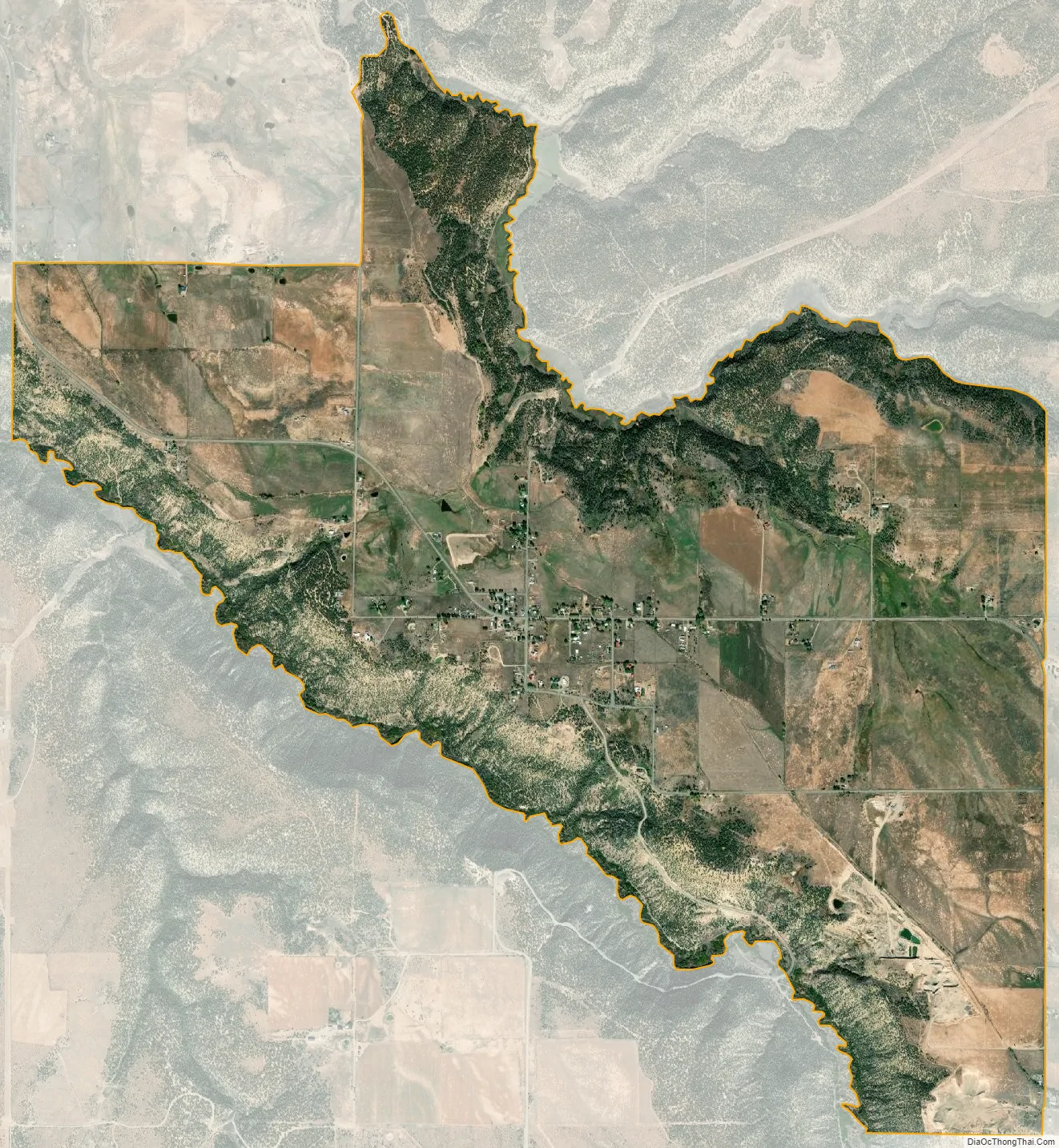
Redvale city Satellite Map
Geography
Redvale is in southern Montrose County near the eastern end of the Colorado Plateau. The community is bordered to the south by San Miguel County. It sits atop Wrights Mesa, bordered by Naturita Canyon to the southwest and Maverick Draw to the northeast. Colorado State Highway 145 passes through the community, leading northwest 10 miles (16 km) to Naturita and southeast 9 miles (14 km) to Norwood.
The Redvale CDP has an area of 4.7 square miles (12.1 km), all land. The community is in the watershed of the San Miguel River, leading northwest to the Dolores River which flows into the Colorado River in Utah.
See also
Map of Colorado State and its subdivision:- Adams
- Alamosa
- Arapahoe
- Archuleta
- Baca
- Bent
- Boulder
- Broomfield
- Chaffee
- Cheyenne
- Clear Creek
- Conejos
- Costilla
- Crowley
- Custer
- Delta
- Denver
- Dolores
- Douglas
- Eagle
- El Paso
- Elbert
- Fremont
- Garfield
- Gilpin
- Grand
- Gunnison
- Hinsdale
- Huerfano
- Jackson
- Jefferson
- Kiowa
- Kit Carson
- La Plata
- Lake
- Larimer
- Las Animas
- Lincoln
- Logan
- Mesa
- Mineral
- Moffat
- Montezuma
- Montrose
- Morgan
- Otero
- Ouray
- Park
- Phillips
- Pitkin
- Prowers
- Pueblo
- Rio Blanco
- Rio Grande
- Routt
- Saguache
- San Juan
- San Miguel
- Sedgwick
- Summit
- Teller
- Washington
- Weld
- Yuma
- Alabama
- Alaska
- Arizona
- Arkansas
- California
- Colorado
- Connecticut
- Delaware
- District of Columbia
- Florida
- Georgia
- Hawaii
- Idaho
- Illinois
- Indiana
- Iowa
- Kansas
- Kentucky
- Louisiana
- Maine
- Maryland
- Massachusetts
- Michigan
- Minnesota
- Mississippi
- Missouri
- Montana
- Nebraska
- Nevada
- New Hampshire
- New Jersey
- New Mexico
- New York
- North Carolina
- North Dakota
- Ohio
- Oklahoma
- Oregon
- Pennsylvania
- Rhode Island
- South Carolina
- South Dakota
- Tennessee
- Texas
- Utah
- Vermont
- Virginia
- Washington
- West Virginia
- Wisconsin
- Wyoming