Saguache (sə-WAHTCH /səˈwɑːtʃ/ (listen)) is a Statutory Town in and the county seat of Saguache County, Colorado, United States. The population was 539 at the United States Census 2020.
| Name: | Saguache town |
|---|---|
| LSAD Code: | 43 |
| LSAD Description: | town (suffix) |
| State: | Colorado |
| County: | Saguache County |
| Incorporated: | August 13, 1891 |
| Elevation: | 7,703 ft (2,348 m) |
| Total Area: | 0.39 sq mi (1.02 km²) |
| Land Area: | 0.39 sq mi (1.02 km²) |
| Water Area: | 0.00 sq mi (0.00 km²) |
| Total Population: | 539 |
| Population Density: | 1,400/sq mi (530/km²) |
| ZIP code: | 81149 |
| Area code: | 719 |
| FIPS code: | 0867005 |
| Website: | www.colorado.gov/saguache |
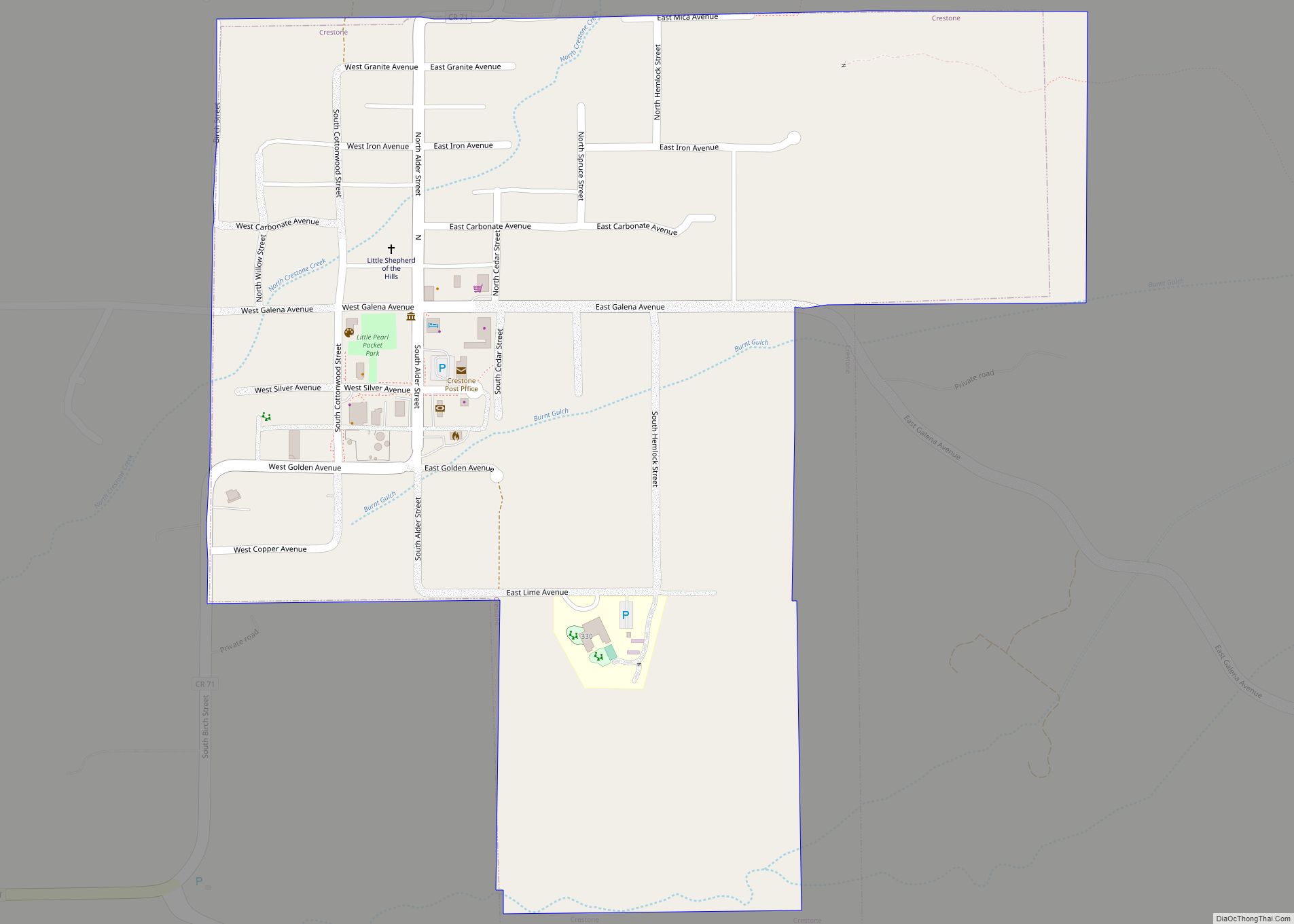
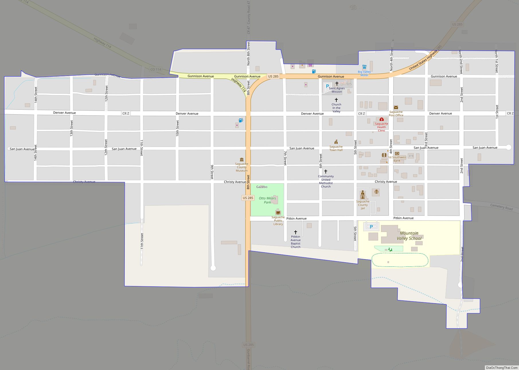
Online Interactive Map
Click on ![]() to view map in "full screen" mode.
to view map in "full screen" mode.
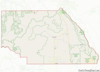
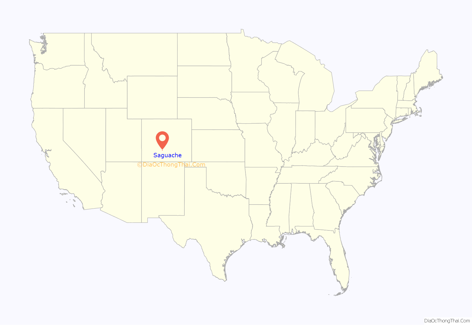
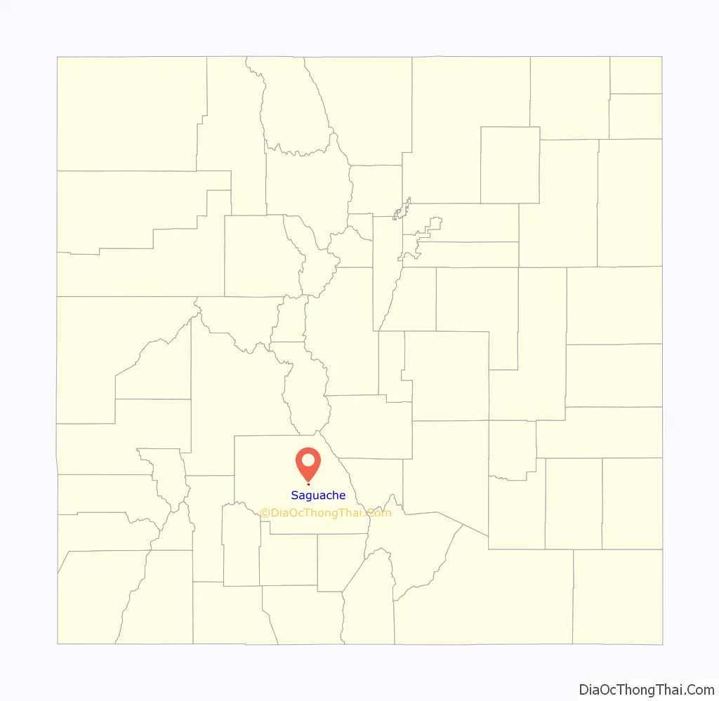
Saguache location map. Where is Saguache town?
History
Saguache is a small historical village in an agricultural area in southern Colorado at the northern gateway to the San Luis Valley, a valley between the Sangre de Cristo Range on the east and the San Juan Mountains to the west. Saguache Creek flows through the town from its beginnings high in the San Juan mountains. The site has been known for centuries to Native Americans who moved down from their summer homes in the mountains to the valley during the winter months. The Spanish began to move into the area in the 1600s and Spanish sheepherders passed through each year as they drove their flocks into the hills for summer grazing. Later the early white settlers and miners passed through this area, many seeking passage west along the Old Spanish Trail. In the mid-1860s, the first permanent white settlements were established in Saguache and the nearby town of Villa Grove. Saguache County was officially founded in 1866.
The formation of the town was influenced by the occupations and needs of the era. Beginning as a trading post, in the late 1800s mining became a significant influence as the Colorado mining boom brought hundreds of mining operations to the surrounding mountains and the miners needed a steady supply of food and other goods.
The town was founded by Otto Mears, who came to Saguache in 1867. Mears constructed a wheat thresher and a grist mill for thrashing and grinding wheat to make flour to supply Saguache and the surrounding mines. He also built toll roads over the nearby mountain passes to use for hauling supplies to mining camps to the north, and to further open the area to settlement. The Saguache Town Company was formed in 1874 turning Saguache into a booming supply town. Mears also established a newspaper, the Saguache Chronicle, to attract pioneers to Saguache. Mears later helped build the Million Dollar Highway.
Today
From its early days as a boom town, the population of Saguache has shrunk to around 500 residents. The Saguache visitor guide writes that “In its heyday, Saguache could boast of having the Colorado Hall (serving the purest wines and liquors), the Saguache Meat Market, a boarding house, a grocery, law firms, a hardware store, a hotel, a sawmill, and The Saguache Chronicle newspaper.” After several name changes, The Saguache Chronicle eventually became The Saguache Crescent. The paper is printed every week on a flatbed press built in 1915 with metal type cast on a Linotype composing machine. The Linotype may be the only one still in use in the United States. It is also still the county’s “paper of record,” and is operated by a third generation descendant of the family who purchased it in 1917.
The early sheep ranching eventually gave way to cattle and alfalfa hay production. Present-day Saguache has “one school, a library, a museum, four churches, two gas stations, one liquor store, two grocery stores, two restaurants, a sawmill, and an organic farm.”
Name
According to a 2013 Denver Post article entitled, “What’s in a Colorado name pronunciation?”, the name Saguache (pronounced /səˈwɑːtʃ/ (listen)) comes from a Ute language word meaning “sand dune”. A Native American, Naranjo, explains the history of the name: “The Utes don’t have an alphabet. The way the immigrants heard it, the way you hear it, is how they spelled it. The word is ‘sə wŭp;’ it means ‘sand dunes.’ But the immigrants couldn’t pronounce it, so they called it ‘sə wäch.’ ”
But according to a 1995 letter to the editor of the Colorado Central Magazine, the name Saguache means “Blue earth — water at the blue earth.” The writer had written to correct an article in which the word was said to mean “green place”, but according to the writer, the word comes from a shortened form of the Ute language word “Saguaguachipa.” The Ute tribe encampments were common in the area around the present-day community and the name “referred to springs in which blue earth was said to be found to the north”. The Editors replied: “The Ute Dictionary, published in 1977 by the Southern Ute Indian Tribe of Ignacio, Colo., defines “sagwa-ci” [diacritical marks omitted] as “‘Saguache’, lit. ‘green place’; name of a town in the San Luis Valley in So. Colorado …” One source states that the “blue earth” mentioned refers to a deposit of blue clay found near the creek.
The Colorado State Historical Society has a different take on the meaning: The note on a community monument: Saguache, “the name derived from the Indian word `Blue Water’.”
The Spanish language version of this name is usually spelled “Saguache”, while the English language version is usually spelled “Sawatch”.
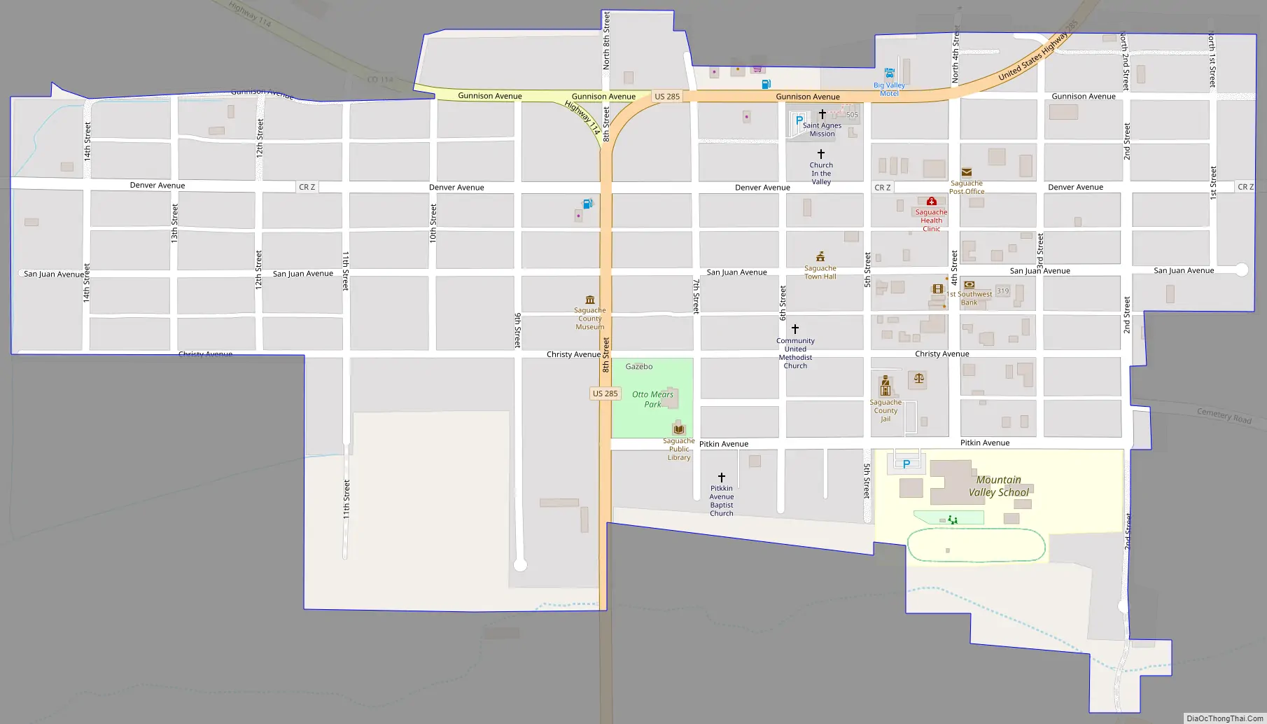
Saguache Road Map
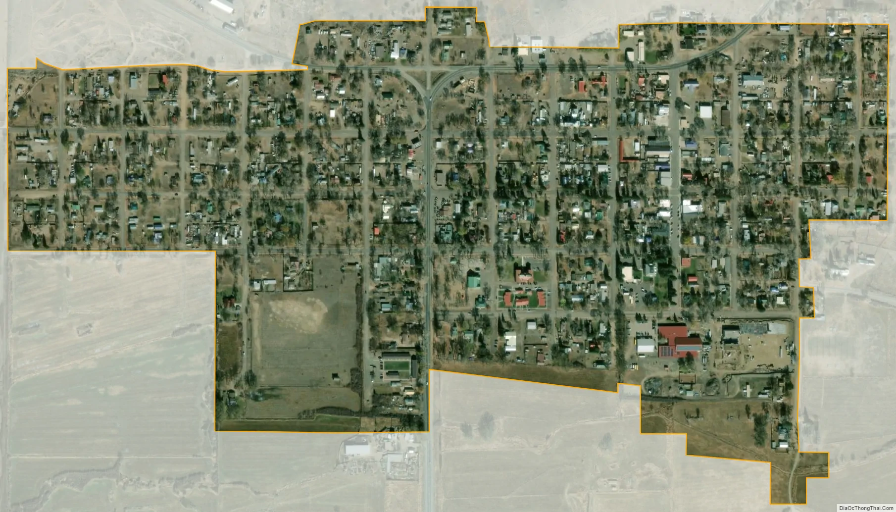
Saguache city Satellite Map
Geography
Saguache is served by U.S. Route 285 and Colorado State Highway 114. Saguache Creek flows past to the southwest of the community.
According to the United States Census Bureau, the town has a total area of 0.4 square miles (1.0 km), all of it land.
See also
Map of Colorado State and its subdivision:- Adams
- Alamosa
- Arapahoe
- Archuleta
- Baca
- Bent
- Boulder
- Broomfield
- Chaffee
- Cheyenne
- Clear Creek
- Conejos
- Costilla
- Crowley
- Custer
- Delta
- Denver
- Dolores
- Douglas
- Eagle
- El Paso
- Elbert
- Fremont
- Garfield
- Gilpin
- Grand
- Gunnison
- Hinsdale
- Huerfano
- Jackson
- Jefferson
- Kiowa
- Kit Carson
- La Plata
- Lake
- Larimer
- Las Animas
- Lincoln
- Logan
- Mesa
- Mineral
- Moffat
- Montezuma
- Montrose
- Morgan
- Otero
- Ouray
- Park
- Phillips
- Pitkin
- Prowers
- Pueblo
- Rio Blanco
- Rio Grande
- Routt
- Saguache
- San Juan
- San Miguel
- Sedgwick
- Summit
- Teller
- Washington
- Weld
- Yuma
- Alabama
- Alaska
- Arizona
- Arkansas
- California
- Colorado
- Connecticut
- Delaware
- District of Columbia
- Florida
- Georgia
- Hawaii
- Idaho
- Illinois
- Indiana
- Iowa
- Kansas
- Kentucky
- Louisiana
- Maine
- Maryland
- Massachusetts
- Michigan
- Minnesota
- Mississippi
- Missouri
- Montana
- Nebraska
- Nevada
- New Hampshire
- New Jersey
- New Mexico
- New York
- North Carolina
- North Dakota
- Ohio
- Oklahoma
- Oregon
- Pennsylvania
- Rhode Island
- South Carolina
- South Dakota
- Tennessee
- Texas
- Utah
- Vermont
- Virginia
- Washington
- West Virginia
- Wisconsin
- Wyoming