Seven Hills is an unincorporated community and a census-designated place (CDP) located in and governed by Boulder County, Colorado, United States. The CDP is a part of the Boulder, CO Metropolitan Statistical Area. The population of the Seven Hills CDP was 129 at the United States Census 2020. The Boulder post office (Zip Code 80302) serves the area.
| Name: | Seven Hills CDP |
|---|---|
| LSAD Code: | 57 |
| LSAD Description: | CDP (suffix) |
| State: | Colorado |
| County: | Boulder County |
| Total Area: | 0.489 sq mi (1.267 km²) |
| Land Area: | 0.489 sq mi (1.266 km²) |
| Water Area: | 0.0003 sq mi (0.0008 km²) |
| Total Population: | 129 |
| Population Density: | 260/sq mi (100/km²) |
| ZIP code: | Boulder 80302 |
| FIPS code: | 0869110 |
Online Interactive Map
Click on ![]() to view map in "full screen" mode.
to view map in "full screen" mode.
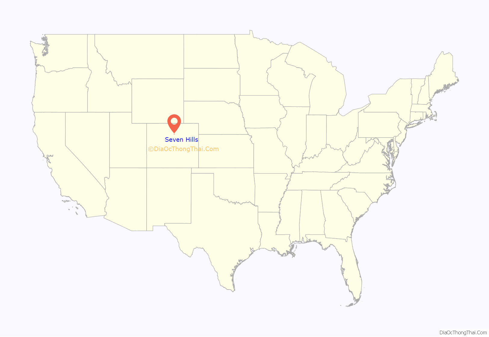
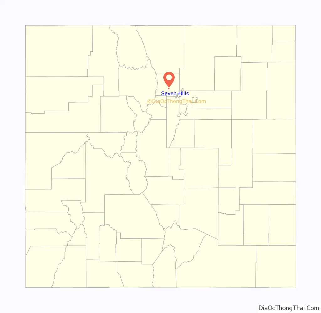
Seven Hills location map. Where is Seven Hills CDP?
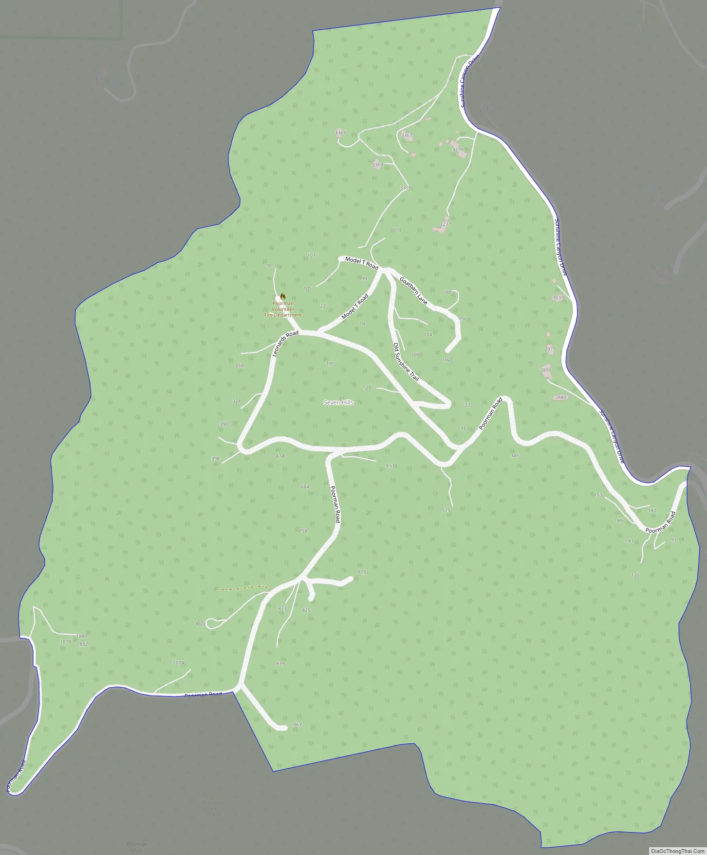
Seven Hills Road Map
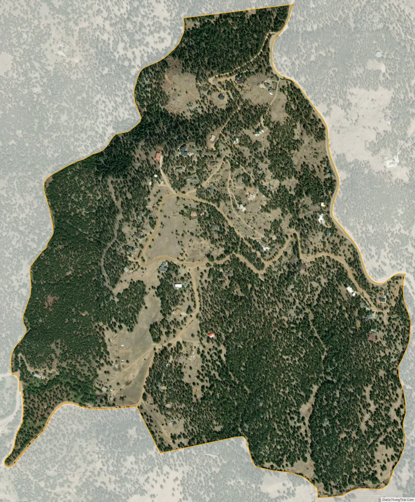
Seven Hills city Satellite Map
Geography
Seven Hills is located in central Boulder County, in the hills west of the city of Boulder. It lies between Sunshine Canyon Drive, which forms the northeast edge of the CDP, and Fourmile Canyon Drive, which touches the southwest edge of the CDP. Elevations range from 6,050 feet (1,840 m) at Fourmile Canyon Drive to 6,780 feet (2,070 m) along Sunshine Canyon Drive. Poorman Road connects the two drives, running through the center of the CDP.
The Seven Hills CDP has an area of 313 acres (1.267 km), including 0.20 acres (0.0008 km) of water.
See also
Map of Colorado State and its subdivision:- Adams
- Alamosa
- Arapahoe
- Archuleta
- Baca
- Bent
- Boulder
- Broomfield
- Chaffee
- Cheyenne
- Clear Creek
- Conejos
- Costilla
- Crowley
- Custer
- Delta
- Denver
- Dolores
- Douglas
- Eagle
- El Paso
- Elbert
- Fremont
- Garfield
- Gilpin
- Grand
- Gunnison
- Hinsdale
- Huerfano
- Jackson
- Jefferson
- Kiowa
- Kit Carson
- La Plata
- Lake
- Larimer
- Las Animas
- Lincoln
- Logan
- Mesa
- Mineral
- Moffat
- Montezuma
- Montrose
- Morgan
- Otero
- Ouray
- Park
- Phillips
- Pitkin
- Prowers
- Pueblo
- Rio Blanco
- Rio Grande
- Routt
- Saguache
- San Juan
- San Miguel
- Sedgwick
- Summit
- Teller
- Washington
- Weld
- Yuma
- Alabama
- Alaska
- Arizona
- Arkansas
- California
- Colorado
- Connecticut
- Delaware
- District of Columbia
- Florida
- Georgia
- Hawaii
- Idaho
- Illinois
- Indiana
- Iowa
- Kansas
- Kentucky
- Louisiana
- Maine
- Maryland
- Massachusetts
- Michigan
- Minnesota
- Mississippi
- Missouri
- Montana
- Nebraska
- Nevada
- New Hampshire
- New Jersey
- New Mexico
- New York
- North Carolina
- North Dakota
- Ohio
- Oklahoma
- Oregon
- Pennsylvania
- Rhode Island
- South Carolina
- South Dakota
- Tennessee
- Texas
- Utah
- Vermont
- Virginia
- Washington
- West Virginia
- Wisconsin
- Wyoming


