Steamboat Springs is a home rule municipality that is the county seat and the most populous municipality of Routt County, Colorado, United States. Steamboat Springs is the principal city of the Steamboat Springs, CO Micropolitan Statistical Area. The population was 13,224 at the 2020 census.
The city is a winter ski resort destination, including the Steamboat Ski Resort on Mount Werner in the Park Range just east of the town and the much smaller Howelsen Hill Ski Area. Steamboat Springs has produced more athletes for the Winter Olympics than any other town in North America.
Steamboat Springs – known colloquially as “The ‘Boat” – is located in the upper valley of the Yampa River, along U.S. Highway 40, just west of the Continental Divide and Rabbit Ears Pass. It is located approximately 150 miles northwest of Denver, and sits approximately 45 miles south of the Wyoming border. It is served by Steamboat Springs Airport (general aviation) and commercial service at nearby Yampa Valley Airport.
| Name: | Steamboat Springs city |
|---|---|
| LSAD Code: | 25 |
| LSAD Description: | city (suffix) |
| State: | Colorado |
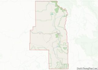
| County: | Routt County |
| Incorporated: | July 19, 1900 |
| Elevation: | 6,732 ft (2,052 m) |
| Total Area: | 9.90 sq mi (25.64 km²) |
| Land Area: | 9.89 sq mi (25.61 km²) |
| Water Area: | 0.01 sq mi (0.03 km²) |
| Total Population: | 13,224 |
| Population Density: | 1,300/sq mi (520/km²) |
| Area code: | 970 |
| FIPS code: | 0873825 |
| GNISfeature ID: | 0172749 |
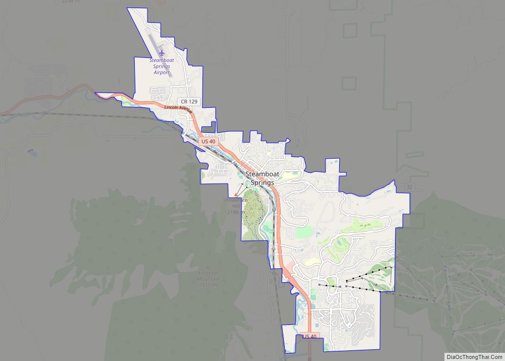
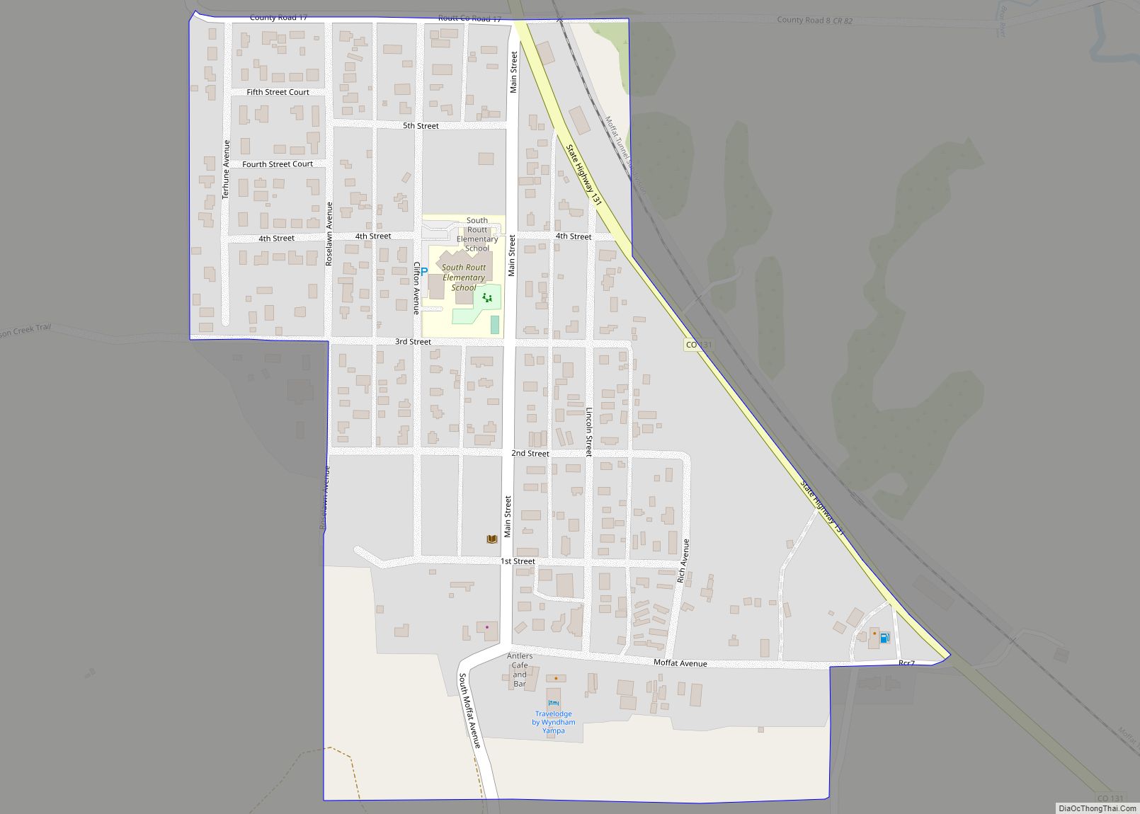
Online Interactive Map
Click on ![]() to view map in "full screen" mode.
to view map in "full screen" mode.
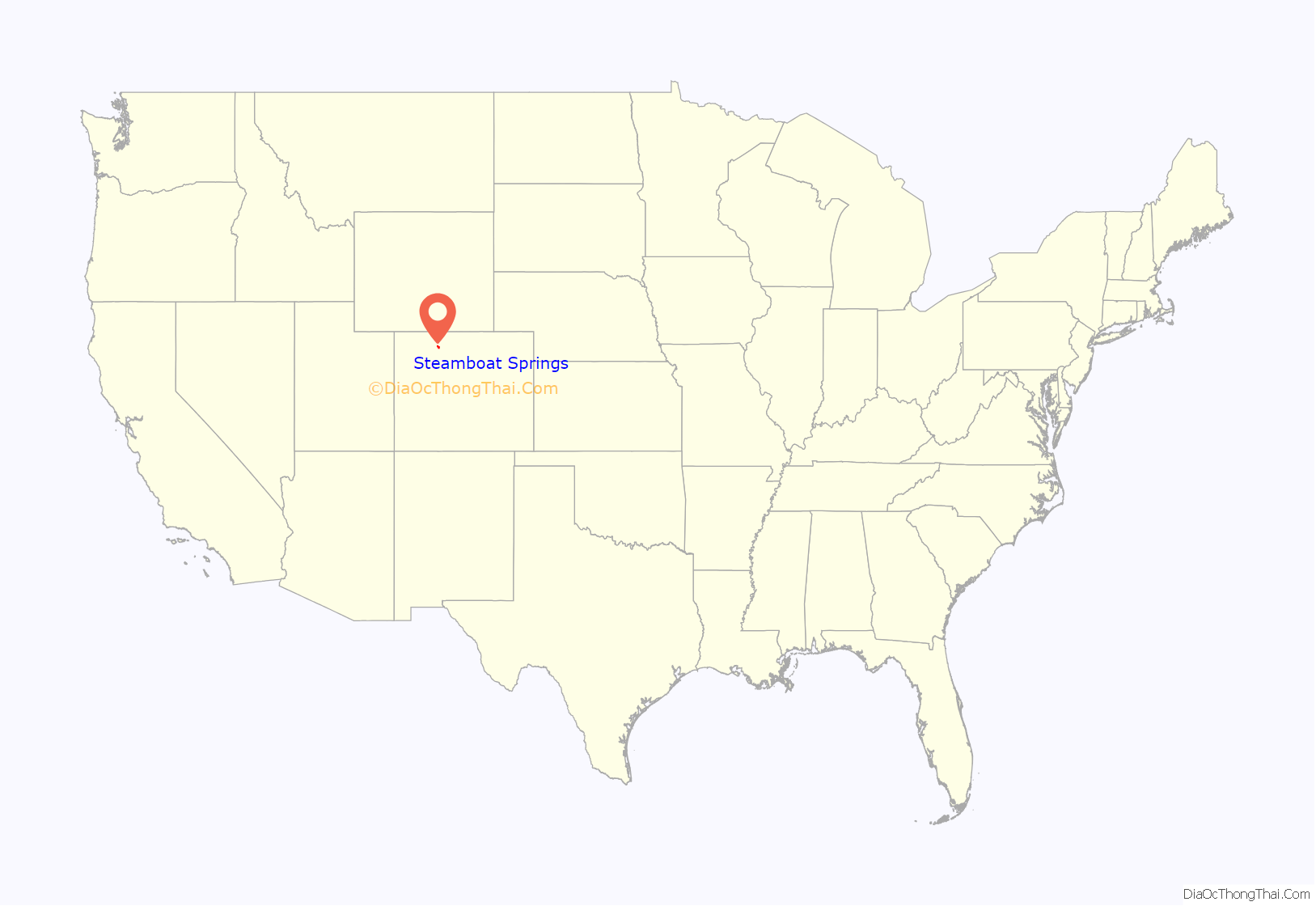
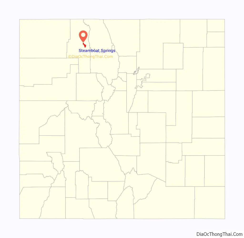
Steamboat Springs location map. Where is Steamboat Springs city?
History
The area surrounding Steamboat Springs was originally inhabited by the Yampatika band of the Utes, who hunted in the valley during the summer. Trappers began to move through the area during the first decades of the 19th century. James Harvey Crawford, the founder of Steamboat Springs, first arrived in the spring of 1874. The Crawford family moved there in 1876, and for the first five years were the sole permanent white residents of the town. The native Utes were forcibly removed from the area to a reservation in Utah by the U.S. Army starting in 1879. Milestones in the development of the pioneer town included the first sawmill in 1873, incorporation of the town in 1900, and the arrival of the railroad in 1909. The economy of the region was originally based on ranching and mining, which still have a large presence in the county.
Steamboat is home to natural hot springs that are located throughout the area (see Geography). Upon first hearing a chugging sound, early trappers believed that a steamboat was coming down the river. When the trappers saw that there was no steamboat, and that the sound was coming from a hot spring, they decided to name the spring Steamboat Spring.
Originally, skiing was the only method of transportation during harsh and snowy Rocky Mountain winters. In turn, the popularity of skiing as a winter pastime catalyzed development of the town and other communities all over the Rocky Mountains. In 1913, Carl Howelsen, a Norwegian, moved to town and introduced ski jumping. Howelsen built the first jump on Howelsen Hill, now part of the Howelsen Ski Area. He also founded the annual Winter Carnival, a celebration still held each winter. The festival includes ski racing and jumping, dog sledding, and chariot events down Lincoln Avenue, the city’s main street. Light shows on both Mount Werner and Howelsen Hill are highlights. Howelsen also founded the Steamboat Springs Winter Sports Club and built the town’s first ski jumps. The oldest continually operating ski area in North America, Howelsen Hill, now bears his name and is one of just three complete ski jumping complexes in the United States.
The Steamboat Ski Resort was largely established by two local men, Jim Temple and John Fetcher. Temple led the effort to develop the area. Fetcher, a local rancher, was the main designer and builder. The resort opened on what was then called Storm Mountain in 1963.
In 1974, The Industrial Company (TIC) was started in Steamboat Springs and has since grown into one of the largest industrial construction companies in the United States with revenues of approximately $2 billion in 2007. The company is one of the largest employers in Routt County and has more than 9,000 employees worldwide. TIC – The Industrial Company was acquired by Kiewit Engineering and all operations except the Training Center moved elsewhere (Denver, etc.). The main TIC complex on Routt County Road 129 has been acquired by Yampa Valley Electric Association as their new headquarters, with extensive renovation. This property provides ample areas for offices, vehicle maintenance, and construction laydown activities.
In 1993, the City Council of Steamboat Springs, Colorado conducted a poll of its residents to choose a new name for the bridge that crossed the Yampa River on Shield Drive. With 7,717 votes, the winning name was “James Brown Soul Center of the Universe Bridge”. The bridge was officially dedicated in September 1993, and James Brown appeared at the ribbon-cutting ceremony for the event.
Historic buildings
Historic buildings in Steamboat Springs include:
- Christian Science Society, at 7th and Oak, was built of logs in 1934 and is now listed on the National Register of Historic Places.
- The Crawford House, at 12th and Crawford, was built of local stone in 1894 by the founder of Steamboat, James Harvey Crawford, and is now listed on the National Register of Historic Places.
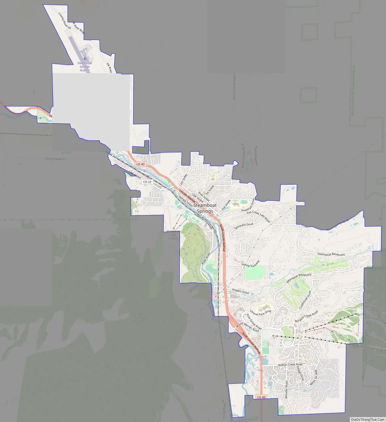
Steamboat Springs Road Map
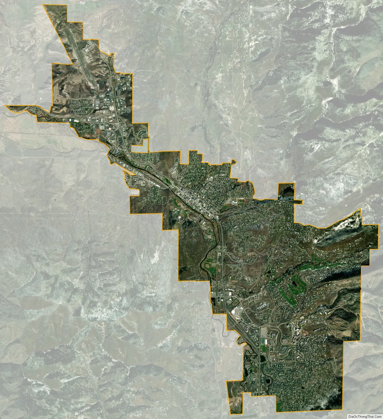
Steamboat Springs city Satellite Map
Geography
According to the United States Census Bureau, the city has a total area of 10.1 square miles (26 km), all of it land except for the Yampa River.
The Yampa Valley and surrounding area contain several geothermal hot springs. The city is named after the Steamboat Spring, located near the present-day library and the old train depot. The spring itself was so named because its bubbling sounded like a steamboat to early settlers.
Though there are no steamboats in the town, except for an allegorical “steamboat” playground in West Lincoln Park which was designed to resemble a steamboat and has since been mostly torn down, the area does offer hot springs that are open to the public.
The Yampa River flows through the middle of town, with several tributary creeks joining in town – Fish Creek, Spring Creek, Soda Creek, and more.
Climate
According to the Köppen Climate Classification system, Steamboat Springs has a warm-summer humid continental climate, abbreviated “Dfb” on climate maps. The hottest temperature recorded in Steamboat Springs was 100 °F (37.8 °C) on June 29, 1990, while the coldest temperature recorded was −54 °F (−47.8 °C) on January 7, 1913.
See also
Map of Colorado State and its subdivision:- Adams
- Alamosa
- Arapahoe
- Archuleta
- Baca
- Bent
- Boulder
- Broomfield
- Chaffee
- Cheyenne
- Clear Creek
- Conejos
- Costilla
- Crowley
- Custer
- Delta
- Denver
- Dolores
- Douglas
- Eagle
- El Paso
- Elbert
- Fremont
- Garfield
- Gilpin
- Grand
- Gunnison
- Hinsdale
- Huerfano
- Jackson
- Jefferson
- Kiowa
- Kit Carson
- La Plata
- Lake
- Larimer
- Las Animas
- Lincoln
- Logan
- Mesa
- Mineral
- Moffat
- Montezuma
- Montrose
- Morgan
- Otero
- Ouray
- Park
- Phillips
- Pitkin
- Prowers
- Pueblo
- Rio Blanco
- Rio Grande
- Routt
- Saguache
- San Juan
- San Miguel
- Sedgwick
- Summit
- Teller
- Washington
- Weld
- Yuma
- Alabama
- Alaska
- Arizona
- Arkansas
- California
- Colorado
- Connecticut
- Delaware
- District of Columbia
- Florida
- Georgia
- Hawaii
- Idaho
- Illinois
- Indiana
- Iowa
- Kansas
- Kentucky
- Louisiana
- Maine
- Maryland
- Massachusetts
- Michigan
- Minnesota
- Mississippi
- Missouri
- Montana
- Nebraska
- Nevada
- New Hampshire
- New Jersey
- New Mexico
- New York
- North Carolina
- North Dakota
- Ohio
- Oklahoma
- Oregon
- Pennsylvania
- Rhode Island
- South Carolina
- South Dakota
- Tennessee
- Texas
- Utah
- Vermont
- Virginia
- Washington
- West Virginia
- Wisconsin
- Wyoming