The town of Two Buttes is a Statutory Town located in Baca County, Colorado, United States. The population was 34 at the 2020 census.
| Name: | Two Buttes town |
|---|---|
| LSAD Code: | 43 |
| LSAD Description: | town (suffix) |
| State: | Colorado |
| County: | Baca County |
| Incorporated: | 1911-10-19 |
| Elevation: | 4,108 ft (1,252 m) |
| Total Area: | 0.25 sq mi (0.64 km²) |
| Land Area: | 0.25 sq mi (0.64 km²) |
| Water Area: | 0.00 sq mi (0.00 km²) |
| Total Population: | 34 |
| Population Density: | 140/sq mi (53/km²) |
| ZIP code: | 81084 |
| Area code: | 719 |
| FIPS code: | 0879270 |
| GNISfeature ID: | 0196063 |
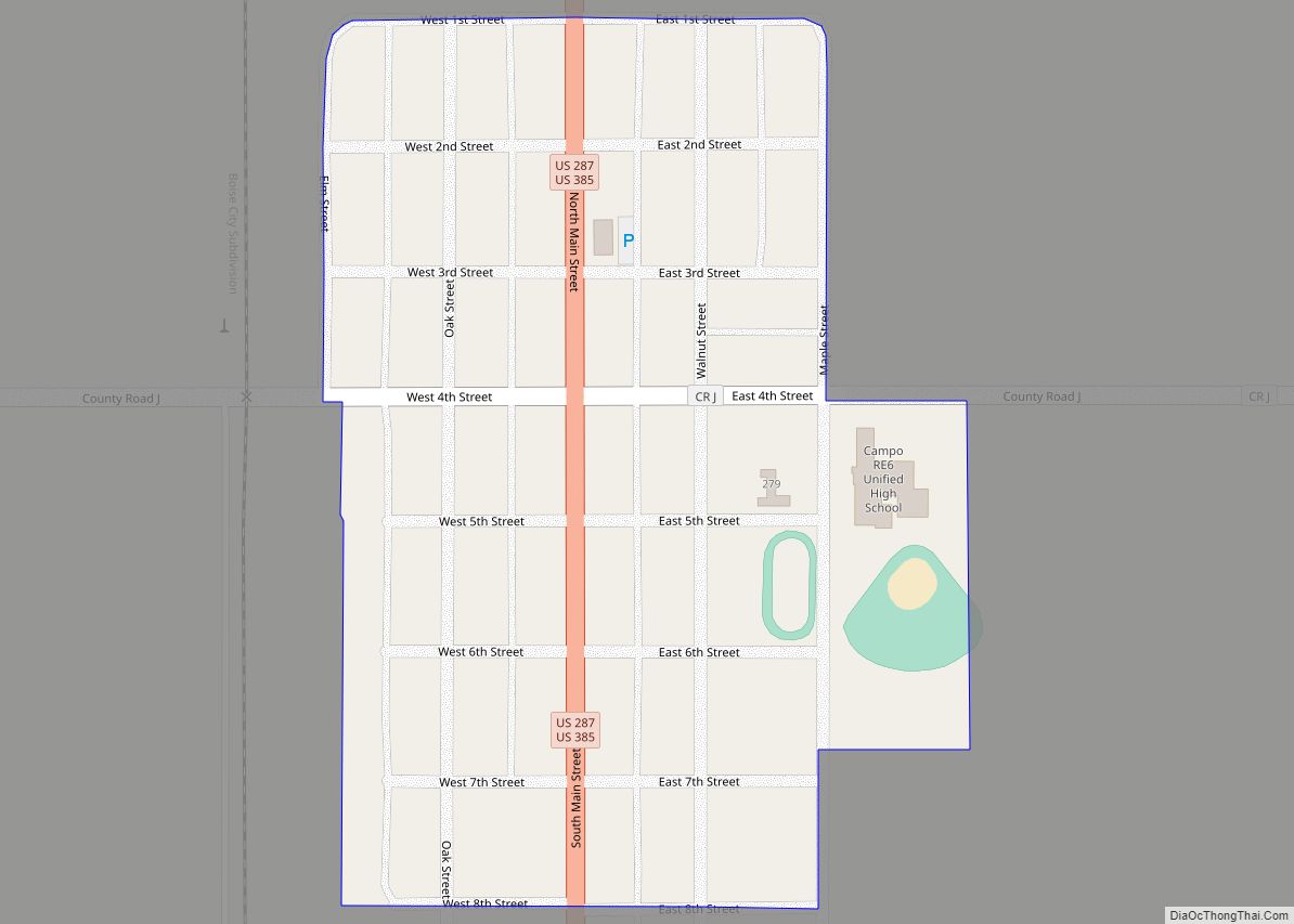
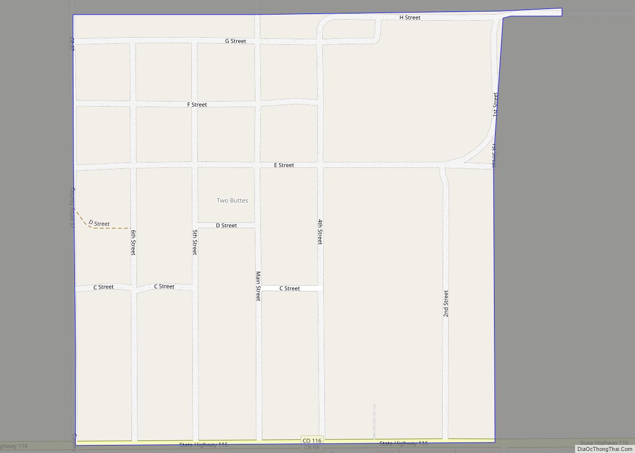
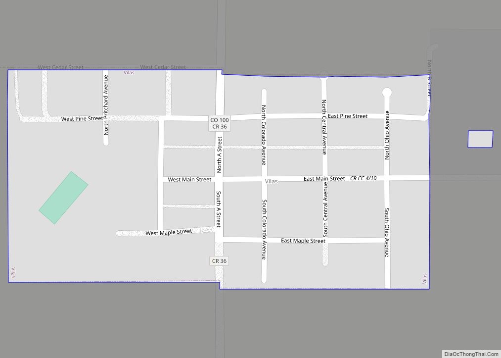
Online Interactive Map
Click on ![]() to view map in "full screen" mode.
to view map in "full screen" mode.
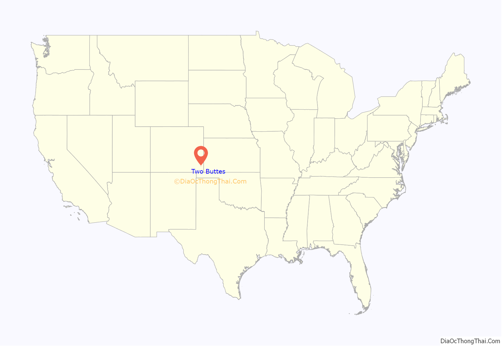
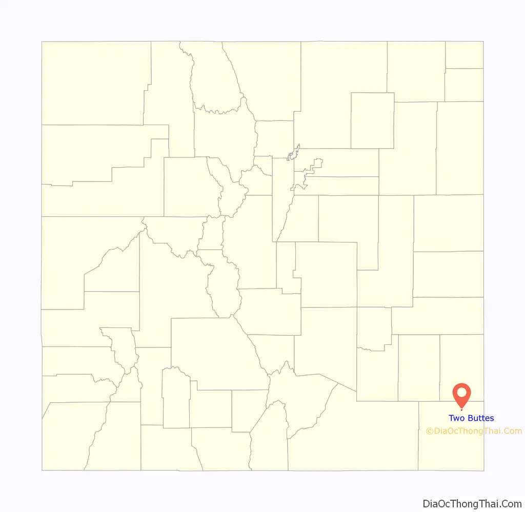
Two Buttes location map. Where is Two Buttes town?
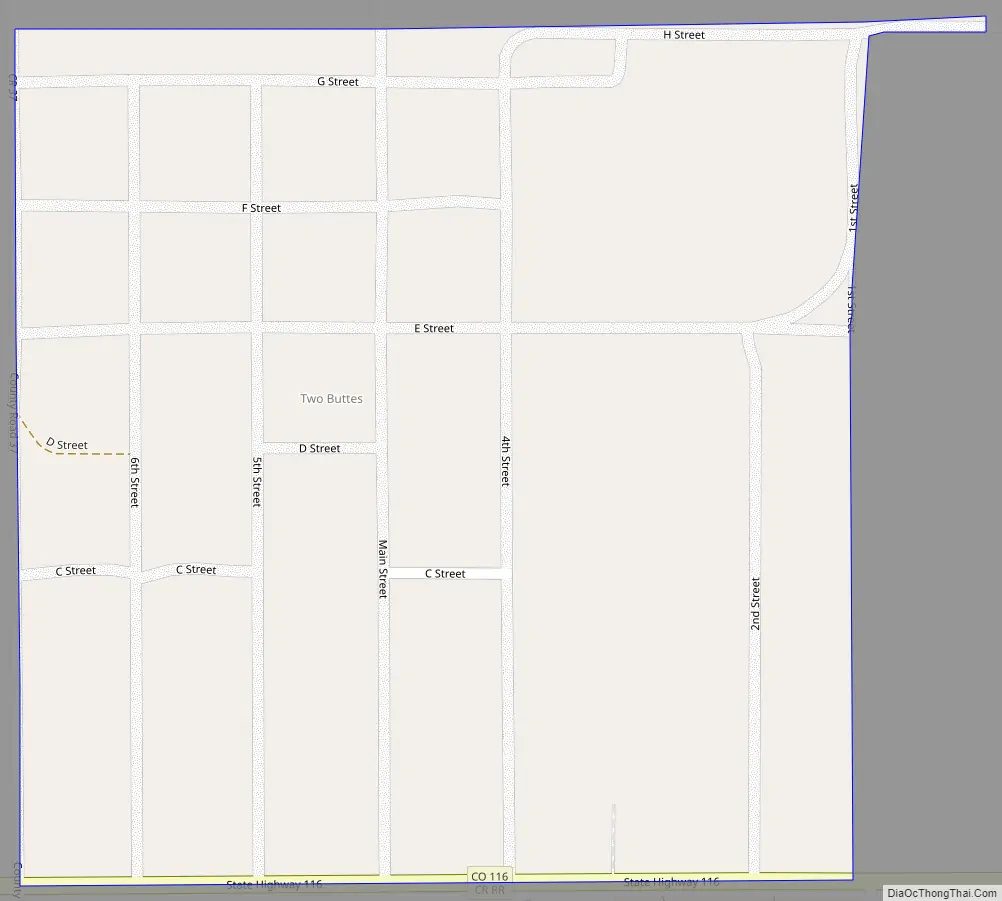
Two Buttes Road Map
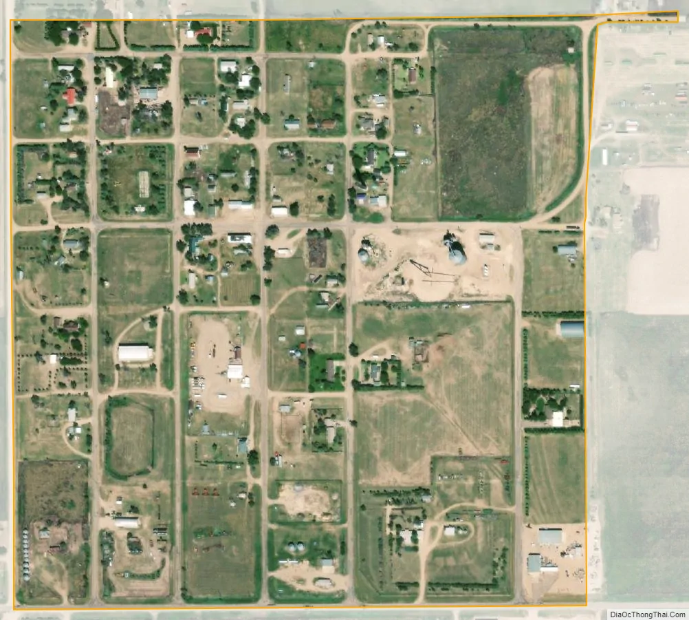
Two Buttes city Satellite Map
Geography
Two Buttes is located in northeast Baca County at 37°33′40″N 102°23′52″W / 37.56111°N 102.39778°W / 37.56111; -102.39778 (37.561046, -102.397729). The hill known as Two Buttes is 8 miles (13 km) to the northwest of the town, overlooking Two Buttes Reservoir on Two Butte Creek, a tributary of the Arkansas River.
The town of Two Buttes is on State Highway 116 and is 23 miles (37 km) by road northeast of Springfield, the Baca County seat. East on Highway 116 it is 20 miles (32 km) to the Kansas border.
According to the United States Census Bureau, the town has a total area of 0.2 square miles (0.52 km), all of it land.
Climate
The Köppen Climate system classifies the weather as semi-arid, abbreviated as BSk.
See also
Map of Colorado State and its subdivision:- Adams
- Alamosa
- Arapahoe
- Archuleta
- Baca
- Bent
- Boulder
- Broomfield
- Chaffee
- Cheyenne
- Clear Creek
- Conejos
- Costilla
- Crowley
- Custer
- Delta
- Denver
- Dolores
- Douglas
- Eagle
- El Paso
- Elbert
- Fremont
- Garfield
- Gilpin
- Grand
- Gunnison
- Hinsdale
- Huerfano
- Jackson
- Jefferson
- Kiowa
- Kit Carson
- La Plata
- Lake
- Larimer
- Las Animas
- Lincoln
- Logan
- Mesa
- Mineral
- Moffat
- Montezuma
- Montrose
- Morgan
- Otero
- Ouray
- Park
- Phillips
- Pitkin
- Prowers
- Pueblo
- Rio Blanco
- Rio Grande
- Routt
- Saguache
- San Juan
- San Miguel
- Sedgwick
- Summit
- Teller
- Washington
- Weld
- Yuma
- Alabama
- Alaska
- Arizona
- Arkansas
- California
- Colorado
- Connecticut
- Delaware
- District of Columbia
- Florida
- Georgia
- Hawaii
- Idaho
- Illinois
- Indiana
- Iowa
- Kansas
- Kentucky
- Louisiana
- Maine
- Maryland
- Massachusetts
- Michigan
- Minnesota
- Mississippi
- Missouri
- Montana
- Nebraska
- Nevada
- New Hampshire
- New Jersey
- New Mexico
- New York
- North Carolina
- North Dakota
- Ohio
- Oklahoma
- Oregon
- Pennsylvania
- Rhode Island
- South Carolina
- South Dakota
- Tennessee
- Texas
- Utah
- Vermont
- Virginia
- Washington
- West Virginia
- Wisconsin
- Wyoming