Campbellton is a town in Jackson County, Florida, United States. The population was 230 at the 2010 census.
| Name: | Campbellton town |
|---|---|
| LSAD Code: | 43 |
| LSAD Description: | town (suffix) |
| State: | Florida |
| County: | Jackson County |
| Elevation: | 184 ft (56 m) |
| Total Area: | 2.68 sq mi (6.93 km²) |
| Land Area: | 2.60 sq mi (6.72 km²) |
| Water Area: | 0.08 sq mi (0.21 km²) |
| Total Population: | 191 |
| Population Density: | 73.60/sq mi (28.42/km²) |
| ZIP code: | 32426 |
| Area code: | 850 |
| FIPS code: | 1209900 |
| GNISfeature ID: | 0279954 |
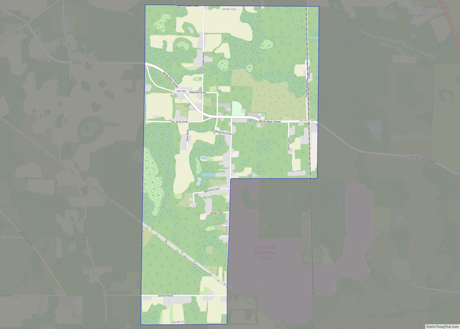
Online Interactive Map
Click on ![]() to view map in "full screen" mode.
to view map in "full screen" mode.
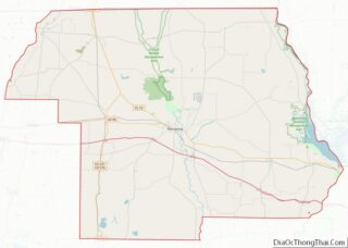
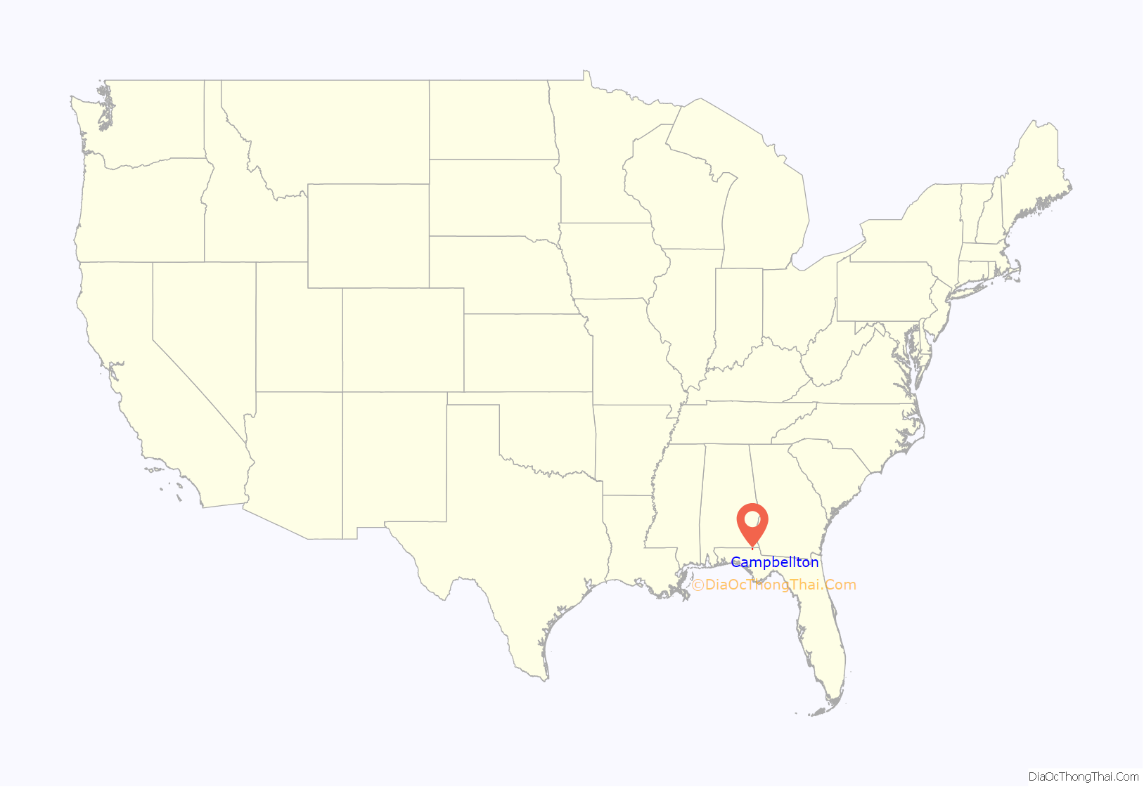
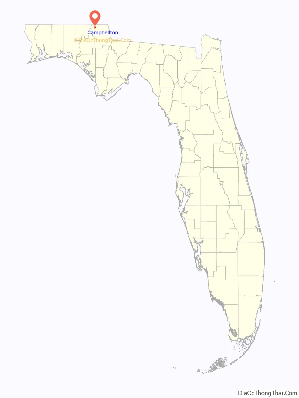
Campbellton location map. Where is Campbellton town?
History
Campbellton was the site of a small skirmish on September 26, 1864, during the waning days of the Civil War. Local Confederate cavalry under the command of Captain Alexander Goodwin unsuccessfully contested the advance of a Federal column led by Brigadier General Alexander Asboth during the preliminary phase of what would become the Battle of Marianna.
The nearby Forks of the Creek Swamp, along the border with Alabama, was a refuge for many Unionist and Confederate deserters during the war. Joseph Sanders, a former Confederate officer who had switched sides and taken a commission as a lieutenant in the Union army, hid out in the swamp for four months during the winter and spring of 1864; he emerged in March of that year to mount an unsuccessful attack on Newton, Alabama, which resulted in the loss of three of his men. Repeated Southern efforts to dislodge the Unionists in the swamp proved unsuccessful.
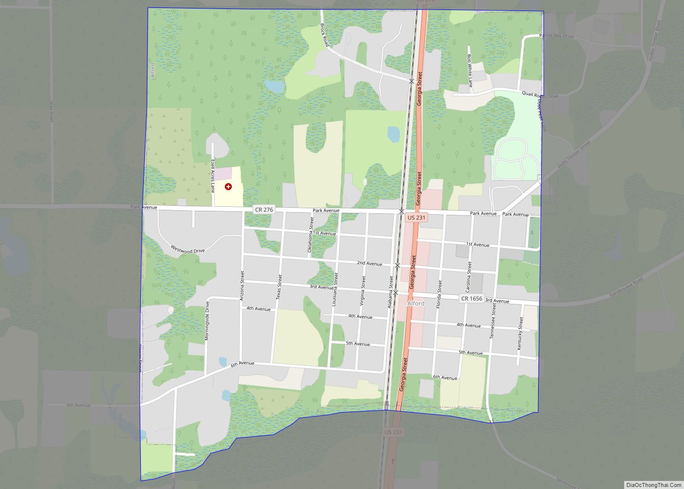
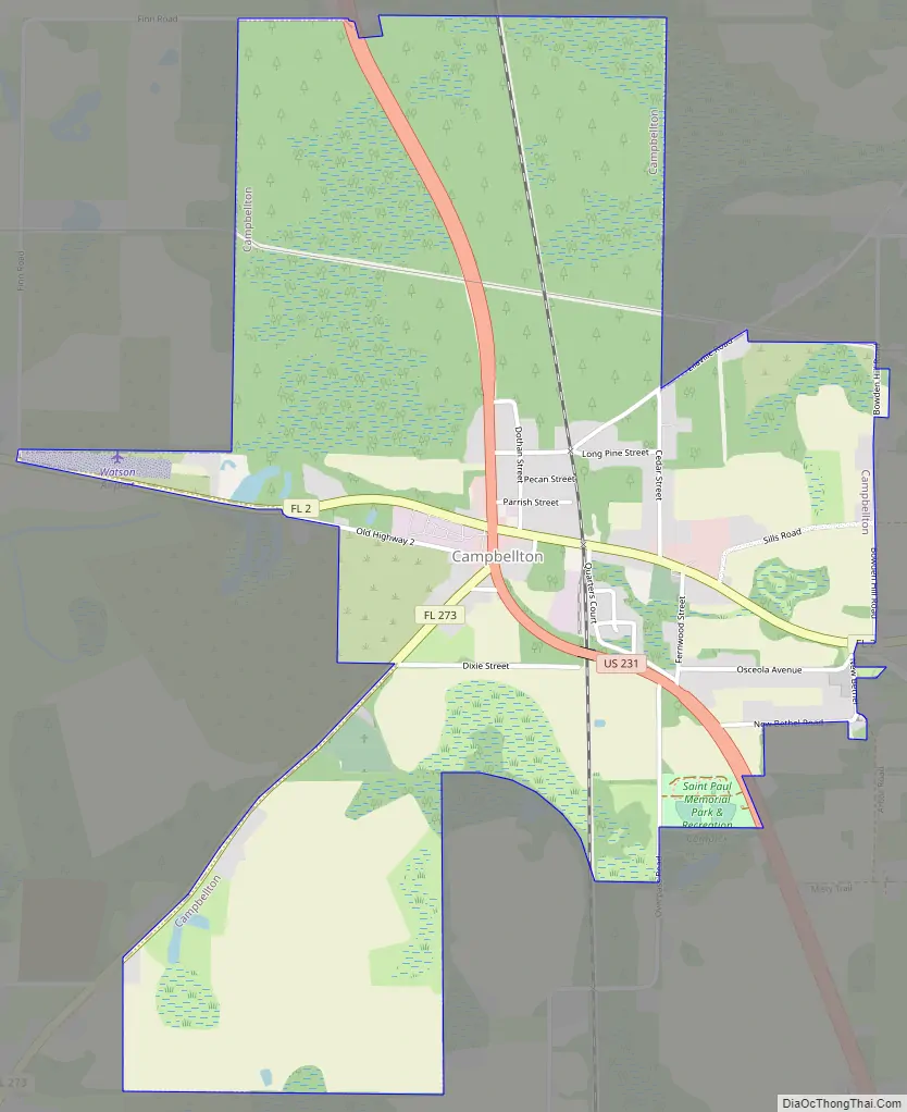
Campbellton Road Map
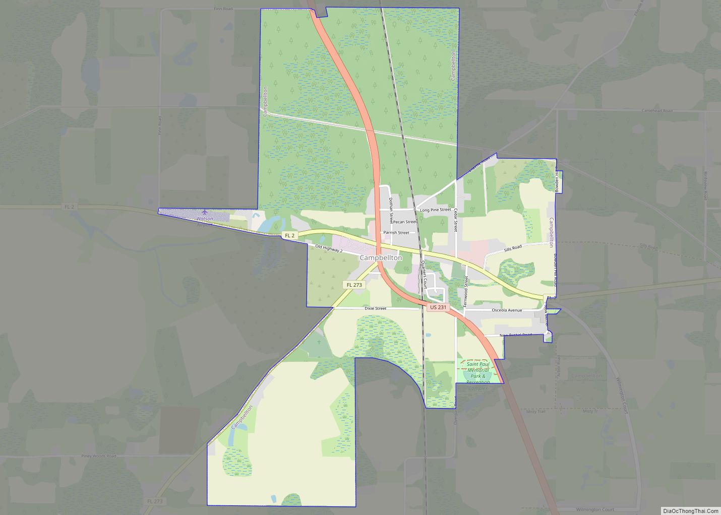
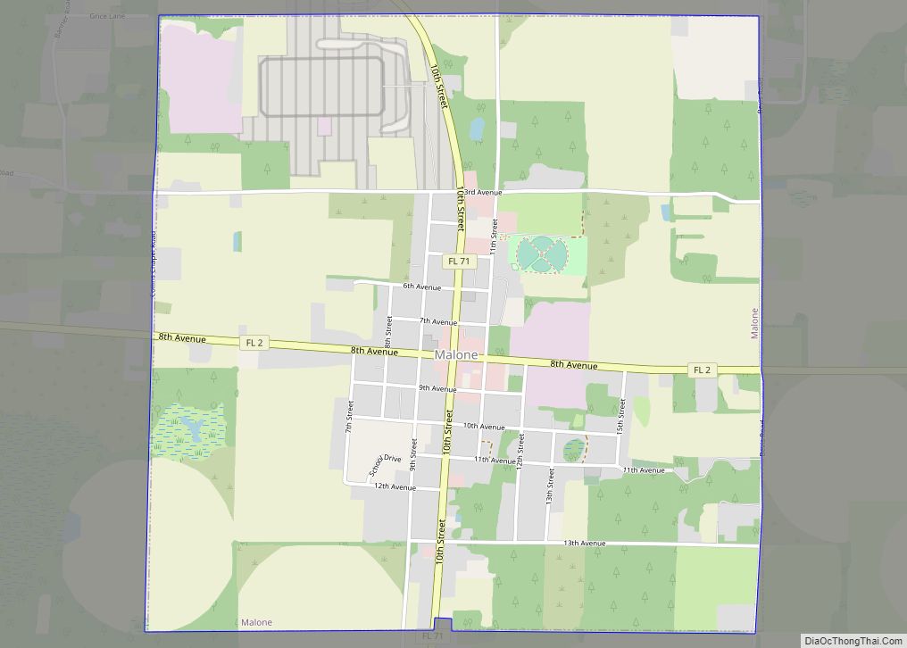
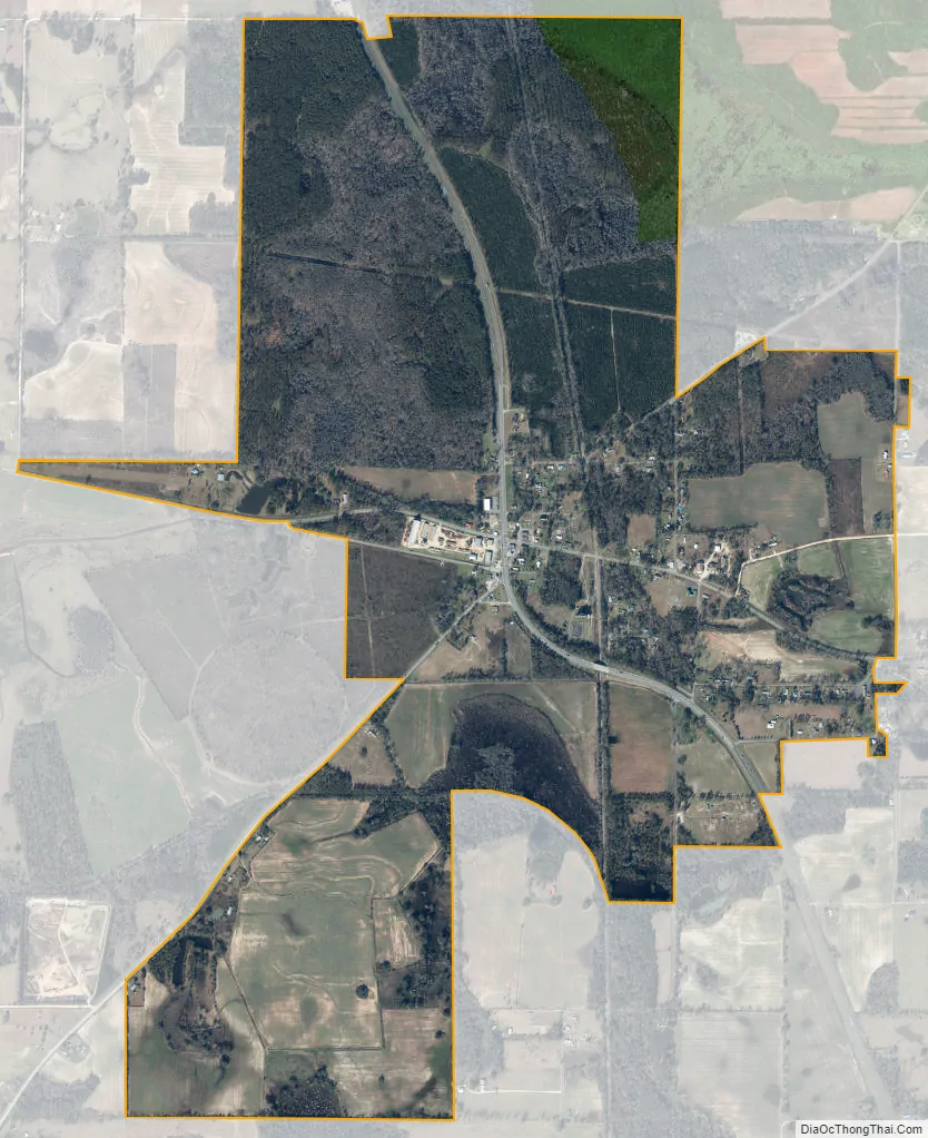
Campbellton city Satellite Map
Geography
Campbellton is located in northwestern Jackson County at 30°56′55″N 85°23′47″W / 30.94861°N 85.39639°W / 30.94861; -85.39639 (30.948587, –85.396472). It sits on a small hill at the junction of U.S. Route 231 and Florida State Road 2. US-231 leads north 19 miles (31 km) to Dothan, Alabama, and south 63 miles (101 km) to Panama City. Marianna, the Jackson County seat, is 17 miles (27 km) to the southeast of Campbellton via US-231 and Florida State Road 73. SR 2 leads east from Campbellton 15 miles (24 km) to Malone and west 6 miles (10 km) to Graceville. SR 273 leads southwest from Campbellton 15 miles (24 km) to Chipley.
According to the United States Census Bureau, Campbellton has a total area of 2.6 square miles (6.7 km), of which 2.5 square miles (6.5 km) are land and 0.1 square miles (0.2 km), or 2.48%, are water.
See also
Map of Florida State and its subdivision:- Alachua
- Baker
- Bay
- Bradford
- Brevard
- Broward
- Calhoun
- Charlotte
- Citrus
- Clay
- Collier
- Columbia
- Desoto
- Dixie
- Duval
- Escambia
- Flagler
- Franklin
- Gadsden
- Gilchrist
- Glades
- Gulf
- Hamilton
- Hardee
- Hendry
- Hernando
- Highlands
- Hillsborough
- Holmes
- Indian River
- Jackson
- Jefferson
- Lafayette
- Lake
- Lee
- Leon
- Levy
- Liberty
- Madison
- Manatee
- Marion
- Martin
- Miami-Dade
- Monroe
- Nassau
- Okaloosa
- Okeechobee
- Orange
- Osceola
- Palm Beach
- Pasco
- Pinellas
- Polk
- Putnam
- Saint Johns
- Saint Lucie
- Santa Rosa
- Sarasota
- Seminole
- Sumter
- Suwannee
- Taylor
- Union
- Volusia
- Wakulla
- Walton
- Washington
- Alabama
- Alaska
- Arizona
- Arkansas
- California
- Colorado
- Connecticut
- Delaware
- District of Columbia
- Florida
- Georgia
- Hawaii
- Idaho
- Illinois
- Indiana
- Iowa
- Kansas
- Kentucky
- Louisiana
- Maine
- Maryland
- Massachusetts
- Michigan
- Minnesota
- Mississippi
- Missouri
- Montana
- Nebraska
- Nevada
- New Hampshire
- New Jersey
- New Mexico
- New York
- North Carolina
- North Dakota
- Ohio
- Oklahoma
- Oregon
- Pennsylvania
- Rhode Island
- South Carolina
- South Dakota
- Tennessee
- Texas
- Utah
- Vermont
- Virginia
- Washington
- West Virginia
- Wisconsin
- Wyoming