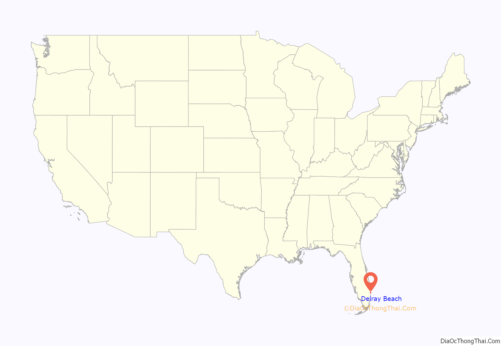
Delray Beach is a city in Palm Beach County, Florida, United States. The population of Delray Beach as of April 1, 2020 was 66,846 according to the 2020 United States Census. Located 52 miles (83 kilometers) north of Miami, Delray Beach is in the Miami metropolitan area.
| Name: | Delray Beach city |
|---|---|
| LSAD Code: | 25 |
| LSAD Description: | city (suffix) |
| State: | Florida |
| County: | Palm Beach County |
| Elevation: | 20 ft (6 m) |
| Total Area: | 16.52 sq mi (42.78 km²) |
| Land Area: | 15.92 sq mi (41.24 km²) |
| Water Area: | 0.59 sq mi (1.54 km²) |
| Total Population: | 66,846 |
| Population Density: | 4,197.81/sq mi (1,620.74/km²) |
| ZIP code: | 33444–33448, 33482–33484 |
| Area code: | 561 |
| FIPS code: | 1217100 |
| GNISfeature ID: | 0281485 |
| Website: | www.mydelraybeach.com |
Online Interactive Map
Click on ![]() to view map in "full screen" mode.
to view map in "full screen" mode.
Delray Beach location map. Where is Delray Beach city?
History
Early years
The earliest known human inhabitants of what is now Delray Beach were the Jaega people. Tequesta Indians likely passed through or inhabited the area at various times. Few other recorded details of these local indigenous settlements have survived.
An 1841 U.S. military map shows a Seminole camp located in the area now known as Lake Ida. In 1876, the United States Life Saving Service built the Orange Grove House of Refuge to rescue and shelter ship-wrecked sailors. The house derived its name from the grove of mature sour orange and other tropical fruit trees found at the site chosen for the house of refuge, but no record or evidence of who planted the trees was discovered.
The first non-indigenous group to build a settlement was a party of African Americans from the panhandle of Florida, who purchased land a little inland from the Orange Grove House of Refuge and began farming around 1884. By 1894 the black community was large enough to establish the first school in the area.
In 1894 William S. Linton, a Republican U.S. Congressman for Saginaw, Michigan, bought a tract of land west of the Orange Grove House of Refuge, and began selling plots in what he hoped would become a farming community. This community was named after Linton. In 1896 Henry Flagler extended his Florida East Coast Railroad south from West Palm Beach to Miami, with a station at Linton.
The Linton settlers established a post office and a store, and began to achieve success with truck farming of winter vegetables for the northern market. A hard freeze in 1898 was a setback, and many of the settlers left, including William Linton. Partly in an attempt to change the community’s luck, or to leave behind a bad reputation, the settlement’s name was changed in 1901 to Delray, after the Detroit neighborhood of Delray (“Delray” being the anglicized spelling of Del Rey, which is Spanish for “of the king”), which in turn was named after the Mexican–American War’s Battle of Molino del Rey.
Settlers from The Bahamas (then part of the British West Indies), sometimes referred to as Nassaws, began arriving in the early 1900s. After 1905, newspaper articles and photographs of Delray events reveal that Japanese settlers from the nearby Yamato farming colony also began participating in Delray civic activities such as parades, going to the movies, and shopping. The 1910 census shows Delray as a town of 904 citizens. Twenty-four U.S. states and nine other countries are listed as the birthplace of its residents. Although still a small town, Delray had a diverse citizenry.
In 1911, the area was chartered by the State of Florida as an incorporated town. In the same year, pineapple and tomato canning plants were built. Pineapples became the primary crop of the area. This is reflected in the name of the present day Pineapple Grove neighborhood near downtown Delray Beach.
Prior to 1909, the Delray settlement land was within Dade County. That year, Palm Beach County was carved out of the northern portion of the region. In 1915, Palm Beach County and Dade County contributed nearly equal portions of land to create what is now Broward County between the two, leaving Delray situated within the southeastern portion of Palm Beach County.
By 1920, Delray’s population had reached 1,051. In the 1920s, drainage of the Everglades west of Delray lowered the water table, making it harder to grow pineapples, while the extension of the Florida East Coast Railway to Key West resulted in competition from Cuban pineapples for the markets of the northern United States.
The Florida land boom of the 1920s brought renewed prosperity to Delray. Tourism and real estate speculation became important parts of the local economy. Delray issued bonds to raise money to install water and sewer lines, paved streets, and sidewalks. Several hotels were built. At that time, Delray was the largest town on the east coast of Florida between West Palm Beach and Fort Lauderdale. The collapse of the land boom in 1926 left Delray saddled with high bond debts, and greatly reduced income from property taxes.
Delray was separated from the Atlantic Ocean beach by the Florida East Coast Canal (now part of the Intracoastal Waterway). In 1923 the area between the canal and the ocean was incorporated as Delray Beach. In 1927 Delray and Delray Beach merged into one town named Delray Beach.
Beginning in the mid-1920s, a seasonal Artists and Writers Colony was established in Delray Beach and the adjacent town of Gulf Stream. At the time, the city of Palm Beach did not welcome Hollywood personalities or all types of artists, so the Delray winter colony drew a more eclectic and bohemian populace. Throughout the 1930s and ’40s, Delray became a popular winter enclave for artists and authors. Two nationally syndicated cartoonists – H.T. Webster (creator of “Caspar Milquetoast”) and Fontaine Fox of “Toonerville Trolley” – had offices upstairs in the Arcade Building over the Arcade Tap Room; a gathering place where the artists and writers might be joined by aristocrats, politicians, entertainers, and sports figures. Other well-known artists and writers of the era who had homes in Delray Beach include: Herb Roth, W.J. “Pat” Enright, Robert Bernstein, Wood Cowan, Denys Wortman, Jim Raymond, Charles Williams, Herb Niblick, Hugh McNair Kahler, Clarence Budington Kelland, Nina Wilcox Putnam, and Edna St. Vincent Millay. These seasonal visitors helped soften the effect of the real estate downturn and The Great Depression on the city.
During the Depression, not much money was available since the two banks had failed, but progress continued, and the town still looked prosperous because of the previous burst of new buildings during the boom years. The Artists and Writers Colony flourished and Delray Beach’s fame as a resort town grew. This era is regarded as Delray Beach’s “golden age of architecture;” a period in which the city ranked 50th in population but 10th in building permits in Florida. Prominent architectural styles in Delray Beach from this period include Art Deco, Mediterranean Revival, Mission Revival, Monterey Colonial, Streamline Moderne, bungalows, and ‘Key West style’ cottage homes for the Artists and Writers Colony winter residents.
Post World War II
For the four years of World War II, citizens of Delray Beach volunteered to watch the beach and ocean 24 hours a day from the faux bell tower atop the seaside Seacrest Hotel. Military personnel patrolled the beach on horseback. Shipping attacks could be seen from the coast. During WWII Delray Beach also saw an influx of service personnel stationed at the nearby Boca Raton Army Airfield. Some of the veterans who had trained at the airfield returned to settle in Delray Beach after the war. Steady growth of the city continued through the 1950s and 1960s.
While Delray Beach had a sizeable African-American population from the beginning, it attempted to keep out Jews. In 1959, the Anti-Defamation League of B’nai B’rith called it “one of the nation’s most completely anti-Semitic communities”. It quoted an unnamed realtor who “proudly called it the only city on the East Coast [of Florida] fully restricted to Gentiles both in buying and selling”.
By the early 1960s Delray Beach was becoming known for surfing. Atlantic Avenue was the biggest seller of surfboards in Florida at the time. Delray Beach’s surfing fame increased somewhat serendipitously after a 1965 shipwreck. During Hurricane Betsy, the 441 feet (134 m) freighter Amaryllis ran aground on Singer Island, creating a windbreak that formed perfectly breaking waves. The ship was dismantled three years later, yet local surfers have retained an association with the area.
In the 1970s, Interstate 95 between Palm Beach Gardens and Miami was fully completed and development began to spread west of the city limits. This pattern continued and accelerated through the 1980s, as downtown and many of the older neighborhoods fell into a period of economic decline.
Revitalization of some historic areas began during the last decade of the twentieth century, as several local landmark structures were renovated. These include the Colony Hotel and Old School Square (the former campus of Delray Elementary School and Delray High School, since turned into a cultural center). The city also established five Historic Districts, listed in the Local Register of Historic Places, and annexed several other historic residential neighborhoods between U.S. Route 1 and the Intracoastal Waterway in an effort to preserve some of the distinctive local architecture.
In 2001, the historic home of teacher/principal Solomon D. Spady was renovated and turned into the Spady Cultural Heritage Museum. The Spady Museum houses black archives. In 2007 the museum was expanded by renovating a 1935 cottage as a Kid’s Cultural Clubhouse, and the construction of a 50-seat amphitheater named for C. Spencer Pompey, a pioneer black educator.
Downtown Delray, located in the eastern part of the city, along Atlantic Avenue, east of I-95 and stretching to the beach, has undergone a large-scale renovation and gentrification. The Delray Beach Tennis Center has brought business to the area. It has hosted several major international tennis events such as the April 2005 Fed Cup (USA vs. Belgium), the April 2004 Davis Cup (USA vs. Sweden), the Delray Beach International Tennis Championships (ATP Event), and the Chris Evert/Bank of America Pro Celebrity.
Atlantic Community High School was rebuilt in 2005 on a different site from the previous school, a plan which was met with much contention.
When DayJet operated from 2007 to 2008, its headquarters were in Delray Beach.
From 2009 to 2012, Pet Airways had its headquarters in Delray Beach.
In 2012, Rand McNally “Best of the Road” named Delray Beach America’s Most Fun Small Town. Delray Beach was rated as the 3rd Happiest Seaside Town in America by Coastal Living in 2015.
Opioid epidemic
Delray Beach has experienced a drastic spike in opioid overdoses in recent years, reaching record numbers in 2016 and 2017. The number reached its pinnacle of 96 in October 2016. Most overdoses are a result of heroin mixed with Fentanyl.
Delray Beach Road Map
Delray Beach city Satellite Map
Geography
- The city’s eastern boundary includes 3 miles (4.8 km) of beachfront along the Atlantic Ocean.
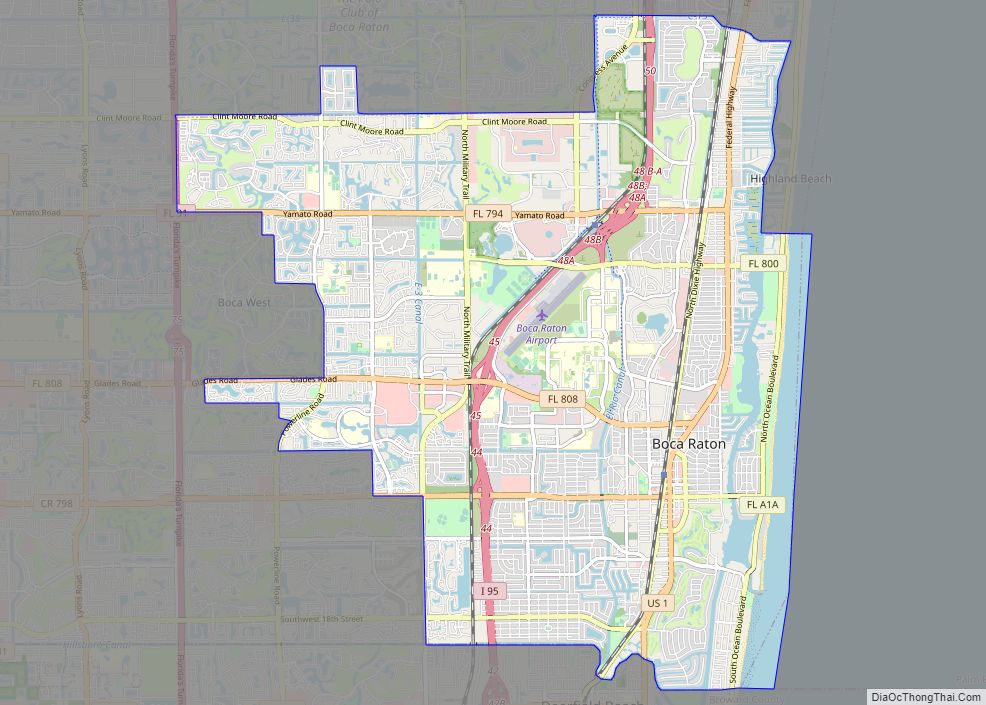
- Directly to the south, the city is bordered by Boca Raton.
- To the south and southeast, the city is bordered by Highland Beach on the same barrier island east of the Intracoastal Waterway.
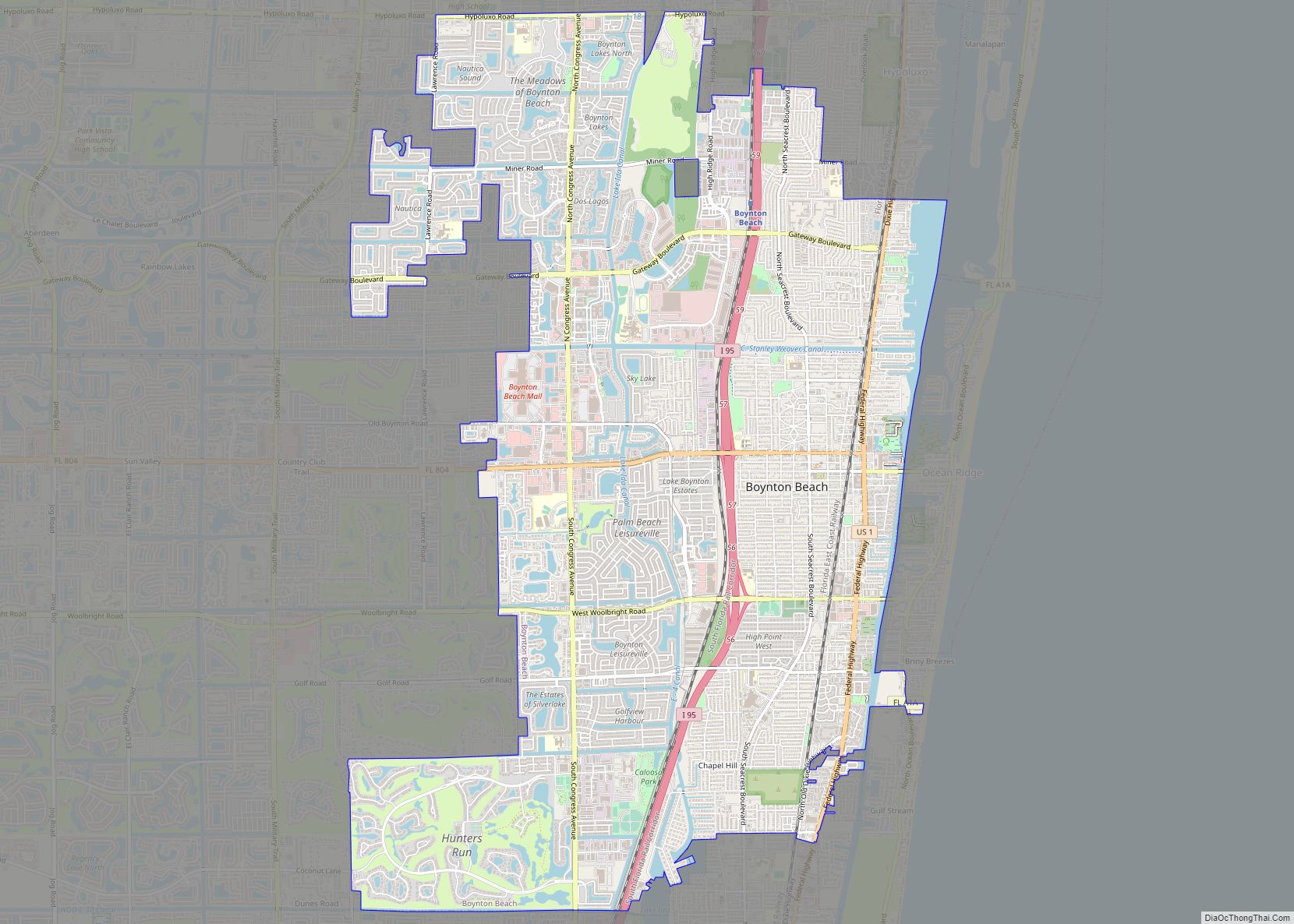
- Directly to the north, the city is bordered by Boynton Beach.
- To the north and northeast, the city is bordered by Gulf Stream on the barrier island and along a section of mainland east of U.S. Route 1.
- To the west, an urbanized area that includes High Point, Kings Point, Villages of Oriole, and multiple gated communities extends from the city’s western boundary to the Loxahatchee National Wildlife Refuge portion of the Everglades. Many residences and businesses within this suburban corridor of unincorporated Palm Beach County possess a Delray Beach postal address despite technically lying outside the city limits. This area is sometimes referred to collectively and informally as “West Delray.”
Delray Beach’s location in Southeastern Palm Beach County is in the middle of Florida’s Gold Coast region.
According to the United States Census Bureau, the city of Delray Beach has a total land area of 15.81 miles (25.44 km).
Downtown location
In earlier years, downtown Delray was centered along Atlantic Avenue as far west as Swinton Avenue and as far east as the intracoastal waterway. Downtown has since expanded. By 2010, downtown extended west to I-95 and east as the Atlantic Ocean; The north–south boundaries extend roughly two blocks north and south of Atlantic Avenue.
Climate
Delray Beach has a tropical climate, more specifically a tropical trade-wind rainforest climate (Köppen climate classification Af), as its driest month (February) averages 64.8mm of precipitation, meeting the minimum standard of 60mm in the driest month needed to qualify for that designation.
Delray Beach has hot and humid summers. High summertime temperatures range from 87–93 °F with low temperatures around 75–78 °F. Winters are warm, with a marked drier season. Ordinarily wintertime high temperatures are typically in the range of 74–83 °F and low temperatures 57–65 °F. However, when occasional cold fronts hit South Florida, daytime high temperatures may only reach the low or mid 60s (°F). Overnight lows during these brief periods can sink into the 40s. These cold fronts do not typically last more than a day or two and only occur several times each winter. Its near sea-level elevation, coastal location, position above the Tropic of Cancer, and proximity to the Gulf Stream shapes its climate. Hurricane season officially runs from June 1 through November 30, although hurricanes can develop outside those dates. The most likely time for hurricane activity is during the peak of the Cape Verde season, which is mid-August through the end of September. Delray Beach has received direct or near direct hits from hurricanes in 1903, 1906, 1928, 1947, 1949, 1964, 1965, 1979, 1992, 1999, 2004, and 2005.
See also
Map of Florida State and its subdivision:- Alachua
- Baker
- Bay
- Bradford
- Brevard
- Broward
- Calhoun
- Charlotte
- Citrus
- Clay
- Collier
- Columbia
- Desoto
- Dixie
- Duval
- Escambia
- Flagler
- Franklin
- Gadsden
- Gilchrist
- Glades
- Gulf
- Hamilton
- Hardee
- Hendry
- Hernando
- Highlands
- Hillsborough
- Holmes
- Indian River
- Jackson
- Jefferson
- Lafayette
- Lake
- Lee
- Leon
- Levy
- Liberty
- Madison
- Manatee
- Marion
- Martin
- Miami-Dade
- Monroe
- Nassau
- Okaloosa
- Okeechobee
- Orange
- Osceola
- Palm Beach
- Pasco
- Pinellas
- Polk
- Putnam
- Saint Johns
- Saint Lucie
- Santa Rosa
- Sarasota
- Seminole
- Sumter
- Suwannee
- Taylor
- Union
- Volusia
- Wakulla
- Walton
- Washington
- Alabama
- Alaska
- Arizona
- Arkansas
- California
- Colorado
- Connecticut
- Delaware
- District of Columbia
- Florida
- Georgia
- Hawaii
- Idaho
- Illinois
- Indiana
- Iowa
- Kansas
- Kentucky
- Louisiana
- Maine
- Maryland
- Massachusetts
- Michigan
- Minnesota
- Mississippi
- Missouri
- Montana
- Nebraska
- Nevada
- New Hampshire
- New Jersey
- New Mexico
- New York
- North Carolina
- North Dakota
- Ohio
- Oklahoma
- Oregon
- Pennsylvania
- Rhode Island
- South Carolina
- South Dakota
- Tennessee
- Texas
- Utah
- Vermont
- Virginia
- Washington
- West Virginia
- Wisconsin
- Wyoming
