Hawthorne (/ˈhɔːθoʊrn/ (listen)) is a city in Alachua County, Florida, United States, incorporated in 1881. Indigenous peoples of the Americas had been living in the area since around 100 CE; Hawthorne grew around their trading trails. Throughout its history, Hawthorne has been known for its agriculture, railroad, and rural lifestyle. Hawthorne’s population was 1,478 at the 2020 census, with an area of 7.38 sq mi (19.1 km).
| Name: | Hawthorne city |
|---|---|
| LSAD Code: | 25 |
| LSAD Description: | city (suffix) |
| State: | Florida |
| County: | Alachua County |
| Elevation: | 148 ft (45 m) |
| Total Area: | 7.64 sq mi (19.79 km²) |
| Land Area: | 7.38 sq mi (19.11 km²) |
| Water Area: | 0.26 sq mi (0.68 km²) |
| Total Population: | 1,478 |
| Population Density: | 200.27/sq mi (77.33/km²) |
| ZIP code: | 32640 |
| Area code: | 352 |
| FIPS code: | 1229275 |
| GNISfeature ID: | 0283829 |
| Website: | www.cityofhawthorne.net |
Online Interactive Map
Click on ![]() to view map in "full screen" mode.
to view map in "full screen" mode.
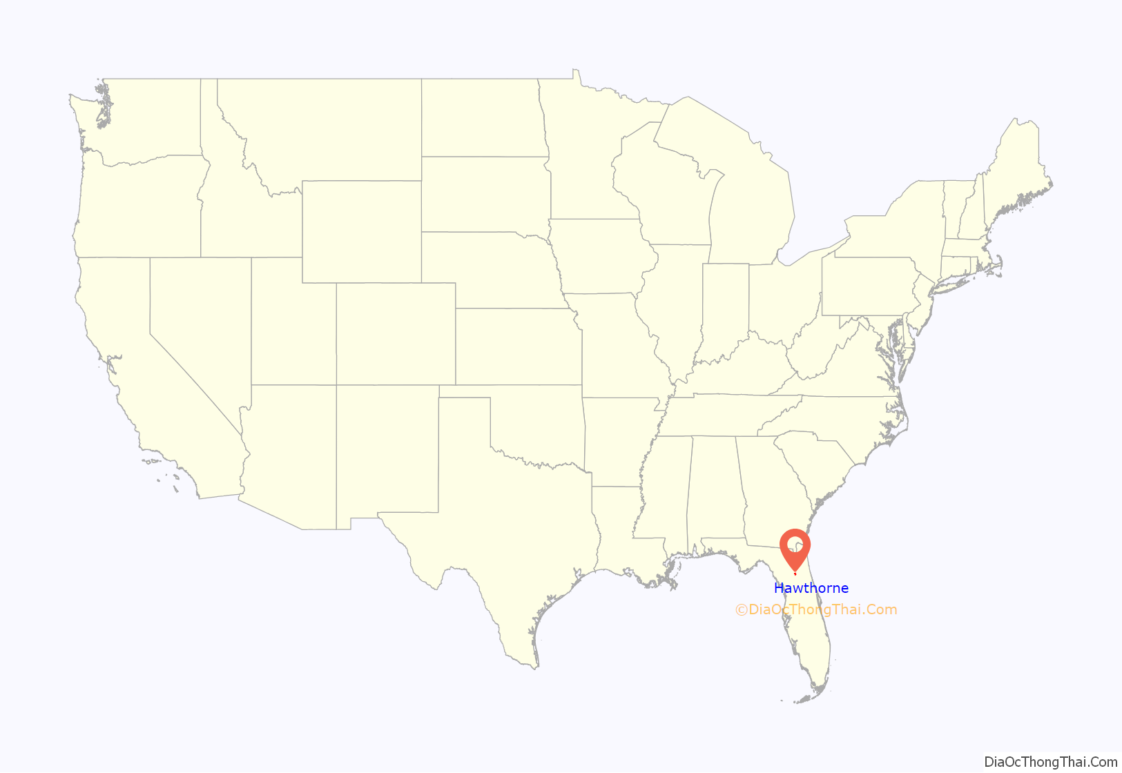
Hawthorne location map. Where is Hawthorne city?
History
People have been living in the Hawthorne area since the mid-Woodland period; a Cades Pond culture (100–600 CE) mound is near the city, and an Alachua culture (600–1700 CE) campsite was found in Hawthorne with aboriginal ceramics and lithics. Timucua-speaking natives were living in North Florida when the Spanish arrived during the 16th century. Natives in Alachua County were allied with Chief Potano, and those in Palatka were allied with Chief Utina. In 1774, William Bartram traveled between western Alachua County and the Palatka area on what he called an “old Spanish highway”, an “old Indian and trading trail” which passed through the Hawthorne area. Hawthorne’s history is tied to its crossroads.
A road between Micanopy and Palatka via the Hawthorne area appears on an 1837 map. During the 1840s, a mill was constructed on Little Orange Creek, 1.5 miles (2.4 km) east of the center of present-day Hawthorne. The Pleasant Grove Baptist Church was founded at this time, and a post office opened at the mill in 1854. In 1869, the area’s first school opened in a log cabin.
Phosphate was discovered near Hawthorne during the late 1870s. Near the same time, the first subdivision, the Town of Hawthorn, was platted. The area had been previously known as Jamestown—named after James M. Hawthorn. A second subdivision, Waits Crossing, was platted in 1881. The subdivisions provided north–south and east–west rights-of-way, which brought rail service. Track was first laid by the Peninsula Railroad in Hawthorne in 1879 for a north–south line intended to connect Waldo and Ocala. Near the same time, track laid by the Florida Southern Railroad reached Hawthorne; its east–west line was intended to connect Palatka and Gainesville. Each railroad company had a depot in the Hawthorne area, about a half-mile apart. A Hawthorn post office was established in 1880, and its spelling was changed to Hawthorne in 1950.
In 1881, 36 years after Florida became a state, the state legislature created the municipal corporation of Hawthorne. Florida Southern began selling land granted to it by the state almost a decade after the railroads were built, including land in Hawthorne described as “in the heart of a famous vegetable region … large public school, churches, stores, hotels, three cotton gins, wagon repair shop.” At this time, Hawthorne was known for its hunting and fishing and “Northern sportsmen frequented the area to enjoy” it. Sportsmen could stay at William Shepard Moore’s hotel; he served breakfast early and had hunting dogs, guides, and horses available.
During the 1880s many orange groves were planted in the Hawthorne area, but after the 1894 Great Freeze ruined citrus trees, growers switched to vegetables; the area became known for Sea Island cotton (Pima cotton) around the turn of the 20th century although it had been grown there since at least the early 1880s. The boll weevil halted the cotton trade, however, and Hawthorne diversified into brickmaking, other agriculture, turpentine production, and railroad work. Because two rail lines crossed in the city, it became a transfer point; there was no passenger station, however, and travelers had to walk (or ride) to the connecting line’s depot. The Florida state railroad commission declared that the depots were inadequate to accommodate the “traveling public”, and required the rail companies to build a segregated union passenger station in Hawthorne by November 1912. Hawthorne was a bustling community in 1913 with a cotton gin, a bank, four general stores, a drug store, three hotels, and two furniture stores.
The city experienced a boom during the 1920s; by late in the decade, Hawthorne had a bank, high school, ice and electric plants, a Western Union, a Railway Express Agency, and a telephone exchange. Although the city suffered during the Great Depression, daily rail service continued; Highway 20 was paved, and a bridge was built over the railroad tracks. The area remained an agricultural center.
The original city hall burned during the mid-to-late 1930s and was replaced by a “white stucco building with Mediterranean influence”, which was Hawthorne’s city hall until 2018. That year, the city hall moved down the street to an old bank building on the corner of County Road 2082, and the old city-hall building began use as a community center.
During the 1940s, agriculture declined because the land had not been replenished. The pulpwood industry began when National Container (a box company later purchased by Owens-Illinois) bought 15,000 acres (6,100 ha) in the area. A state forest was created south of Hawthorne with 40,000 acres (16,000 ha) of purchased land. While there was not much growth after World War II, Hawthorne was still a center for hunting and fishing. Little growth occurred in the 1950s and 1960s; Hawthorne was known for its lima beans, and more farmland was sold to lumber companies. Trees were still tapped for turpentine before that industry ended in the late 1950s. US 301, built during the early 1960s, bypassed downtown Hawthorne to reduce driving times.
Growth revived somewhat during the 1970s. As automobiles became the dominant means of transportation, passenger trains and buses stopped serving the city. Many residents began commuting to Gainesville to work after local industries declined. The area’s rural lifestyle became appreciated during the 1980s, although local jobs still existed at sand mines, chicken ranches, and plywood mills. Since the 1980s, Hawthorne has experienced little population growth.
The city of Hawthorne annexed approximately 1,300 acres owned by Plum Creek Land Company in 2015.
Morrison’s Mill, c. 1850
James M. Hawthorn, c. 1890
Cotton gin, c. 1900
Railroad station, 1914
Historical marker, front
Historical marker, reverse
Old city hall, c. 2008
New city hall, 2018
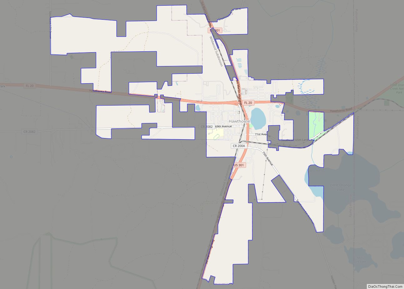
Hawthorne Road Map
Hawthorne city Satellite Map
Geography
Hawthorne is on the eastern boundary of Alachua County, and a portion of the city borders the Alachua–Putnam county line. It is 17 miles (27 km) east of Gainesville, the largest city in the county. According to the United States Census Bureau, the city has a total area of 7.06 sq mi (18.3 km); 6.802 sq mi (17.62 km) is land, and 0.258 sq mi (0.67 km) is water.
See also
Map of Florida State and its subdivision:- Alachua
- Baker
- Bay
- Bradford
- Brevard
- Broward
- Calhoun
- Charlotte
- Citrus
- Clay
- Collier
- Columbia
- Desoto
- Dixie
- Duval
- Escambia
- Flagler
- Franklin
- Gadsden
- Gilchrist
- Glades
- Gulf
- Hamilton
- Hardee
- Hendry
- Hernando
- Highlands
- Hillsborough
- Holmes
- Indian River
- Jackson
- Jefferson
- Lafayette
- Lake
- Lee
- Leon
- Levy
- Liberty
- Madison
- Manatee
- Marion
- Martin
- Miami-Dade
- Monroe
- Nassau
- Okaloosa
- Okeechobee
- Orange
- Osceola
- Palm Beach
- Pasco
- Pinellas
- Polk
- Putnam
- Saint Johns
- Saint Lucie
- Santa Rosa
- Sarasota
- Seminole
- Sumter
- Suwannee
- Taylor
- Union
- Volusia
- Wakulla
- Walton
- Washington
- Alabama
- Alaska
- Arizona
- Arkansas
- California
- Colorado
- Connecticut
- Delaware
- District of Columbia
- Florida
- Georgia
- Hawaii
- Idaho
- Illinois
- Indiana
- Iowa
- Kansas
- Kentucky
- Louisiana
- Maine
- Maryland
- Massachusetts
- Michigan
- Minnesota
- Mississippi
- Missouri
- Montana
- Nebraska
- Nevada
- New Hampshire
- New Jersey
- New Mexico
- New York
- North Carolina
- North Dakota
- Ohio
- Oklahoma
- Oregon
- Pennsylvania
- Rhode Island
- South Carolina
- South Dakota
- Tennessee
- Texas
- Utah
- Vermont
- Virginia
- Washington
- West Virginia
- Wisconsin
- Wyoming
