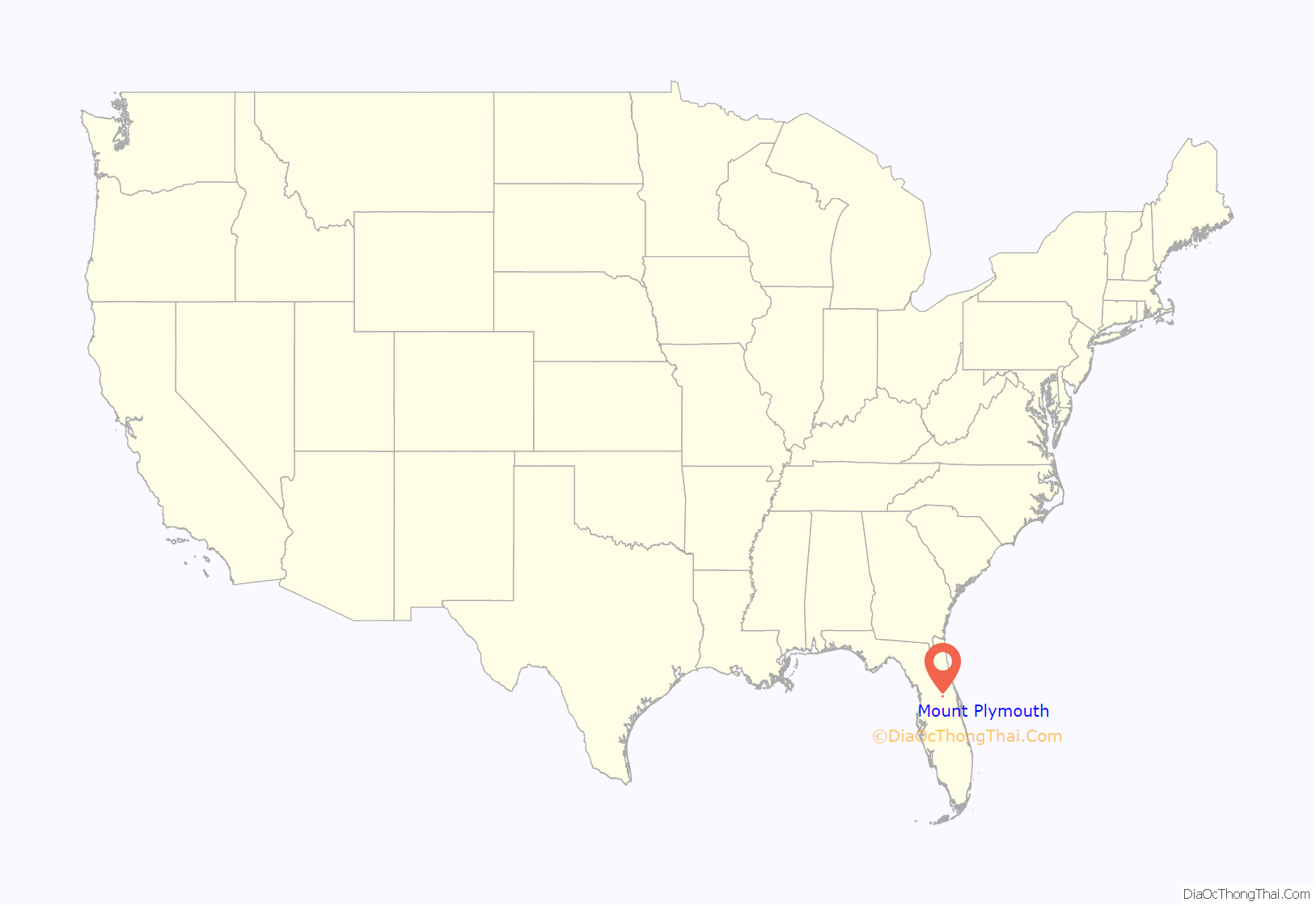
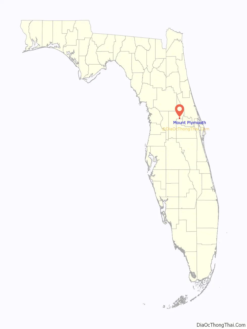
Mount Plymouth is an unincorporated community and census-designated place (CDP) in Lake County, Florida, United States. As of the 2010 census, the CDP population was 4,011, up from 2,814 in 2000. It is part of the Orlando–Kissimmee Metropolitan Statistical Area.
| Name: | Mount Plymouth CDP |
|---|---|
| LSAD Code: | 57 |
| LSAD Description: | CDP (suffix) |
| State: | Florida |
| County: | Lake County |
| Elevation: | 79 ft (24 m) |
| Total Area: | 3.02 sq mi (7.83 km²) |
| Land Area: | 2.88 sq mi (7.45 km²) |
| Water Area: | 0.15 sq mi (0.38 km²) |
| Total Population: | 4,417 |
| Population Density: | 1,535.28/sq mi (592.77/km²) |
| ZIP code: | 32776 |
| Area code: | 352 |
| FIPS code: | 1247125 |
| GNISfeature ID: | 2403311 |
Online Interactive Map
Click on ![]() to view map in "full screen" mode.
to view map in "full screen" mode.
Mount Plymouth location map. Where is Mount Plymouth CDP?
History
The focal point of a golf resort for the region was the Historic Mount Plymouth Hotel, which was constructed in 1926 at a cost of $350,000. The hotel became a center of activity in the area. Guests such as Al Capone, Connie Mack, Babe Ruth and Kate Smith were able to utilize the hotel’s airfield for arrival.
Four 18-hole golf courses patterned after the St. Andrews course in Scotland were originally planned for the resort. However, the Florida real estate crash of 1926 prevented completion of three of the four courses. The first course, called Mount Plymouth Golf Club, closed in 2007. Lucia Mida would use Mount Plymouth as her temporary place of residence while participating in Florida state golfing tournaments.
In 1959, Florida Central Academy occupied the building and grounds of the 150-room hotel. Originally a boys boarding school, in 1971 the academy began accepting girls. The school remained operational until June 1983. The building, condemned by county health officials, quickly became the target of vandals. In 1986 and 1987, fire destroyed the building.
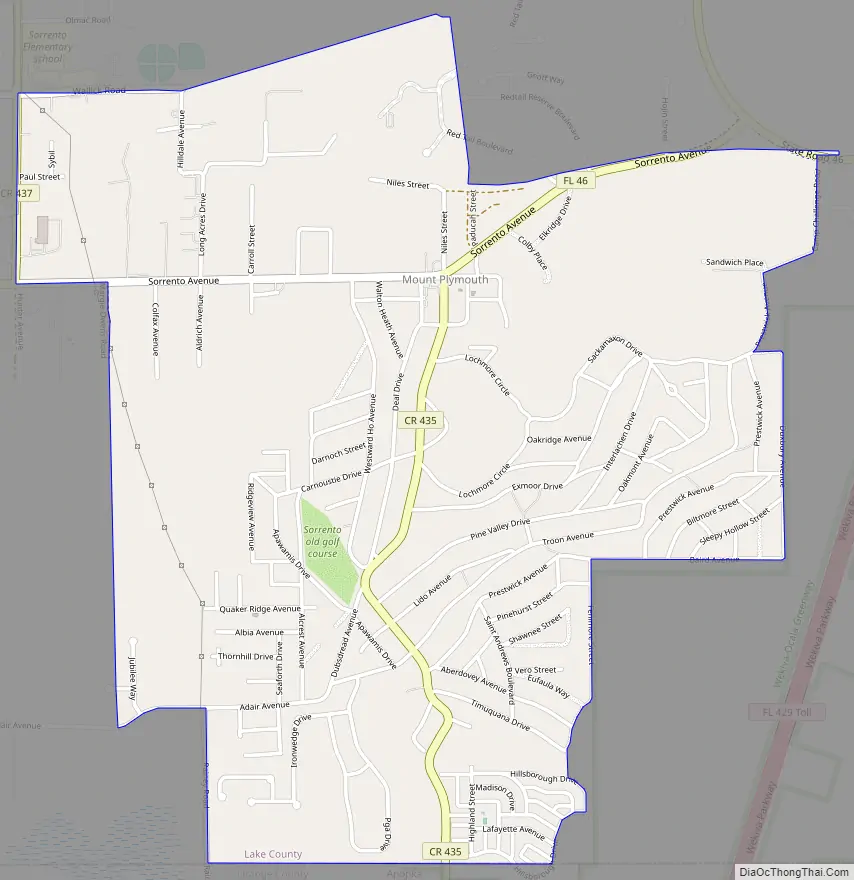
Mount Plymouth Road Map
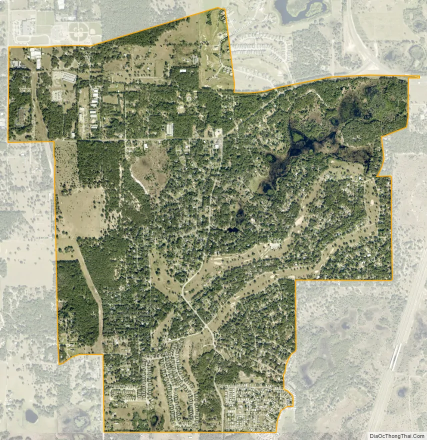
Mount Plymouth city Satellite Map
Geography
Mount Plymouth is located in eastern Lake County at 28°47′57″N 81°31′54″W / 28.79917°N 81.53167°W / 28.79917; -81.53167. It is bordered to the south by the city of Apopka in Orange County. Florida State Road 46 passes through the center of the community, leading east 17 miles (27 km) to Sanford and west 7 miles (11 km) to Mount Dora. Tavares, the Lake county seat, is 12 miles (19 km) west of Mount Plymouth. Florida State Road 429, the Wekiva Parkway, passes east and south of Mount Plymouth, leading south around the west side of the Orlando area 42 miles (68 km) to Interstate 4.
According to the United States Census Bureau, the Mount Plymouth CDP has a total area of 3.1 square miles (7.9 km), of which 2.9 square miles (7.5 km) are land and 0.2 square miles (0.4 km), or 4.91%, are water.
Climate
See also
Map of Florida State and its subdivision:- Alachua
- Baker
- Bay
- Bradford
- Brevard
- Broward
- Calhoun
- Charlotte
- Citrus
- Clay
- Collier
- Columbia
- Desoto
- Dixie
- Duval
- Escambia
- Flagler
- Franklin
- Gadsden
- Gilchrist
- Glades
- Gulf
- Hamilton
- Hardee
- Hendry
- Hernando
- Highlands
- Hillsborough
- Holmes
- Indian River
- Jackson
- Jefferson
- Lafayette
- Lake
- Lee
- Leon
- Levy
- Liberty
- Madison
- Manatee
- Marion
- Martin
- Miami-Dade
- Monroe
- Nassau
- Okaloosa
- Okeechobee
- Orange
- Osceola
- Palm Beach
- Pasco
- Pinellas
- Polk
- Putnam
- Saint Johns
- Saint Lucie
- Santa Rosa
- Sarasota
- Seminole
- Sumter
- Suwannee
- Taylor
- Union
- Volusia
- Wakulla
- Walton
- Washington
- Alabama
- Alaska
- Arizona
- Arkansas
- California
- Colorado
- Connecticut
- Delaware
- District of Columbia
- Florida
- Georgia
- Hawaii
- Idaho
- Illinois
- Indiana
- Iowa
- Kansas
- Kentucky
- Louisiana
- Maine
- Maryland
- Massachusetts
- Michigan
- Minnesota
- Mississippi
- Missouri
- Montana
- Nebraska
- Nevada
- New Hampshire
- New Jersey
- New Mexico
- New York
- North Carolina
- North Dakota
- Ohio
- Oklahoma
- Oregon
- Pennsylvania
- Rhode Island
- South Carolina
- South Dakota
- Tennessee
- Texas
- Utah
- Vermont
- Virginia
- Washington
- West Virginia
- Wisconsin
- Wyoming


