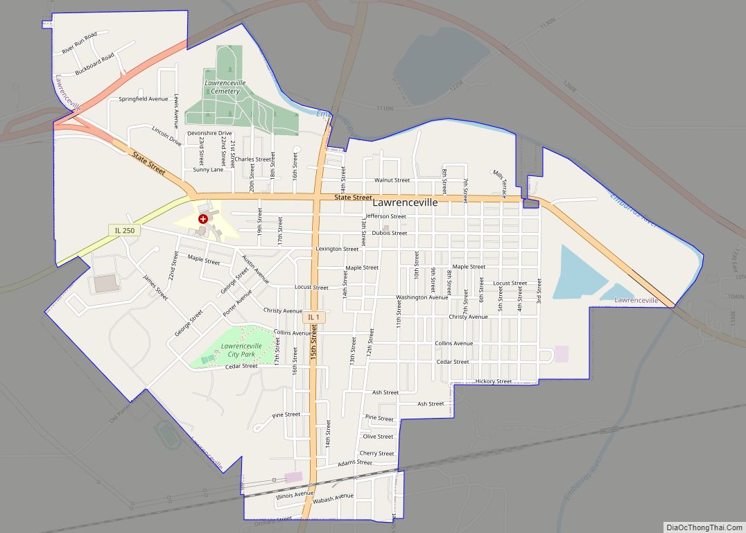
Lawrenceville is a city in and the county seat of Lawrence County, Illinois, United States, located along the Embarras River. The population was 4,348 at the 2010 census. Lawrenceville is located in southeast Illinois, northwest of Vincennes, Indiana.
The city is home of the Lawrenceville “Indians”, Illinois Class A high school state basketball champions in 1972, 1974, 1982 and 1983. The team had a combined two season win–loss record of 68-0 from 1982–83. The team was coached by Ron Felling, who, after the 1983 season at Lawrenceville, went on to coach at Indiana University as an assistant under Bobby Knight.
| Name: | Lawrenceville city |
|---|---|
| LSAD Code: | 25 |
| LSAD Description: | city (suffix) |
| State: | Illinois |
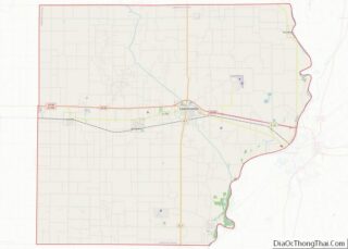
| County: | Lawrence County |
| Elevation: | 449 ft (137 m) |
| Total Area: | 2.16 sq mi (5.60 km²) |
| Land Area: | 2.16 sq mi (5.60 km²) |
| Water Area: | 0.00 sq mi (0.00 km²) |
| Total Population: | 4,164 |
| Population Density: | 1,924.21/sq mi (743.08/km²) |
| Area code: | 618 |
| FIPS code: | 1742405 |
| GNISfeature ID: | 2395649 |
| Website: | http://www.lawrencecity.com |
Online Interactive Map
Click on ![]() to view map in "full screen" mode.
to view map in "full screen" mode.
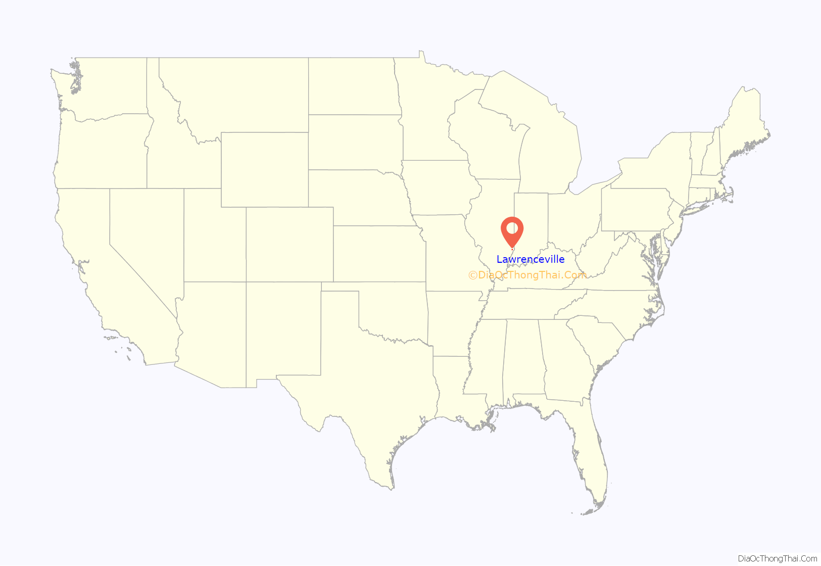
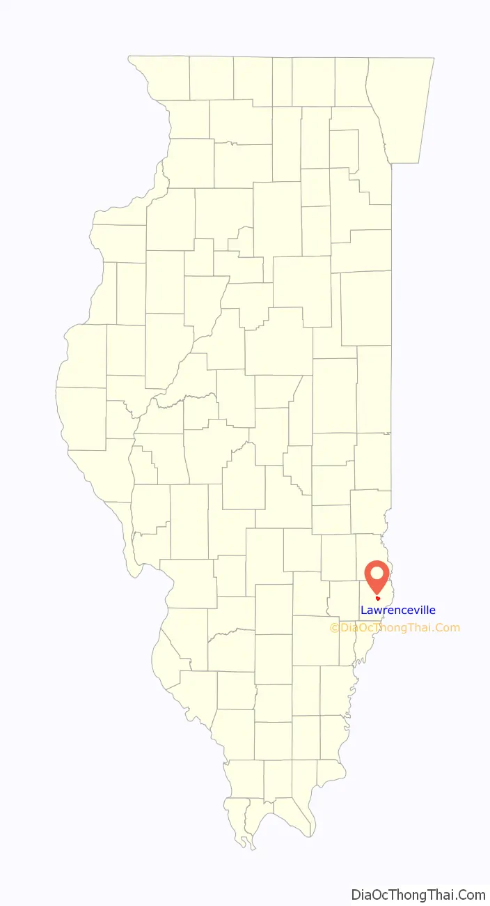
Lawrenceville location map. Where is Lawrenceville city?
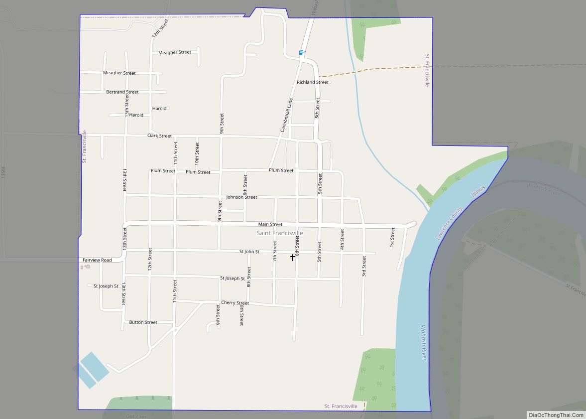
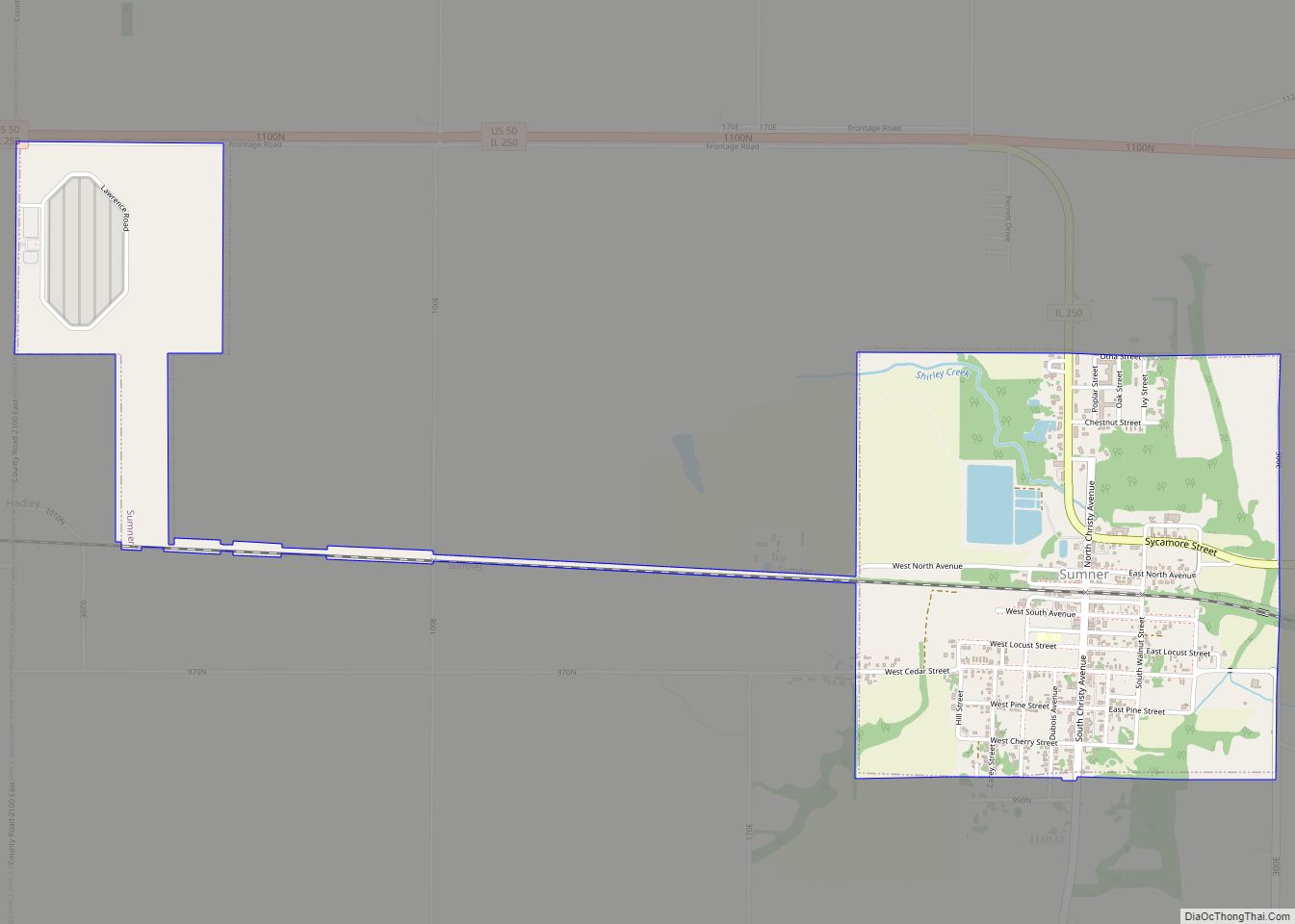
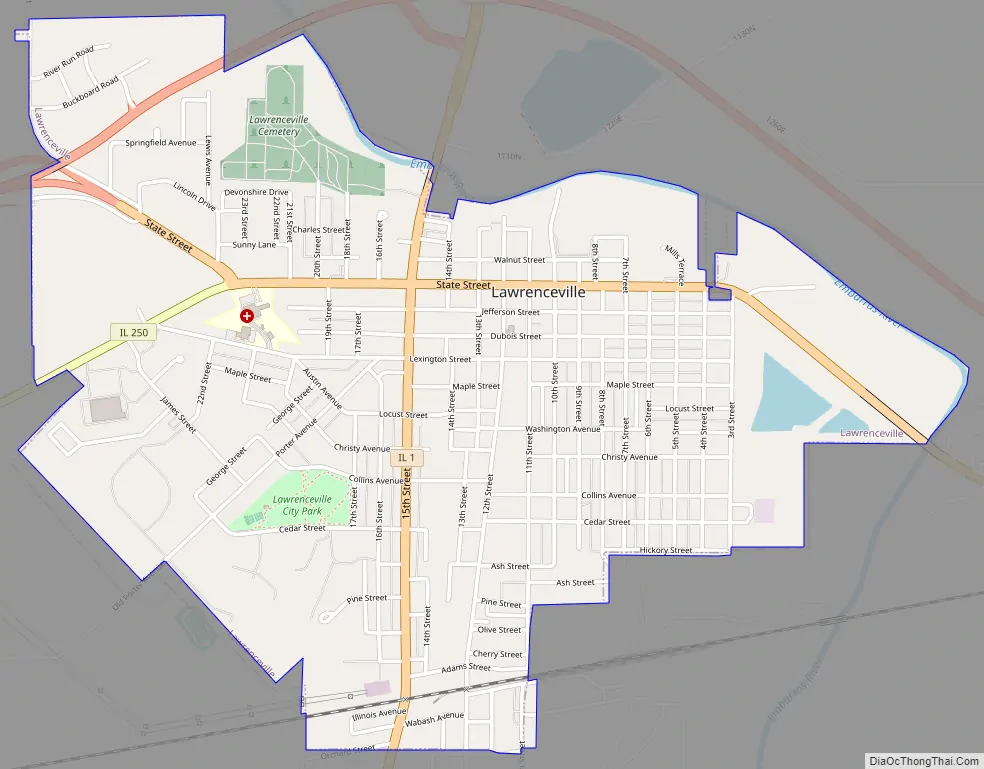
Lawrenceville Road Map
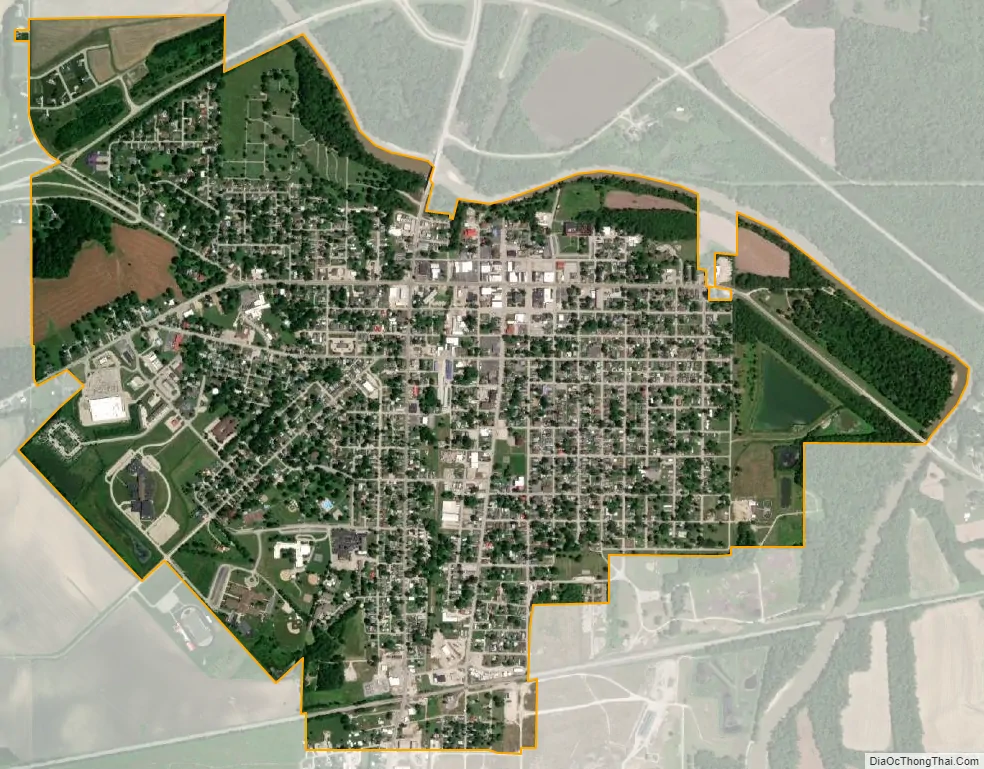
Lawrenceville city Satellite Map
Geography
According to the 2010 census, Lawrenceville has a total area of 2.2 square miles (5.70 km), all land.
See also
Map of Illinois State and its subdivision:- Adams
- Alexander
- Bond
- Boone
- Brown
- Bureau
- Calhoun
- Carroll
- Cass
- Champaign
- Christian
- Clark
- Clay
- Clinton
- Coles
- Cook
- Crawford
- Cumberland
- De Kalb
- De Witt
- Douglas
- Dupage
- Edgar
- Edwards
- Effingham
- Fayette
- Ford
- Franklin
- Fulton
- Gallatin
- Greene
- Grundy
- Hamilton
- Hancock
- Hardin
- Henderson
- Henry
- Iroquois
- Jackson
- Jasper
- Jefferson
- Jersey
- Jo Daviess
- Johnson
- Kane
- Kankakee
- Kendall
- Knox
- La Salle
- Lake
- Lake Michigan
- Lawrence
- Lee
- Livingston
- Logan
- Macon
- Macoupin
- Madison
- Marion
- Marshall
- Mason
- Massac
- McDonough
- McHenry
- McLean
- Menard
- Mercer
- Monroe
- Montgomery
- Morgan
- Moultrie
- Ogle
- Peoria
- Perry
- Piatt
- Pike
- Pope
- Pulaski
- Putnam
- Randolph
- Richland
- Rock Island
- Saint Clair
- Saline
- Sangamon
- Schuyler
- Scott
- Shelby
- Stark
- Stephenson
- Tazewell
- Union
- Vermilion
- Wabash
- Warren
- Washington
- Wayne
- White
- Whiteside
- Will
- Williamson
- Winnebago
- Woodford
- Alabama
- Alaska
- Arizona
- Arkansas
- California
- Colorado
- Connecticut
- Delaware
- District of Columbia
- Florida
- Georgia
- Hawaii
- Idaho
- Illinois
- Indiana
- Iowa
- Kansas
- Kentucky
- Louisiana
- Maine
- Maryland
- Massachusetts
- Michigan
- Minnesota
- Mississippi
- Missouri
- Montana
- Nebraska
- Nevada
- New Hampshire
- New Jersey
- New Mexico
- New York
- North Carolina
- North Dakota
- Ohio
- Oklahoma
- Oregon
- Pennsylvania
- Rhode Island
- South Carolina
- South Dakota
- Tennessee
- Texas
- Utah
- Vermont
- Virginia
- Washington
- West Virginia
- Wisconsin
- Wyoming