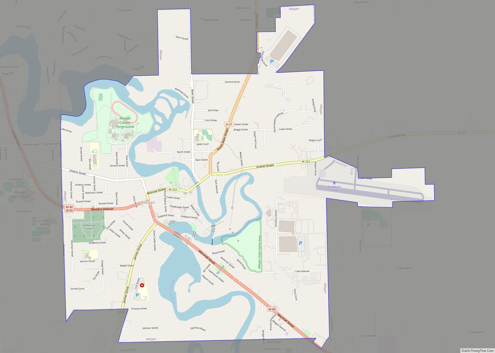
Allegan (/ˈæləɡən/ AL-ə-gən) is a city in the U.S. state of Michigan. Its population was 5,222 at the 2020 census. It is the county seat of Allegan County. It lies within Allegan Township but is administratively autonomous.
| Name: | Allegan city |
|---|---|
| LSAD Code: | 25 |
| LSAD Description: | city (suffix) |
| State: | Michigan |
| County: | Allegan County |
| Elevation: | 653 ft (199 m) |
| Total Area: | 4.26 sq mi (11.03 km²) |
| Land Area: | 3.85 sq mi (9.96 km²) |
| Water Area: | 0.41 sq mi (1.07 km²) |
| Total Population: | 5,222 |
| Population Density: | 1,357.77/sq mi (524.18/km²) |
| ZIP code: | 49010 |
| Area code: | 269 |
| FIPS code: | 2601260 |
| GNISfeature ID: | 0619961 |
| Website: | http://www.cityofallegan.org/ |
Online Interactive Map
Click on ![]() to view map in "full screen" mode.
to view map in "full screen" mode.
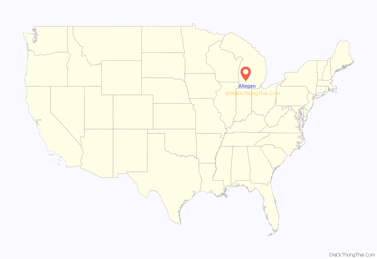
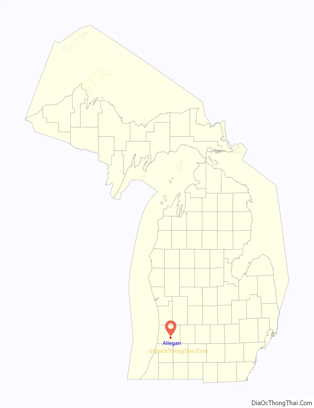
Allegan location map. Where is Allegan city?
History
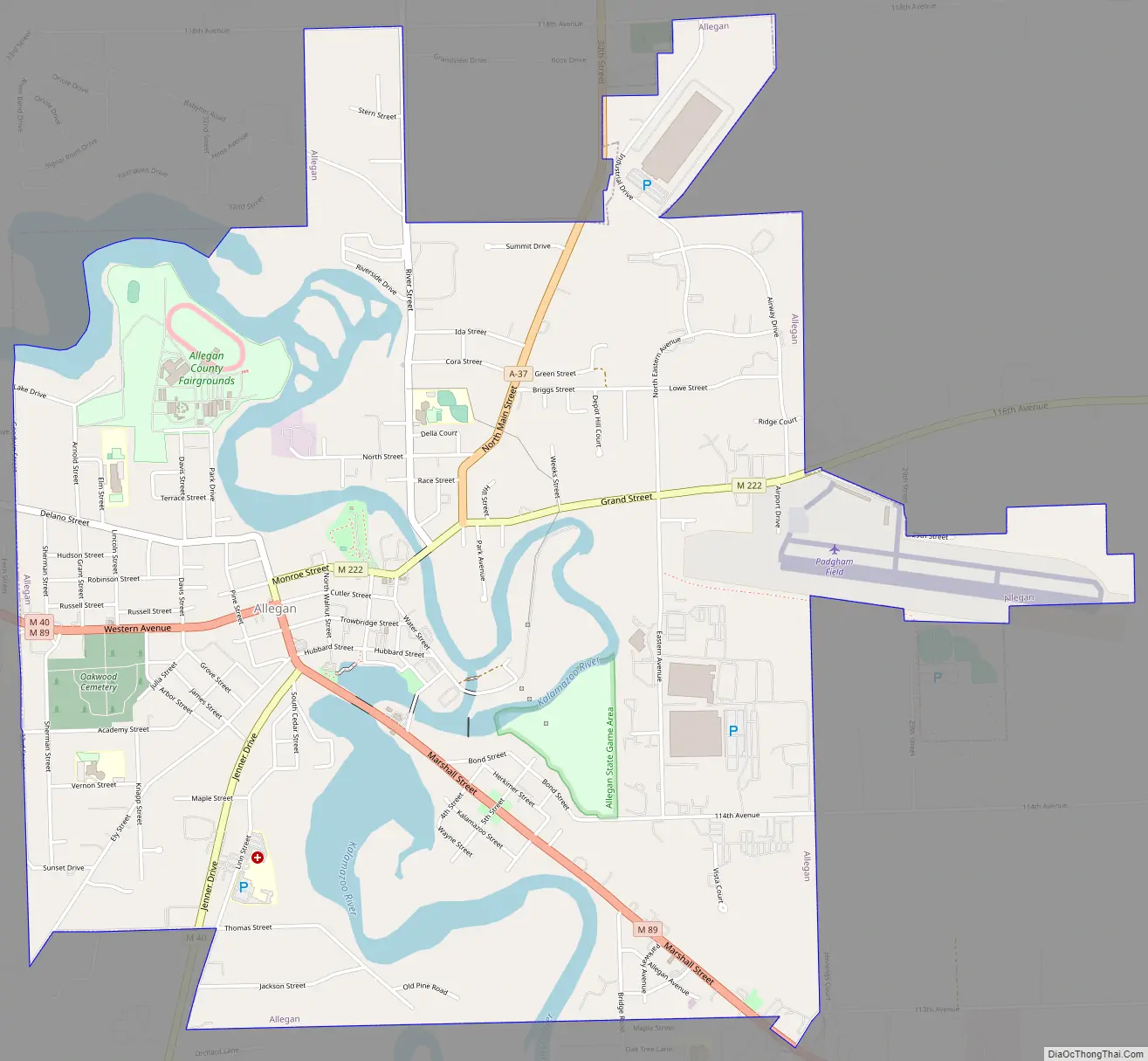
The men after whom Allegan’s downtown streets were named – Elisha Ely, Samuel Hubbard, Charles Christopher Trowbridge, Pliny Cutler, and Edmund Monroe – patented land in the area in 1833. They considered the site a prime location for industry, due to its potential for water power (since it straddled the Kalamazoo River) and water bound transportation. By 1835, a dam and sawmill had been established.
Allegan was named in a neologism by Michigan historian Henry Rowe Schoolcraft in 1837 to sound like a Native American word. Land was purchased from government to form the downtown business district; village organization came in 1838 with city incorporation authorized in 1907.
In 1886, a one-lane bridge was built over the Kalamazoo River to connect limited highway M-89 to the downtown area. The bridge fell into disrepair and was going to be removed until a group of activists raised the money to restore the bridge in 1983. Now a highlight of Allegan, the one-lane bridge is used in the city logo and is considered an important part of the city.
In 1914, Allegan entered the automobile race car industry as the manufacturing site of Howard E. Blood and Louis Chevrolet’s chain-drive Cornelian automobile. The venture was short-lived, and less than 100 Cornelians were produced.
Allegan Road Map
Allegan city Satellite Map
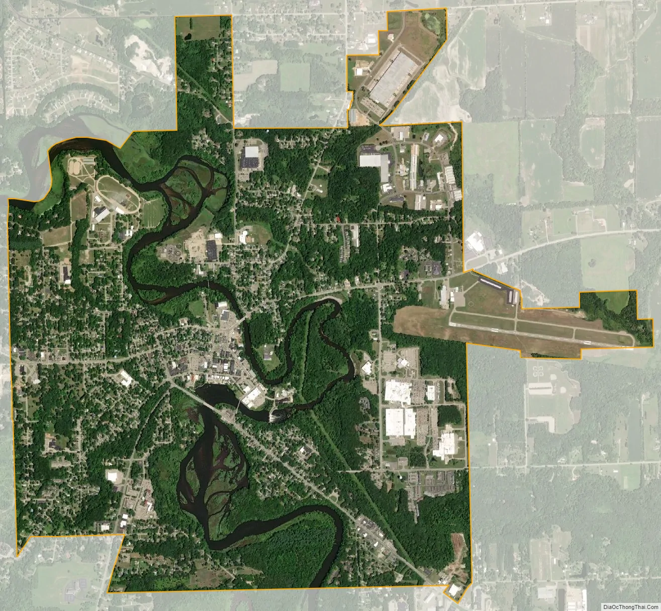
Geography
The city has a total area of 4.26 square miles (11.03 km), of which 3.85 square miles (9.97 km) is land and 0.41 square miles (1.06 km) is water.
Climate
This climatic region is typified by large seasonal temperature differences, with warm to hot (and often humid) summers and cold (sometimes severely cold) winters. According to the Köppen climate classification system, Allegan has a humid continental climate, abbreviated “Dfa” on climate maps.
See also
Map of Michigan State and its subdivision:- Alcona
- Alger
- Allegan
- Alpena
- Antrim
- Arenac
- Baraga
- Barry
- Bay
- Benzie
- Berrien
- Branch
- Calhoun
- Cass
- Charlevoix
- Cheboygan
- Chippewa
- Clare
- Clinton
- Crawford
- Delta
- Dickinson
- Eaton
- Emmet
- Genesee
- Gladwin
- Gogebic
- Grand Traverse
- Gratiot
- Hillsdale
- Houghton
- Huron
- Ingham
- Ionia
- Iosco
- Iron
- Isabella
- Jackson
- Kalamazoo
- Kalkaska
- Kent
- Keweenaw
- Lake
- Lake Hurron
- Lake Michigan
- Lake St. Clair
- Lake Superior
- Lapeer
- Leelanau
- Lenawee
- Livingston
- Luce
- Mackinac
- Macomb
- Manistee
- Marquette
- Mason
- Mecosta
- Menominee
- Midland
- Missaukee
- Monroe
- Montcalm
- Montmorency
- Muskegon
- Newaygo
- Oakland
- Oceana
- Ogemaw
- Ontonagon
- Osceola
- Oscoda
- Otsego
- Ottawa
- Presque Isle
- Roscommon
- Saginaw
- Saint Clair
- Saint Joseph
- Sanilac
- Schoolcraft
- Shiawassee
- Tuscola
- Van Buren
- Washtenaw
- Wayne
- Wexford
- Alabama
- Alaska
- Arizona
- Arkansas
- California
- Colorado
- Connecticut
- Delaware
- District of Columbia
- Florida
- Georgia
- Hawaii
- Idaho
- Illinois
- Indiana
- Iowa
- Kansas
- Kentucky
- Louisiana
- Maine
- Maryland
- Massachusetts
- Michigan
- Minnesota
- Mississippi
- Missouri
- Montana
- Nebraska
- Nevada
- New Hampshire
- New Jersey
- New Mexico
- New York
- North Carolina
- North Dakota
- Ohio
- Oklahoma
- Oregon
- Pennsylvania
- Rhode Island
- South Carolina
- South Dakota
- Tennessee
- Texas
- Utah
- Vermont
- Virginia
- Washington
- West Virginia
- Wisconsin
- Wyoming