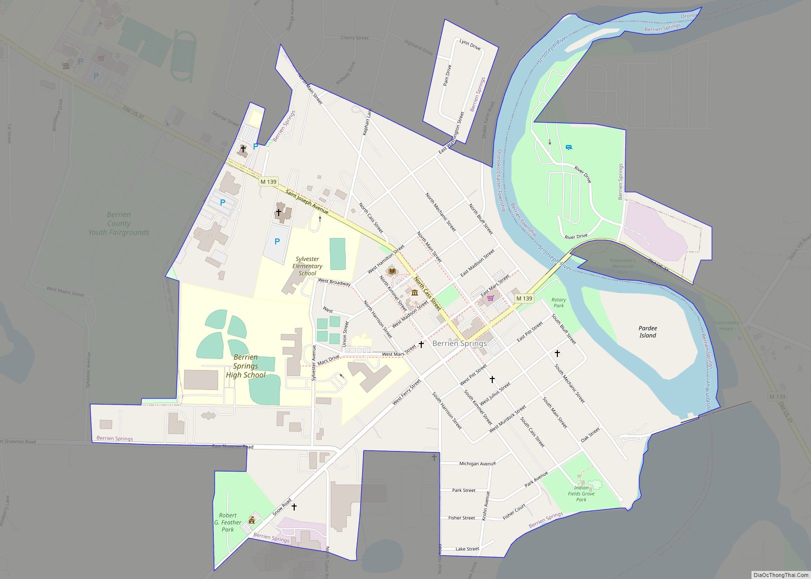
Berrien Springs is a village in Berrien County in the U.S. state of Michigan. The population was 1,800 at the time of the 2010 census. The village is located within Oronoko Charter Township.
| Name: | Berrien Springs village |
|---|---|
| LSAD Code: | 47 |
| LSAD Description: | village (suffix) |
| State: | Michigan |
| County: | Berrien County |
| Elevation: | 673 ft (205 m) |
| Total Area: | 1.00 sq mi (2.59 km²) |
| Land Area: | 0.92 sq mi (2.38 km²) |
| Water Area: | 0.08 sq mi (0.21 km²) |
| Total Population: | 1,910 |
| Population Density: | 2,080.61/sq mi (803.43/km²) |
| Area code: | 269 |
| FIPS code: | 2607860 |
| GNISfeature ID: | 2398105 |
| Website: | www.villageofberriensprings.com |
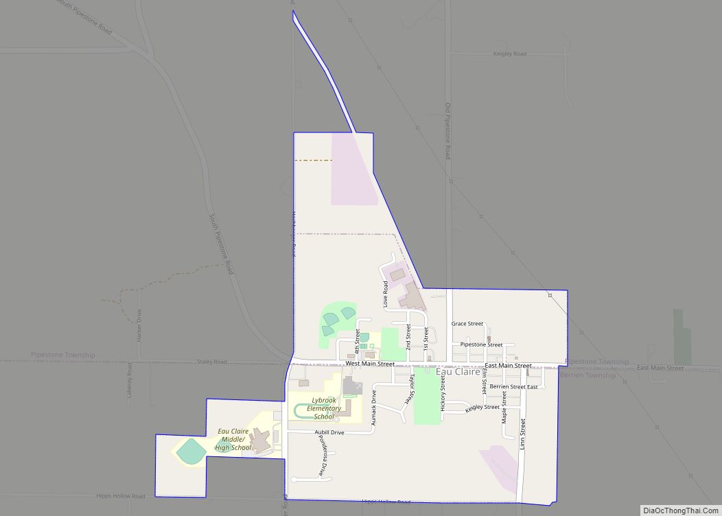
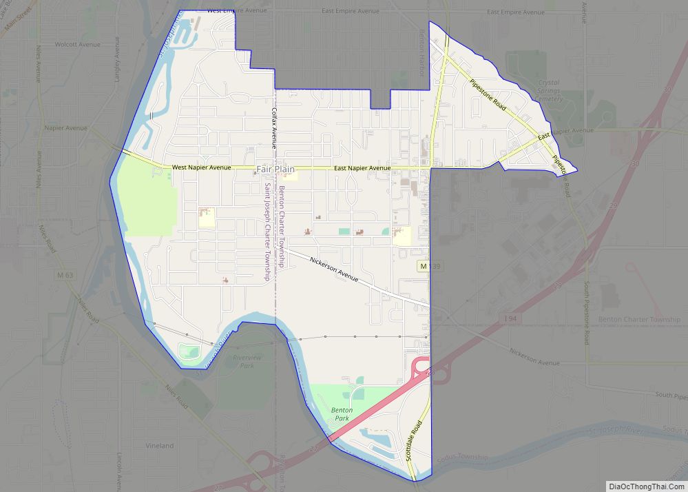
Online Interactive Map
Click on ![]() to view map in "full screen" mode.
to view map in "full screen" mode.
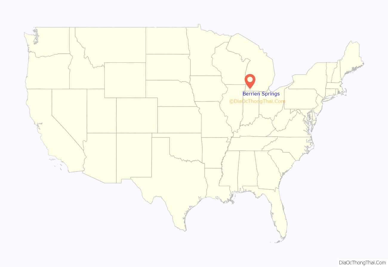
Berrien Springs location map. Where is Berrien Springs village?
History
Berrien Springs, like Berrien County, is named for John M. Berrien; “Springs” was added after mineral springs were discovered in the area. The village is the site of the earliest settlement in Oronoko Township, and was first known as “Wolf’s Prairie” in reference to the 1,000-acre prairie in which it was situated. The site had been a village under the leadership of a Potawatamie man named Wolf. The first permanent settlers, John Pike and his family, arrived in 1829. Francis B. Murdoch, later known for his work as a freedom suit lawyer, was a co-founder of the village and the first lawyer in the county.
The village of Berrien was platted in 1831, and the village of Berrien Springs was incorporated in 1863. Berrien Springs was the county seat from 1837 until 1894, when St. Joseph became county seat. The Berrien Springs post office opened with the name Berrien on December 4, 1832 and changed to Berrien Springs on April 18, 1836.
1839 Courthouse
When Berrien Springs became the county seat and its courthouse, designed by local architect Gilbert B. Avery, was completed in 1839. The Greek Revival-style courthouse emulated the architecture of ancient Greece with its large columns, triangular pediment and white paint. After the county seat was moved in 1894, the building was put to various uses and briefly was vacant. In 1967, efforts to preserve and restore the courthouse were started, before being completed by 1975.
The restored courthouse square contains Michigan’s oldest courthouse as part of the Midwest’s most complete surviving mid-nineteenth century county government complex. Today the square houses a county museum and archives and serves as headquarters for the Berrien County Historical Association. Its original buildings are listed on the National Register of Historic Places. The property is dedicated to the preservation of Berrien County’s history and does this through permanent and temporary exhibits, programs, events, and community outreach.
Christmas Pickle Capital of the World
Berrien Springs was once known as the Christmas pickle capital of the world. A festival was established by the Berrien Springs-Eau Claire Chamber of Commerce and along with the Berrien County Historical Association and the village, which included parades, games, activities, and even a Pickle Prince and Princess contest. The event ran until the mid-2000s. In 2021, the Pickle Festival was revived by the Village, the BCHA, and the Berrien Springs Community Library.
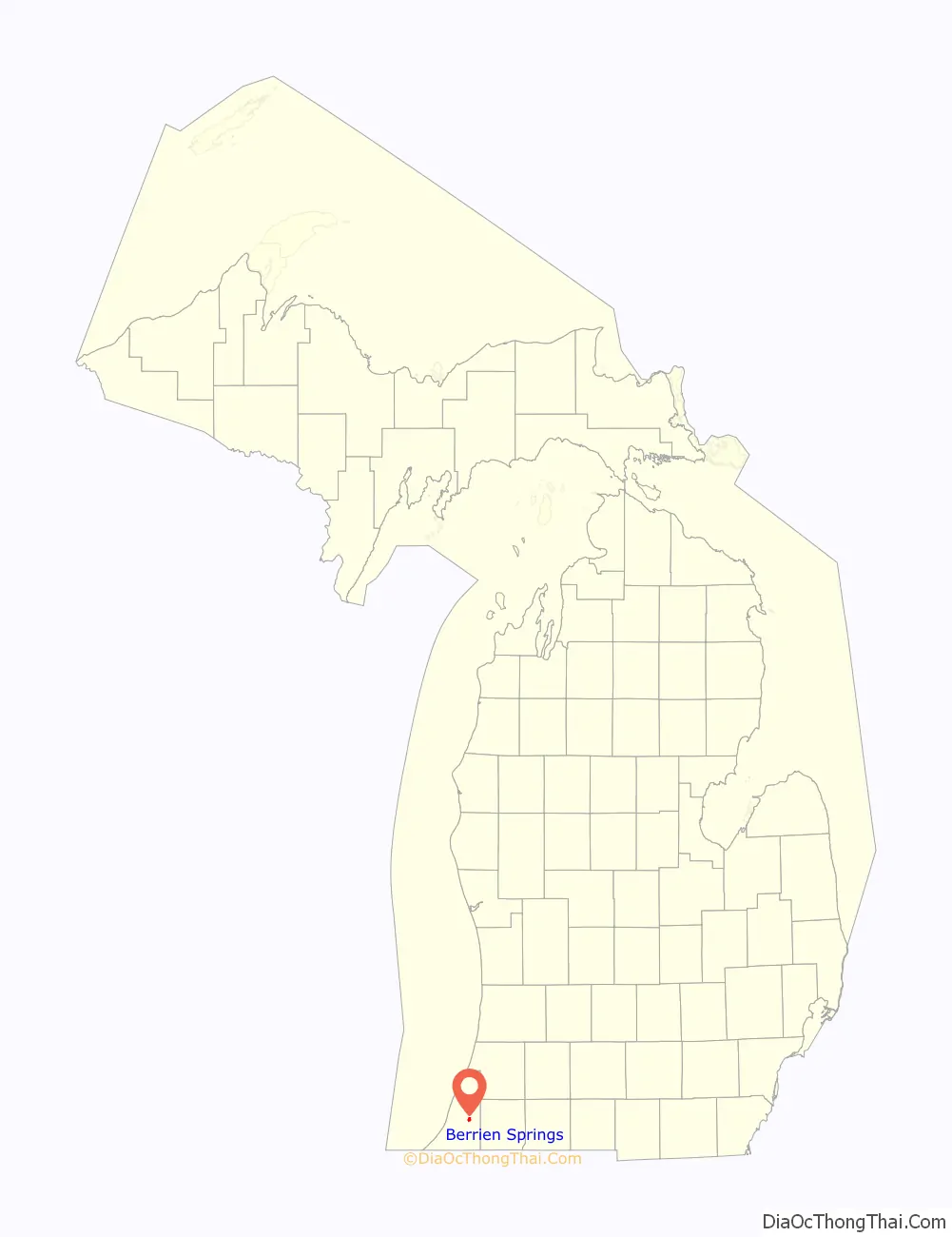
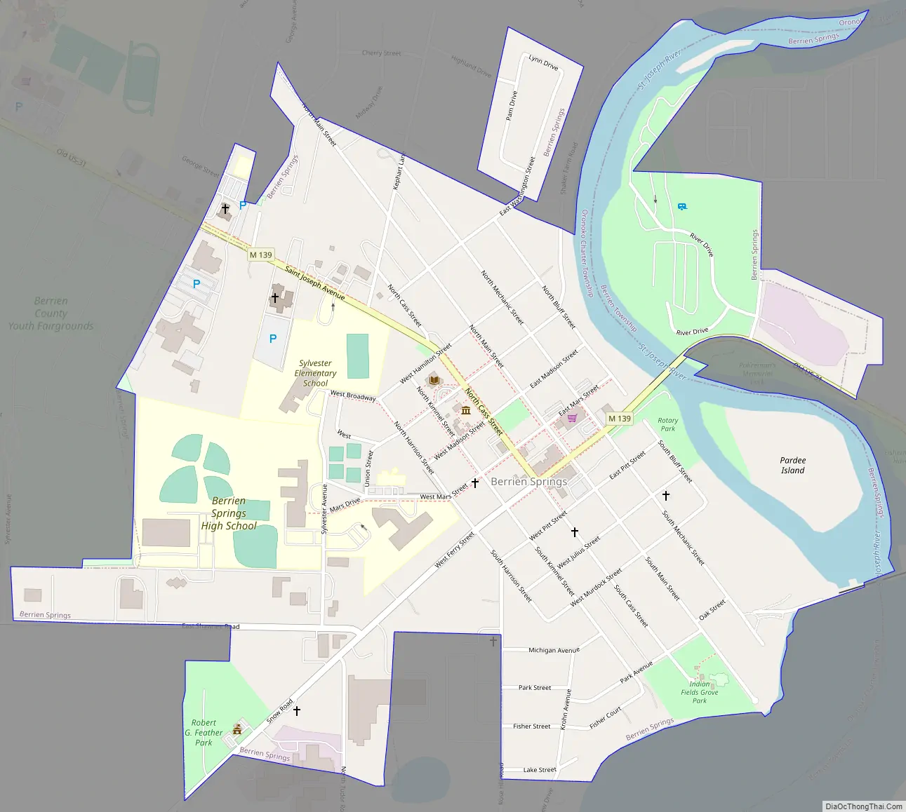
Berrien Springs Road Map
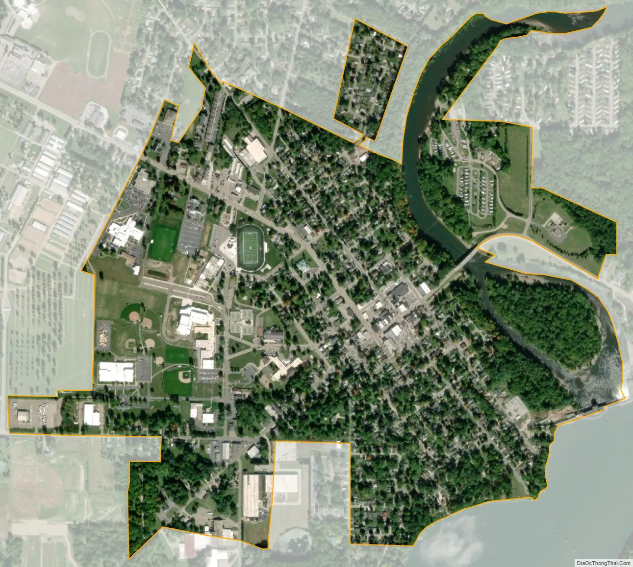
Berrien Springs city Satellite Map
Geography
According to the United States Census Bureau, the village has a total area of 1.02 square miles (2.64 km), of which 0.94 square miles (2.43 km) is land and 0.08 square miles (0.21 km) is water. The village is situated on the St. Joseph River.
See also
Map of Michigan State and its subdivision:- Alcona
- Alger
- Allegan
- Alpena
- Antrim
- Arenac
- Baraga
- Barry
- Bay
- Benzie
- Berrien
- Branch
- Calhoun
- Cass
- Charlevoix
- Cheboygan
- Chippewa
- Clare
- Clinton
- Crawford
- Delta
- Dickinson
- Eaton
- Emmet
- Genesee
- Gladwin
- Gogebic
- Grand Traverse
- Gratiot
- Hillsdale
- Houghton
- Huron
- Ingham
- Ionia
- Iosco
- Iron
- Isabella
- Jackson
- Kalamazoo
- Kalkaska
- Kent
- Keweenaw
- Lake
- Lake Hurron
- Lake Michigan
- Lake St. Clair
- Lake Superior
- Lapeer
- Leelanau
- Lenawee
- Livingston
- Luce
- Mackinac
- Macomb
- Manistee
- Marquette
- Mason
- Mecosta
- Menominee
- Midland
- Missaukee
- Monroe
- Montcalm
- Montmorency
- Muskegon
- Newaygo
- Oakland
- Oceana
- Ogemaw
- Ontonagon
- Osceola
- Oscoda
- Otsego
- Ottawa
- Presque Isle
- Roscommon
- Saginaw
- Saint Clair
- Saint Joseph
- Sanilac
- Schoolcraft
- Shiawassee
- Tuscola
- Van Buren
- Washtenaw
- Wayne
- Wexford
- Alabama
- Alaska
- Arizona
- Arkansas
- California
- Colorado
- Connecticut
- Delaware
- District of Columbia
- Florida
- Georgia
- Hawaii
- Idaho
- Illinois
- Indiana
- Iowa
- Kansas
- Kentucky
- Louisiana
- Maine
- Maryland
- Massachusetts
- Michigan
- Minnesota
- Mississippi
- Missouri
- Montana
- Nebraska
- Nevada
- New Hampshire
- New Jersey
- New Mexico
- New York
- North Carolina
- North Dakota
- Ohio
- Oklahoma
- Oregon
- Pennsylvania
- Rhode Island
- South Carolina
- South Dakota
- Tennessee
- Texas
- Utah
- Vermont
- Virginia
- Washington
- West Virginia
- Wisconsin
- Wyoming