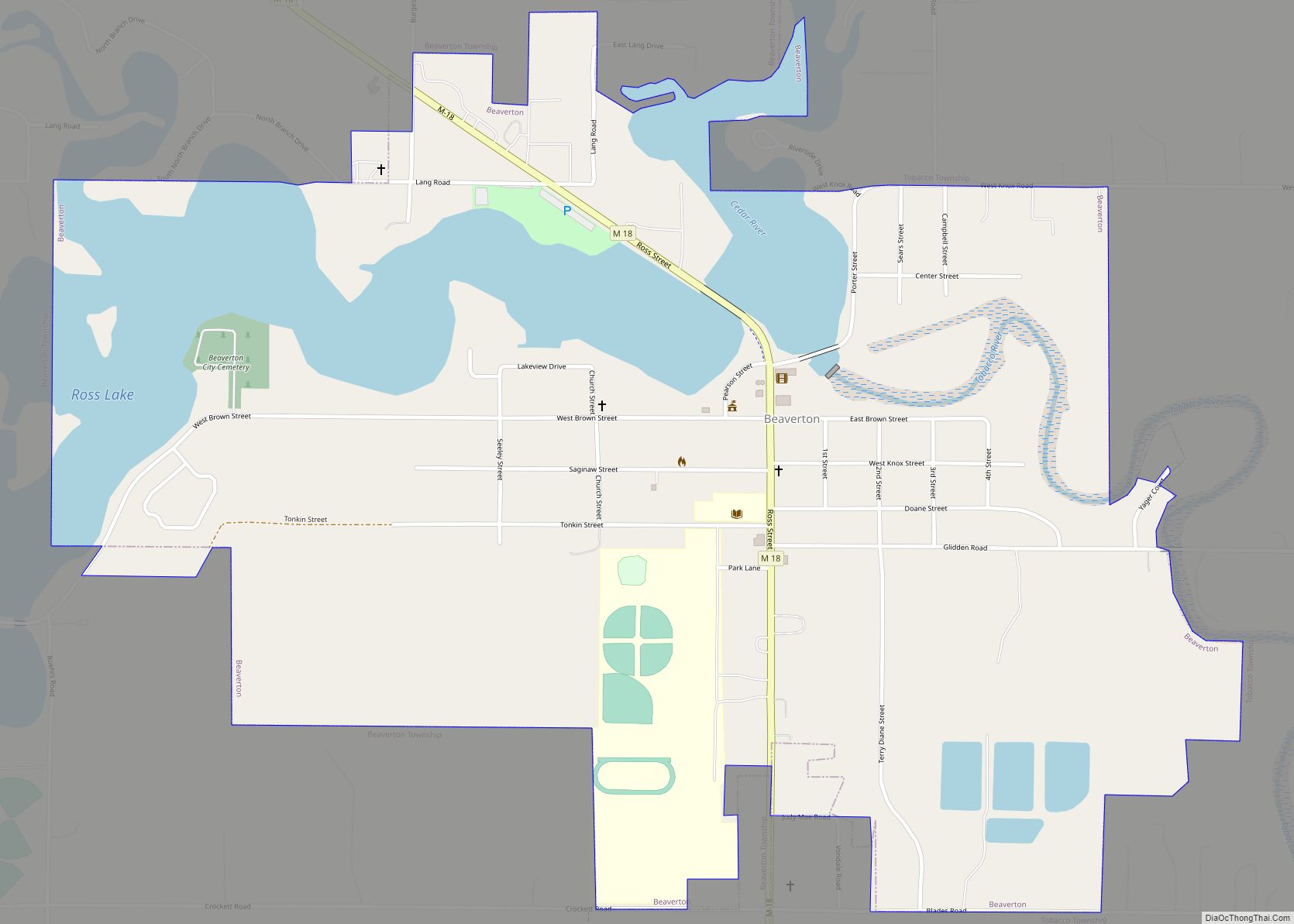
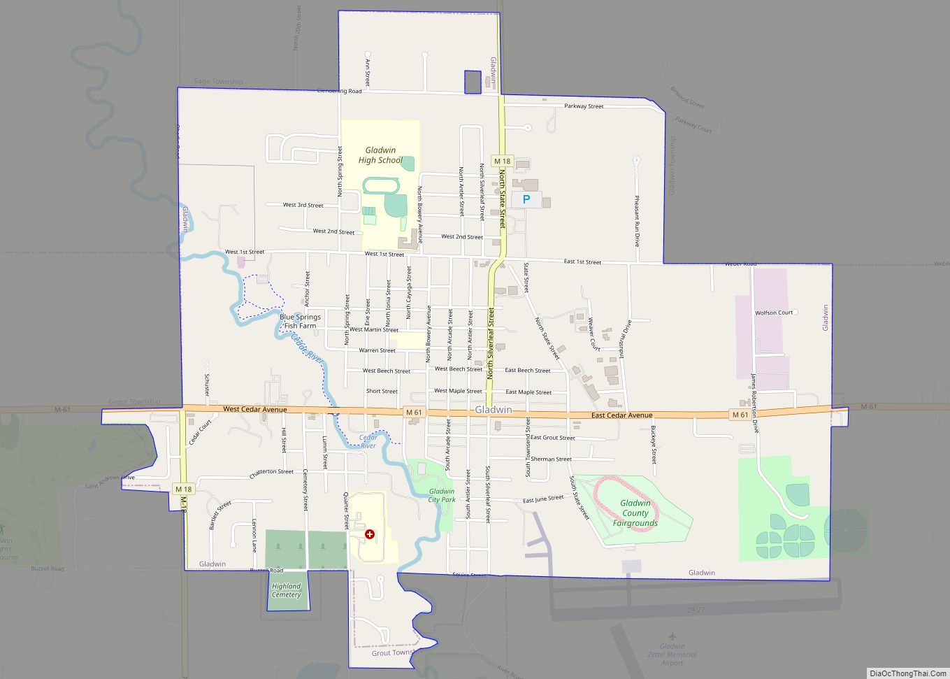
Gladwin is a city in Gladwin County in the U.S. state of Michigan. The population was 2,933 at the 2010 census. Gladwin is the county seat of Gladwin County. The city is at the southwest corner of Gladwin Township, but the two are administered autonomously.
| Name: | Gladwin city |
|---|---|
| LSAD Code: | 25 |
| LSAD Description: | city (suffix) |
| State: | Michigan |
| County: | Gladwin County |
| Incorporated: | 1885 (village) 1893 (city) |
| Elevation: | 784 ft (239 m) |
| Total Area: | 2.90 sq mi (7.51 km²) |
| Land Area: | 2.88 sq mi (7.45 km²) |
| Water Area: | 0.02 sq mi (0.05 km²) |
| Total Population: | 3,069 |
| Population Density: | 1,066.74/sq mi (411.83/km²) |
| Area code: | 989 |
| FIPS code: | 2632320 |
| GNISfeature ID: | 0626857 |
Online Interactive Map
Click on ![]() to view map in "full screen" mode.
to view map in "full screen" mode.
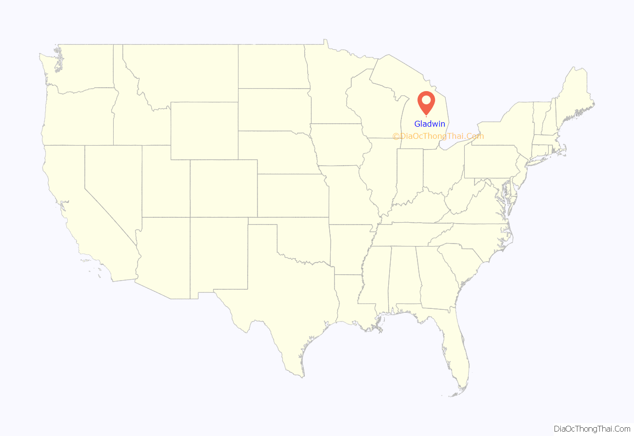
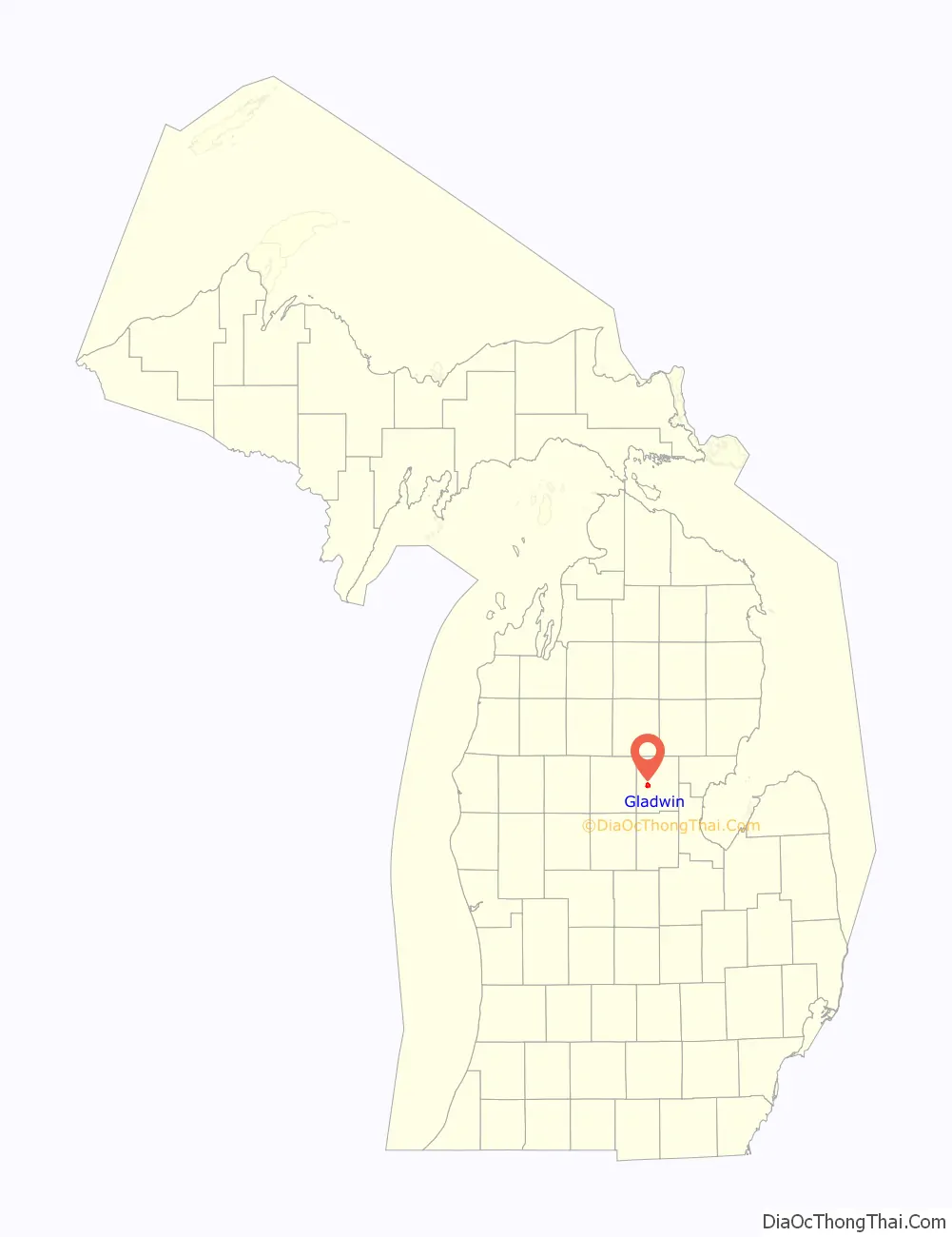
Gladwin location map. Where is Gladwin city?
History
Gladwin county is named for Henry Gladwin, a British military commander at Detroit during Pontiac’s War. The county was named in 1831 and organized in 1875. Gladwin had its beginnings in 1875 during the Michigan lumber boom. Situated on the Cedar River, the city was named Cedar until it was discovered that another Michigan town shared the same name. Thereafter, the city was named after the county. The first church in Gladwin was a Methodist church completed on March 31, 1878. In the Fall of 1878, the first schoolhouse was built by Isaac Hanna, later being replaced by a four-room schoolhouse in 1883. Gladwin was incorporated as a village in 1885.
Gladwin Road Map

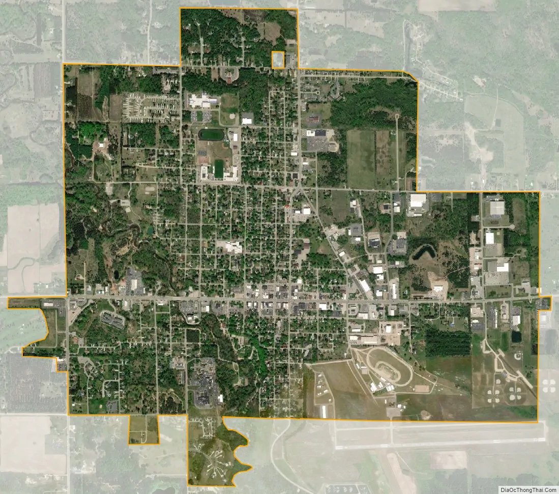
Gladwin city Satellite Map
Geography
According to the U.S. Census Bureau, the city has a total area of 2.90 square miles (7.51 km), of which 2.88 square miles (7.46 km) is land and 0.02 square miles (0.05 km) (0.69%) is water.
Major highways
- M-18
- M-61
Climate
This climatic region is typified by large seasonal temperature differences, with warm to hot (and often humid) summers and cold (sometimes severely cold) winters. According to the Köppen Climate Classification system, Gladwin has a humid continental climate, abbreviated “Dfb” on climate maps.
See also
Map of Michigan State and its subdivision:- Alcona
- Alger
- Allegan
- Alpena
- Antrim
- Arenac
- Baraga
- Barry
- Bay
- Benzie
- Berrien
- Branch
- Calhoun
- Cass
- Charlevoix
- Cheboygan
- Chippewa
- Clare
- Clinton
- Crawford
- Delta
- Dickinson
- Eaton
- Emmet
- Genesee
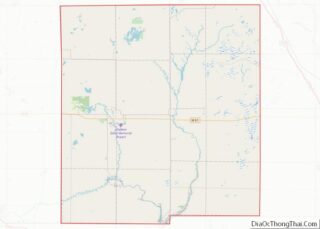
- Gladwin
- Gogebic
- Grand Traverse
- Gratiot
- Hillsdale
- Houghton
- Huron
- Ingham
- Ionia
- Iosco
- Iron
- Isabella
- Jackson
- Kalamazoo
- Kalkaska
- Kent
- Keweenaw
- Lake
- Lake Hurron
- Lake Michigan
- Lake St. Clair
- Lake Superior
- Lapeer
- Leelanau
- Lenawee
- Livingston
- Luce
- Mackinac
- Macomb
- Manistee
- Marquette
- Mason
- Mecosta
- Menominee
- Midland
- Missaukee
- Monroe
- Montcalm
- Montmorency
- Muskegon
- Newaygo
- Oakland
- Oceana
- Ogemaw
- Ontonagon
- Osceola
- Oscoda
- Otsego
- Ottawa
- Presque Isle
- Roscommon
- Saginaw
- Saint Clair
- Saint Joseph
- Sanilac
- Schoolcraft
- Shiawassee
- Tuscola
- Van Buren
- Washtenaw
- Wayne
- Wexford
- Alabama
- Alaska
- Arizona
- Arkansas
- California
- Colorado
- Connecticut
- Delaware
- District of Columbia
- Florida
- Georgia
- Hawaii
- Idaho
- Illinois
- Indiana
- Iowa
- Kansas
- Kentucky
- Louisiana
- Maine
- Maryland
- Massachusetts
- Michigan
- Minnesota
- Mississippi
- Missouri
- Montana
- Nebraska
- Nevada
- New Hampshire
- New Jersey
- New Mexico
- New York
- North Carolina
- North Dakota
- Ohio
- Oklahoma
- Oregon
- Pennsylvania
- Rhode Island
- South Carolina
- South Dakota
- Tennessee
- Texas
- Utah
- Vermont
- Virginia
- Washington
- West Virginia
- Wisconsin
- Wyoming