Howell is the largest city and county seat of Livingston County, Michigan. As of the 2020 census, the city had a population of 10,068. The city is mostly surrounded by Howell Township, but the two are administered autonomously. Howell is part of the South Lyon–Howell–Brighton Urban Area, which is an extension of the larger Detroit–Warren–Dearborn (Metro Detroit) Metropolitan Statistical Area.
| Name: | Howell city |
|---|---|
| LSAD Code: | 25 |
| LSAD Description: | city (suffix) |
| State: | Michigan |
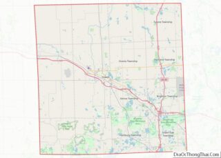
| County: | Livingston County |
| Incorporated: | 1863 |
| Elevation: | 935 ft (285 m) |
| Land Area: | 4.99 sq mi (12.93 km²) |
| Water Area: | 0.20 sq mi (0.53 km²) |
| Population Density: | 2,017.23/sq mi (778.80/km²) |
| Area code: | 517 |
| FIPS code: | 2639540 |
| GNISfeature ID: | 0628717 |
| Website: | www.cityofhowell.org |
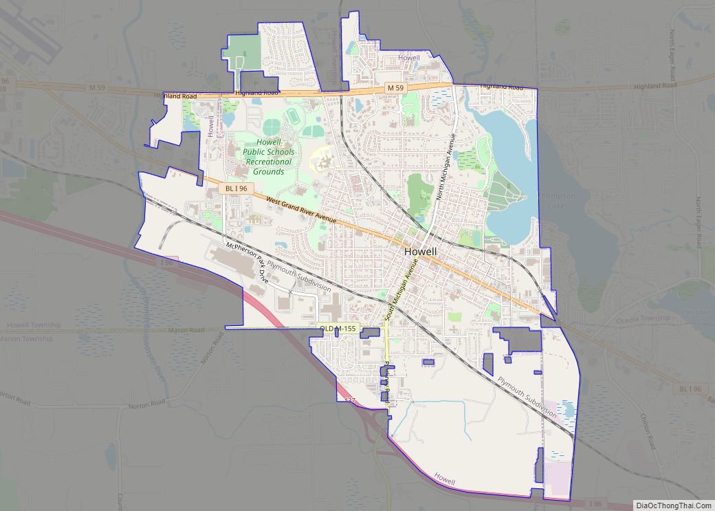
Online Interactive Map
Click on ![]() to view map in "full screen" mode.
to view map in "full screen" mode.
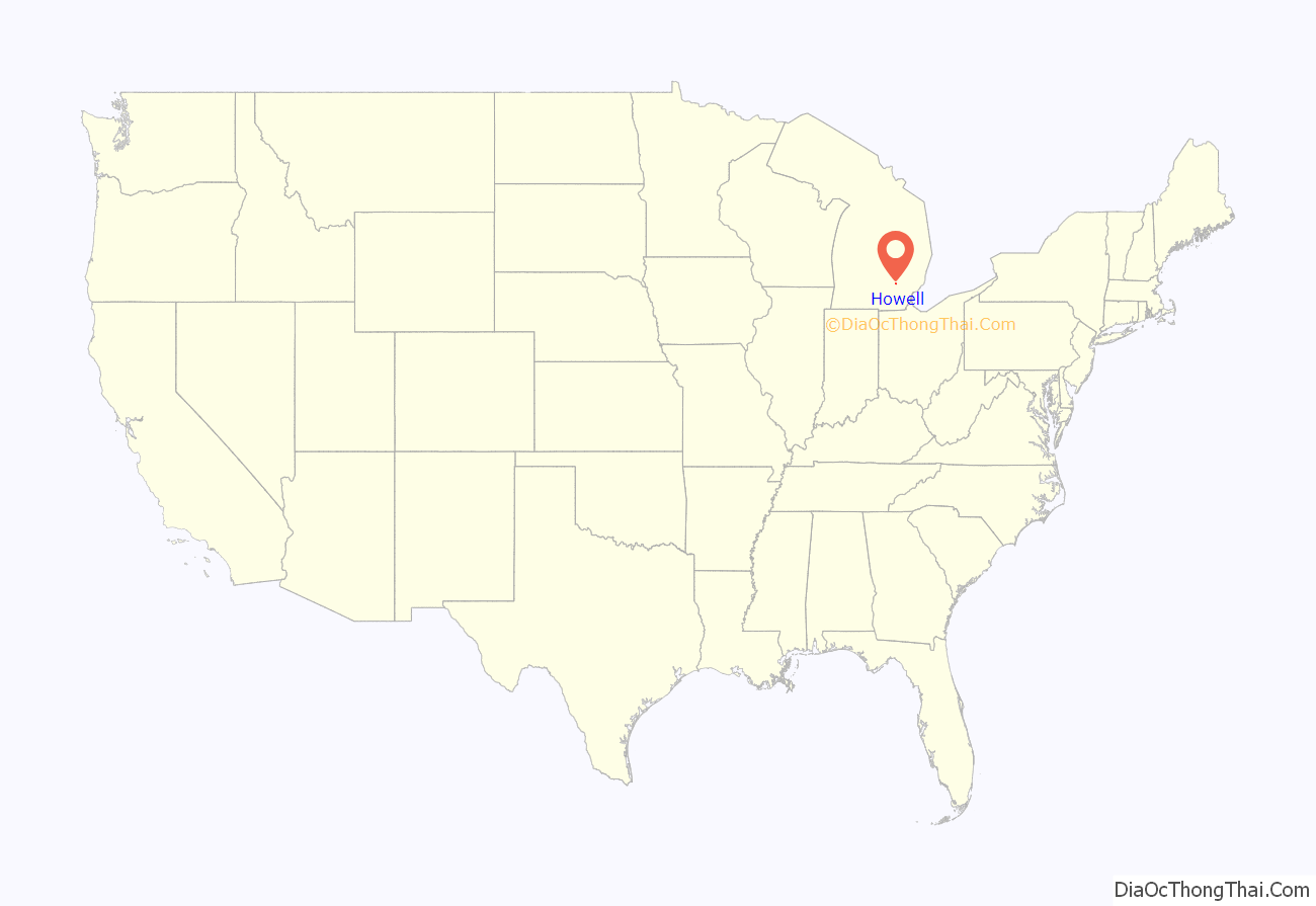
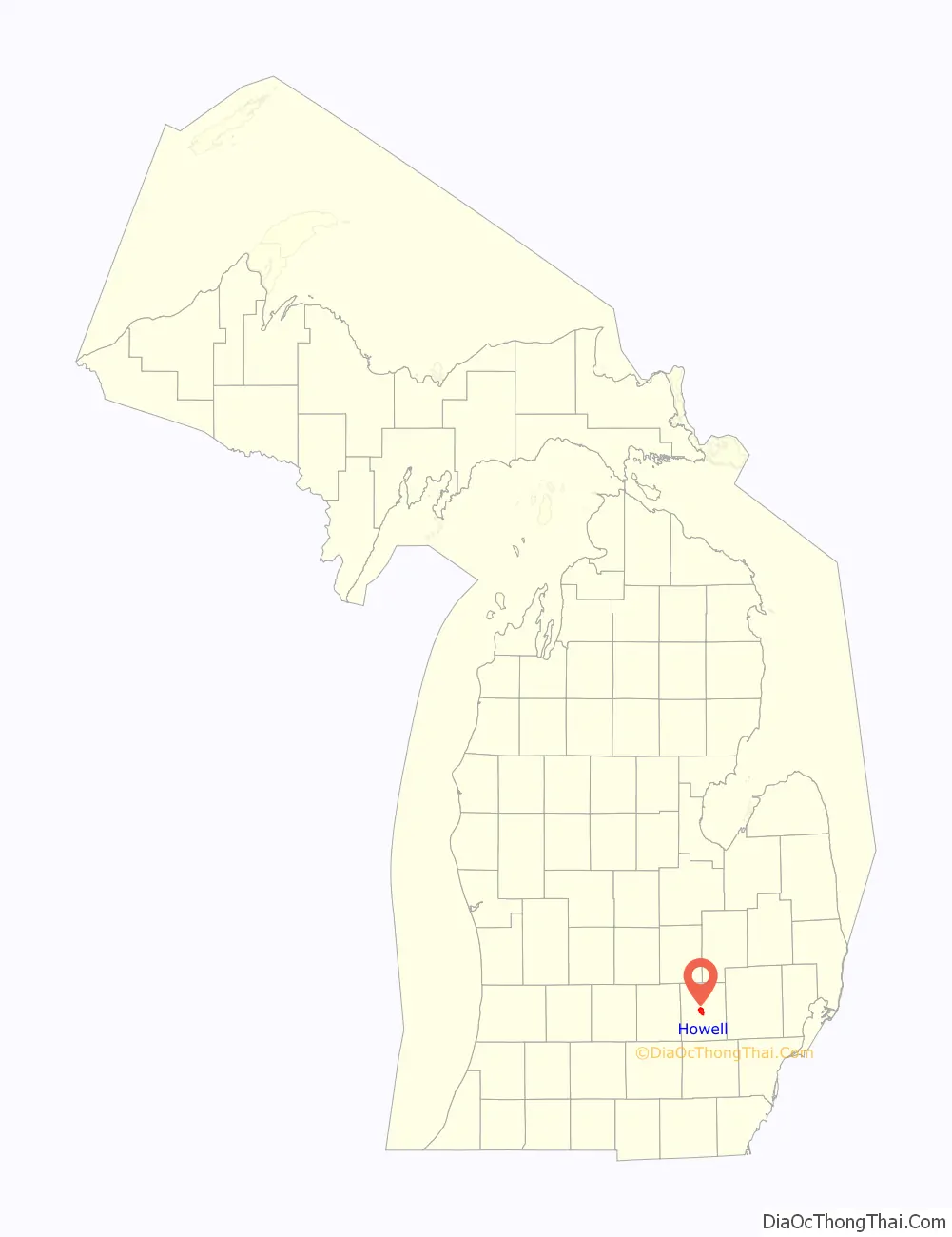
Howell location map. Where is Howell city?
History
January 1836 saw the establishment of the first post office. Flavius J. B. Crane was postmaster and the post office was in the Eagle Tavern. In March of this same year, there was a mail route started between Howell and the village of Kensington, and west to Grand Rapids.
The City of Howell is the county seat of Livingston County. On 24 March 1836, the legislature passed an act organizing Livingston County and Howell was slated to become the county seat. This claim was vigorously opposed by a group from Brighton and was not wholly relinquished by them until the county buildings were erected 12 years later. Howell at once assumed the dignity of the county seat.
The town was originally called Livingston Center and was established as a village by an act of Legislature on 14 March 1863, consisting of sections 35 and 36, and the south half of sections 25 and 26 of Howell Township.
The Howell Home Rule City Charter was initially adopted in 1955.
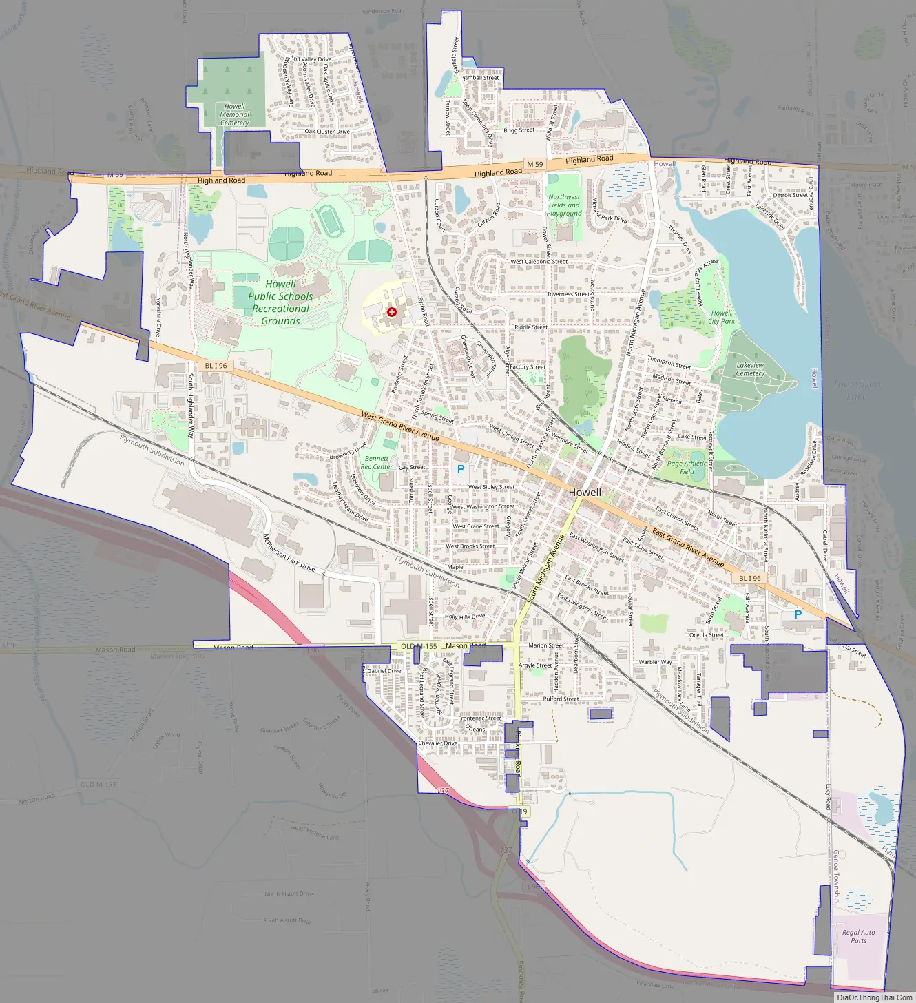
Howell Road Map
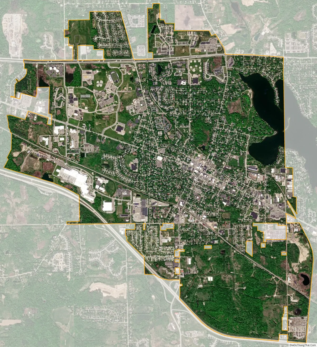
Howell city Satellite Map
Geography
According to the United States Census Bureau, the city has an area of 4.95 square miles (12.82 km), of which 4.75 square miles (12.30 km) is land and 0.20 square miles (0.52 km) is water.
Major highways
- I-96
- BL I-96
- M-59
- M-155 (unsigned)
- D-19
See also
Map of Michigan State and its subdivision:- Alcona
- Alger
- Allegan
- Alpena
- Antrim
- Arenac
- Baraga
- Barry
- Bay
- Benzie
- Berrien
- Branch
- Calhoun
- Cass
- Charlevoix
- Cheboygan
- Chippewa
- Clare
- Clinton
- Crawford
- Delta
- Dickinson
- Eaton
- Emmet
- Genesee
- Gladwin
- Gogebic
- Grand Traverse
- Gratiot
- Hillsdale
- Houghton
- Huron
- Ingham
- Ionia
- Iosco
- Iron
- Isabella
- Jackson
- Kalamazoo
- Kalkaska
- Kent
- Keweenaw
- Lake
- Lake Hurron
- Lake Michigan
- Lake St. Clair
- Lake Superior
- Lapeer
- Leelanau
- Lenawee
- Livingston
- Luce
- Mackinac
- Macomb
- Manistee
- Marquette
- Mason
- Mecosta
- Menominee
- Midland
- Missaukee
- Monroe
- Montcalm
- Montmorency
- Muskegon
- Newaygo
- Oakland
- Oceana
- Ogemaw
- Ontonagon
- Osceola
- Oscoda
- Otsego
- Ottawa
- Presque Isle
- Roscommon
- Saginaw
- Saint Clair
- Saint Joseph
- Sanilac
- Schoolcraft
- Shiawassee
- Tuscola
- Van Buren
- Washtenaw
- Wayne
- Wexford
- Alabama
- Alaska
- Arizona
- Arkansas
- California
- Colorado
- Connecticut
- Delaware
- District of Columbia
- Florida
- Georgia
- Hawaii
- Idaho
- Illinois
- Indiana
- Iowa
- Kansas
- Kentucky
- Louisiana
- Maine
- Maryland
- Massachusetts
- Michigan
- Minnesota
- Mississippi
- Missouri
- Montana
- Nebraska
- Nevada
- New Hampshire
- New Jersey
- New Mexico
- New York
- North Carolina
- North Dakota
- Ohio
- Oklahoma
- Oregon
- Pennsylvania
- Rhode Island
- South Carolina
- South Dakota
- Tennessee
- Texas
- Utah
- Vermont
- Virginia
- Washington
- West Virginia
- Wisconsin
- Wyoming