White Cloud is a city in the U.S. state of Michigan, a small town on the bank of the White River. As of the 2020 census, the city population was 1,479. It is the county seat of Newaygo County. Being designated a trail town, the outdoors are a big part of life in White Cloud, with the 4,600 mile North Country Trail stretching nearby, the Mill Pond Park with a beach and playground, and the White Cloud County Park and Campground, being major draws to the area. White Cloud was recognized by the North Country Trail Association as a “Trail Town”.
| Name: | White Cloud city |
|---|---|
| LSAD Code: | 25 |
| LSAD Description: | city (suffix) |
| State: | Michigan |
| County: | Newaygo County |
| Elevation: | 873 ft (266 m) |
| Total Area: | 1.99 sq mi (5.15 km²) |
| Land Area: | 1.93 sq mi (5.01 km²) |
| Water Area: | 0.06 sq mi (0.14 km²) |
| Total Population: | 1,479 |
| Population Density: | 765.13/sq mi (295.38/km²) |
| ZIP code: | 49349 |
| Area code: | 231 |
| FIPS code: | 2686680 |
| GNISfeature ID: | 1622135 |
| Website: | www.cityofwhitecloud.org |
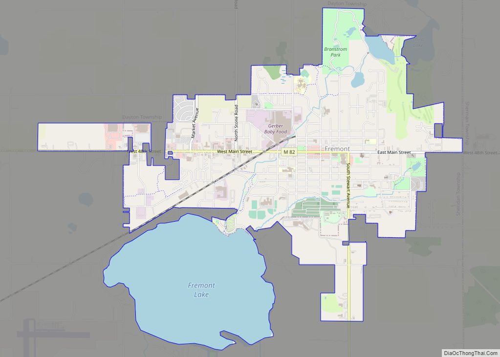
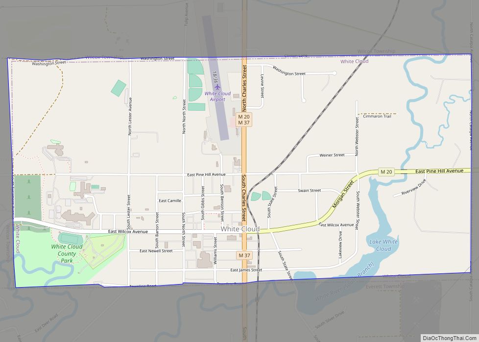
Online Interactive Map
Click on ![]() to view map in "full screen" mode.
to view map in "full screen" mode.
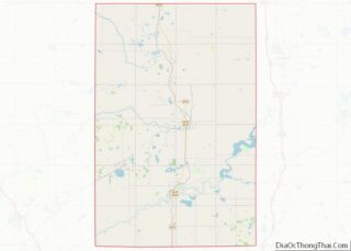
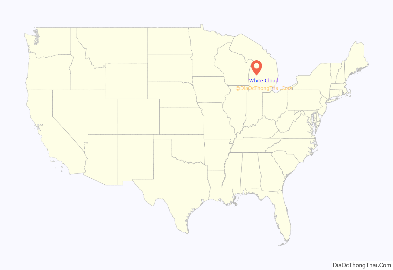
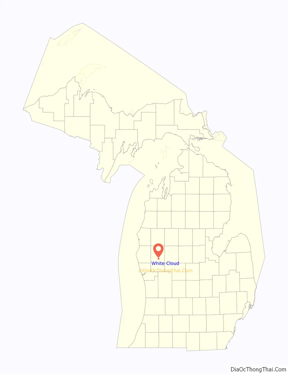
White Cloud location map. Where is White Cloud city?
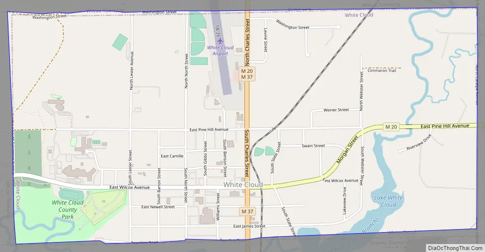
White Cloud Road Map
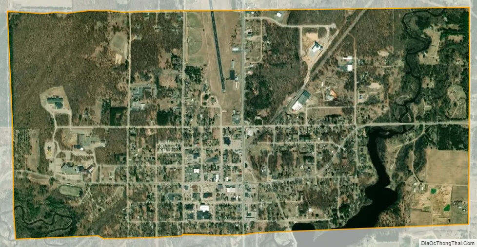
White Cloud city Satellite Map
Geography
According to the United States Census Bureau, the city has a total area of 2.00 square miles (5.18 km), of which 1.95 square miles (5.05 km) is land and 0.05 square miles (0.13 km) is water.
See also
Map of Michigan State and its subdivision:- Alcona
- Alger
- Allegan
- Alpena
- Antrim
- Arenac
- Baraga
- Barry
- Bay
- Benzie
- Berrien
- Branch
- Calhoun
- Cass
- Charlevoix
- Cheboygan
- Chippewa
- Clare
- Clinton
- Crawford
- Delta
- Dickinson
- Eaton
- Emmet
- Genesee
- Gladwin
- Gogebic
- Grand Traverse
- Gratiot
- Hillsdale
- Houghton
- Huron
- Ingham
- Ionia
- Iosco
- Iron
- Isabella
- Jackson
- Kalamazoo
- Kalkaska
- Kent
- Keweenaw
- Lake
- Lake Hurron
- Lake Michigan
- Lake St. Clair
- Lake Superior
- Lapeer
- Leelanau
- Lenawee
- Livingston
- Luce
- Mackinac
- Macomb
- Manistee
- Marquette
- Mason
- Mecosta
- Menominee
- Midland
- Missaukee
- Monroe
- Montcalm
- Montmorency
- Muskegon
- Newaygo
- Oakland
- Oceana
- Ogemaw
- Ontonagon
- Osceola
- Oscoda
- Otsego
- Ottawa
- Presque Isle
- Roscommon
- Saginaw
- Saint Clair
- Saint Joseph
- Sanilac
- Schoolcraft
- Shiawassee
- Tuscola
- Van Buren
- Washtenaw
- Wayne
- Wexford
- Alabama
- Alaska
- Arizona
- Arkansas
- California
- Colorado
- Connecticut
- Delaware
- District of Columbia
- Florida
- Georgia
- Hawaii
- Idaho
- Illinois
- Indiana
- Iowa
- Kansas
- Kentucky
- Louisiana
- Maine
- Maryland
- Massachusetts
- Michigan
- Minnesota
- Mississippi
- Missouri
- Montana
- Nebraska
- Nevada
- New Hampshire
- New Jersey
- New Mexico
- New York
- North Carolina
- North Dakota
- Ohio
- Oklahoma
- Oregon
- Pennsylvania
- Rhode Island
- South Carolina
- South Dakota
- Tennessee
- Texas
- Utah
- Vermont
- Virginia
- Washington
- West Virginia
- Wisconsin
- Wyoming