Michigan City is a city in Nelson County, North Dakota, United States. The population was 263 at the 2020 census. Though the official name is Michigan City, local residents commonly refer to the city as Michigan. The town population has been declining since the 1980 census.
Michigan City was founded in 1882 by Edwin A. Lamb, who came to the area from Port Huron, Michigan.
SITE OF THE 1945 MICHIGAN TRAIN WRECK, Michigan, North Dakota
In 1945, a Great Northern passenger train collided into the rear of another near the city, causing 309 injuries and 34 deaths. Most of the passengers on the two trains were soldiers returning home from World War II.
The city hosts the annual Michigan Days festival each August.
| Name: | Michigan City city |
|---|---|
| LSAD Code: | 25 |
| LSAD Description: | city (suffix) |
| State: | North Dakota |
| County: | Nelson County |
| Founded: | 1882 |
| Elevation: | 1,519 ft (463 m) |
| Total Area: | 0.51 sq mi (1.33 km²) |
| Land Area: | 0.50 sq mi (1.30 km²) |
| Water Area: | 0.01 sq mi (0.03 km²) |
| Total Population: | 263 |
| Population Density: | 522.86/sq mi (201.89/km²) |
| ZIP code: | 58259 |
| Area code: | 701 |
| FIPS code: | 3852740 |
| GNISfeature ID: | 1036161 |
| Website: | michigannd.com |
Online Interactive Map
Click on ![]() to view map in "full screen" mode.
to view map in "full screen" mode.
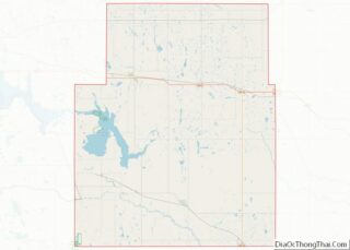
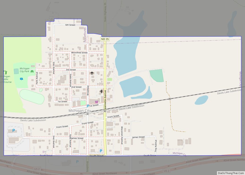
Michigan City location map. Where is Michigan City city?
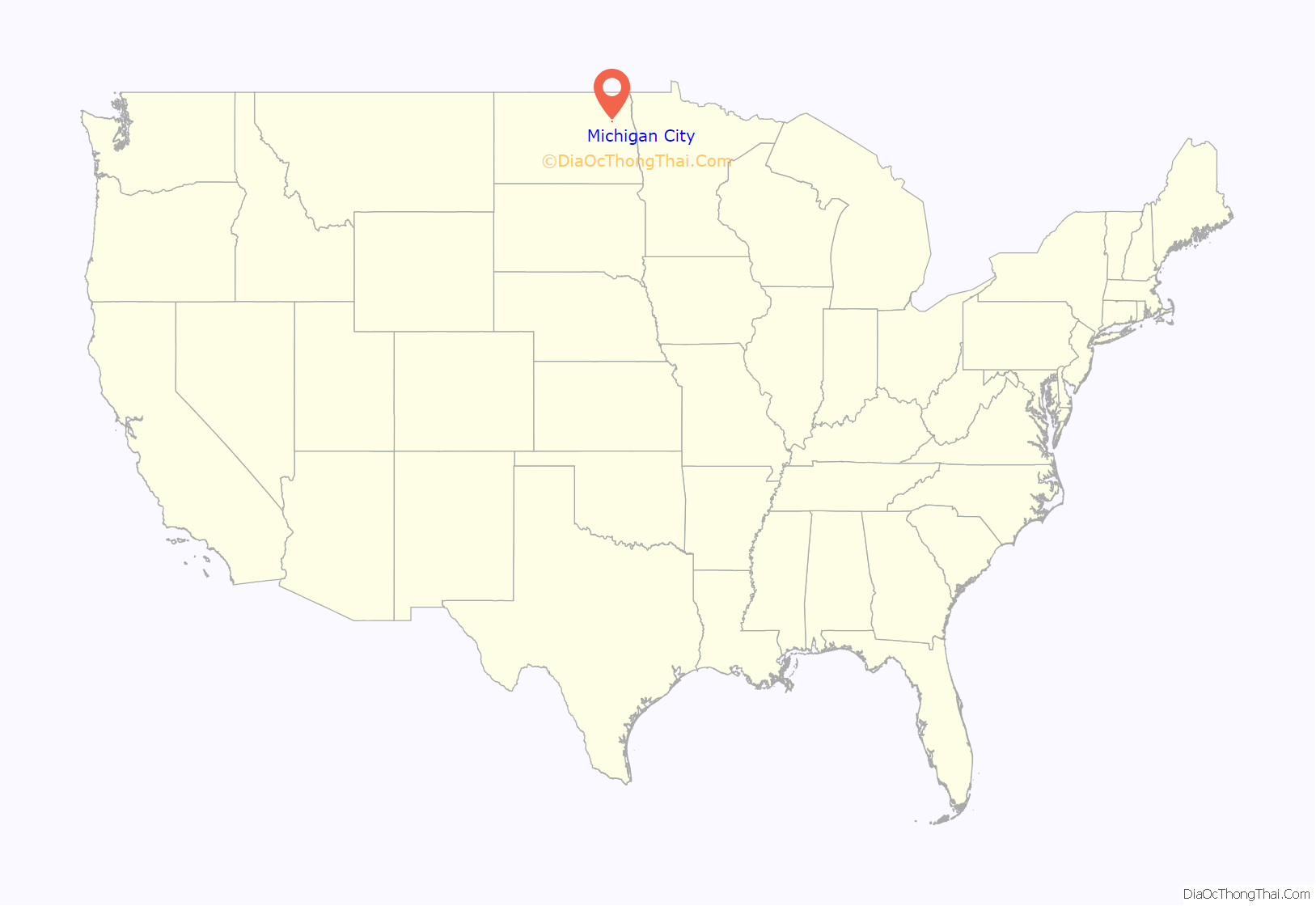
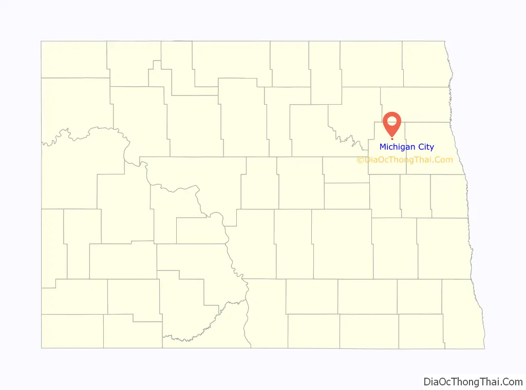
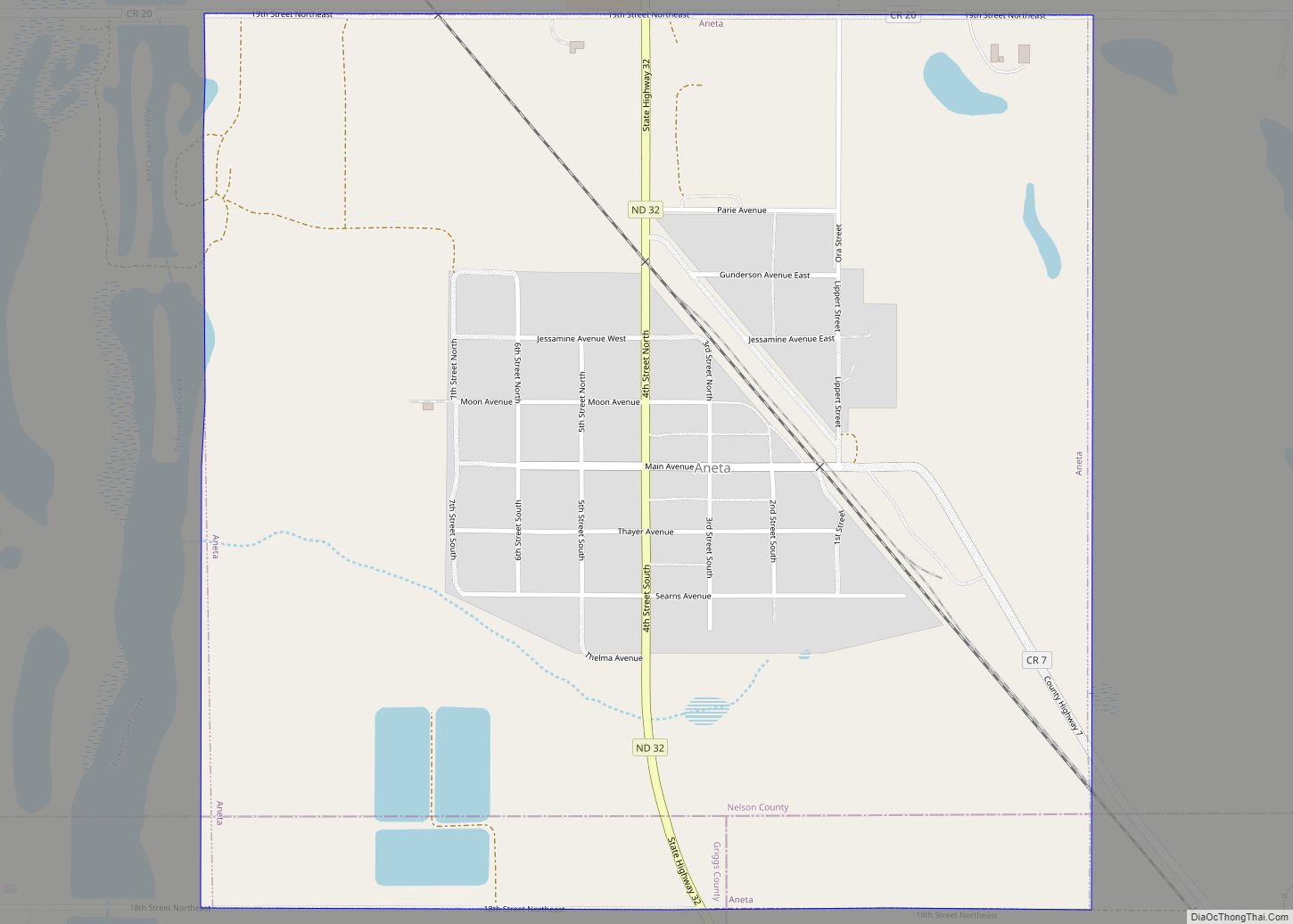
Michigan City Road Map
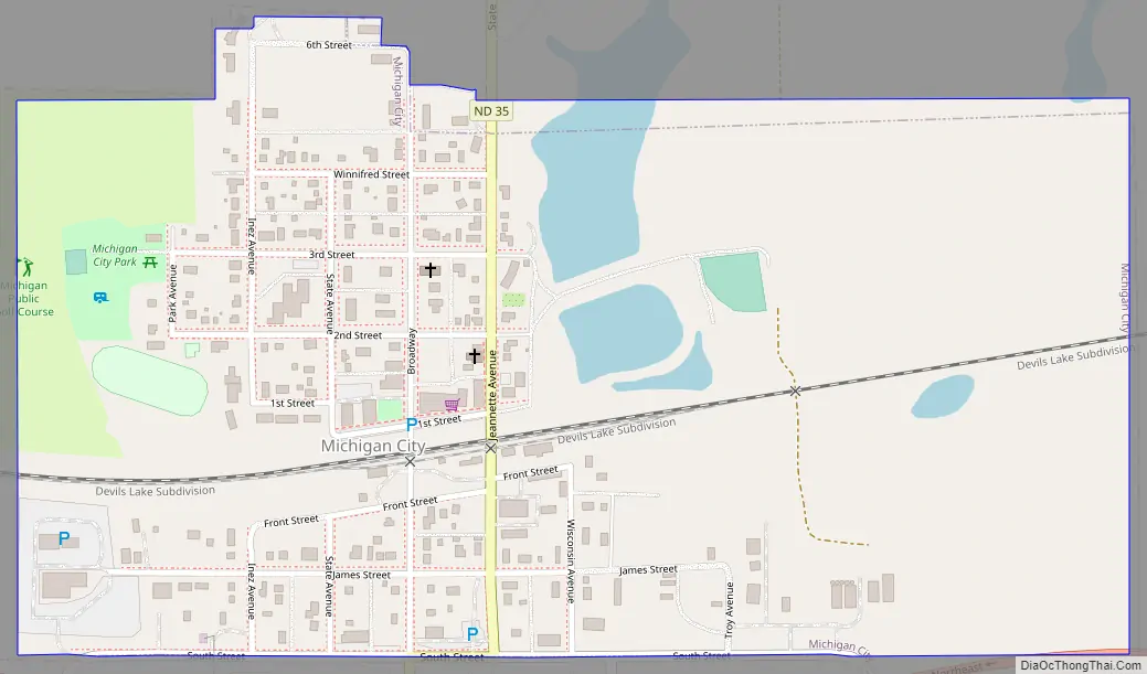
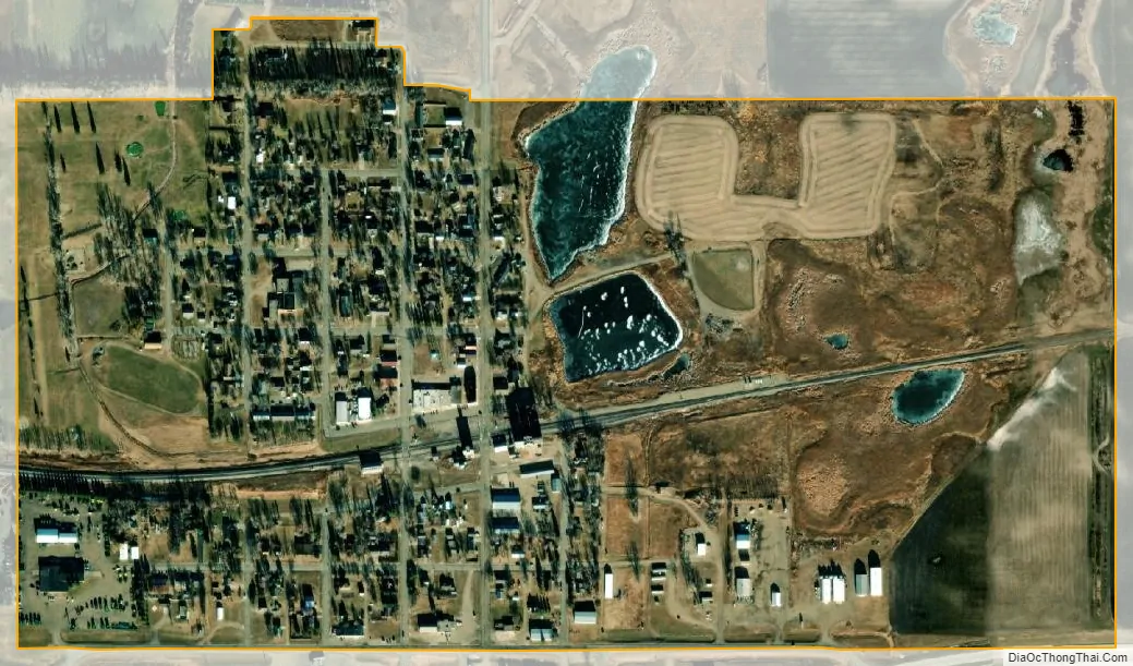
Michigan City city Satellite Map
Geography
Michigan City is located at 48°1′28″N 98°7′19″W / 48.02444°N 98.12194°W / 48.02444; -98.12194 (48.024415, -98.121851).
According to the United States Census Bureau, the city has a total area of 0.52 square miles (1.35 km), of which 0.51 square miles (1.32 km) is land and 0.01 square miles (0.03 km) is water.
Michigan is located between Grand Forks and Devils Lake, both in North Dakota.
See also
Map of North Dakota State and its subdivision:- Adams
- Barnes
- Benson
- Billings
- Bottineau
- Bowman
- Burke
- Burleigh
- Cass
- Cavalier
- Dickey
- Divide
- Dunn
- Eddy
- Emmons
- Foster
- Golden Valley
- Grand Forks
- Grant
- Griggs
- Hettinger
- Kidder
- Lamoure
- Logan
- McHenry
- McIntosh
- McKenzie
- McLean
- Mercer
- Morton
- Mountrail
- Nelson
- Oliver
- Pembina
- Pierce
- Ramsey
- Ransom
- Renville
- Richland
- Rolette
- Sargent
- Sheridan
- Sioux
- Slope
- Stark
- Steele
- Stutsman
- Towner
- Traill
- Walsh
- Ward
- Wells
- Williams
- Alabama
- Alaska
- Arizona
- Arkansas
- California
- Colorado
- Connecticut
- Delaware
- District of Columbia
- Florida
- Georgia
- Hawaii
- Idaho
- Illinois
- Indiana
- Iowa
- Kansas
- Kentucky
- Louisiana
- Maine
- Maryland
- Massachusetts
- Michigan
- Minnesota
- Mississippi
- Missouri
- Montana
- Nebraska
- Nevada
- New Hampshire
- New Jersey
- New Mexico
- New York
- North Carolina
- North Dakota
- Ohio
- Oklahoma
- Oregon
- Pennsylvania
- Rhode Island
- South Carolina
- South Dakota
- Tennessee
- Texas
- Utah
- Vermont
- Virginia
- Washington
- West Virginia
- Wisconsin
- Wyoming