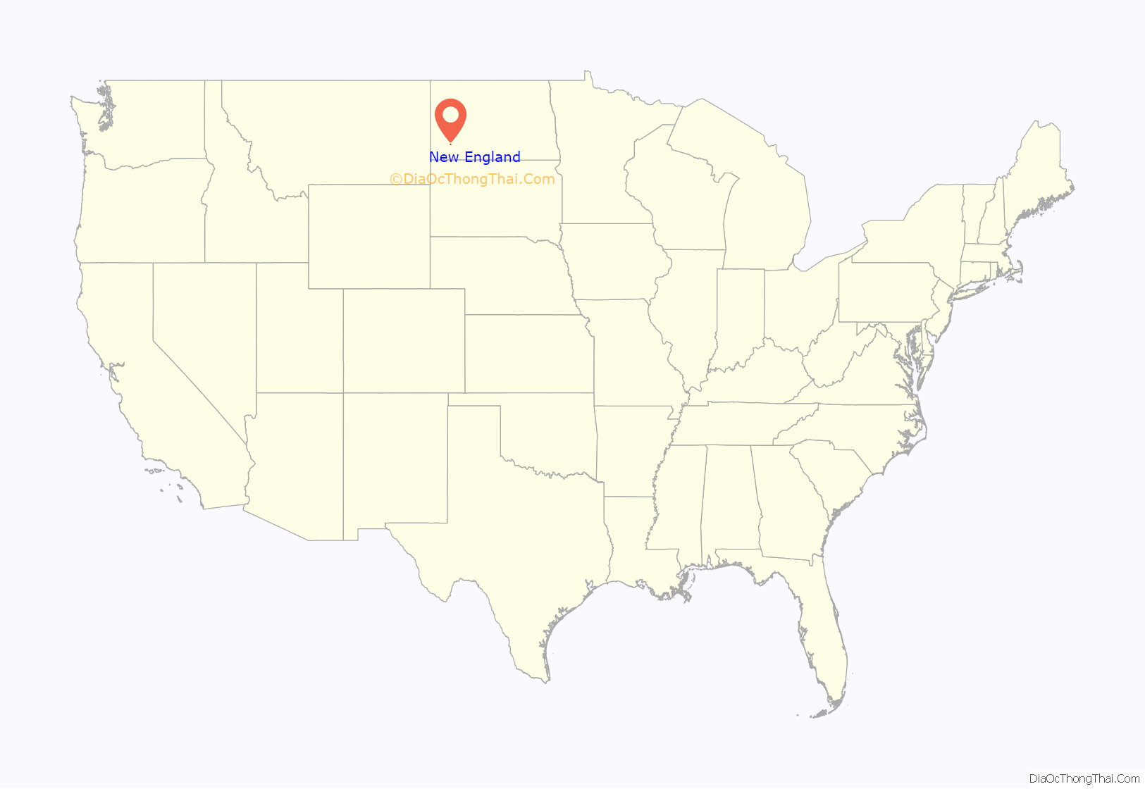
New England is a city in Hettinger County, North Dakota, United States. The population was 683 at the 2020 census.
New England was founded in 1887, predating all other settlements in Hettinger County by many years. The name recognizes that many early settlers were from the New England states of Vermont and Massachusetts. Until the tracks were abandoned in 1983, the city was located at the terminus of a Milwaukee Road branch line that split from the railroad’s Pacific Extension in McLaughlin, South Dakota.
The silhouette of the two Rainy Buttes near New England is a distinguishing symbol of the town.
| Name: | New England city |
|---|---|
| LSAD Code: | 25 |
| LSAD Description: | city (suffix) |
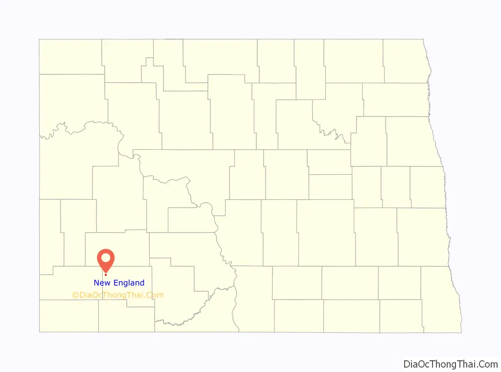
| State: | North Dakota |
| County: | Hettinger County |
| Elevation: | 2,595 ft (791 m) |
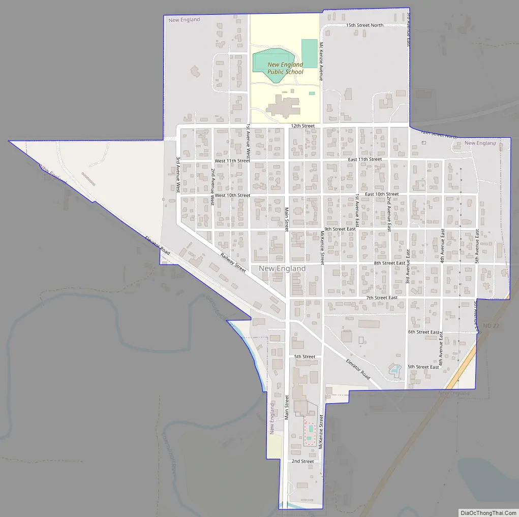
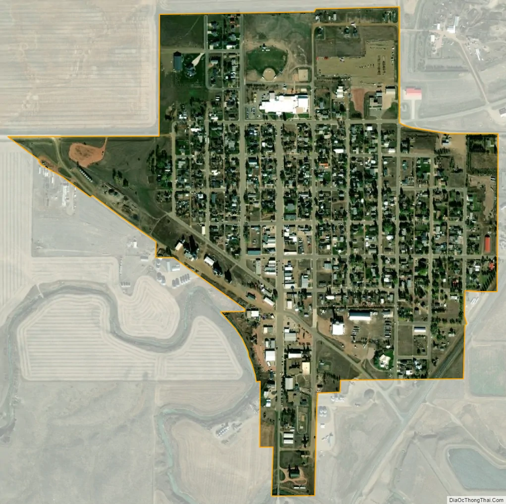
| Total Area: | 0.49 sq mi (1.28 km²) |
| Land Area: | 0.49 sq mi (1.28 km²) |
| Water Area: | 0.00 sq mi (0.00 km²) |
| Total Population: | 683 |
| Population Density: | 1,385.40/sq mi (535.29/km²) |
| ZIP code: | 58647 |
| Area code: | 701 |
| FIPS code: | 3856180 |
| GNISfeature ID: | 1030383 |
| Website: | ndnewengland.com |
Online Interactive Map
Click on ![]() to view map in "full screen" mode.
to view map in "full screen" mode.
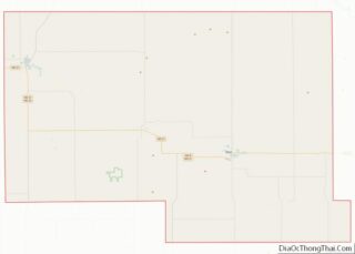
New England location map. Where is New England city?
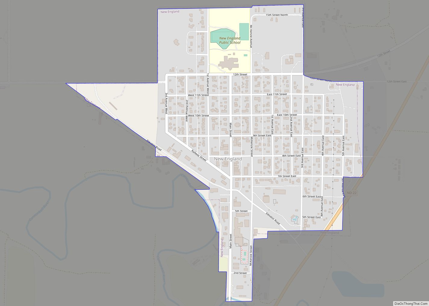
New England Road Map
New England city Satellite Map
Geography
New England is located at 46°32′24″N 102°51′56″W / 46.54000°N 102.86556°W / 46.54000; -102.86556 (46.539925, −102.865597).
According to the United States Census Bureau, the city has a total area of 0.49 square miles (1.27 km), all land.
Climate
New England has a borderline humid continental climate (Dfb)/cool semi-arid climate (BSk), characterised by very warm summers with moderate rainfall mostly from thunderstorms, and freezing, dry winters. The frequent occurrence of warm chinook winds in winter, however, means that New England holds the record for the warmest temperature recorded in North Dakota in December and is only 1 °F or 0.6 °C below Fort Yates’ record for the state’s warmest February (and winter season) temperature.
See also
Map of North Dakota State and its subdivision:- Adams
- Barnes
- Benson
- Billings
- Bottineau
- Bowman
- Burke
- Burleigh
- Cass
- Cavalier
- Dickey
- Divide
- Dunn
- Eddy
- Emmons
- Foster
- Golden Valley
- Grand Forks
- Grant
- Griggs
- Hettinger
- Kidder
- Lamoure
- Logan
- McHenry
- McIntosh
- McKenzie
- McLean
- Mercer
- Morton
- Mountrail
- Nelson
- Oliver
- Pembina
- Pierce
- Ramsey
- Ransom
- Renville
- Richland
- Rolette
- Sargent
- Sheridan
- Sioux
- Slope
- Stark
- Steele
- Stutsman
- Towner
- Traill
- Walsh
- Ward
- Wells
- Williams
- Alabama
- Alaska
- Arizona
- Arkansas
- California
- Colorado
- Connecticut
- Delaware
- District of Columbia
- Florida
- Georgia
- Hawaii
- Idaho
- Illinois
- Indiana
- Iowa
- Kansas
- Kentucky
- Louisiana
- Maine
- Maryland
- Massachusetts
- Michigan
- Minnesota
- Mississippi
- Missouri
- Montana
- Nebraska
- Nevada
- New Hampshire
- New Jersey
- New Mexico
- New York
- North Carolina
- North Dakota
- Ohio
- Oklahoma
- Oregon
- Pennsylvania
- Rhode Island
- South Carolina
- South Dakota
- Tennessee
- Texas
- Utah
- Vermont
- Virginia
- Washington
- West Virginia
- Wisconsin
- Wyoming