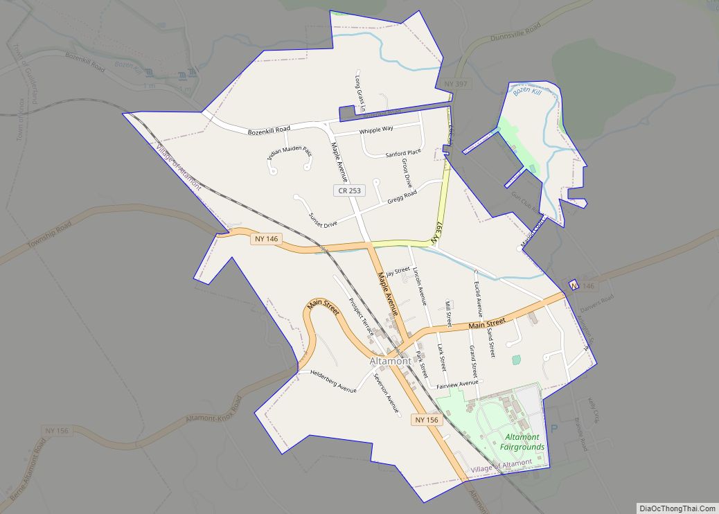
Altamont is a village located in the town of Guilderland in Albany County, New York, United States. The village is in the western part of the town. The population was 1,720 at the 2010 census. The name means “high mountain.”
| Name: | Altamont village |
|---|---|
| LSAD Code: | 47 |
| LSAD Description: | village (suffix) |
| State: | New York |
| County: | Albany County |
| Incorporated: | 1890 |
| Elevation: | 451 ft (137 m) |
| Total Area: | 1.27 sq mi (3.28 km²) |
| Land Area: | 1.27 sq mi (3.28 km²) |
| Water Area: | 0.00 sq mi (0.00 km²) |
| Total Population: | 1,675 |
| Population Density: | 1,323.06/sq mi (510.80/km²) |
| ZIP code: | 12009 |
| Area code: | 518 |
| FIPS code: | 3601517 |
Online Interactive Map
Click on ![]() to view map in "full screen" mode.
to view map in "full screen" mode.
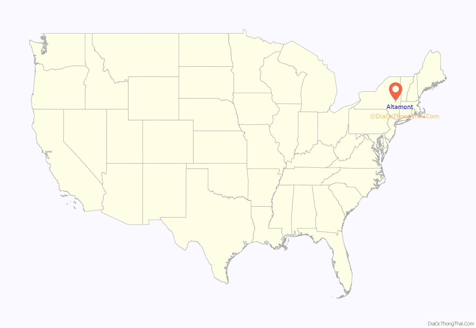
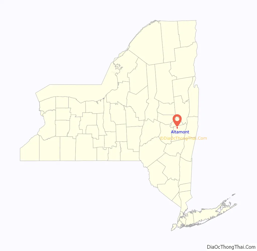
Altamont location map. Where is Altamont village?
History
In colonial times, this area was part of the Manor of Rensselaerwyck, granted by the Dutch West India Company to Killian Van Rensselaer in 1630. The area was known as Hellerburgh in the early 18th century. In the early 19th century Knowersville, was established in the rural part of Albany County, just below the Helderberg Mountains. This settlement eventually became known as Altamont.
Altamont was a summer vacation spot that was reached by train. The train station which once served this formerly busy whistle stop is now the location of the Altamont Free Library. The old hotel in the town center burned down nearly a century ago. A village fair has been held annually in the local fairgrounds since 1893. The fairground is also the site of other festivals.
The village incorporated in 1890. Hiram Griggs (1836–1909) was the first mayor of the village of Altamont and his house was listed on the National Register of Historic Places in 2010. Also listed on the National Register of Historic Places are the Delaware and Hudson Railroad Passenger Station, Fine Arts and Flower Building Altamont Fairground, Hayes House, and Lainhart Farm Complex and Dutch Barn.
Altamont Road Map
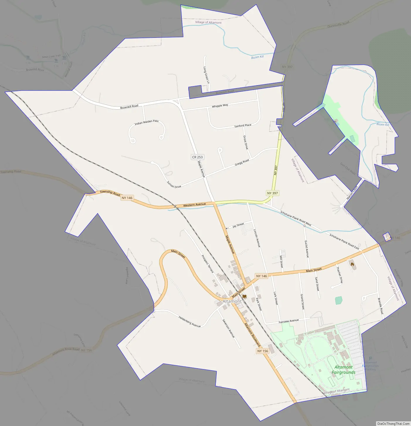
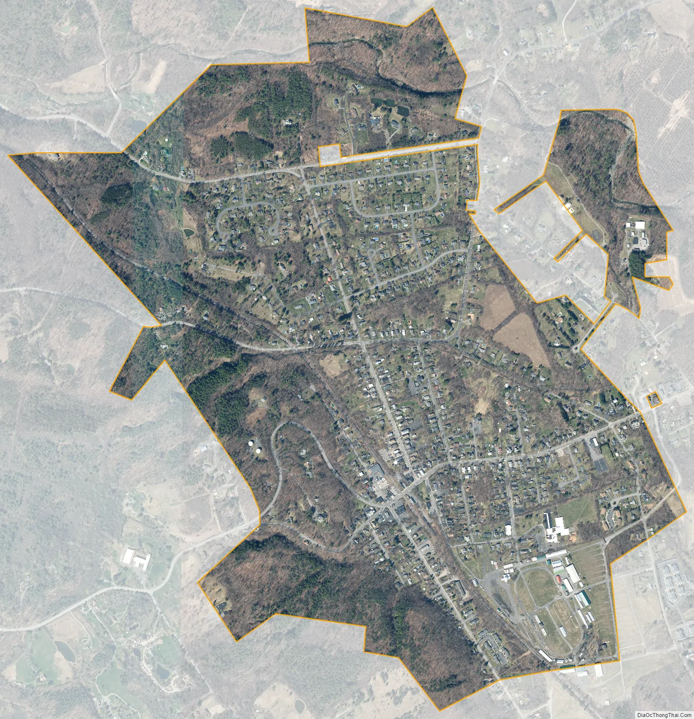
Altamont city Satellite Map
Geography
According to the United States Census Bureau, the village has a total area of 1.2 square miles (3.1 km), all land. However, there are two major streams that run through the town center, the Joriohenen and the Ostenraakie.[1]
See also
Map of New York State and its subdivision:- Albany
- Allegany
- Bronx
- Broome
- Cattaraugus
- Cayuga
- Chautauqua
- Chemung
- Chenango
- Clinton
- Columbia
- Cortland
- Delaware
- Dutchess
- Erie
- Essex
- Franklin
- Fulton
- Genesee
- Greene
- Hamilton
- Herkimer
- Jefferson
- Kings
- Lake Ontario
- Lewis
- Livingston
- Madison
- Monroe
- Montgomery
- Nassau
- New York
- Niagara
- Oneida
- Onondaga
- Ontario
- Orange
- Orleans
- Oswego
- Otsego
- Putnam
- Queens
- Rensselaer
- Richmond
- Rockland
- Saint Lawrence
- Saratoga
- Schenectady
- Schoharie
- Schuyler
- Seneca
- Steuben
- Suffolk
- Sullivan
- Tioga
- Tompkins
- Ulster
- Warren
- Washington
- Wayne
- Westchester
- Wyoming
- Yates
- Alabama
- Alaska
- Arizona
- Arkansas
- California
- Colorado
- Connecticut
- Delaware
- District of Columbia
- Florida
- Georgia
- Hawaii
- Idaho
- Illinois
- Indiana
- Iowa
- Kansas
- Kentucky
- Louisiana
- Maine
- Maryland
- Massachusetts
- Michigan
- Minnesota
- Mississippi
- Missouri
- Montana
- Nebraska
- Nevada
- New Hampshire
- New Jersey
- New Mexico
- New York
- North Carolina
- North Dakota
- Ohio
- Oklahoma
- Oregon
- Pennsylvania
- Rhode Island
- South Carolina
- South Dakota
- Tennessee
- Texas
- Utah
- Vermont
- Virginia
- Washington
- West Virginia
- Wisconsin
- Wyoming