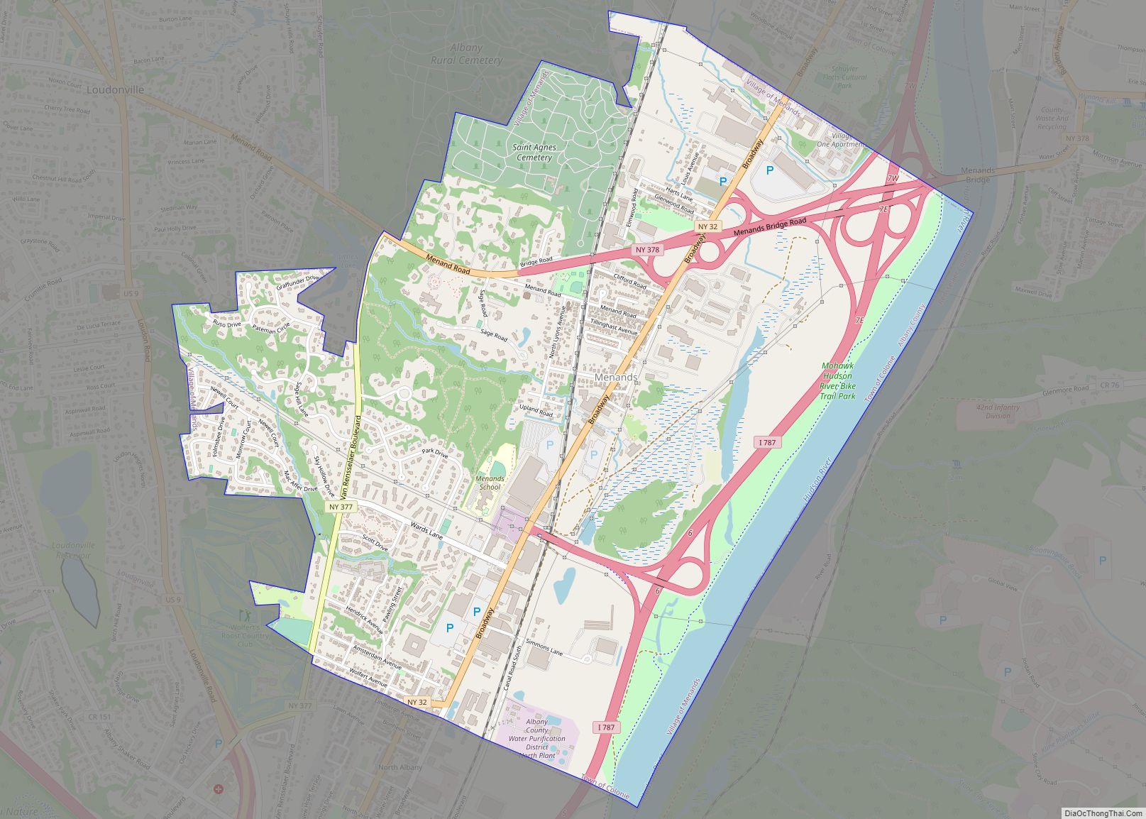
Menands /mɪˈnændz/ is a village in Albany County, New York, United States. The population was 3,990 at the 2010 census. The village is named after Louis Menand. The village lies inside the town of Colonie and borders the northern city line of Albany.
| Name: | Menands village |
|---|---|
| LSAD Code: | 47 |
| LSAD Description: | village (suffix) |
| State: | New York |
| County: | Albany County |
| Elevation: | 36 ft (11 m) |
| Total Area: | 3.31 sq mi (8.58 km²) |
| Land Area: | 3.06 sq mi (7.93 km²) |
| Water Area: | 0.25 sq mi (0.65 km²) |
| Total Population: | 4,554 |
| Population Density: | 1,487.26/sq mi (574.31/km²) |
| ZIP code: | 12204 |
| Area code: | 518 |
| FIPS code: | 3646536 |
| GNISfeature ID: | 0956959 |
| Website: | http://www.villageofmenands.com |
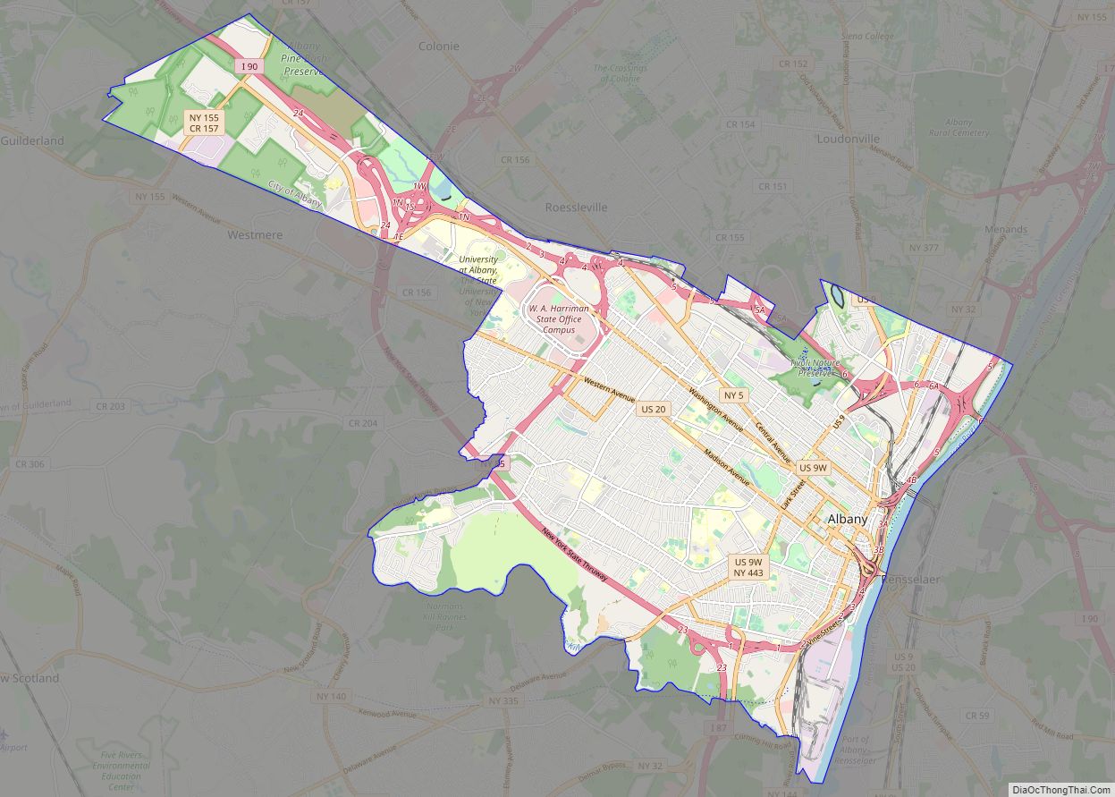
Online Interactive Map
Click on ![]() to view map in "full screen" mode.
to view map in "full screen" mode.
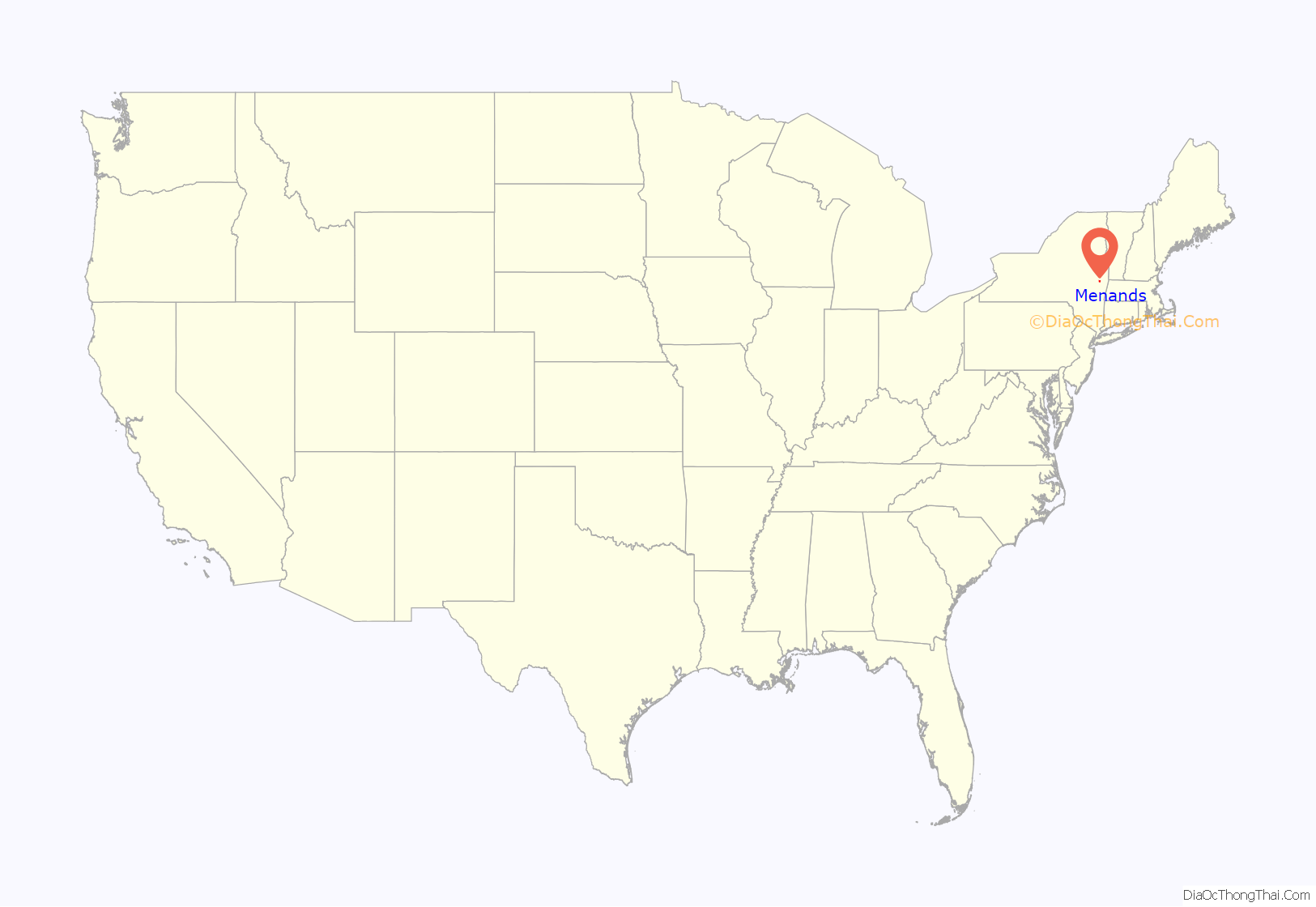
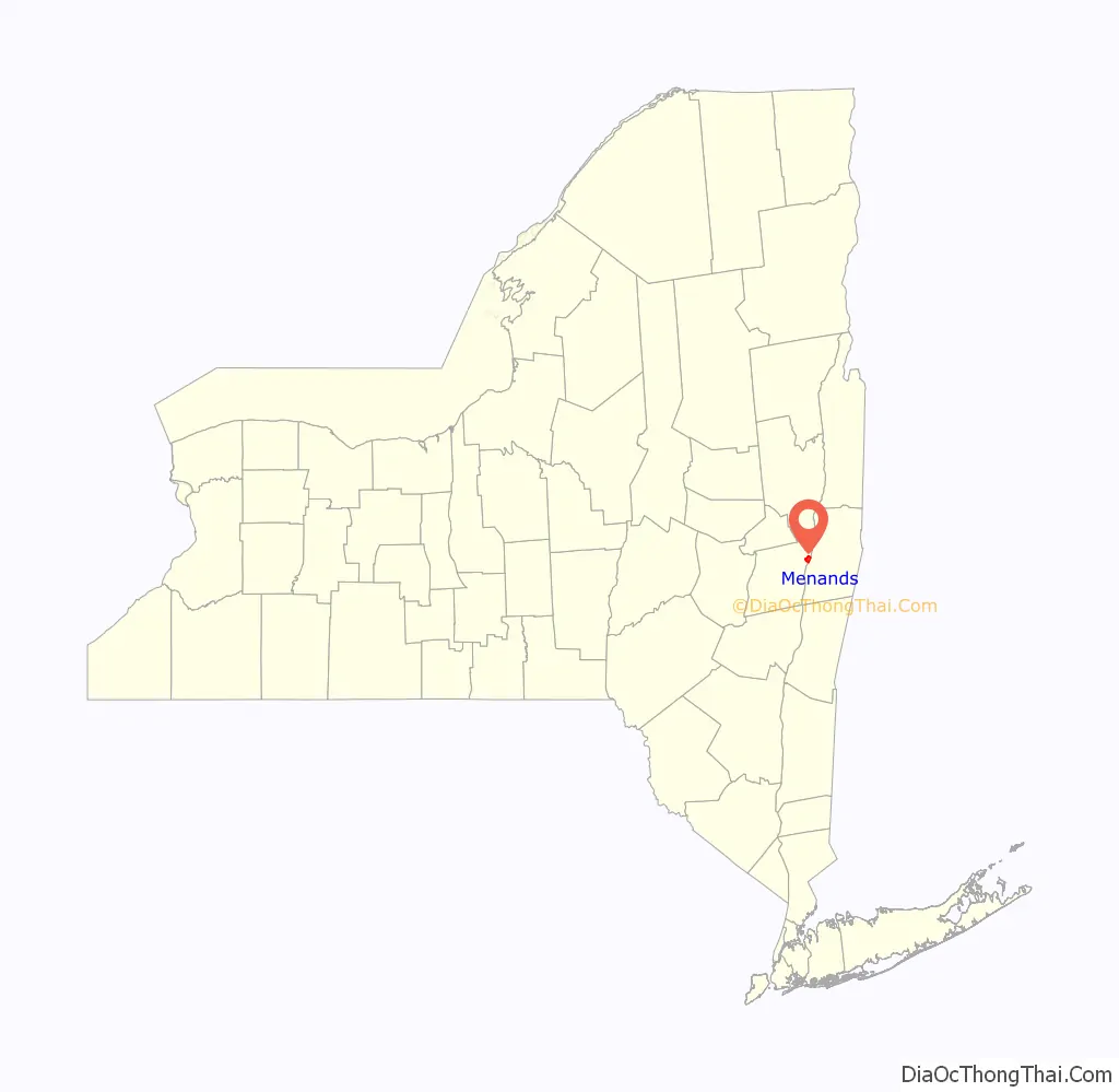
Menands location map. Where is Menands village?
History
Menands would have been first spotted by Europeans circa 1609, when Henry Hudson dropped anchor somewhere near Cuyler or Pleasure Island during his voyage on the river later to be named after him. This would be the furthest north on the river that Hudson would go in the Half Moon. Today, those islands are connected to the mainland, and are the site of Interstate 787 exits 6 and 7, which includes the cloverleaf interchange with NY 378 and the Troy-Menands Bridge.
Louis Menand settled in the village in 1842 and established an important horticultural business. He at first rented land that later became the Home for Aged Men, then in 1847 bought 11 acres of land where the Albany-Watervliet Turnpike (today Broadway) met the road going to Ireland’s Corners (today Loudonville); that road is today called Menand Road. When the Albany and Northern Railroad was built in 1856, it established a stop in present-day Menands and named the stop “Menand’s Crossing”, since Menand was the only landowner in that area at the time. When the Albany and Northern became part of the Delaware and Hudson, a station was built at that stop and called “Menand’s Station”. In the early 1920s, rumors circulated that the city of Albany was going to annex the area, so on August 23, 1924 a vote was taken and the village of Menands was incorporated by a vote of 167 for and 47 against, the population of the new village at that time being 1,272 people. The boundaries of the new village were those of the 15th School District of the town of Colonie. The original boundaries did not include what are now the Sage Hill Lane, Sky Hollow, and Roost Country Estates; those were annexed later and continue to be in the North Colonie Central School District.
When the Erie Canal was originally constructed, it passed through what would become Menands. Bridges spanned the canal to allow access to the land between the canal and the Hudson. From north to south they were- Richardson, Mix, Leary, Keyes, Kanes, Lundergans, Island Park, Delaware and Hudson Railroad, and Garbarance. Most of the names of the bridges were those of the neighboring farm owners.
In 1938, the first large scale FHA multiple housing project in Upstate New York was conceived by Harry D. Yates on 13 acres (53,000 m) of land in Menands. The land was purchased for $20,000, from the Van Rensselaer family who had owned it since 1639. Original plans called for 30 buildings, but cost overruns trimmed it to 13. All thirteen were named for historic people and locations in the Capital District; subsequent additions have kept to that tradition with the exception of Tremaine House, named for a former NY State Comptroller and Yates House for a former manager of Dutch Village.
In 1940, the now-defunct New York Herald Tribune declared Dutch Village to be “one of the most interesting scale housing developments in the East”. The steeped roofs and brick construction were designed to reflect early Dutch architecture. Wards Lane at the time was small and unpaved on a steep slope, but by using money from a federal program designed to pave “farm to market” roads, the project was able to improve the road to Dutch Village without any cost to the village of Menands.
One of the largest printing plants in the eastern USA existed in Menands in the forties and fifties. Williams Press (aka: J. B. Lyons Co.) at its prime employed more than 1,000 people. Built on Broadway with rail tracks behind, Williams printed many of today’s magazines such as Business Week, Sports Illustrated and many others, plus most of the New England telephone directories. They were forced to close because of labor issues, location constraints and outdated equipment.
The village’s current motto, “Urban-Suburban Village”, and its official seal, came into being as part of the village’s 50th anniversary celebrations in 1974. The motto and seal were chosen based on contest entries submitted by local school children at Menands Elementary school. Two boys came up with the design for the seal, and the motto was chosen from an entry by a girl in the school’s seventh grade class.
Menands Road Map
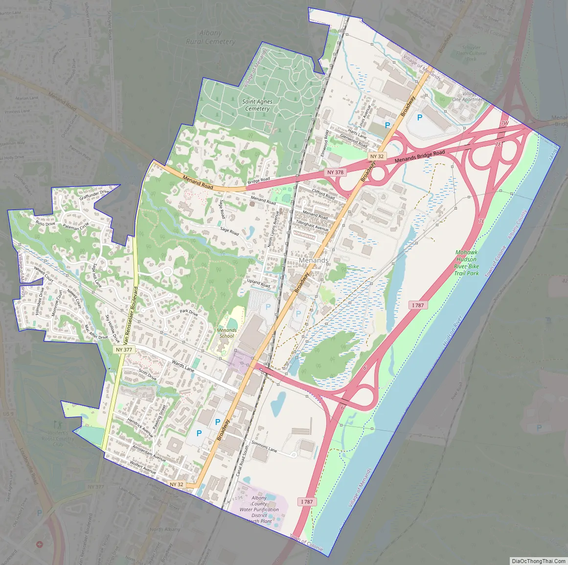
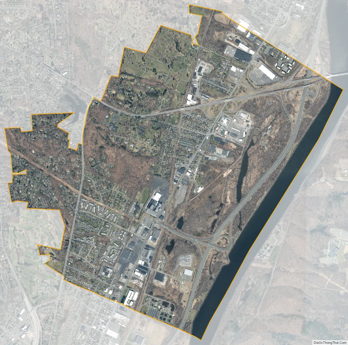
Menands city Satellite Map
Geography
According to the United States Census Bureau, the village has a total area of 3.4 square miles (8.8 km), of which 3.2 square miles (8.3 km) is land and 0.2 square miles (0.52 km) (6.45%) is water.
Menands is along the Hudson River on the west bank. The village is within the town of Colonie, which is also to the north and west, with the city of Albany to the south. The village is mostly flat with a gentle slope to the west.
See also
Map of New York State and its subdivision:- Albany
- Allegany
- Bronx
- Broome
- Cattaraugus
- Cayuga
- Chautauqua
- Chemung
- Chenango
- Clinton
- Columbia
- Cortland
- Delaware
- Dutchess
- Erie
- Essex
- Franklin
- Fulton
- Genesee
- Greene
- Hamilton
- Herkimer
- Jefferson
- Kings
- Lake Ontario
- Lewis
- Livingston
- Madison
- Monroe
- Montgomery
- Nassau
- New York
- Niagara
- Oneida
- Onondaga
- Ontario
- Orange
- Orleans
- Oswego
- Otsego
- Putnam
- Queens
- Rensselaer
- Richmond
- Rockland
- Saint Lawrence
- Saratoga
- Schenectady
- Schoharie
- Schuyler
- Seneca
- Steuben
- Suffolk
- Sullivan
- Tioga
- Tompkins
- Ulster
- Warren
- Washington
- Wayne
- Westchester
- Wyoming
- Yates
- Alabama
- Alaska
- Arizona
- Arkansas
- California
- Colorado
- Connecticut
- Delaware
- District of Columbia
- Florida
- Georgia
- Hawaii
- Idaho
- Illinois
- Indiana
- Iowa
- Kansas
- Kentucky
- Louisiana
- Maine
- Maryland
- Massachusetts
- Michigan
- Minnesota
- Mississippi
- Missouri
- Montana
- Nebraska
- Nevada
- New Hampshire
- New Jersey
- New Mexico
- New York
- North Carolina
- North Dakota
- Ohio
- Oklahoma
- Oregon
- Pennsylvania
- Rhode Island
- South Carolina
- South Dakota
- Tennessee
- Texas
- Utah
- Vermont
- Virginia
- Washington
- West Virginia
- Wisconsin
- Wyoming