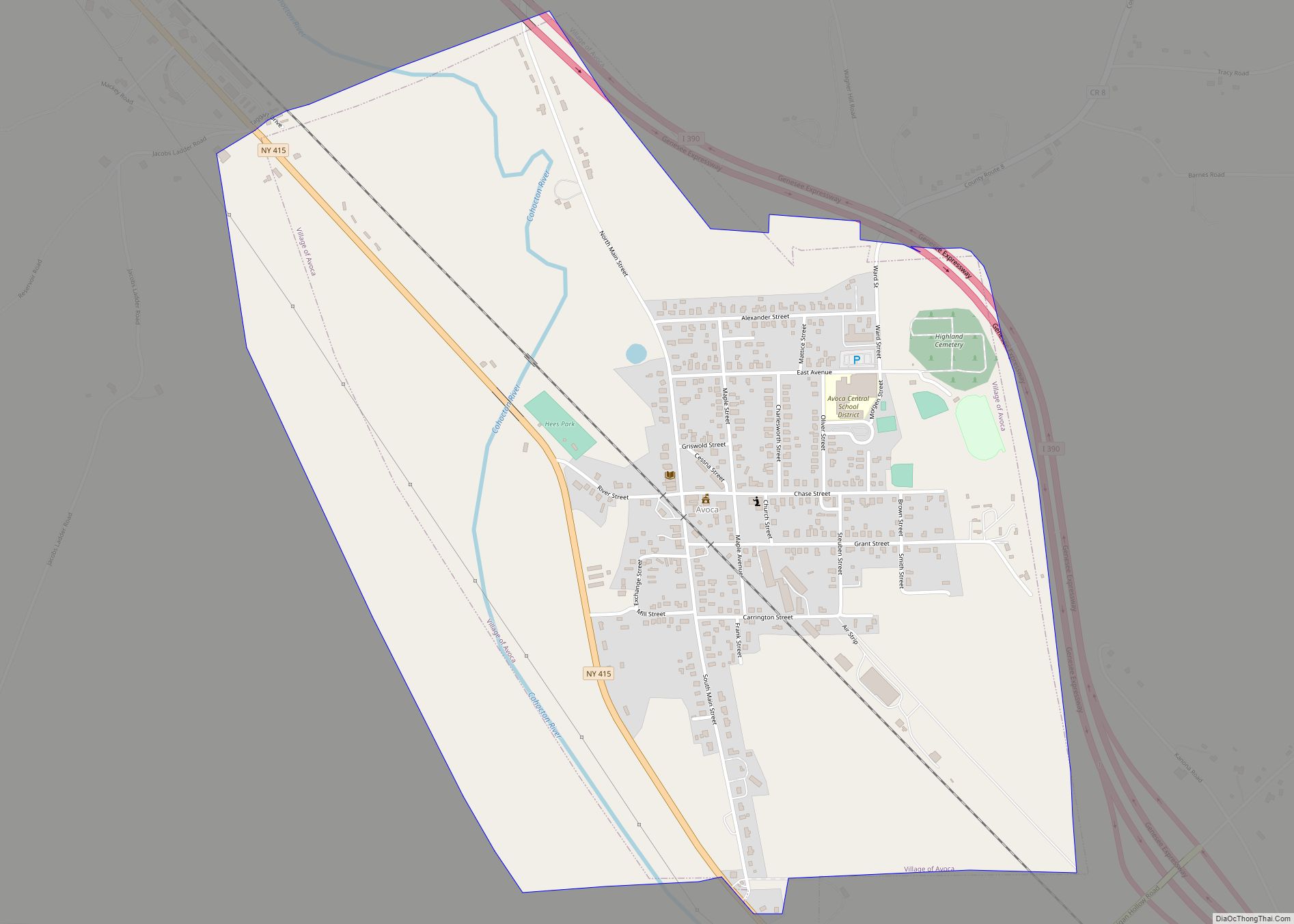
Avoca is a village located in the Town of Avoca in Steuben County, New York, United States. The population was 946 at the 2010 census.
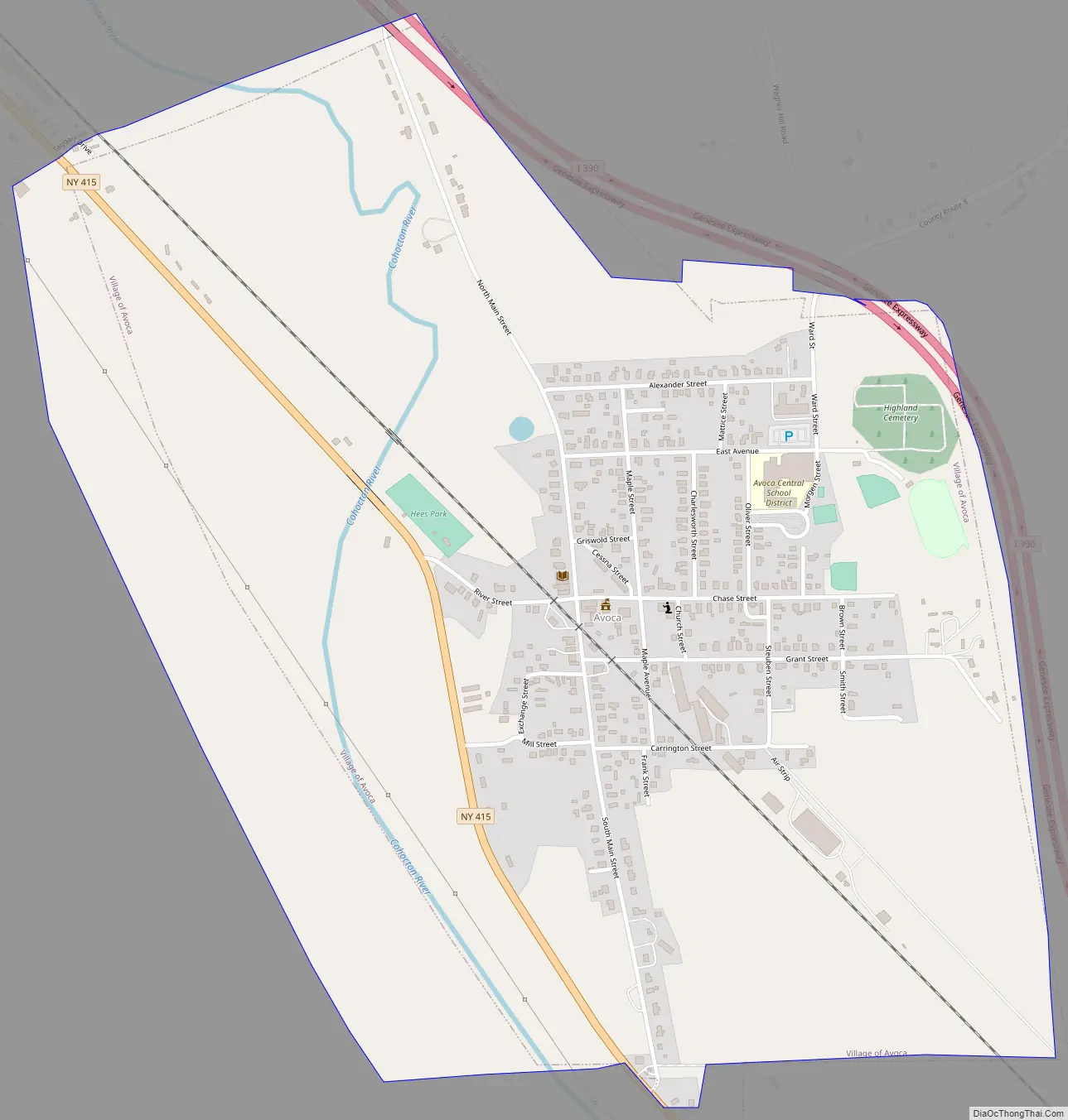
The Village of Avoca is located in the eastern part of the town, northwest of Bath.
| Name: | Avoca village |
|---|---|
| LSAD Code: | 47 |
| LSAD Description: | village (suffix) |
| State: | New York |
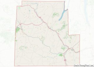
| County: | Steuben County |
| Elevation: | 1,194 ft (364 m) |
| Total Area: | 1.33 sq mi (3.44 km²) |
| Land Area: | 1.33 sq mi (3.43 km²) |
| Water Area: | 0.00 sq mi (0.01 km²) |
| Total Population: | 809 |
| Population Density: | 610.11/sq mi (235.58/km²) |
| ZIP code: | 14809 |
| Area code: | 607 |
| FIPS code: | 3603331 |
| GNISfeature ID: | 0942735 |
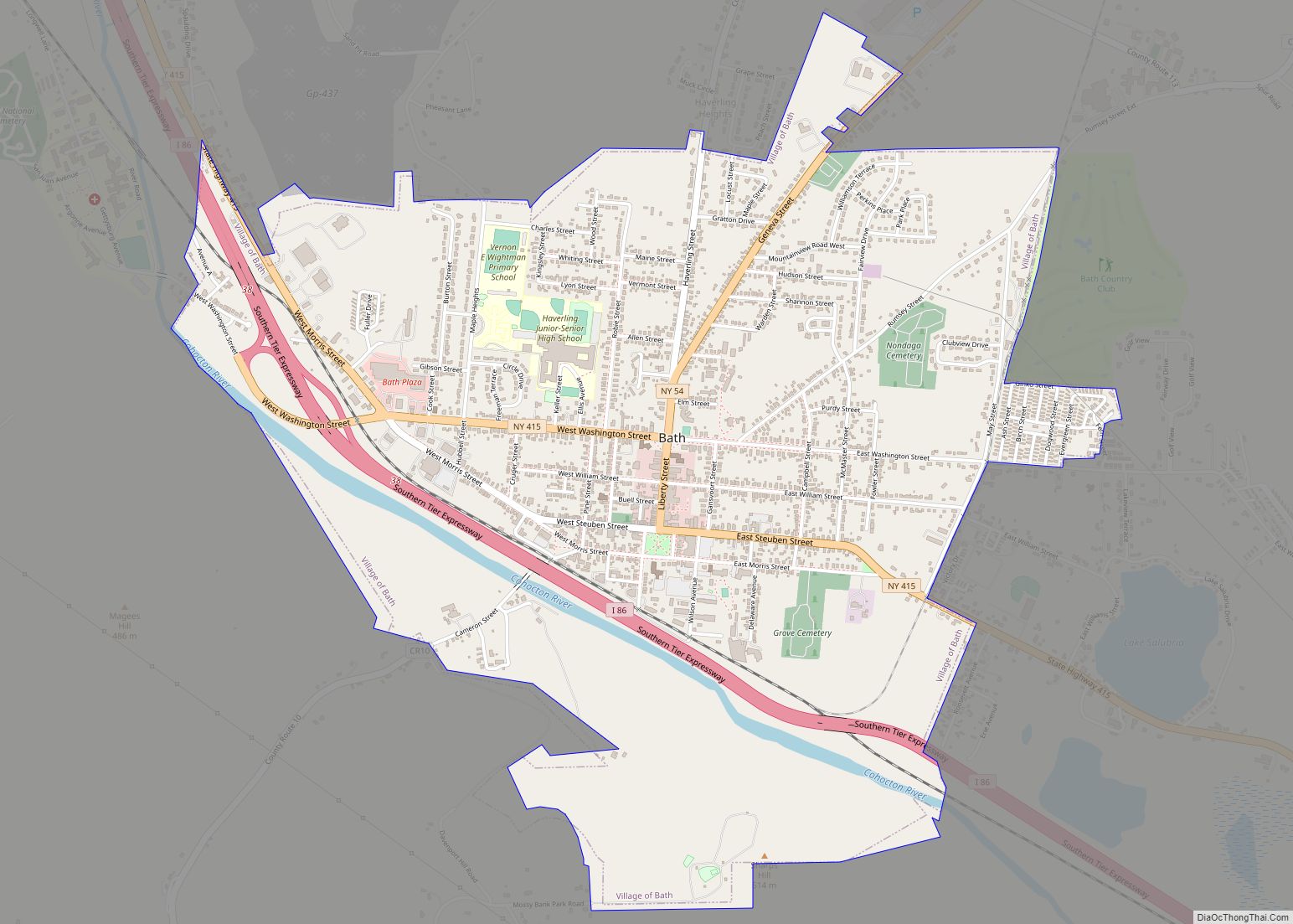
Online Interactive Map
Click on ![]() to view map in "full screen" mode.
to view map in "full screen" mode.
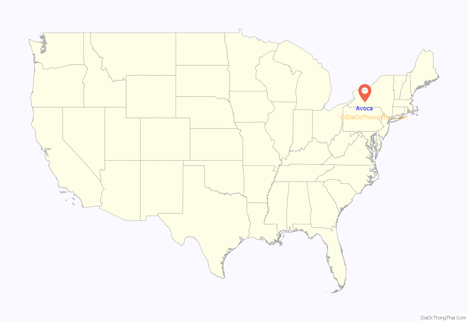
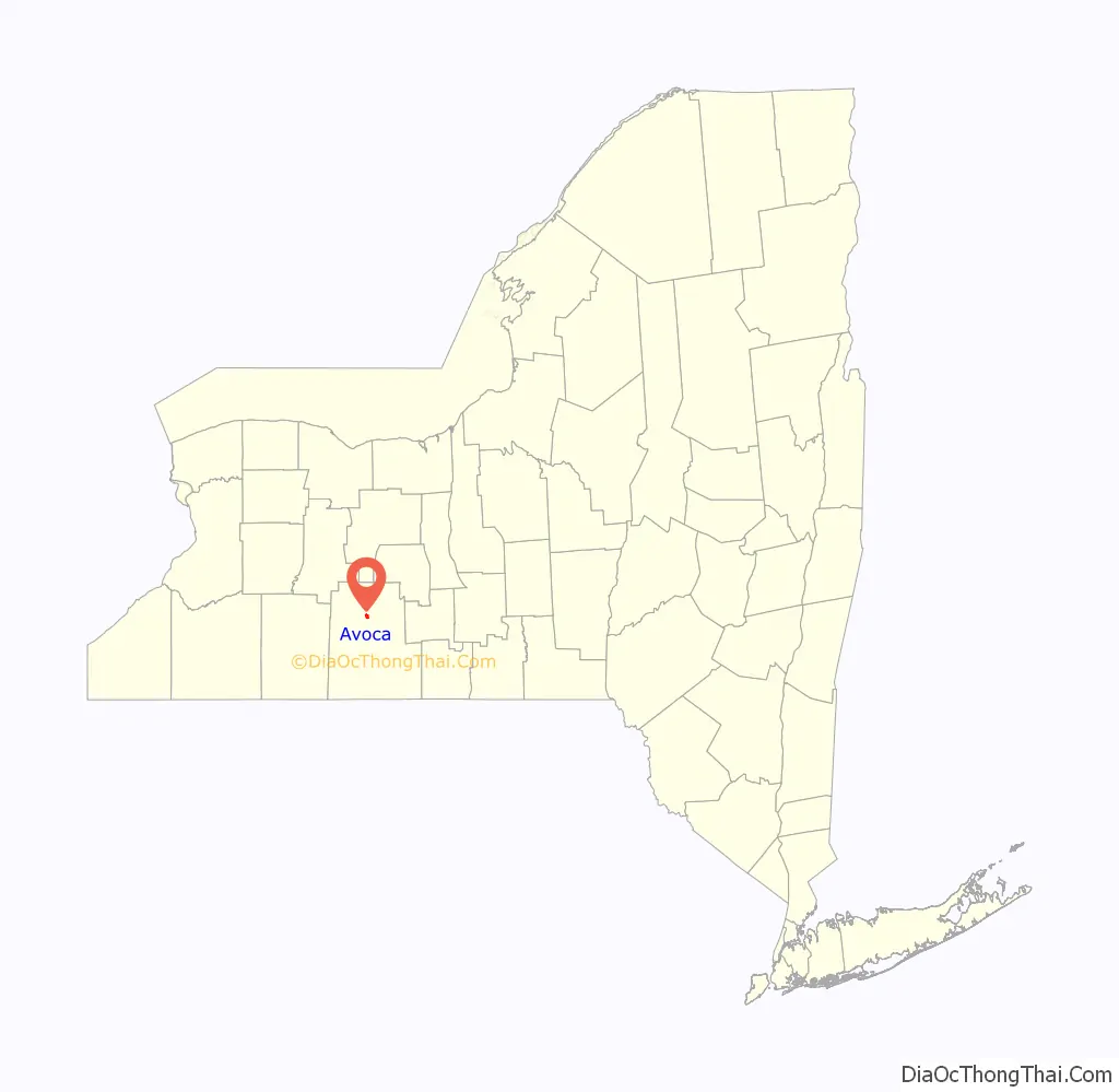
Avoca location map. Where is Avoca village?
History
Avoca was the first settlement in the town, circa 1794. The village was previously known as “Eight Mile Tree”, then “Podunk” before it adopted the current name. Avoca was incorporated as a village in 1883. The name is thought to come from Avoca in Ireland. The change to Avoca is reported to be the deathbed wish of a young girl who admired the name.
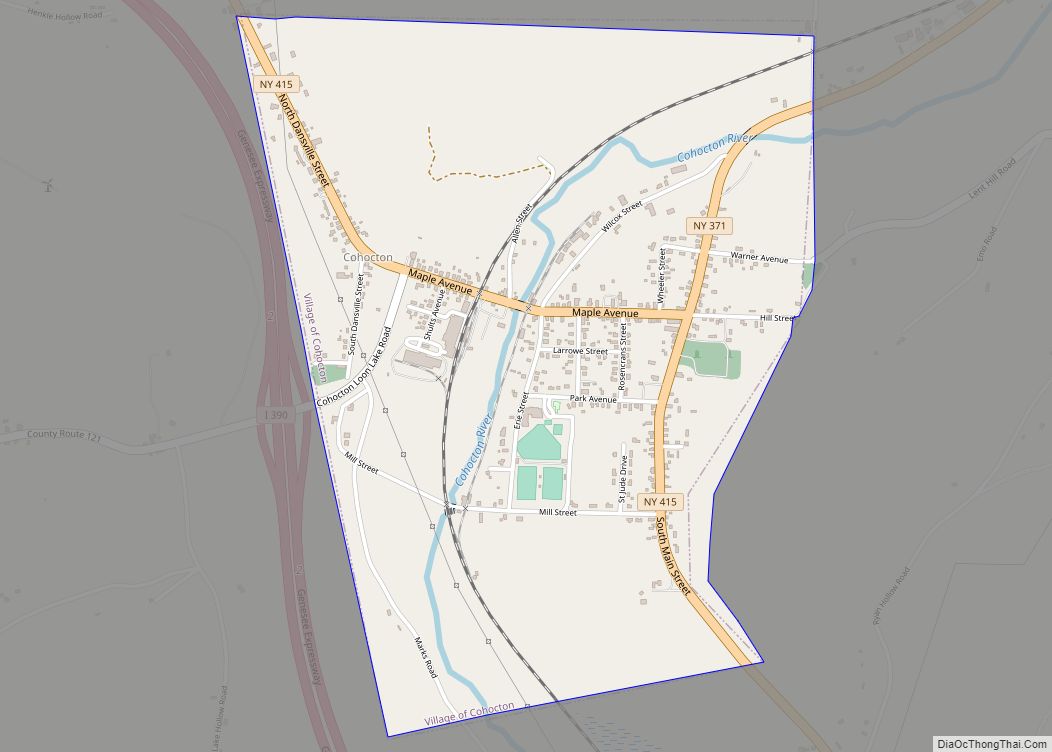
Avoca Road Map
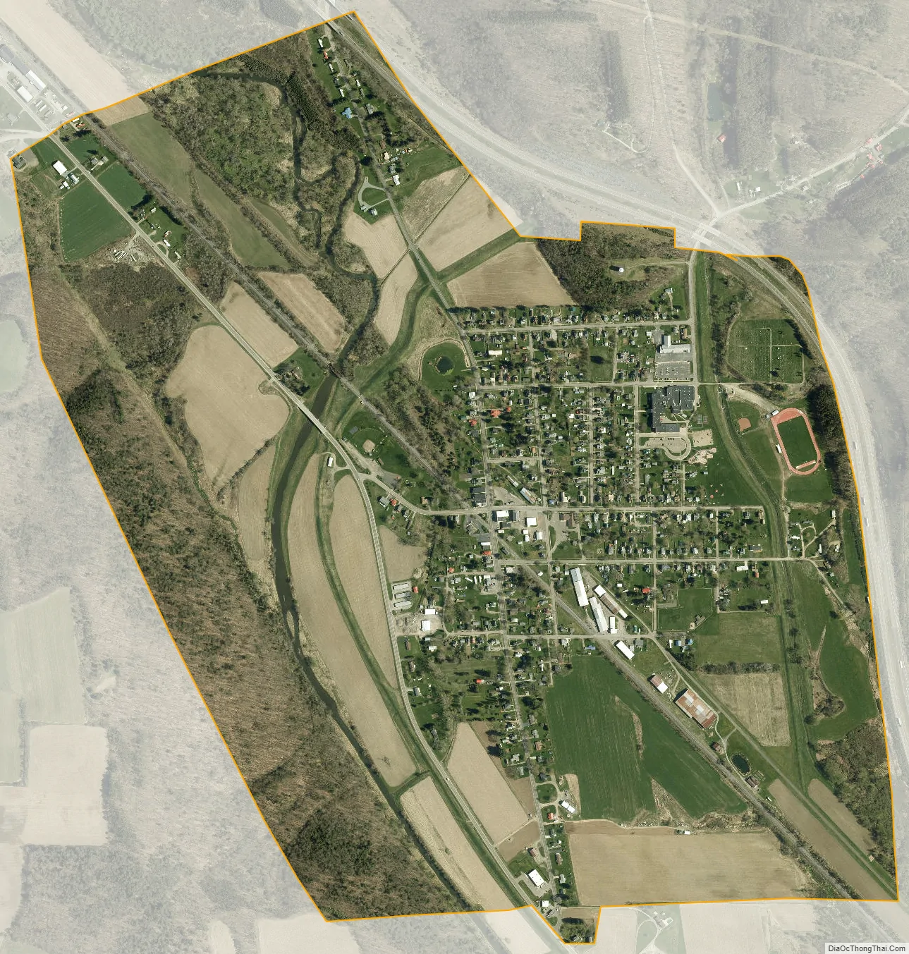
Avoca city Satellite Map
Geography
Avoca is located at 42°24′38″N 77°25′13″W / 42.41056°N 77.42028°W / 42.41056; -77.42028 (42.410614, -77.420359).
According to the United States Census Bureau, the village has a total area of 1.2 square miles (3.1 km), all land.
New York State Route 415 passes north-to-south through the village, and County Road 8 enters the northeast part of the village. Avoca is on west side of Interstate 390, north of the junction with the Southern Tier Expressway.
Avoca is located on the Gang Mills (Painted Post) to Wayland line of the B&H (Bath & Hammondsport) Rail Corp.
Avoca is on the Cohocton River.
See also
Map of New York State and its subdivision:- Albany
- Allegany
- Bronx
- Broome
- Cattaraugus
- Cayuga
- Chautauqua
- Chemung
- Chenango
- Clinton
- Columbia
- Cortland
- Delaware
- Dutchess
- Erie
- Essex
- Franklin
- Fulton
- Genesee
- Greene
- Hamilton
- Herkimer
- Jefferson
- Kings
- Lake Ontario
- Lewis
- Livingston
- Madison
- Monroe
- Montgomery
- Nassau
- New York
- Niagara
- Oneida
- Onondaga
- Ontario
- Orange
- Orleans
- Oswego
- Otsego
- Putnam
- Queens
- Rensselaer
- Richmond
- Rockland
- Saint Lawrence
- Saratoga
- Schenectady
- Schoharie
- Schuyler
- Seneca
- Steuben
- Suffolk
- Sullivan
- Tioga
- Tompkins
- Ulster
- Warren
- Washington
- Wayne
- Westchester
- Wyoming
- Yates
- Alabama
- Alaska
- Arizona
- Arkansas
- California
- Colorado
- Connecticut
- Delaware
- District of Columbia
- Florida
- Georgia
- Hawaii
- Idaho
- Illinois
- Indiana
- Iowa
- Kansas
- Kentucky
- Louisiana
- Maine
- Maryland
- Massachusetts
- Michigan
- Minnesota
- Mississippi
- Missouri
- Montana
- Nebraska
- Nevada
- New Hampshire
- New Jersey
- New Mexico
- New York
- North Carolina
- North Dakota
- Ohio
- Oklahoma
- Oregon
- Pennsylvania
- Rhode Island
- South Carolina
- South Dakota
- Tennessee
- Texas
- Utah
- Vermont
- Virginia
- Washington
- West Virginia
- Wisconsin
- Wyoming